Five fur trading posts were known as Rocky Mountain House near the same site as present-day Rocky Mountain House. Rocky Mountain House is post no. 467 in “Historic forts and trading posts” by Ernest Voorhis [1859–1933] :
North West Co. post on North Saskatchewan river, 1-1/4 miles above mouth of Clearwater river, 3 miles below Hangman’s tree (1790) on north bank of river, 70 yards from river’s edge. It stood on high bank, well adapted for defense as block-houses commanded the fort. Of exceptional strength being in territory of Blackfeet Indians. Hence it was sometimes called “Blackfeet post.” Built by John McDonald of Garth in 1802, although the first structure was erected in 1799. It was visited by David Thompson in 1800 and 1806 and by Alexander Henry Jr. in 1811. It was the uppermost permanent post of the North West Co. on the Saskatchewan river. Ruins were still visible in 1886. After union of the two companies it was occupied by the Hudson’s Bay Co. for many years and finally discontinued in 1875.
The Hudson’s Bay Co. constructed a fort nearby (about 114°59′ w. & 52°22’ N.) called Acton House or Rocky Mt. House, both names being given on some maps. [1]
Archaeologists at the Rocky Mountain House National Historic Site have identified four fur trade post:
Rocky Mountain House of the North West Company, built in 1799.
Acton House of the Hudson’s Bay Company, also built in 1799.
Rocky Mountain House, the Hudson’s Bay Company post of 1835-1861
Rocky Mountain House, the Hudson’s Bay Company Post of 1868-1875.
They searched for the fifth post, but it stood where the river runs now. The Hudson’s Bay Company built this temporary post (1865-1868). It housed fur traders and their families until the last post was finished.
Voorhis notes that there was also a North West Company fort on the Mackenzie River called Rocky Mountain House, built in 1800 and soon abandoned. The following forts were also called Rocky Mountain House: Jasper House (No. 245), Hudson’s Hope (No. 227), Acton House (No. 3), Henry’s House (No. 218).
References:
- 1. Voorhis, Ernest [1859–1933]. Historic Forts and Trading Posts of the French Régime and of the English Fur Trading Companies. Ottawa: Department of the Interior, 1930, p. 149. University of British Columbia Library [accessed 3 January 2026]
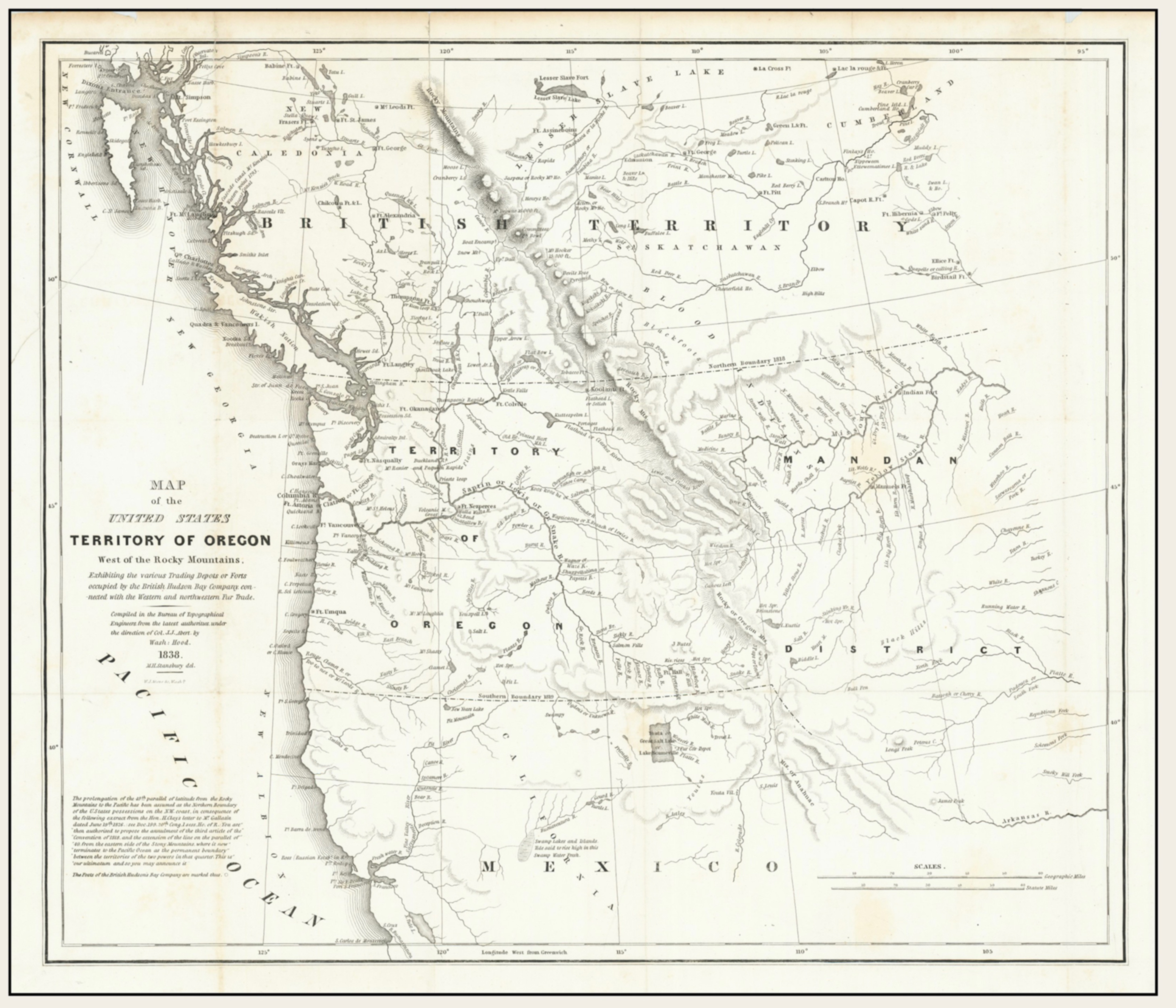
![Map of the United States Territory of Oregon West of the Rocky Mountains [detail] Hood 1838](/wp-content/uploads/2026/01/map-hood-oregon-1838-detail-scaled.jpg)