Author Archives: Swany

Oog Mountain

British Columbia. Mountain
Between heads of Ptarmigan Creek and Dome Creek, W of Crescent Spur
53.5408 N 120.9772 W — Map 093H10 — GoogleGeoHack
Name officially adopted in 1982
Official in BCCanada

Adopted in 1982 as submitted by Northwood Pulp & Timber Ltd. The name “oog” goes back to the Indian history of the area, and represents a legendary being, according to Northwood.

Mount Cushman

British Columbia. Mount
S of Dome Mountain, NE of Bowron Lake Provincial Park
53.4808 N 121.0136 W — Map 093H06 — GoogleGeoHack
Name officially adopted in 1997
Official in BCCanada

Adopted in 1997 as proposed by J.O. Premischook and endorsed by area Parks and Regional District representatives.

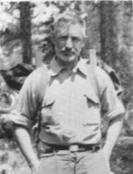
Named after Barkerville-area fixture Francis (Frank) Arthur Cushman [1924 – 1994]. Cushman was at Yakima, Washington, and served with the US Marine Corp in WW II before moving to BC with his family in 1955. After ranching at Nicola and Stump Lakes, he purchased the Cariboo Hunting & Fishing Lodge on Bowron Lake in 1961, and later operated Wolverine Mountain Outfitters in the vicinity of this mountain.

He is remembered as one of Barkerville‘s most colourful characters, playing the role of Ned Stout, Bavarian placer miner, in street vignettes. With a rugged face and handlebar moustache, Cushman’s was one of the most photographed faces in BC, appearing in hundreds of magazines and calendars over the years (although I haven’t been able to find one).
References:

Elysium Pass

Alberta. Pass
Head of Minaga Creek and Snaring River
52.9547 N 118.3394 W — Map 083D16 — GoogleGeoHack
Name officially adopted in 1951
Official in Canada

If you have a map of Jasper Park you will see a Pass called Elysium Pass, along the Pyramid range, and lies North west of Jasper. Curlie lost his life in the slide that came down North of the Pass on the waters of the Snaring River.

— Letter from Bert Wilkins to James Monroe Thorington [1895–1989], April 10, 1938

Wilkins was refering to the death of Donald “Curly” Phillips [1884–1938].

References:

  • Banff: Whyte Museum. J. Monroe Thorington fonds M106/147 (1924). Whyte Museum
Also see:

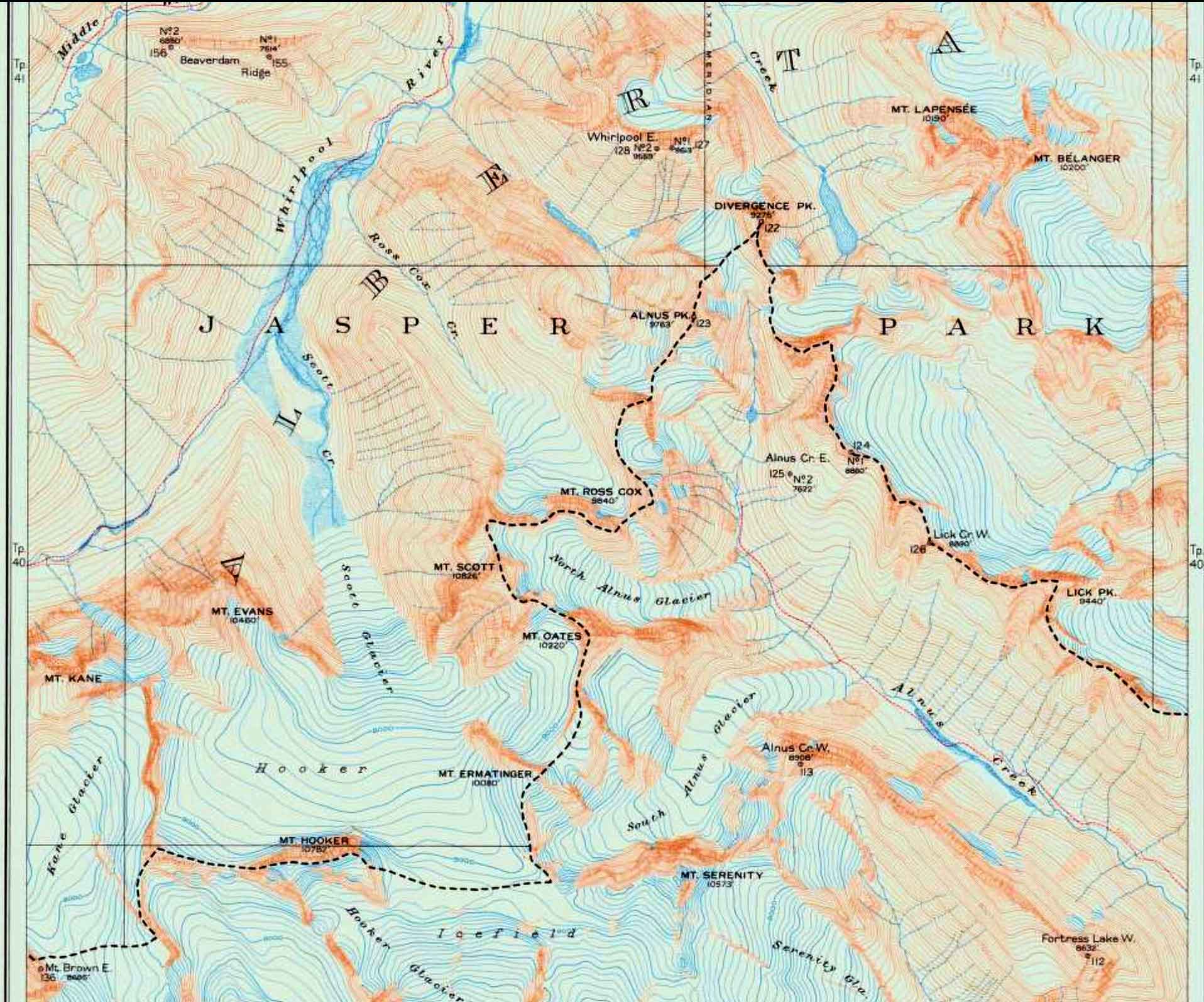
Divergence Peak

Alberta-BC boundary. Peak
N of Mount Hooker near head of Wood River and Whirlpool River
52.5 N 117.9917 W — Map 083C12 — GoogleGeoHack
Name officially adopted in 1921
Official in BCCanada
Boundary between Alberta and British Columbia. Sheet 26. Surveyed in 1920

Boundary between Alberta and British Columbia. Sheet 26. Surveyed in 1920
Internet Archive

The altitude of Divergence Peak is 9275 feet. The watershed line does not reach the summit, but at an altitude of 8920 feet is deflected sharply from a little west of north to southwest, for which reason the name has been given to the peak.

So wrote surveyor Arthur Oliver Wheeler [1860–1945] of the Alberta-British Columbia Boundary Commission regarding surveys done in 1920.

References:

  • Cautley, Richard William [1873–1953], and Wheeler, Arthur Oliver [1860–1945]. Report of the Commission appointed to delimit the boundary between the Provinces of Alberta and British Columbia. Part II. 1917 to 1921. From Kicking Horse Pass to Yellowhead Pass.. Ottawa: Office of the Surveyor General, 1924. Whyte Museum
Also see:

Wallbridge Mountain

British Columbia. Mountain
SW of Cecilia Lake in Kakwa Provincial Park
53.9036 N 120.0694 W — Map 093H16 — GoogleGeoHack
Name officially adopted in 1925
Official in BCCanada

Named by Alberta-British Columbia Boundary Commission surveyors in 1923:

The Bastille-Wallbridge ridge shows steep shale slopes on the southwest side and a precipitous rock face on the northeast side, the latter supporting a cliff glacier, two miles in length.

References:

  • Cautley, Richard William [1873–1953], and Wheeler, Arthur Oliver [1860–1945]. Report of the Commission Appointed to Delimit the Boundary between the Provinces of Alberta and British Columbia. Parts IIIA & IIIB, 1918 to 1924. From Yellowhead Pass Northerly. Ottawa: Office of the Surveyor General, 1925. Whyte Museum
  • British Columbia Geographical Names. Wallbridge Mountain
Also see:

Raymond T. Zillmer

Ray Zillmer

Ray Zillmer
Wikipedia

Raymond T. Zillmer [1887–1960]

b. 1887 — Milwaukee, Wisconsin
d. 1960 — Milwaukee, Wisconsin

Zillmer was an American attorney, mountaineer, and conservationist. During the 1930s-40s, Zillmer became an accomplished and respected explorer and mountaineer. In July, 1934 Zillmer was part of a team of five mountaineers who completed the first ascent of Anchorite Peak, British Columbia, Canada. He would go on to complete several other first ascents and describe previously uncharted lands. In the summer of 1938, he and Lorin Tiefenthaler retraced the steps of the expedition of Alexander Mackenzie [1764–1820] in 1792-93 between the Fraser and Bella Coola rivers. He described the adventure in detail in his first of four articles published in the Canadian Alpine Journal.

Sources of biographical information about Zillmer:

  • Thorington, James Monroe [1895–1989]. “Raymond T. Zillmer, 1887-1960.” American Alpine Journal, 12:2 (1961) American Alpine Club
  • Wikipedia. Ray_Zillmer
Zillmer is the namesake of the following places in the Mount Robson region:

Works pertinent to the Mount Robson region of which Zillmer was author or co-author:

  • —   “Explorations in the Southern Cariboos.” Canadian Alpine Journal, Vol. 27 (1939):48-61
  • —   “The exploration of the source of the Thompson River in British Columbia.” American Alpine Journal, Vol. 4, No. 1 (1940):69–81. American Alpine Club
  • —   “The location of Mt. Milton and the restoration of the names ‘Mt. Milton and Mt. Cheadle’.” American Alpine Journal, Vol. 5, No. 1 (1943). American Alpine Club
  • —   “The exploration of the Cariboo Range from the east.” American Alpine Journal, 5:2 (1944):261-274. American Alpine Club
  • —   “The exploration of the sources of the McLennan River.” American Alpine Journal, Vol. 6, No. 1 (1946). American Alpine Club
  • —   “Exploration of the McLennan completed.” Canadian Alpine Journal, Vol. 30 (1947):85-95
  • —   “The first crossing of the Cariboo Range.” Canadian Alpine Journal, Vol. 31 (1948):26–37
  • —   “Cariboo Range.” Canadian Alpine Journal, Vol. 27 (1950):120

Talbot Lake

Alberta. Lake: Athabasca River drainage
E of Jasper Lake
53.0978 N 117.9942 W — Map 083F04 — GoogleGeoHack
Name officially adopted in 1956
Official in Canada

Named in 1925 after Hon. Peter Talbot (1854-1919), Lacombe; member of the Senate of Canada, 1906-1919.

References:

  • Canadian Board on Geographical Names. Place-names of Alberta. Published for the Geographic Board by the Department of the Interior. Ottawa: Department of the Interior, 1928. Hathi Trust