In 1793
Alexander Mackenzie [1764–1820] crossed the Continental Divide through what is now this park, on his way to the Pacific OceN.
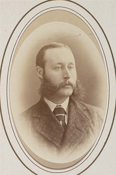
Simon Fraser [1776–1862] followed the same route in 1805.
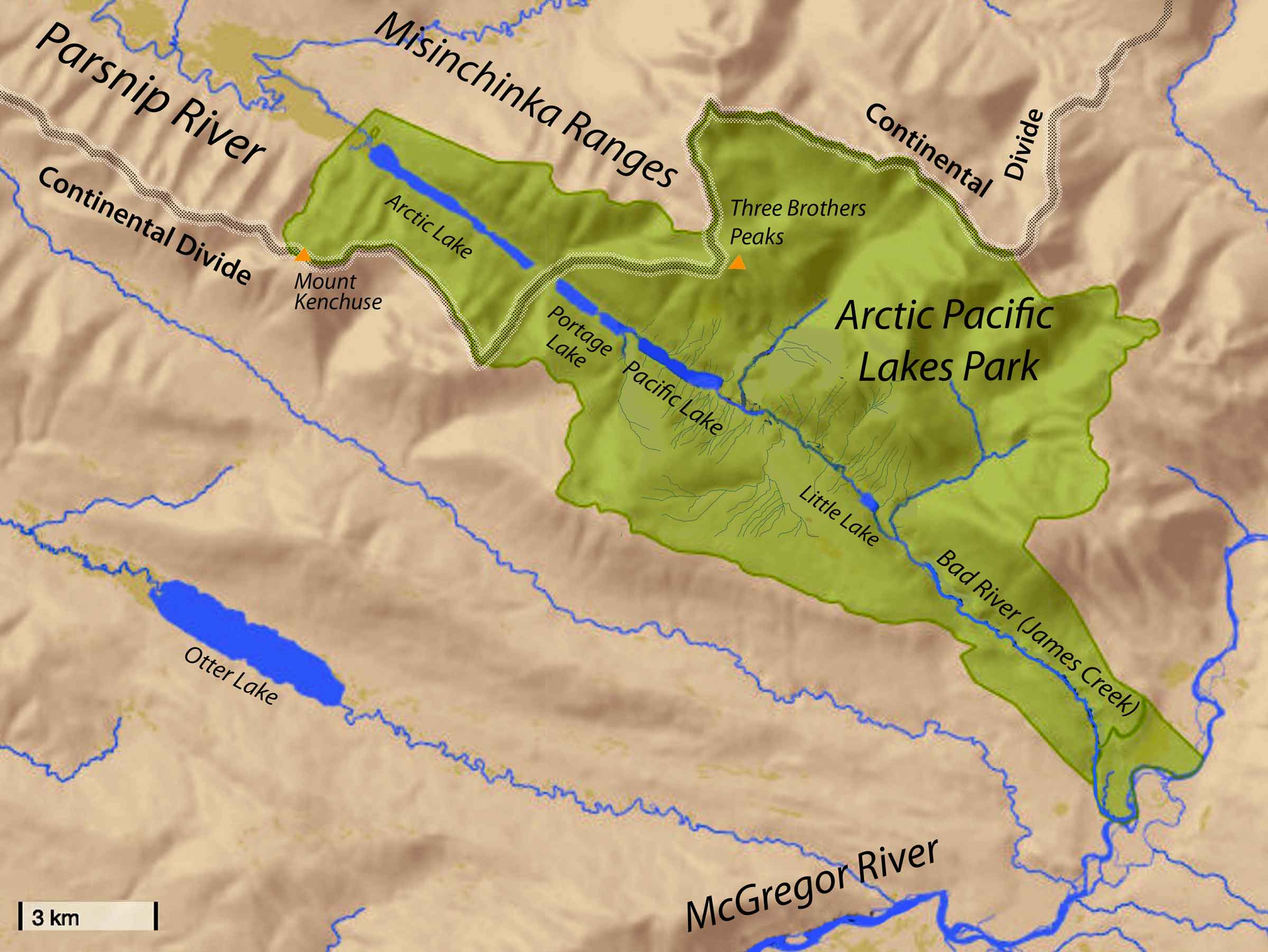
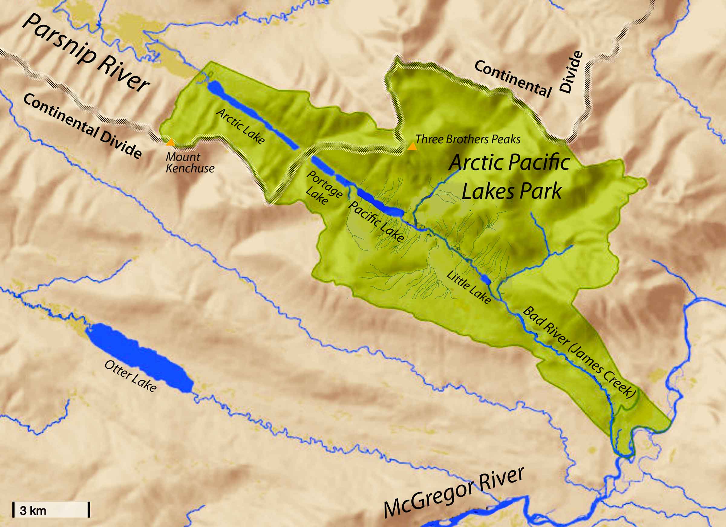
Arctic Lake drains north into the Parsnip River, and through the Peace River and the Mackenzie River reaches the Arctic Ocean.
Pacific Lake (and Portage Lake) are at the headwaters of Bad River (James Creek), which drains into Herrick Creek, thence McGregor River, which empties into the Fraser River on to the Pacific Ocean.
The park also encloses Little Lake on Bad River.
The lakes are a beautiful turquoise colour, and situated in a very scenic area, with alpine peaks and ridges as a distant backdrop. Situated in an area of limestone bedrock, some watercourses drain underground. Valley bottoms alongside the lakes support wet meadows and mixed forest. Valley sides include extensive avalanche chutes and small, picturesque waterfalls.
The park, established in 2000, protects high value fall and spring grizzly habitat, and year-round caribou habitat. Lakes and streams support diverse fish populations, and provide excellent opportunities for fishing. Diverse fish populations including lake trout, bull trout, rainbow trout, kokanee, dolly varden, mountain whitefish, redside shiner, lake char, and chinook salmon, and arctic grayling in Arctic Lake.
There appears to be a resource road leading to the Parsnip side of the pass, starting at Bear Lake on the Hart Highway.