Category Archives: Place

Cariboo Mountains

British Columbia. Mountains
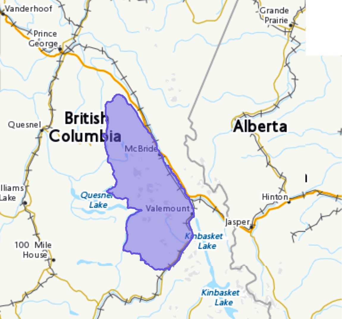
Between Rocky Mountain Trench and E side of Bowron Lake
52.9167 N 120.25 W — Map 93A/16 — GoogleGeoHack
Earliest known reference to this name is 1861 (James Douglas)
Name officially adopted in 1918
Official in BCCanada
Cariboo Mountains

Cariboo Mountains

The name “Cariboo” is derived from an Algonquian word xalibu, meaning “pawer” or “scratcher,” referring to the North American reindeer. The name was first applied to the goldfield area around Quesnel and Barkerville, where caribou were once abundant. The name goes back to at least 1861, near the beginning of the gold rush, when governor James Douglas [1803–1877] of the colony of British Columbia used the name “Cariboo” to describe the area in dispatches to Britain.

Raymond T. Zillmer made a number of explorations in the Cariboo Mountains in the 1930s and 40s and wrote articles about area in the Canadian Alpine Journal and the American Alpine Journal.

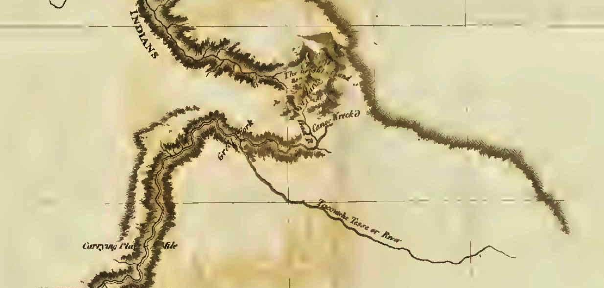
The Cariboo Range is important in the development of Canada. When the Canadian Pacific Railway considered the matter of its route across the continental divide, it tentatively selected Yellowhead Pass, for it offered the easiest crossing. But that decision was frustrated by the Cariboo Mountains. A practical railroad route led from Yellowhead Pass to the Fraser River and down the Fraser until the Cariboo Range was reached, about 50 miles west of the pass. Here, from an elevation of 2400 ft., at Tête Jaune Cache, the Cariboo Range rises in a very short distance to as high as 11,750 ft., the height of Mt. Sir Wilfred Laurier, the highest peak of the entire Interior Ranges of British Columbia. If a route could not be found across the range, a long detour to the northwest or to the south was necessary—the routes now followed by the Canadian National Railway. So from 1871 to 1874 four well- equipped expeditions sought a route across the Cariboo Mountains. But they found that only high glacial passes were available. So the route across Yellowhead Pass was abandoned in favor of the more southerly route now used by the Canadian Pacific Railway.

— Zillmer 1939

The name “Cariboo Mountains” was officially adopted in 1918, not “Cariboo Range” as labelled on Bowman’s 1887 map of the Cariboo Mining District.

References:

  • Holway, Edward Willet Dorland [1853–1923]. “The Cariboo Mountains.” Canadian Alpine Journal, 8 (1917):36-39
  • Trutch, Joseph William [1826–1904]. Map of British Columbia to the 56th Parallel North Latitude. Victoria, B.C.: Lands and Works Office, 1871. University of Victoria
  • Bowman, Amos B. [1839–1894]. Maps of the principal auriferous creeks in the Cariboo mining district, British Columbia. Ottawa: Geological Survey of Canada, 1895. Hathi Trust
  • Bowman, Amos B. [1839–1894]. Map of the Cariboo Mining District, British Columbia, to illustrate the report of Amos Bowman. 1895. Cariboo Gold Rush
  • Zillmer, Raymond T. [1887–1960]. “Explorations in the Southern Cariboos.” Canadian Alpine Journal, Vol. 27 (1939):48-61
  • Zillmer, Raymond T. [1887–1960]. “The exploration of the Cariboo Range from the east.” American Alpine Journal, 5:2 (1944):261-274. American Alpine Club
  • Thorington, James Monroe [1895–1989]. “Canada, Cariboo Range.” American Alpine Journal, Vol. 7, No. 2 (1949). American Alpine Club
  • Akrigg, Helen B., and Akrigg, George Philip Vernon [1913–2001]. British Columbia Place Names. Vancouver: UBC Press, 1997. Internet Archive
  • British Columbia Geographical Names. Cariboo Mountains

Carcajou Pass

Alberta-BC boundary. Pass
Fraser River and Smoky River drainages
Between Holmes River and Carcajou Creek
53.2333 N 119.2667 W — Map 83E/3 — GoogleGeoHack
Earliest known reference to this name is 1924 (Wheeler)
Name officially adopted in 1925
Official in BCCanada

In the earliest references to this location, it was called “Wolverine Pass.” Named in association with Carcajou Creek.

The name appears as “Wolverine Pass” on the 1915 map North and West of Robson by Donald “Curly” Phillips [1884–1938].

“Nearly midway between Bess Pass and Robson Pass is a pass of the watershed which is locally known as Wolverine Pass, noted
Arthur Oliver Wheeler [1860–1945] during the 1924 Alberta-British Columbia Boundary Commission survey. “There is another Wolverine Pass in a more southerly part of the Canadian Rockies, so the pass under discussion is here referred to as Carcajou Pass, a synonym for Wolverine.”

Pertaining to passes on the Great Divide, Wheeler wrote, “North of Mount Robson are a number of passes …. Of these Carcajou Pass, 5120 feet in altitude, originally named Wolverine Pass, but changed on account of duplication, is most striking. Its summit is a broad swamp, numerous channels carrying off the glacial outflow of the magnificent ice-bound cirque below Mt. Phillips. Here, half a dozen icefalls sent their masses down in wildest confusion.”

The word carcajou was used by the French in North America, and is apparently of Indian origin. “The fur hunter’s greatest enemy is the wolverine or carcajou,” wrote Milton and Cheadle in 1863.

References:

  • Wheeler, Arthur Oliver [1860–1945]. “The Alpine Club of Canada’s expedition to Jasper Park, Yellowhead Pass and Mount Robson region, 1911.” Canadian Alpine Journal, Vol. 4 (1912):9-80
  • Cautley, Richard William [1873–1953], and Wheeler, Arthur Oliver [1860–1945]. Report of the Commission appointed to delimit the boundary between the Provinces of Alberta and British Columbia. Part II. 1917 to 1921. From Kicking Horse Pass to Yellowhead Pass.. Ottawa: Office of the Surveyor General, 1924. Whyte Museum
  • Wheeler, Arthur Oliver [1860–1945]. “Passes of the Great Divide.” Canadian Alpine Journal, Vol. 16 (1927–1927):117-135

Canoe River

British Columbia. River: Columbia River drainage
Flows E into Kinbasket Lake near Valemount
52.7833 N 119.1667 W — Map 83D/14 — GoogleGeoHack
Earliest known reference to this name is 1811 (David Thompson)
Name officially adopted in 1930
Official in BCCanada

In 1811, at this river’s confluence with the Columbia River, North West Company explorer David Thompson [1770–1857] and his men built the canoe in which they voyaged down the Columbia.

Our residence was near the junction of two Rivers from the Mountains with the Columbia: the upper Stream which forms the defile by which we came to the Columbia, I named the Flat Heart, from the Men being dispirited ; it had nothing particular. The other was the Canoe River ; which ran through a bold rude valley, of a steady descent, which gave to this River a very rapid descent without any falls…

Birch trees grew in the vicinity, but because of the mild climate, according to Thompson, the bark was too thin to use. So his men “split out thin boards of Cedar wood of about six inches in breadth and builded a Canoe of twenty-five feet by fifty inches in breadth, of the same form of a common canoe, using cedar boards instead of Birch Rind, which proved to be equally light and much stronger than Birch Rind, the greatest difficulty which we had was sewing the boards to each other round the timbers. As we had no nails we had to make use of the fine Roots of the Pine which we split.”

References:

  • Thompson, David [1770–1857]. David Thompson’s Narrative of his explorations in western America, 1784-1812. Joseph Burr Tyrrell, editor. Toronto: Champlain Society, 1916, p. 451. University of British Columbia

Caniche Peak

Alberta-BC boundary. Peak
S of Yellowhead Pass
52.75 N 118.3667 W — Map 083D16 — GoogleGeoHack
Name officially adopted in 1951
Official in BCCanada

Arthur Oliver Wheeler [1860–1945] suggested the name “Poodle Peak” because the summit resembled in shape the head of a poodle. The French word for poodle was chosen “to further distinguish the name,” according to the Akriggs, who do not specfiy their source. Wheeler explored in the Mount Robson area in 1911 and 1913, and was involved in naming places during the Alberta-British Columbia Boundary Commission surveys, 1917–1923.

References:

  • Akrigg, Helen B., and Akrigg, George Philip Vernon [1913–2001]. British Columbia Place Names. Vancouver: UBC Press, 1997. Internet Archive
  • British Columbia Geographical Names. Caniche Peak

Bad River (James Creek)

British Columbia. Creek: Fraser River drainage
Flows SE into Herrick Creek
54.3 N 121.4333 W — Map 93I/6 — GoogleGeoHack
Earliest known reference to this name is 1793 (Mackenzie)
Name officially adopted in 1976
Official in BCCanada
This creek appears on:
Mackenzie’s map North America 1803
Map of Mackenzie’s track in 1793 (detail of pass through Rocky Mountains)

Map of Mackenzie’s track in 1793 (detail of pass through Rocky Mountains)
Internet Archive

Map showing Bad River, with the note “Canoe Wreck’d.” Also showing the height of land and the small lakes in the pass, now named Pacific Lake, Portage Lake, and Arctic Lake.

Alexander Mackenzie [1764–1820] travelled from his winter quarters near Finlay Forks to the Pacific coast in 1793. On his return, travelling through the same unnamed pass through the Rocky Mountains that he traversed on his voyage out, he wrote in his journal:

Friday, 16 August, 1793. The weather continued to be the same as yesterday, and at two in the afternoon we came to the carrying-place which leads to the first small lake; but it was so filled with drift wood, that a considerable portion of time was employed in making our way through it. We now reached the high land which separates the source of the Tacoutche Tesse, or Columbia River, and Unjigah, or Peace River: the latter of which, after receiving many tributary streams, passes through the great Slave Lake, and disembogues itself in the Frozen Ocean, in latitude 69-1/2 North, longitude 135. West from Greenwich; while the former, confined by the immense mountains that run nearly parallel with the Pacific Ocean, and keep it in a Southern course, empties itself in 46. 20. North latitude and longitude 124. West from Greenwich.

Mackenzie was incorrect about Tacoutche Tesse being the Columbia River, it is the Fraser River.

The name “James Creek” was adopted in the 18th Report of the Geographic Board of Canada, 1924, not “Bad River”, the long-established local name. The name was changed to “Bad River (James Creek)” in 1976 to accommodate local usage, which dates to the earliest days of exploration in the northern Rocky Mountains.

References:

  • Mackenzie, Alexander [1764–1820]. Voyages from Montreal on the River St. Lawrence through the Continent of North America to the Frozen and Pacific Oceans in the years 1789 and 1793. London: T. Cadell, Jun., and W. Davies, 1803. Internet Archive
  • Woollacott, Arthur P. Mackenzie and his voyageurs. By canoe to the Artic and the Pacific 1789-93. London and Toronto: J. M. Dent & Sons, Ltd., 1927. University of British Columbia Library