Flows SE into Herrick Creek
54.3 N 121.4333 W — Map 93I/6 — Google — GeoHack
Earliest known reference to this name is 1793 (Mackenzie)
Name officially adopted in 1976
Official in BC – Topo map from Canadian Geographical Names
Mackenzie’s Tracks of 1789 and 1793 published 1803
BC Lands Central BC 1892
Brownlee’s map Province of BC 1893
Jörgensen Map Province of BC 1895
Cram’s map British Columbia 1913
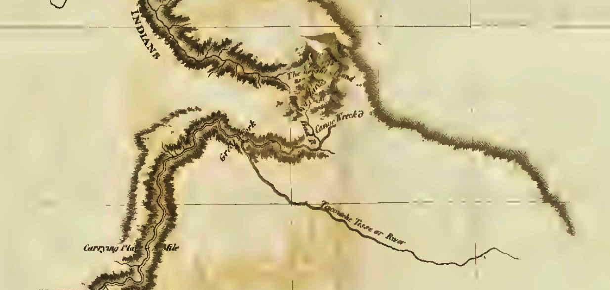
Map of Mackenzie’s track in 1793 (detail of pass through Rocky Mountains) Internet Archive
Alexander Mackenzie [1764–1820] travelled from his winter quarters at Fork Fort to the Pacific coast in 1793. On his return, travelling through the same unnamed pass through the Rocky Mountains that he traversed on his voyage out, he wrote in his journal:
Friday, 16 August, 1793. The weather continued to be the same as yesterday, and at two in the afternoon we came to the carrying-place which leads to the first small lake; but it was so filled with drift wood, that a considerable portion of time was employed in making our way through it. We now reached the high land which separates the source of the Tacoutche Tesse, or Columbia River, and Unjigah, or Peace River: the latter of which, after receiving many tributary streams, passes through the great Slave Lake, and disembogues itself in the Frozen Ocean, in latitude 69-1/2 North, longitude 135. West from Greenwich; while the former, confined by the immense mountains that run nearly parallel with the Pacific Ocean, and keep it in a Southern course, empties itself in 46. 20. North latitude and longitude 124. West from Greenwich [1].
Mackenzie was incorrect about Tacoutche Tesse being the Columbia River, it is the Fraser River.
Having persuaded one of the Sekanais to accompany them in the capacity of guide, Mackenzie and party reached (June 12, 1793) a lake two miles long, which was no other than the source of the Parsnip. After a portage of only 817 paces, they came to another lake, whence they entered a small stream which was to try sorely their patience, and which, for that reason, they called the “Bad River.”
— Morice 1904 [2]
The name “James Creek” was adopted in the 18th Report of the Geographic Board of Canada, 1924, not “Bad River”, the long-established local name. The name was changed to “Bad River (James Creek)” in 1976 to accommodate local usage, which dates to the earliest days of exploration in the northern Rocky Mountains.
- 1. Mackenzie, Alexander [1764–1820]. Voyages from Montreal on the River St. Lawrence through the Continent of North America to the Frozen and Pacific Oceans in the Years 1789 and 1793 with a Preliminary Account of the Rise, Progress, and Present State of the Fur Trade of That Country. London: T. Cadell, Jun., and W. Davies, 1803. Internet Archive [accessed 10 March 2025]
- 2. Morice, Adrien-Gabriel [1859–1939]. The History of the Northern Interior of British Columbia (formerly New Caledonia). Toronto: William Briggs, 1904. Gutenberg [accessed 20 March 2026]