Tag Archives: Surveyor

Narraway River

British Columbia. River: Smoky River drainage
Flows NE across BC-Alberta boundary into Wapiti River
54.35 N 120 W — Map 093I08 — GoogleGeoHack
Name officially adopted in 1924
Official in BCCanada

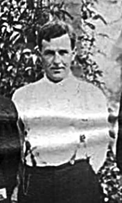
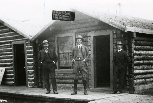
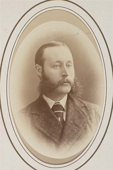
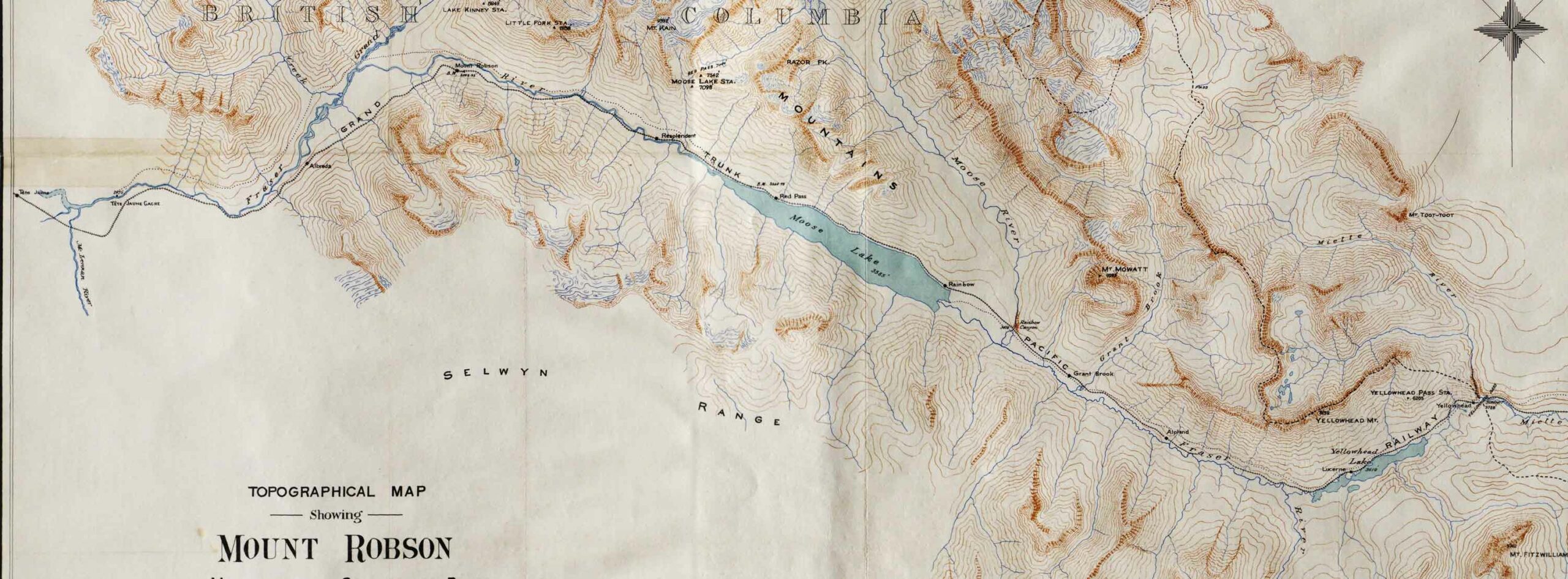
“Narraway River” adopted in 1923 on BC-Alberta boundary sheet 40, not “Sheep Creek” as labelled on BC Lands’ maps 1G, 1916, and 1H, 1917, nor “Crooked River” as submitted on preliminary plans of the interprovincial boundary survey by Richard William Cautley [1873–1953], Dominion Land Surveyor.

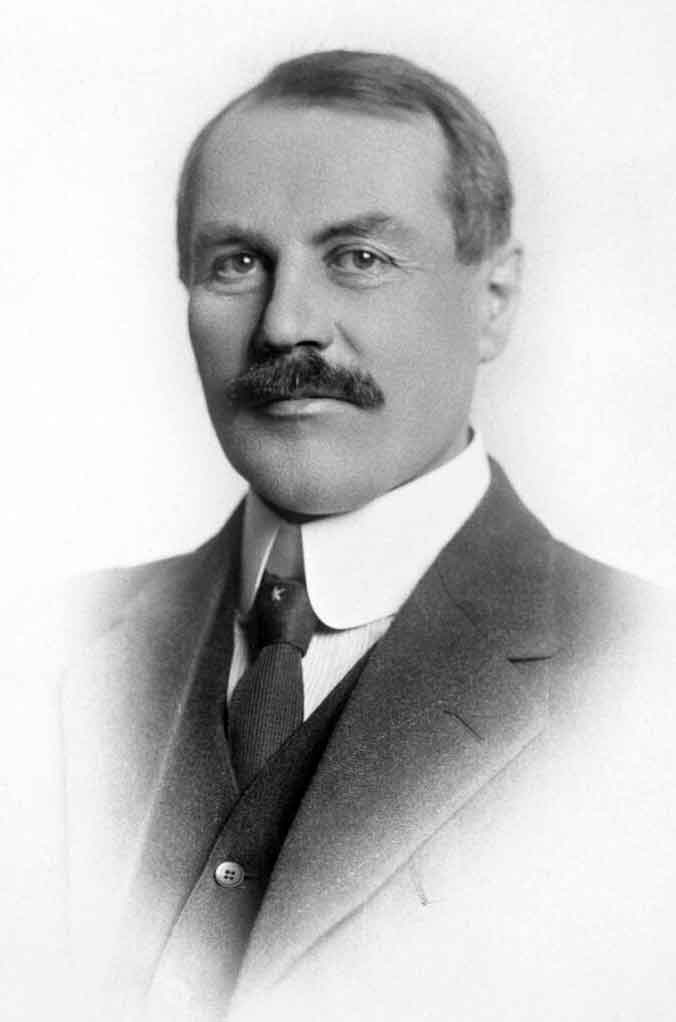
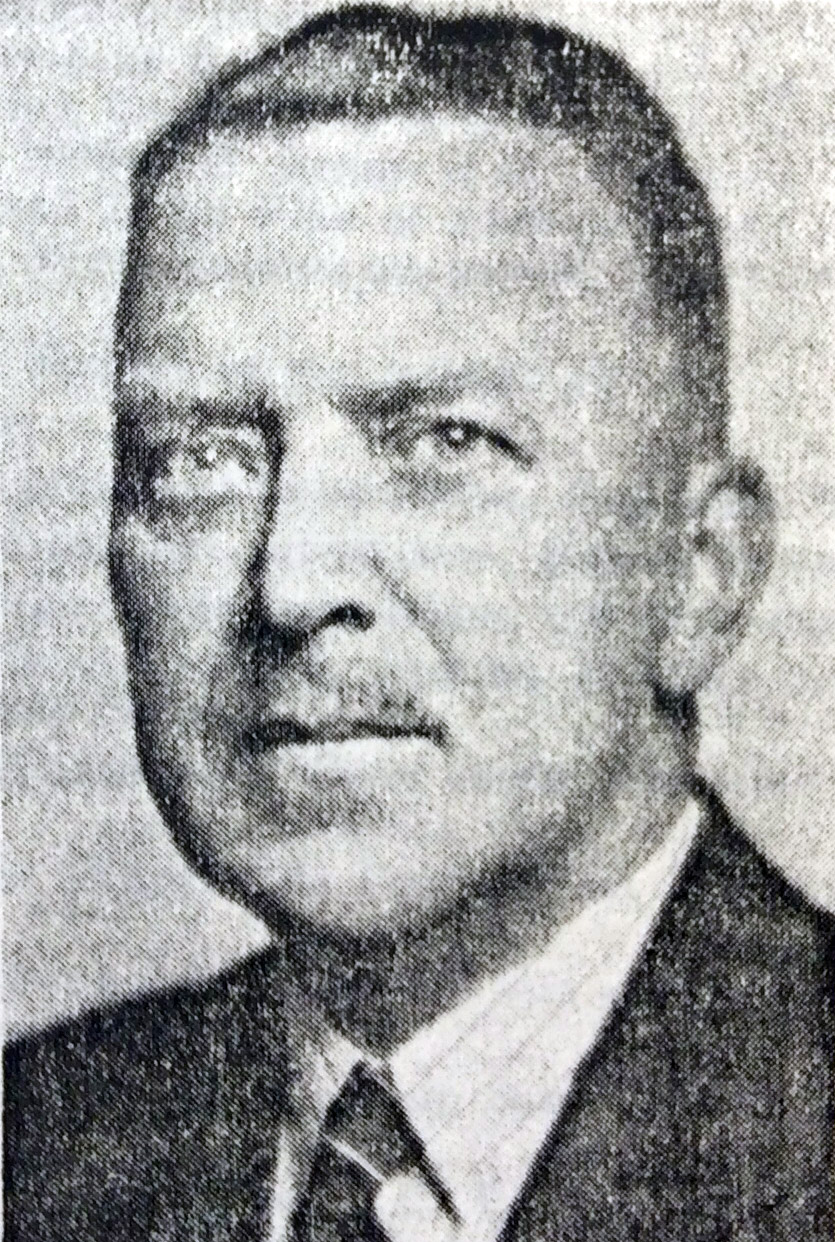
Named after Athos Maxwell Narraway [1888–1974], DLS, who had surveyed the trail between Fort St. John and Fort Nelson River in 1921, and, as controller of surveys for the Department of Mines and Resources, Ottawa, had visited this area while inspecting Cautley’s interprovincial boundary survey party in 1922. He was co-author of Aircraft in Forestry: Containing Air Operations for Forest Fire Protection (1928) and Applied Aerial Photography (1929).

Côté, Mount

Alberta-BC boundary. Mount
Fraser River and Smoky River drainages
Between Intersection Mountain and Cecilia Lake
53.8833 N 120.0008 W — Map 083E13 — GoogleGeoHack
Name officially adopted in 1925
Official in BCCanada
Jean Léon Côté, M.L.A., Edmonton. Ca. 1915

Jean Léon Côté, M.L.A., Edmonton. Ca. 1915
Wikipedia


J. L. Côté and Reginald Cautley, Dawson, Yukon, ca. 1902

J. L. Côté and Reginald Cautley, Dawson, Yukon, ca. 1902
Provincial Archives of Alberta

Named for the French-Canadian politician Jean Léon Côté (1867-1924), born in Les Éboulements, Canada East. Côté was a surveyor and civil engineer by trade, and first visited the Edmonton area in 1886 as part of a survey crew. He returned to the East and trained as a Dominion Land Surveyor for the Department of the Interior, where he worked from 1893 to 1900. In 1899, Côté was sent by the Department to the Klondike gold rush, arriving in Dawson City that summer. Sometime after his arrival in Dawson City, Côté joined the Cautley brothers in a surveying partnership that lasted several years.

In the spring of 1909, Côté was induced to enter politics as a Liberal as he was well known in the Athabasca, Lesser Slave Lake, Peace River, and Fort McMurray areas through his numerous surveying activities. He was elected in the new Grouard riding in 1913 and re-elected by acclamation in 1918 and again in 1921. Côté was provincial secretary and Minister of Mines, Railways and Telephones. As Minister, Côté promoted the issue and approval by the Government of Alberta of an Order in Council establishing what would become known as the Alberta Research Council.

He died suddenly on September 24, 1924, at the age of 57 from peritonitis.

References:

  • Côté, Jean Gustave. Senator Jean Léon Côté: Pioneer Land Surveyor and Early Legislator. Edmonton: Jean G. Côté, 1992. Whyte Museum
  • Alberta Land Surveyors’ Association. J. L. Cote. 2014. ALSA
  • British Columbia Geographical Names. Mount Côté
  • Wikipedia. Jean Côté
Also see:

Mahood Lake

British Columbia. Lake: North Thompson River drainage
SW side of Wells Gray Provincial Park
51.9306 N 120.3819 W — Map 092P16 — GoogleGeoHack
Name officially adopted in 1955
Official in BCCanada

James Adams Mahood [d. 1901] conducted a Canadian Pacific Railway survey party along the shore of the lake in 1872.

EXPLORER’S DEATH
Funeral of Surveyor J. A. Mahood Takes Place Today, The funeral of J. A. Mahood is taking place this afternoon from the residence of his sister, Mrs. Berkley, Burdett avenue, and from Christ Church cathedral

The deceased was a native of St. Andrew’s, N. B., and has been engaged during the greater part of his active life with exploring parties. He served with the surveying party which prospected the proposed line across the continent from the Atlantic to the Pacific, thence up the coast to Alaska, across Behring Straits and through Siberia to the various parts of Europe. The scheme was never put into practical form.

Mr. Mahood served as major in the surveying party which had the Siberian portion of the survey to make. Upon the abandonment of this work Mr. Mahood returned to America and was engaged for a time in making surveys for the forts of San Francisco bay.

in 1872 he came to British Columbia and followed his profession in the survey works of the province.

Victoria Times, 1901-02-25, Page 3

By 1892, Mahood had cut a trail past Indianpoint Lake on his way to Tête Jaune Cache, where he was to meet the Thompson River party of Alfred Richard Cecil Selwyn [1824–1902]. A few months later the CPR chose a route far to the south and the trail fell into disuse.

References:

  • Wright, Richard. “Tales of a trail [Goat River].” BC Outdoors, (1985)
Also see:

Herrick Creek

British Columbia. Creek: Fraser River drainage
Flows SW into McGregor River
54.2667 N 121.4833 W — Map 93I/6 — GoogleGeoHack
Name officially adopted in 1915
Official in BCCanada

Named in recognition of Captain James Herrick McGregor [1869–1915], Provincial Land Surveyor, who fell at Ypres 25 April 1915.

Jarvis Pass

Alberta-BC boundary. Pass
Fraser River and Mackenzie River drainages
Between Jarvis Creek and Hanington Creek
54.0906 N 120.1583 W — Map 93I/1 — GoogleGeoHack
Earliest known reference to this name is 1915
Name officially adopted in 1982
Official in BCCanada
E. W. Jarvis — Christmas, 1872

E. W. Jarvis — Christmas, 1872

The name was adopted by the Geographic Board of Canada in 1917 in recognition of surveyor Edward Worrell Jarvis [1846–1894].

“E.W. Jarvis, CE, and Major C. F. Hanington of Ottawa made an adventurous winter journey across the Rockies in 1875. The pass through which they crossed the mountains was named Jarvis Pass by the Geographic Board of Canada and the name Jarvis is also borne by a mountain on the south side of the pass opposite Mount Hanington. The exploration was undertaken to see if this route across the mountains would be a practicable one for the Canadian Pacific Railway. The elevation of the pass, about 5,000 feet, proved too high. The starting point of the journey was Quesnel, which was left on December 9, 1874, and a 1,000-mile journey, mostly on foot, occupying five and a half months, was concluded at Winnipeg on May 21, 1875.” (extract from Natural Resources Canada, Ottawa, June 1927)

References:

  • Hanington, Charles Francis [1848–1930]. Journal of Mr. C.F. Hanington from Quesnelle through the Rocky Mountains, during the winter of 1874-5. 1875. Internet Archive
  • McBride, Sam. “Edward Worrell Jarvis in Western Canada.” Manitoba History, Number 78 (Summer 2015). Manitoba Historical Society
  • British Columbia Geographical Names. Jarvis Pass

Arthur Wheeler’s map of the Mount Robson region 1912

Topographical Map Showing Mount Robson and Mountains of the Continental Divide North of Yellowhead Pass. Arthur O. Wheeler, 1912

Topographical Map Showing Mount Robson and Mountains of the Continental Divide North of Yellowhead Pass. Arthur O. Wheeler, 1912
Victoria Library, University of Toronto


Detail showing stations on the Grand Trunk Pacific Railway.

Detail showing stations on the Grand Trunk Pacific Railway.
Victoria Library, University of Toronto

Topographical Map Showing Mount Robson and Mountains of the Continental Divide North of Yellowhead Pass
To accompany the Reports of the Alpine Club of Canada’s Expedition, 1911
From Photographic Surveys by Arthur Oliver Wheeler [1860–1945], A.C.C., Director
Annual report of the Topographical Surveys Branch, 1911-1912

With an inset showing a detail of the Geological Survey of Canada’s 1900 map of the Yellowhead Pass Route by James McEvoy [1862–1935] .

References:

  • Wheeler, Arthur Oliver [1860–1945]. “The Mountains of the Yellowhead Pass.” Alpine Journal, Vol. 26, No.198 (1912):382
  • Wheeler, Arthur Oliver [1860–1945]. “The Alpine Club of Canada’s expedition to Jasper Park, Yellowhead Pass and Mount Robson region, 1911.” Canadian Alpine Journal, Vol. 4 (1912):9-80

Walker Creek

British Columbia. Creek: Fraser River drainage
Flows SW into Torpy River, N of Holy Cross Mountain
53.8 N 120.9 W — Map 93H/15 — GoogleGeoHack
Earliest known reference to this name is 1930
Name officially adopted in 1965
Official in BCCanada
James Alexander Walker

James Alexander Walker
Corporation of BCLS, 1956

British Columbia Land Surveyor James Alexander Walker [1887–1959] started surveys in the upper Fraser River area in 1912. In 1913 and 1914, he surveyed within the three-mile land reserve on the Fraser near McBride, subdividing the country into 40-acre tracts. That year 80,000 acres of land was opened by the provincial government. Walker reported that “a great rush resulted, about 175 pre-emptions having been filed upon. All summer clearing land and building cabins have been the chief industries in the valley. A splendid type of settlers, by far the majority of whom are English-speaking, has come in. There are no Indians in the valley from Tête Jaune Cache to the Fort George Indian reserves.”

Walker Creek (not “East Fork of Torpy River”) identified in the 1930 and 1953 BC Gazetteers.

References:

  • Walker, James Alexander [1887–1959]. “South fork of Fraser River, Dore River to Clearwater River. December 15, 1913.” Report of the Minister of Lands, (1914). Google Books
  • Walker, James Alexander [1887–1959]. “South fork of Fraser River, vicinity of McBride. November 11, 1914.” Report of the Minister of Lands for the Province of British Columbia for the Year Ending 31st December 1914, (1915). Google Books
  • Andrews, Gerald Smedley [1903–2005]. Professional Land Surveyors of British Columbia. Cumulative nominal roll. Victoria: Corporation of Land Surveyors of British Columbia, 1978
  • City of Vancouver Archives. Walker, J. Alexander (2000). City of Vancouver Archives
  • British Columbia Geographical Names. Walker Creek

Mount Morkill

Alberta-BC boundary. Mount
Near headwaters of Morkill River
53.7 N 119.8333 W — Map 83E/12 — GoogleGeoHack
Official in BCCanada

The camera station “Morkill” was established on this summit in 1923 (BC-Alberta boundary sheet #37, and Report Part III, p.62); so-named by the Interprovincial Boundary Commission in association with Morkill River and Morkill Pass.

References:

  • Fay, Samuel Prescott [1884–1971]. The Forgotten Explorer: Samuel Prescott Fay’s 1914 Expedition to the Northern Rockies. Edited by Charles Helm and Mike Murtha. Victoria, B.C.: Rocky Mountain Books, 2009
  • Interprovincial Boundary Commission. Boundary between Alberta and British Columbia. Sheet 37. Ottawa: Office of the Surveyor General, 1924. Internet Archive
  • Cautley, Richard William [1873–1953], and Wheeler, Arthur Oliver [1860–1945]. Report of the Commission Appointed to Delimit the Boundary between the Provinces of Alberta and British Columbia – Part III – from 1918 to 1924. Atlas. Ottawa: Office of the Surveyor General, 1925
  • British Columbia Geographical Names. Mount Morkill

Morkill River

British Columbia. River: Fraser River drainage
Flows SW into Fraser River near Loos
53.6 N 120.7 W — Map 93H/10 — GoogleGeoHack
Earliest known reference to this name is 1915
Name officially adopted in 1925
Official in BCCanada

The name was adopted in 1925 to recognize surveyor Dalby Brooks Morkill [1880–1955].

Morkill was born in Sherbrooke, Québec, and came to British Columbia in 1898. He received his commission as a British Columbia Land Surveyor in 1910. Morkill was employed in 1912 by the British Columbia government making surveys on the Fraser River between Horsey Creek and Holmes River. In 1913, with Alan S. Thompson, Morkill surveyed between Goat River and Catfish Creek.

Morkill worked on the Alberta-British Columbia Boundary Commission surveys north of Yellowhead Pass in the early 1920s. Subsequently Morkill surveyed in several other areas of the Province. During his last years he spent summers at his residence at Barkerville and winters in Vancouver.

The Morkill River is known locally as the Smoky River, a name that dates back to at least 1909. (There is also a Smoky River in Alberta, headwaters at Robson Pass.)

References:

  • Cautley, Richard William [1873–1953], and Wheeler, Arthur Oliver [1860–1945]. Report of the Commission appointed to delimit the boundary between the Provinces of Alberta and British Columbia. Part II. 1917 to 1921. From Kicking Horse Pass to Yellowhead Pass.. Ottawa: Office of the Surveyor General, 1924. Whyte Museum
  • Cautley, Richard William [1873–1953], and Wheeler, Arthur Oliver [1860–1945]. Report of the Commission Appointed to Delimit the Boundary between the Provinces of Alberta and British Columbia. Parts IIIA & IIIB, 1918 to 1924. From Yellowhead Pass Northerly. Ottawa: Office of the Surveyor General, 1925. Whyte Museum
  • Association of British Columbia Land Surveyors. Annual Report (1956)., 1956
  • Robson Valley Courier. Weekly newspaper published by Pyramid Press of Jasper from 1968–88 (1968–1988).
  • Andrews, Gerald Smedley [1903–2005]. Métis outpost. Memoirs of the first schoolmaster at the Métis settlement of Kelly Lake, B.C. 1923-1925. Victoria: G.S. Andrews, 1985. Internet Archive
  • Akrigg, Helen B., and Akrigg, George Philip Vernon [1913–2001]. British Columbia Place Names. Vancouver: UBC Press, 1997. Internet Archive
  • British Columbia Geographical Names. Morkill River

McLennan River

British Columbia. River: Fraser River drainage
Flows N into Fraser River at Tête Jaune Cache
52.9681 N 119.4611 W — Map 83D/14 — GoogleGeoHack
Earliest known reference to this name is 1900 (McEvoy)
Name officially adopted in 1951
Official in BCCanada
The First Canadian Pacific R.R. and Geological Survey parties for British Columbia, July 22 1871 Left to right : L. N. Rheaumis, Roderick McLennan, A. S. Hall, West West Ireland, Alfred Selwyn, Alex Maclennan, Walter Moberly, C. E. Gilette, James Richardson, -- -- McDonald, George Watt.

The First Canadian Pacific R.R. and Geological Survey parties for British Columbia, July 22 1871 Left to right : L. N. Rheaumis, Roderick McLennan, A. S. Hall, West West Ireland, Alfred Selwyn, Alex Maclennan, Walter Moberly, C. E. Gilette, James Richardson, — — McDonald, George Watt.
Toronto Public Library


Detail: Roderick McLennan

Detail: Roderick McLennan
Toronto Public Library

In 1871-72, Canadian Pacific Railway surveyors Roderick M. McLennan [1805–] and Charles Horetzky [1838–1900] made a reconnaisance from the Big Bend of the Columbia River up to the North Thompson River. McLennan left Kamloops on August 19, 1871, and in October decided to winter his party in the vicinity of Tête Jaune Cache. He built a camp four or five miles upstream from the Canoe River on what consequently came to be named Camp Creek. In 1872 he undertook an expedition to Moose Lake.

George Monro Grant mentions McLennan in his book Ocean to Ocean:

[South of Albreda] the trail was as bad as could well be, although a great amount of honest work had been expended on it. Before McCord [surveyor] had come through, it must havbe been simple impassable except for an Indian on foot, — worse than when Milton and Cheadle forced through with their one pack-horse at the rate of three miles a day; for the large Canadian party [Overlanders] had immediately preceded them, whereas no one attempted to follow in their steps till McLellan [McLennan ?] , in 1871, and in the intervening nine years much of the trail had been buried out of sight, or hopelessly blocked up by masses of timber, torrents, landslides, or debris.

“The stream here called McLennan River, its real source, is also known as Mica Creek,” reported Munday in 1925.

References:

  • Grant, George Monro [1835–1902]. Ocean to Ocean: Sandford Fleming’s Expedition through Canada in 1872. Being a Diary Kept During a Journey from the Atlantic to the Pacific with the Expedition of the Engineer-in-Chief of the Canadian Pacific and Intercolonial Railways. Toronto: James Campbell and Son, 1873, p. 265. Google Books
  • Munday, Walter Alfred Don [1890–1950]. “In the Cariboo Range – Mt. David Thompson.” Canadian Alpine Journal, Vol. 15 (1925):130-136
  • MacGregor, James Grierson [1905–]. Overland by the Yellowhead. Saskatoon: Western Producer, 1974. Internet Archive
  • Andrews, Gerald Smedley [1903–2005]. Professional Land Surveyors of British Columbia. Cumulative nominal roll. Victoria: Corporation of Land Surveyors of British Columbia, 1978
  • Fairhall, Charles. “Surveyors of the Past. Roderick M. McLennan, 1805–1908. Civil Engineer, Land Surveyor, Explorer.” Ontario Land Surveyor, Summer (1983):27-28. Krcmar