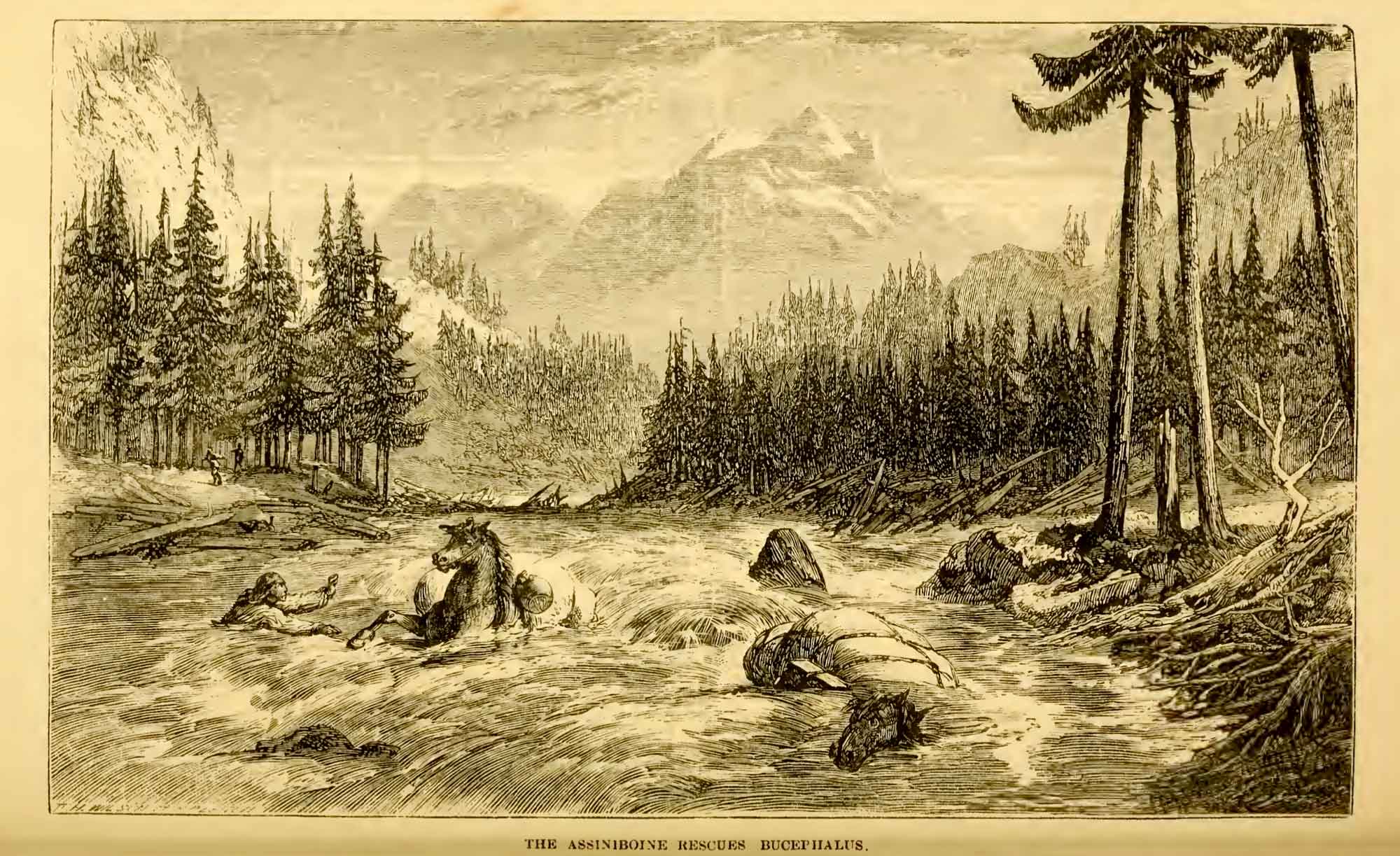
Botanist
David Douglas [1799–1834] crossed the
Athabasca Pass on May 1, 1827:
After breakfast, about one o’clock, being well refreshed, I set out with the view of ascending what seemed to be the highest peak on the north. The height from its apparent base exceeds 6000 feet, 17,000 feet above the level of the sea. After passing over the lower ridge of about 200 feet, by far the most difficult and fatiguing part, on snow-shoes, there was a crust on the snow, over which I walked with the greatest ease. A few mosses and lichens, Andreae and Jungermanniae, were seen. At the elevation of 4800 feet vegetation no longer exists not so much as a lichen of any kind to be seen, 1200 feet of eternal ice. The view from the summit is of that cast too awful to afford pleasure nothing as far as the eye can reach in every direction but mountains towering above each other, rugged beyond all description; the dazzling reflection from the snow, the heavenly arena of the solid glacier, and the rainbow-like tints of its shattered fragments, together with the enormous icicles suspended from the perpendicular rocks ; the majestic but terrible avalanche hurtling down from the southerly exposed rocks producing a crash, and groans through the distant valleys, only equalled by an earthquake. Such gives us a sense of the stupendous and wondrous works of the Almighty. This peak, the highest yet known in the northern continent of America, I felt a sincere pleasure in naming MOUNT BROWN, in honour of R. Brown, Esq., the illustrious botanist, no less distinguished by the amiable qualities of his refined mind. A little to the south is one nearly of the same height, rising more into a sharp point, which I named MOUNT HOOKER, in honour of my early patron the enlightened and learned Professor of Botany in the University of Glasgow, Dr. Hooker, to whose kindness I, in a great measure, owe my success hitherto in life, and I feel exceedingly glad of an opportunity of recording a simple but sincere token of my kindest regard for him and respect for his profound talents. .” [1]
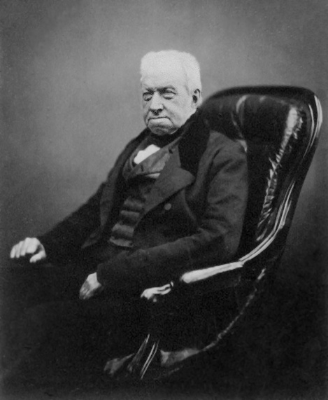
Robert Brown [1775–1858], the first keeper of the botanical department in the British Museum, was also the namesake of Brownian motion, the incessant motion of microscopic particles suspended in fluids. David Douglas was his student. Douglas’s ascent was the earliest recorded climb in the Canadian Rockies. [2]
When mountaineers first came to the Rockies in the late nineteenth century, they were anxious to find and climb this “highest yet known” peak. [3] In 1893 the highest mountain Arthur Philemon Coleman [1852–1939] could find near the Athabasca Pass was about 9,000 feet (2740 m) high. [4] In 1908 Hugh Edward Millington Stutfield [1858–1929] and John Norman Collie [1859–1942] took another look for the 17,000 foot Mount Brown and nearby 16,000 foot Mount Douglas. “If David Douglas climbed a 17,000 foot peak alone on a May afternoon,” they wrote, “when the snow must have been pretty deep on the ground, all one can say is that he must have been an uncommonly active person. What, of course, he really did was to ascent the Mount Brown of Professor Arthur Coleman. These two fabulous Titans, which for nearly seventy years have been masquerading as the monarches of the Canadian Rockies, must now be finally deposed, and Mounts Forbes, Columbia, and Alberta, with Peak Robson, west of the Yellowhead Pass, must reign in their stead. [5]”
Edward Willet Dorland Holway [1853–1923], in “New Light on Mounts Brown and Hooker,” states, “My theory is that possibly after he [Douglas] returned to England he learned of Thompson’s Survey and that he then inserted the height and named the mountains.” [6]
David Thompson’s [1770–1857] Narrative of his explorations in western America, under March 10th, 1809:
At the greatest elevation of the passage across the Mountains by the Athabasca River the point by boiling water gave 11,000 feet and the peaks are full 7,000 feet above this passage; and the general height may be fairly taken at 18,000 feet above the Pacific Ocean. [7]