British Columbia. Locality: Columbia River drainage
Confluence of Canoe River and Columbia River (now submerged in Kinbasket Lake)
52.1167 N 118.4333 W — Map 83D01 — Google — GeoHack
Earliest known reference to this name is 1811 (David Thompson)
Not currently an official name.
Confluence of Canoe River and Columbia River (now submerged in Kinbasket Lake)
52.1167 N 118.4333 W — Map 83D01 — Google — GeoHack
Earliest known reference to this name is 1811 (David Thompson)
Not currently an official name.
This locality appears on:
Map North America 1817 [A NWC post indicated here]
John Arrowsmith’s map BC 1859
Map North America 1817 [A NWC post indicated here]
John Arrowsmith’s map BC 1859
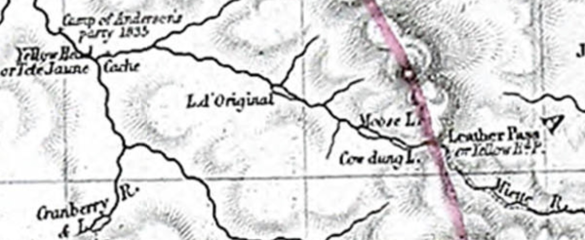
On John Arrowsmith’s 1859 map of British Columbia, “Canoe Encampment” is the name for the Boat Encampment established by David Thompson [1770–1857] in 1811.
![George A. Walkem [left], Dr. Walter Cheadle [seated], Viscount Milton [right, with hat in left hand], photographed in San Francisco, 1863](/wp-content/uploads/2021/04/milton-cheadle-sf.jpg)