Indigenous people
These Indigenous people appear on:
Map America with NWC posts 1817
Map America with NWC posts 1817
Map number 13 in Vooris [1].
Map number 81 in Vooris [1].
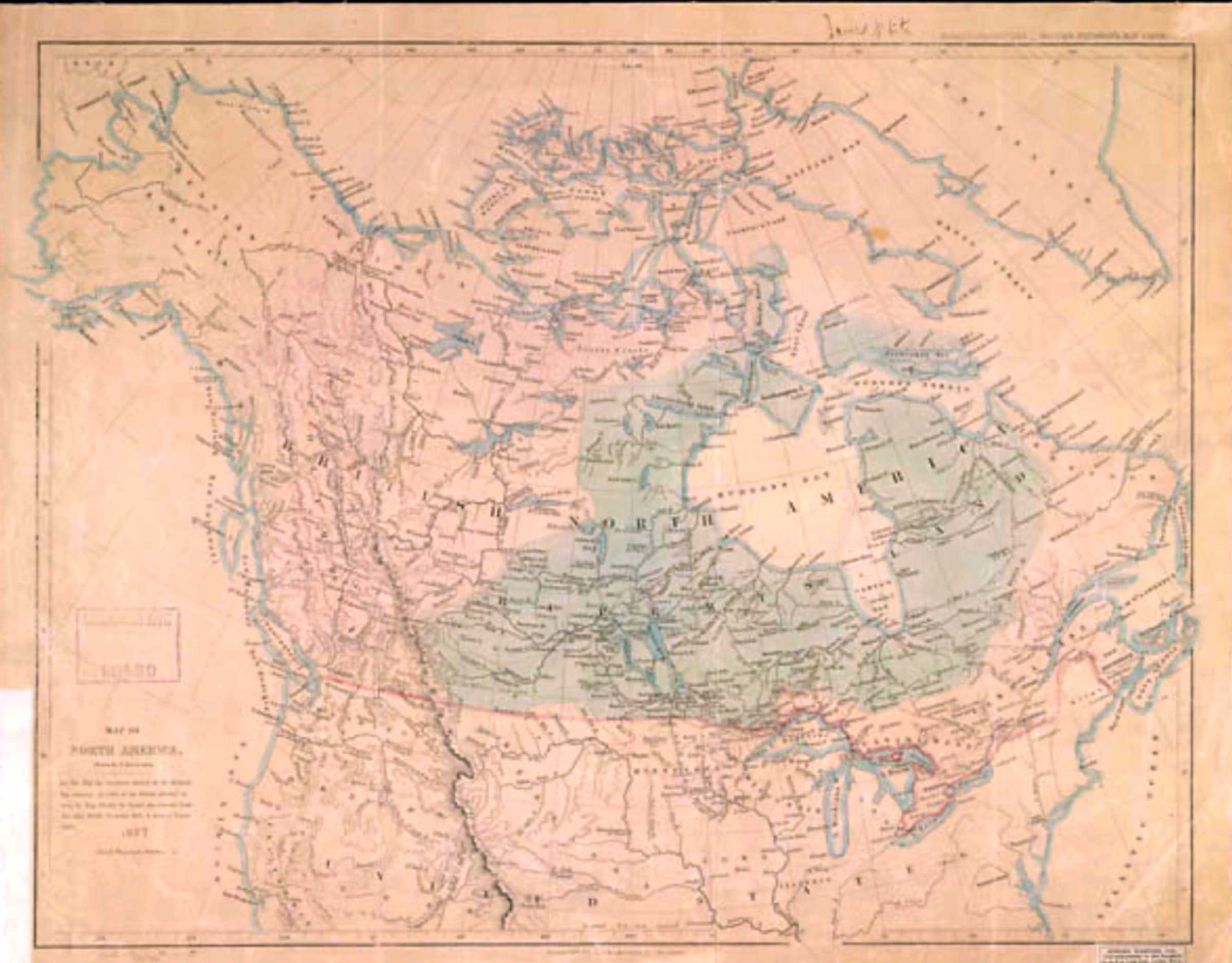
Map of North America.
Drawn by J. Arrowsmith, 1857
Library and Archives Canada [accessed 10 February 2026]
Map of North America.
Drawn by J. Arrowsmith.
On this map, the territories claimed by the Hudson’s Bay Company in virtue of the charter granted to them by King Charles the Second, are coloured green the other British territories, pink & those of Russia, yellow.
1857
Map number 8 in Voorhis [1].
I’ve been unable o pin down this map; it is not John Arrowsmith’s map BC 1859.
No. 5 in Voorhis [2].
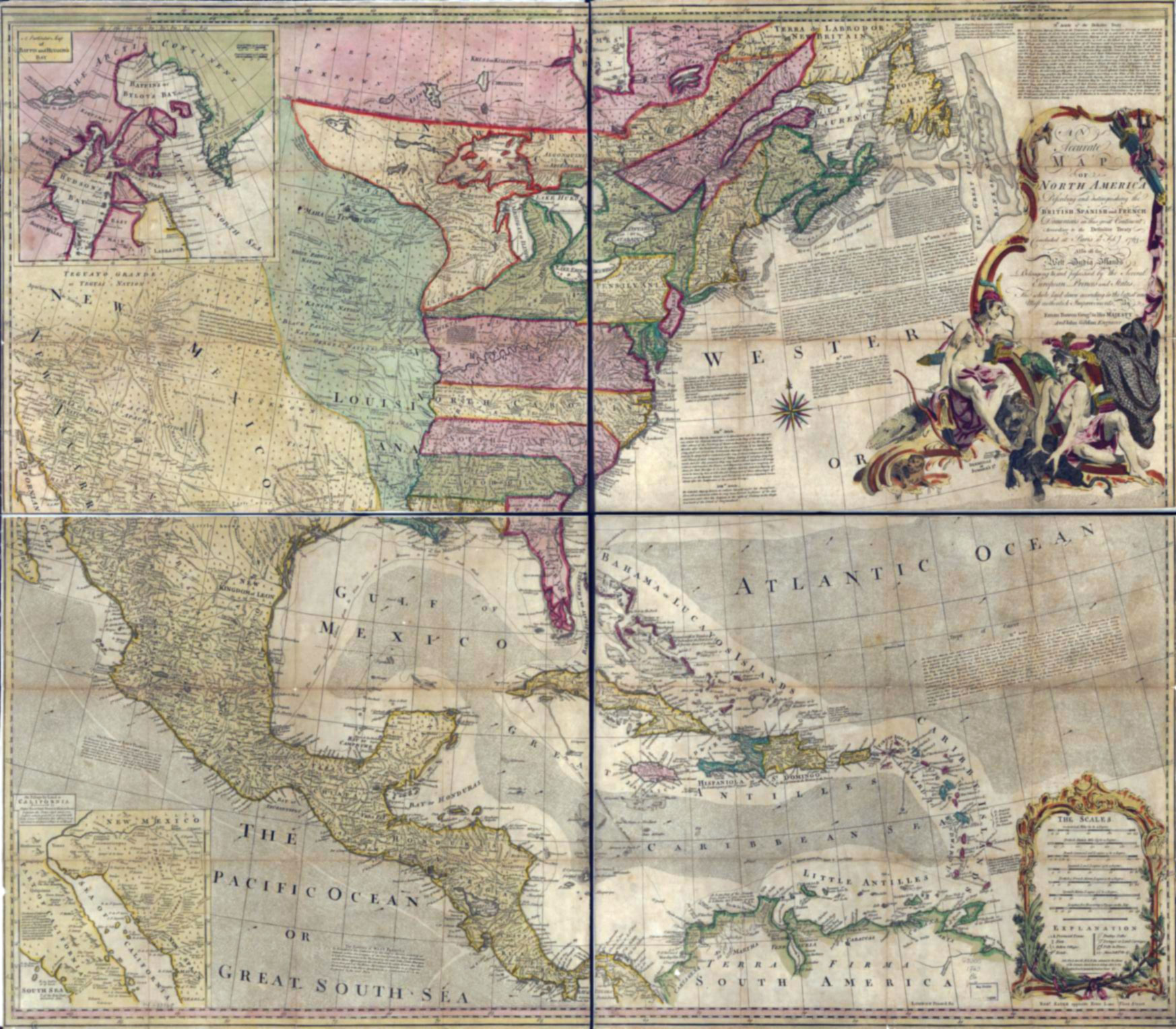
An accurate map of North America.
Attributed to Emmanuel Bowen 1763
Library of Congress [accessed 19 January 2026]
An accurate map of North America.
Describing and distinguishing the British, Spanish and French dominions on this great continent;
according to the definitive treaty concluded at Paris 10th Feby. 1763.
Also all the West India Islands belonging to, and possessed by the several European princes and states. The whole laid down according to the latest and most authentick improvements.
London, Printed for Robt. Sayer.
Attributed to Welsh cartographer Emanuel Bowen [1694–1767].
The Treaty of Paris, also known as the Treaty of 1763, was signed on 10 February 1763 by the kingdoms of Great Britain, France, and Spain, with Portugal in agreement, following Great Britain and Prussia’s victory over France and Spain during the Seven Years’ War. The signing of the treaty formally ended the conflict between France and Great Britain over control of North America (the Seven Years’ War, known as the French and Indian War in the United States), and marked the beginning of an era of British dominance outside Europe. Great Britain and France each returned much of the territory that they had captured during the war, but Great Britain gained much of France’s possessions in North America [1].
Ernest Voorhis [1859–1933] in Historic Forts and Trading Posts mistakenly says this map shows Jasper House, “built in 1799 at outlet of Brûlé Lake and called Rocky Mountain House” [2].
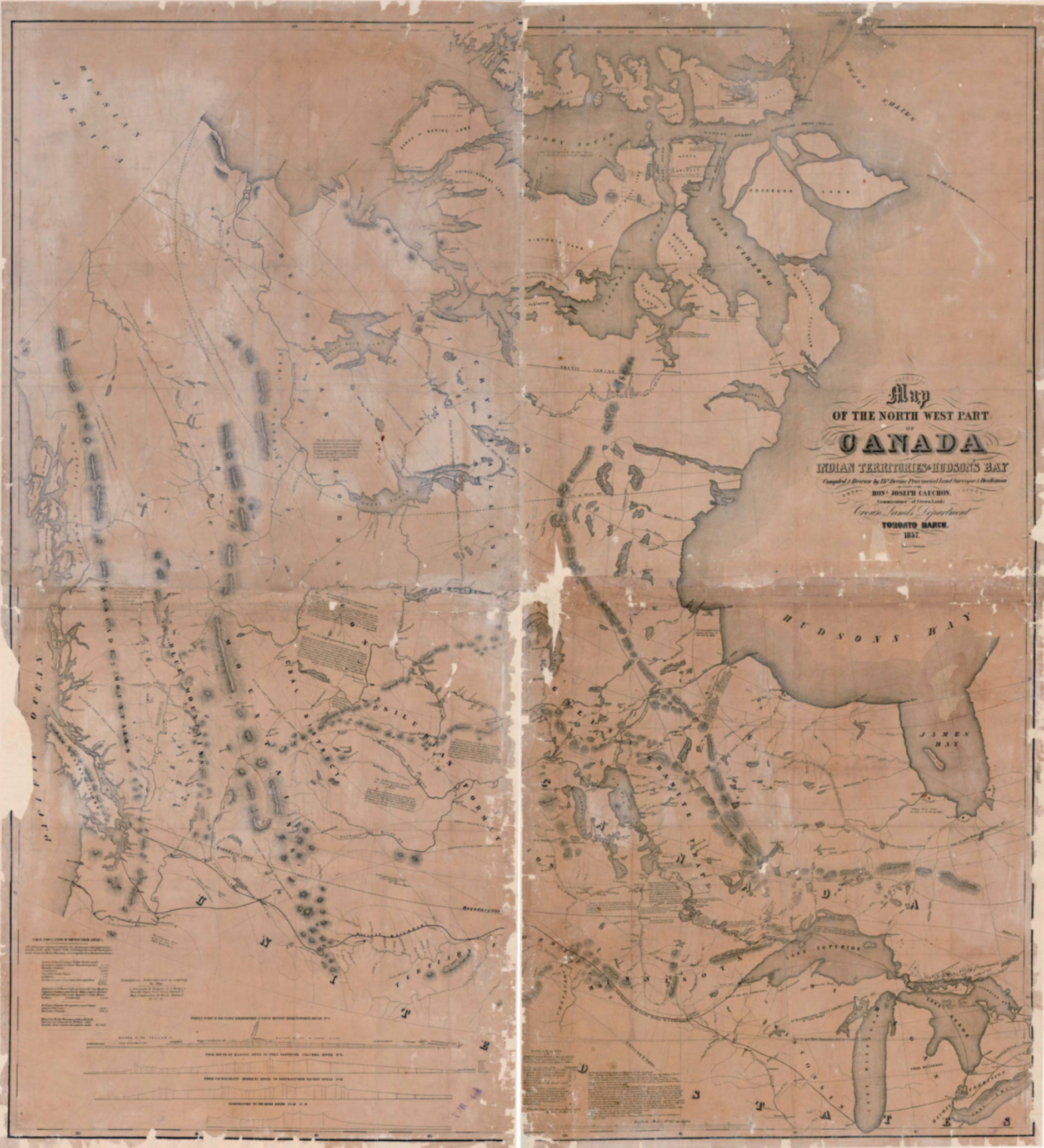
Map of the North West part of Canada.
Indian Territories & Hudson’s Bay
Library and Archives Canada [accessed 19 January 2026]
Map of the North West Part of Canada.
Indian Territories & Hudson’s Bay
Compiled & Drawn by Thos. Devine, Provincial Land Surveyor & Draftsman, by Order of the Hon. Joseph Cauchon, Commissioner of Crown Lands
Crown Lands Department
Toronto March, 1857.
Profiles of a) Route for Pacific railroad from St. Pauls Mississippi River to Puget Sound No. I, b) Mouth of Kansas River to Fort Vancouver Columbia River No. II. c) Council Bluff Missouri River to San Francisco Pacific Ocean No. III; d) Westport to the River Savier Utah No. IV Erebus & Terror Bay 1 1/2″ x 2 1/4″
Map No. 12 in Voorhis [1].