Son of William Pittman Lett [1819–1892] of County Wexford, Ireland, and Maria Hinton [ca. 1828–1881] of Carleton, Upper Canada. In 1912 R. C. W. Lett married Helena Sarah DeCourcy Topley, daughter of photographer
William James Topley [1845–1930] of Ottawa, who travelled with the
1914 Arthur Conan Dolye trip to Jasper
Brother of Rebecca Lett, Andrew John Lett, William Pittman Lett II, Anna Elizabeth Lett, Frederick Piercy Austin Lett, Norman Harold Hinton Lett and Maria Dulcibella Lett.
[1].
———— 115 [2]
Frederick Arthur Ambrose Talbot [1880–1924]
The new garden of Canada. By pack-horse and canoe through undeveloped new British Columbia. London: Cassell, 1911
1910:
p. vii
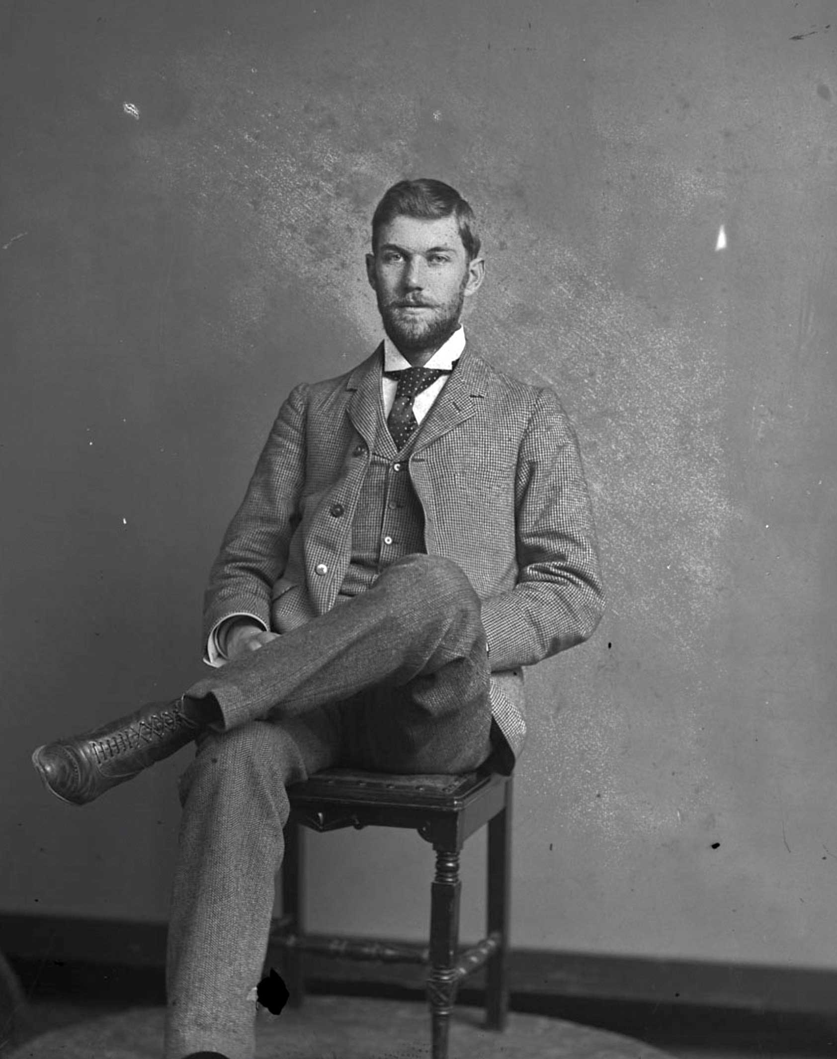
I was one of a party of six which set out from the western fringe of civilisation in Alberta to make the “North-West Passage” by land, threading 1,200 miles of wonderful, practically unknown country-the interior of New Caledonia, or, as it is now officially called, New British Columbia. The party consisted of Harry R. Charlton, Montreal; Robert C. W. Lett, Winnipeg; H. D. Lowry, Washington, U.S.A.; G. Horne Russell, Montreal; a photographer, and myself. The first and third left the party at Tête Jaune Cache to return. The object of my investigations was to form some notion of the economic and scenic value of the country traversed.
Lett, who can manage a dug-out as well as any Indian
shot a bear
p 129
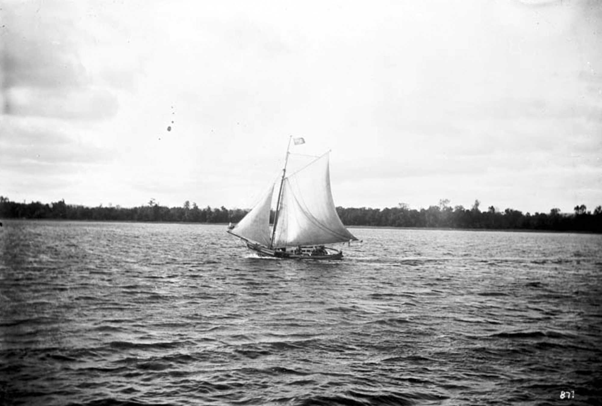
Two legs of bear were lying in the prow, and we were pulling along gaily in the misty morning, when we heard a furious screech over our heads. Looking up, there was a large bald-headed eagle poised about two hundred feet above, and evidently attracted by the sight of the fresh meat. He swooped down a bit, looking a trifle aggressive, and Lett whipped out his Browning automatic and let drive seven shots in rapid succession
p. 209
Lett grabbed up his line and a stick to form an im- promptu rod, ours having been left behind on the Little Smoky River. The dug-out was soon pulling towards the centre of the lake with the troll out. Presently we saw a vicious tug, and an instant later there was a bright flash in the air as the fish made a leap of about ten feet. The fighting and plunging went on for about ten minutes, and then the dug-out came in with a sharp shoot with another quivering specimen lying in the bottom. When weighed it tipped the beam at 8| lb. , and they were two as fine specimens of the trout family as one could desire to land. Our American visitor said they were “fair devils ” when hooked, and would often jump clean over the canoe, while their rushes made the pike’s movements a mere tortoise crawl in comparison. Lett confessed that his catch had given him a lively five minutes, accustomed though he was to all classes of fish found in Canadian river waters.
a competent hunter and fisherman and boatsman
———- 131 [3]
Wheeler, Arthur Oliver [1860-1945 ]. “The Alpine Club of Canada’s expedition to Jasper Park, Yellowhead Pass and Mount Robson region, 1911.” Canadian Alpine Journal, Vol. 4 (1912):9-80
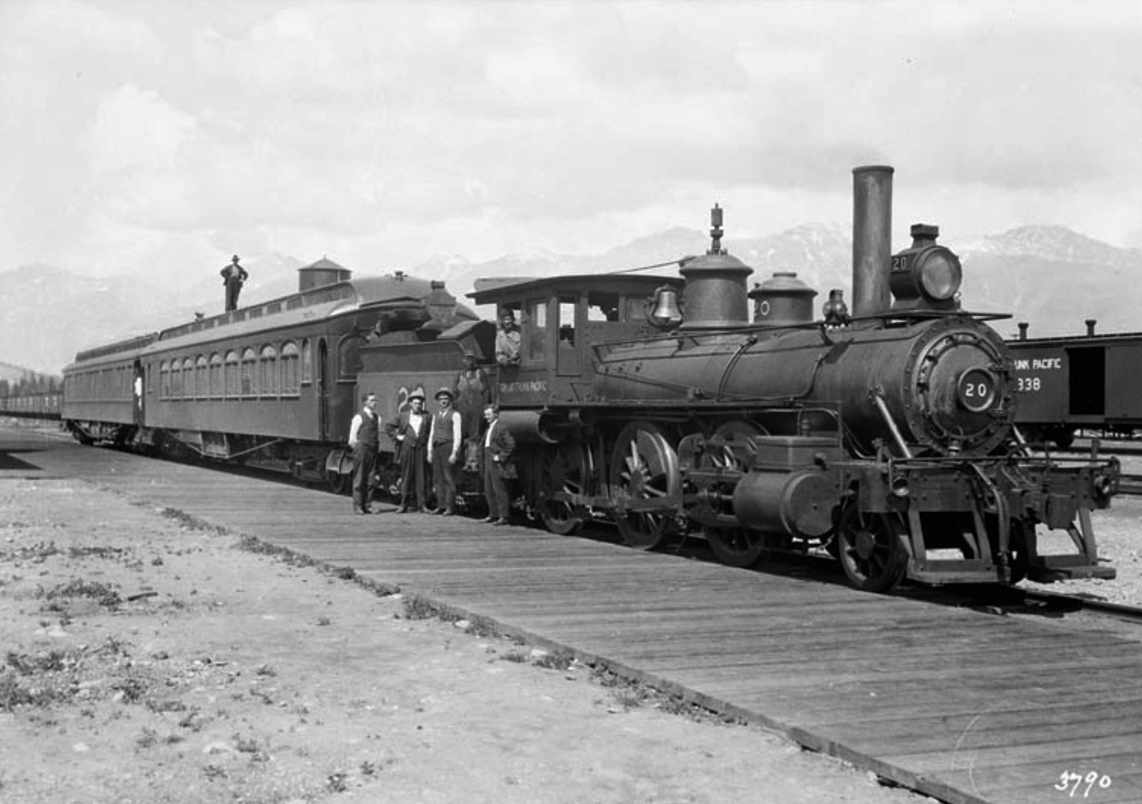
We left Edmonton for the West by the Grand Trunk Pacific train on the 1st July. Attached to the train was the private car of W. P. Hinton, General Passenger Agent. With him were H. R. Charlton, General Advertising Agent, and R. C. W. Lett, Travelling Passenger and Colonization Agent.
——–562 [4]
Talbot, Frederick Arthur Ambrose [1880–1924]. Making Good in Canada. London: Adam and Charles Black, 1912
one of a series of “books for colonists”
The material in the book is undated, other than it is before 1912.
This is the true spirit in which the new arrival must view and attack things Canadian. No calling is too humble ; no occupation should be despised.
Among the occupations: packing, roadbuilding, trapping, wood cutting, game and fre wardens, prospecting, farmingm lumbering, logging, and timber cruising.
let appear in chapter 4, cutting trails and building roads
chapter 5, trapping
chapter 9, game and fire wardens.
p 122
One of the members of our party on this occasion, Mr. Robert C. W. Lett, a few years before had thrown in his lot with these lonely patrollers, for the purposes of restoring his health. The scene of his activity was in Algonquin Park, some way up in the Highlands of Ontario, and he painted me some very powerful pictures of the life of this official under all varying conditions.…
During the summer, life as a game-warden in such a park is enviable to those compelled to drudge in the suffocating and broiling city, because the men spend the whole of their time in the open air, which, bearing in mind the situation and altitude of the reserve, is a most invigorating tonic.
chapter 14, prospecting for minerals
p. 186
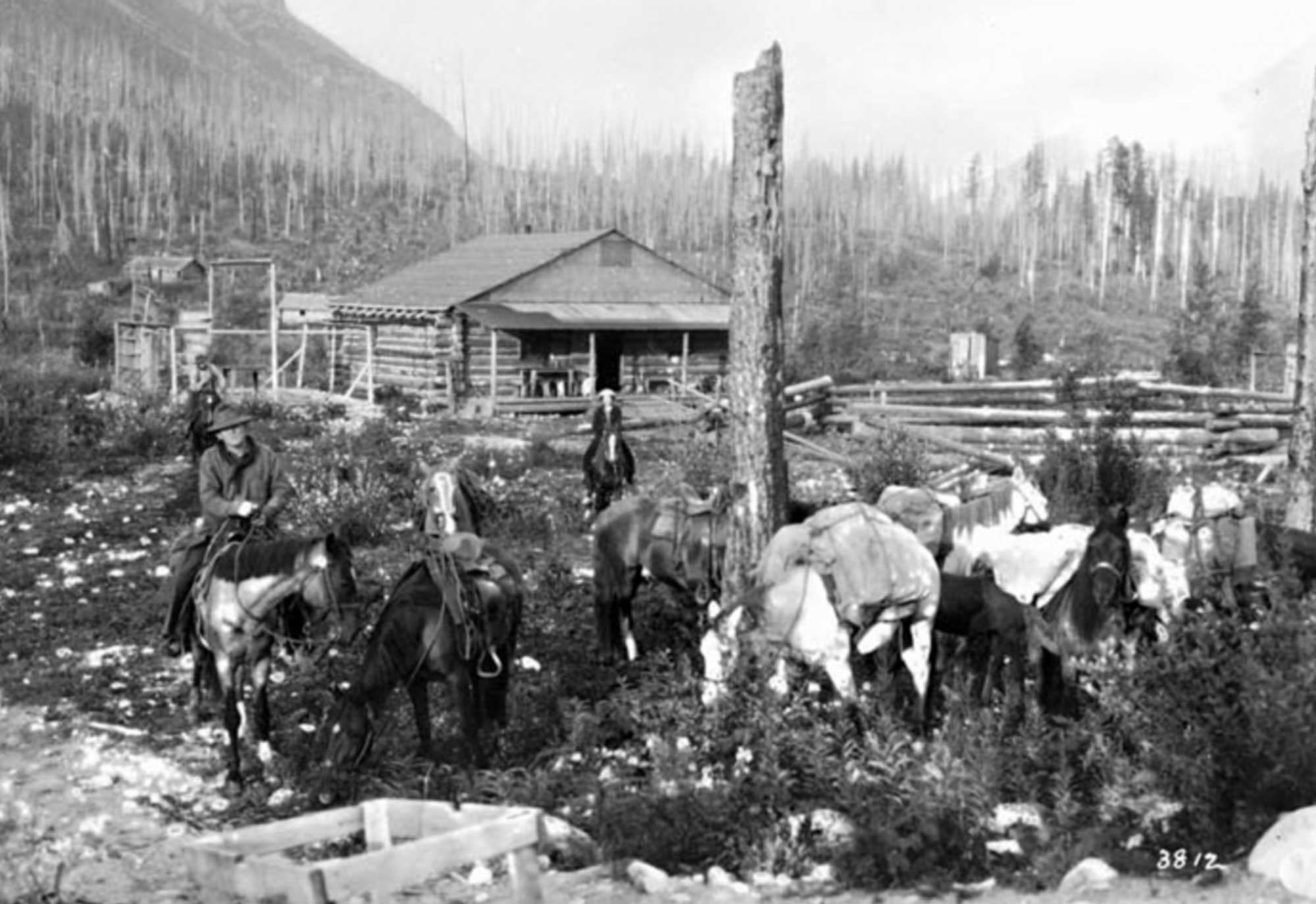
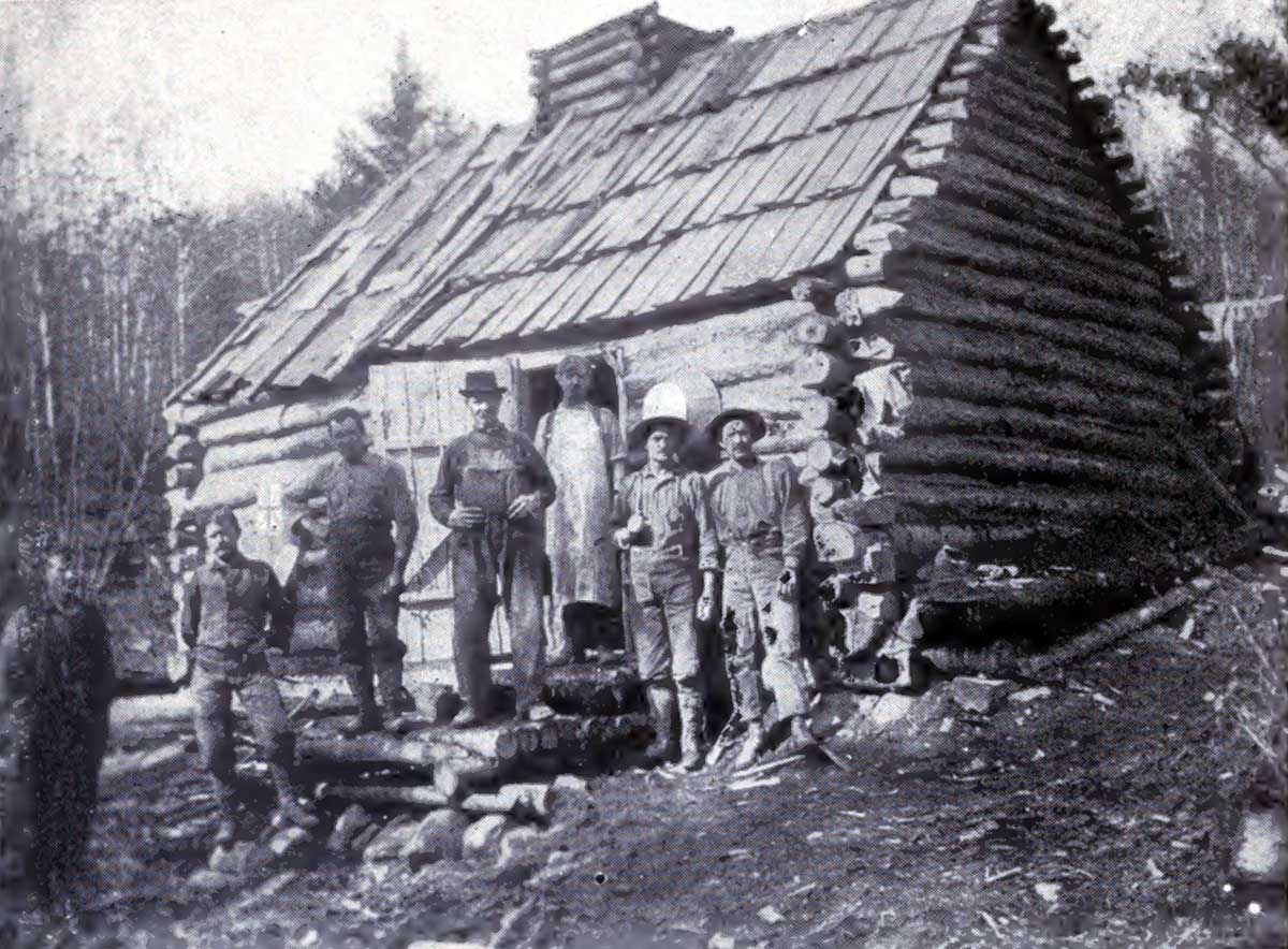
A graphic and intimate impression of the adventurous life of the mineral prospector was conveyed to me one night round the blazing camp fire, by my companion on the trail, Robert C. W. Lett. When he broke away from the lonely calling of game-warden in Algonquin Park, he embarked upon a prospecting expedition. Two experienced companions joined him in this pursuit of fortune, the projected field for their labours being one of the innermost recesses of Ontario, which has since gained fame as the Gowganda country.
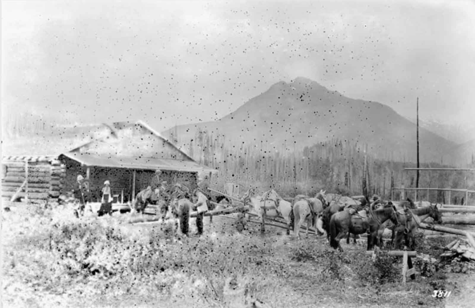
Shack built on Wapoose River by Mr. Lett’s prospecting party with eleven nails.
————-165 [5]
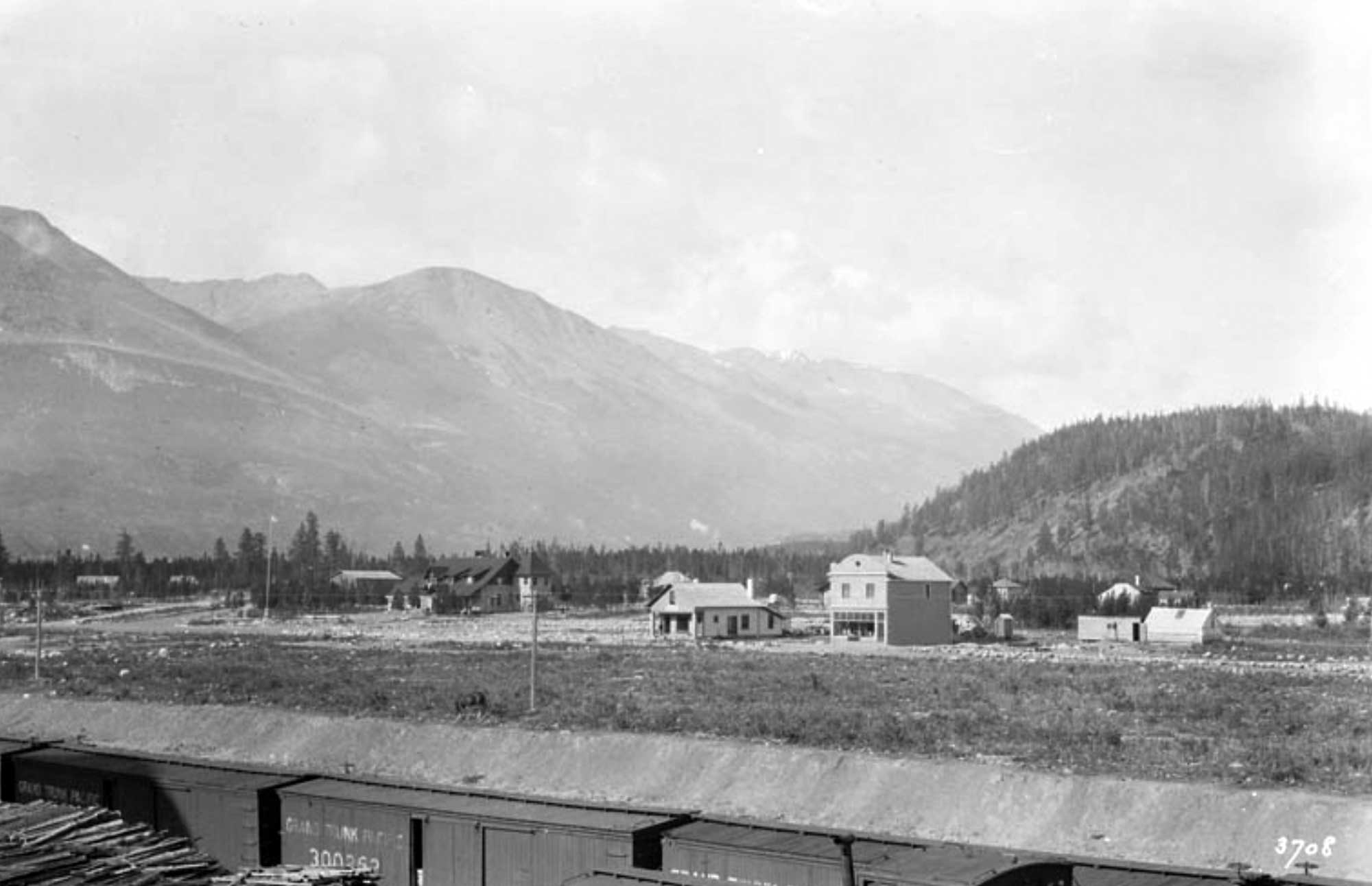
Grand Trunk Pacific Railway. The Canadian Rockies. Yellowhead Pass Route. Winnipeg: Issued by the General Passenger Department, G.T.P. Railway, 1913
165
R.C.W. Lett, Tourist and Colonization Agent, GTP, Winnipeg, Manitoba
Ealry this year a Bill was passed, setting aside a large area in the Yellowhead Pass district, which will be known as Mount Robson Park. The central feature of this Park will be the famous Mount Robson, the highest peak in the Canadian Rockies, and it is the itnention of the Grand Trunk Pacific Railway Company to build a large up-to-date hotel in the park, from which one of the best views of the mountain will be obtained.
——–260 walcott [6]
With our party in 1912 we had Mr. Harry H. Blagden, who accompanied the expedition in 1911; also Mr. R. C. W. Lett, of the Grand Trunk Pacific Railway, who took many fine photographs the first two weeks of the trip; Sidney S. Walcott, Closson Otto, Dr. I. F. Burgin, and Arthur Brown, all of whom were qualified by experience and physique to overcome the physical obstacles and hardships of the trip.
—-307 Wheeler [7]
The following were in attendance at the Robson Camp:
among the honorary members R. C. W. Lett, GTP Ry,Winnipeg.
———669 doyle [8]
In 1914, R.C.W. held a prominent position with the Grand Trunk Railway and persuaded his father-in-law, the noted Ottawa photographer William James Topley, to photograph Sir Arthur Conan Doyle on his rail trip through Western Canada in June of that year.
——– 920 – dcb topley [9]
Topley and his wife, who died in 1927, spent much of their last years in Edmonton with their daughter, Helena Sarah, and son-in-law, Robert C. W. Lett, an employee of the Grand Trunk Pacific Railway who had probably been influential in the naming of Topley, a community on the GTP line in northern British Columbia.
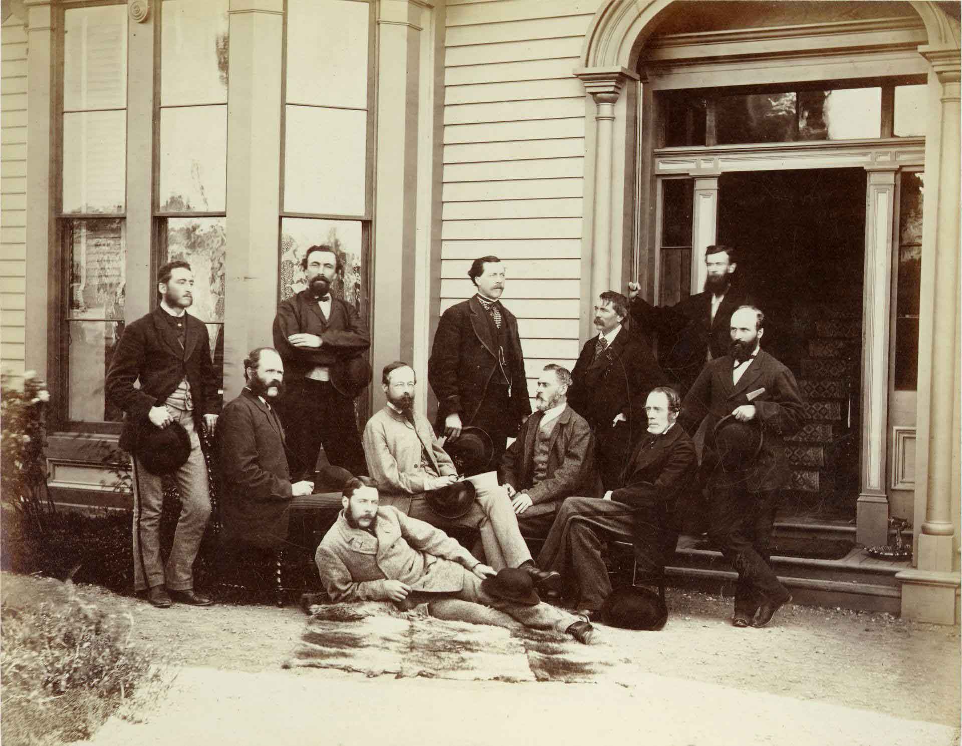
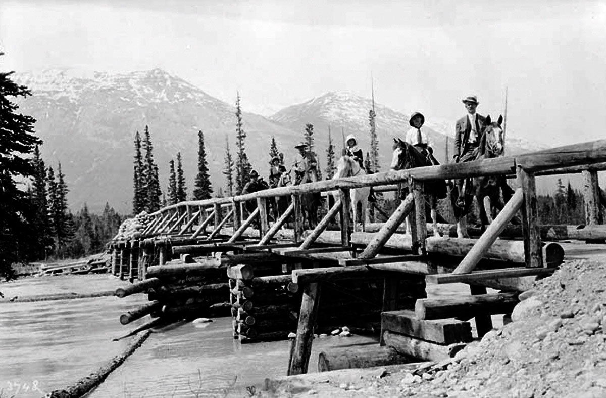
![Press Excursion Party at Summit [Yellowhead Pass] Photo: William James Topley, 1914](/wp-content/uploads/2025/10/topley-excursion-party.jpg)