NW of Goat River station, SW of Crescent Spur
53.5122 N 120.6594 W — Map 093H10 — Google — GeoHack
Name officially adopted in 1965
Official in BC – Canada
Pre-emptor’s map Tête Jaune 3H 1919
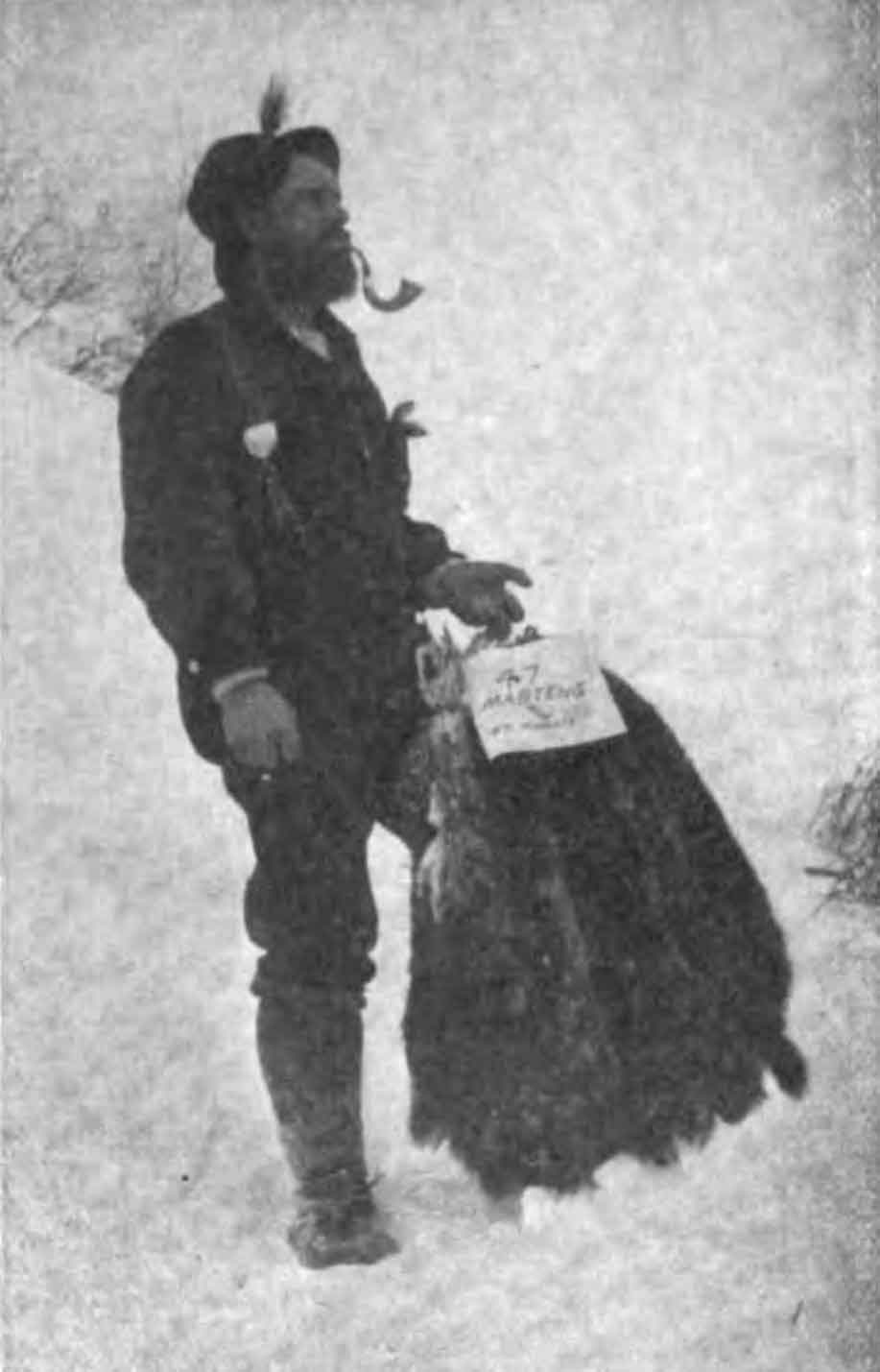
Mr. La Salle, with a bunch of furs consisting of 47 martens and 48 weasels; a five weeks’ catch that sold for $440.00.
Hunter—Trader—Trapper, v. 24 (1912): 23
Roy Howard of Dunster has identified the namesake of La Salle Lakes, who is not the American businessman J. LaSalle (or Laselle) who purchased the South Fort George townsite in 1909. Around 1912 there was trapper in the Goat River region named Joe La Salle. “He had cabins, one of which is still standing, but barely, at Km 6 of the Goat R. Forest Service Road,” Roy wrote in 2017 (see comment below).
La Salle wrote an article in the Hunter-Trader-Trapper magazine in 1912 about his experiences in the Goat River area that contains the following statements:
From my camp on the Goat to Barkerville, a distance of eighty-five miles, by way of the Goat River Pass, the snow is all the way from three to ten feet deep.
By the way I forgot to mention that there is a steamer running on the Fraser from Fort George to Tete Juane Cache, and the Grand Trunk Pacific Railway is expected to be in Tete Juane Cache by this summer. It is reported to be within fifty miles of the Cache now.
I am the only trapper that I know of on this side of the Pass. My nearest neighbors being two English boys on Isaac Lake, twenty-two miles from here. [Goat River Pass is currently unnamed.]
There is a good trail from Barkerville to within six miles below my home camp to Milk River, a tributary to the Goat.
While in Barkerville I picked up with a fellow that was willing to come with me and hunt, also be my partner for this season. Well! he was until some time in July. We were working for the Government on the Goat River Trail, clearing and widening it.
The only drawback to this country is the lack of transportation. At the present time the only way to get here would be by way of Ashcroft on the C. P. R. over the old Caribou Road, but when the G. T. P. gets through the Fraser River Valley it will be very easy then. When this road gets through it will open up one of the best countries for game, mineral and scenery that. I know of, and will also cheapen the cost of living. Flour costs me $18.00 per hundred landed here on the Goat River.
Ellice Blackman of Tête Jaune Cache has photographs of caribou trophies “procured by Joe LaSalle party, 1915, McBride.”
- La Salle, Joe. “Trapping in the mountains of British Columbia.” Hunter—Trader—Trapper, v. 24 (1912):21-. Hathi Trust
- British Columbia Geographical Names. La Salle Lakes
![Rafting Lake Kinney [George B. Kinney and Harry Blagden]. Photo: Byron Harmon, 1911](/wp-content/uploads/2021/12/wmcr-harmonb-v263-na-0971.jpg)