Hudson’s Bay Company director George Simpson [1792–1860] wrote in 1824,
At our Encampment [Boat Encampment, near the junction of Canoe River and the Columbia] fell in with a band of free Iroquois who have for several years hunted in the neighbourhood of Canoe River Cranberry & Moose Lake New Caledonia and the North branch of Thompson’s River.
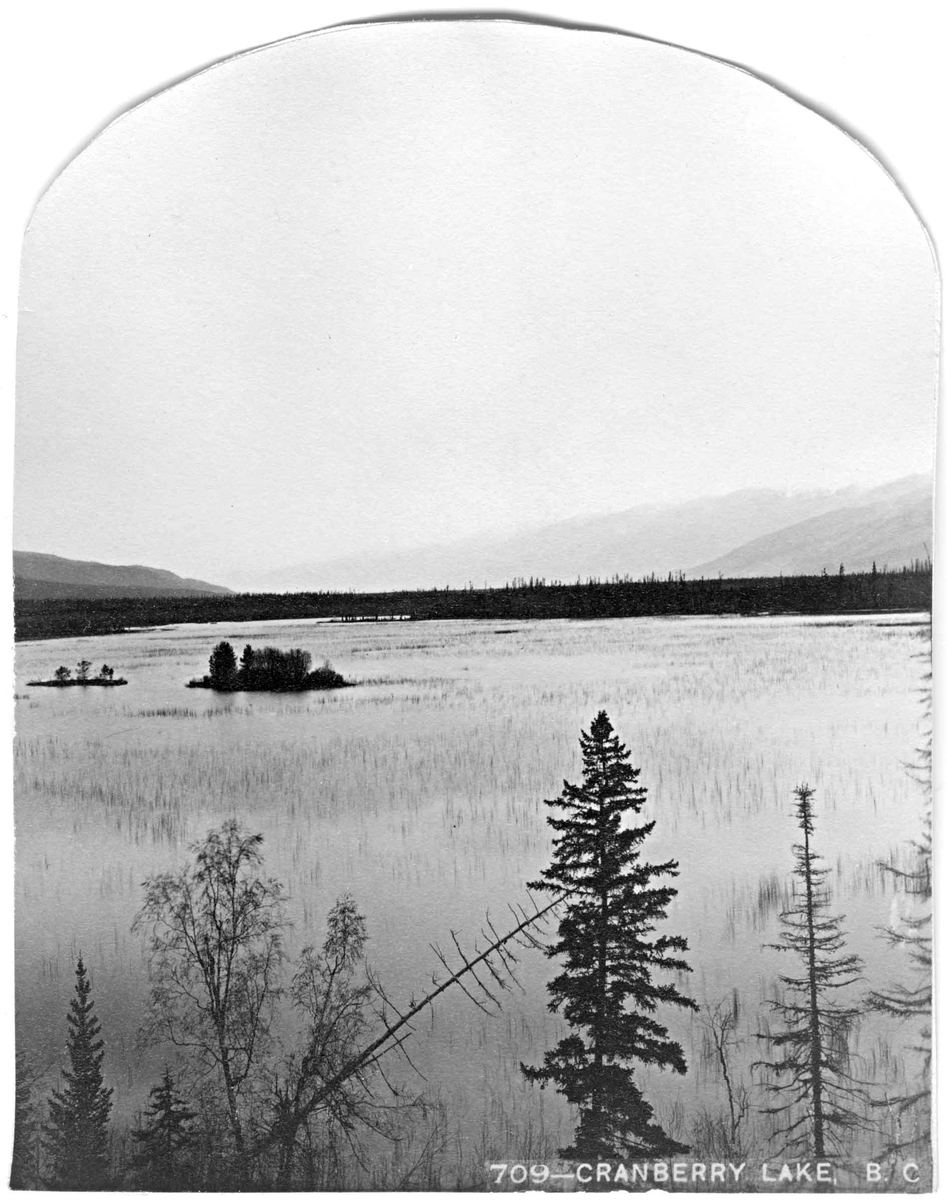
Cranberry Lake, labelled on BC map 3H, 1919, was later drained and divided into lots (description of subdivision in 1924).
“Cranberry Lake, which is about seven hundred acres in area, lies on the divide between the McLennan and Canoe rivers,” wrote surveyor A. W. Johnson in 1912. “The lake apparently drains naturally into the McLennan, but it is a mere trickle. The lake is of beaver construction, and must have been quite recently a spruce-swamp, for there are many old roots under the water, which is nowhere more than three or four feet deep. It has nothing to justify its perpetuation as a lake, except that it makes a fine foreground for photographs of the surrounding mountains. So shallow that our paddle stirs up evil smells all the time, and while we were there, at any rate, avoided by ducks and geese, it would fulfill a higher destiny as a hay meadow. The water is warm in summer and almost stagnant; quite unfit to drink. Cranberry Lake is so called because there are no cranberries anywhere near it.”
The Cranberry Lake post office was open from 1913 to 1918, when it was changed to Swift Creek. In 1928, Swift Creek was changed to Valemount. There are less than ten cancellation marks known from the Cranberry Lake post office.
“Who remembers Cranberry Lake ?” asks an early settler. “It had a small island in the centre which grew swamp cranberries.” During the construction of the Yellowhead Highway in 1965, Cranberry Lake was filled in.
References:
- Simpson, George [1792–1860], and Merk, Frederick [1887–1977], editor. Fur trade and empire. George Simpson’s journal entitled Remarks connected with fur trade in consequence of a voyage from York Factory to Fort George and back to York Factory 1824-25. Cambridge, Mass.: Harvard University Press, 1931, p. 36. University of British Columbia Library
- Johnson, Alfred William, D.L.S., P.L.S. [1874–1918]. “Report on Surveys between Tête Jaune Cache and the North Thompson River, on the route of the Canadian Northern Pacific Railway.” Report of the Minister of Lands for the Province of British Columbia for the year ending 31st December 1912, (1913):246-250. Google Books
- Topping, William. A checklist of British Columbia post offices. Vancouver: published by the author, 7430 Angus Drive, 1983
- Valemount Historic Society. Yellowhead Pass and its People. Valemount, B.C.: 1984