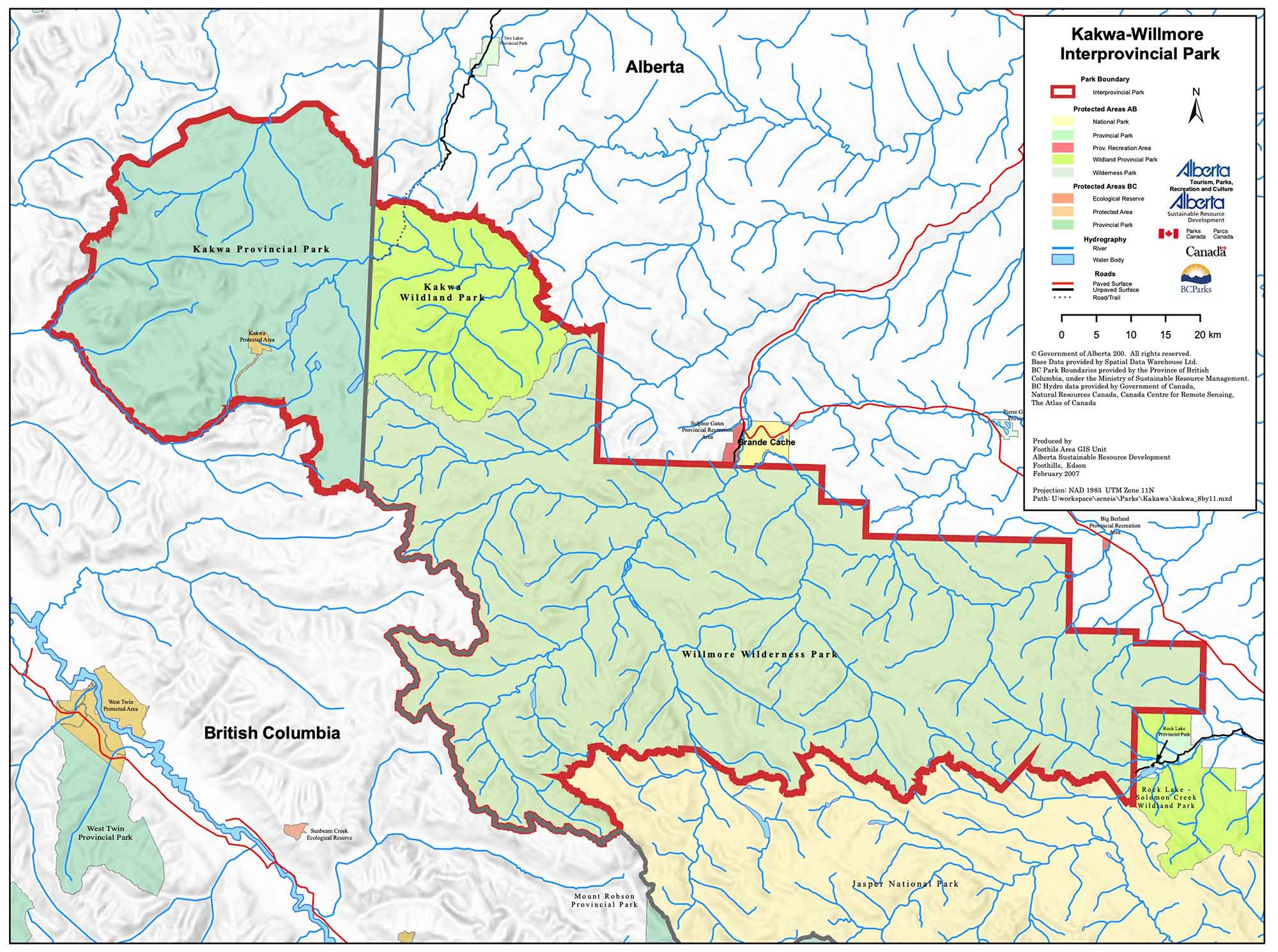
Kakwa Willmore Interprovincial Park map
Leave a reply
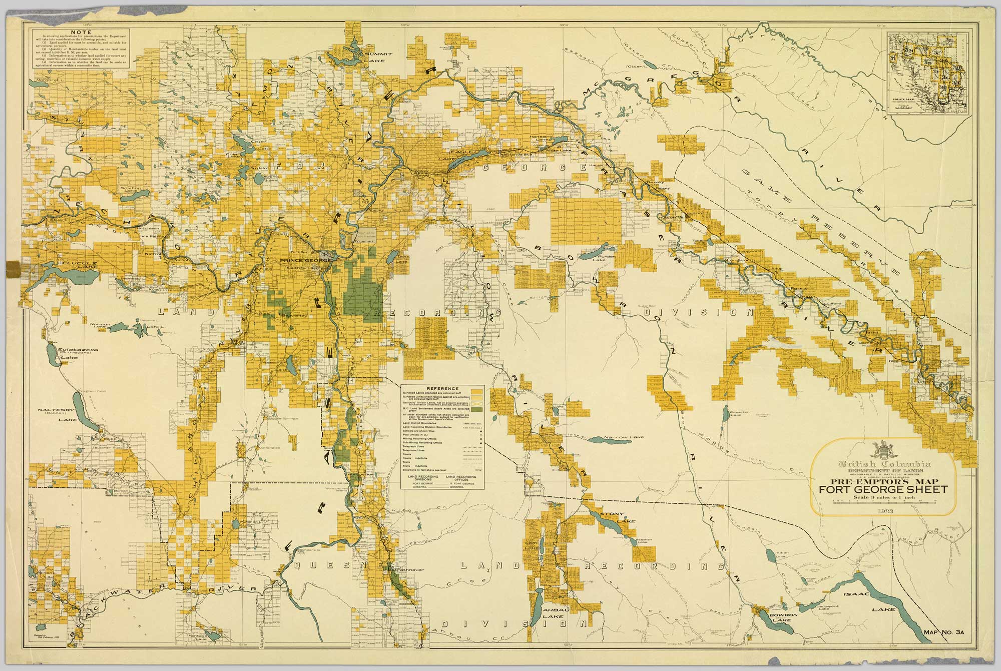
Colour-coded map depicting lands surveyed as alienated, reserved, Statutory Timber Lands, B.C. Land Settlement Board Area, or open for pre-emption. Depicts land districts, land recording divisions, communities, game reserves, bodies of water, transport routes, and communication lines.
Colour-coded map depicting surveyed lands respectively open and closed to preemption. Depicts land recording divisions, game reserves, communities, bodies of water, and transport routes.
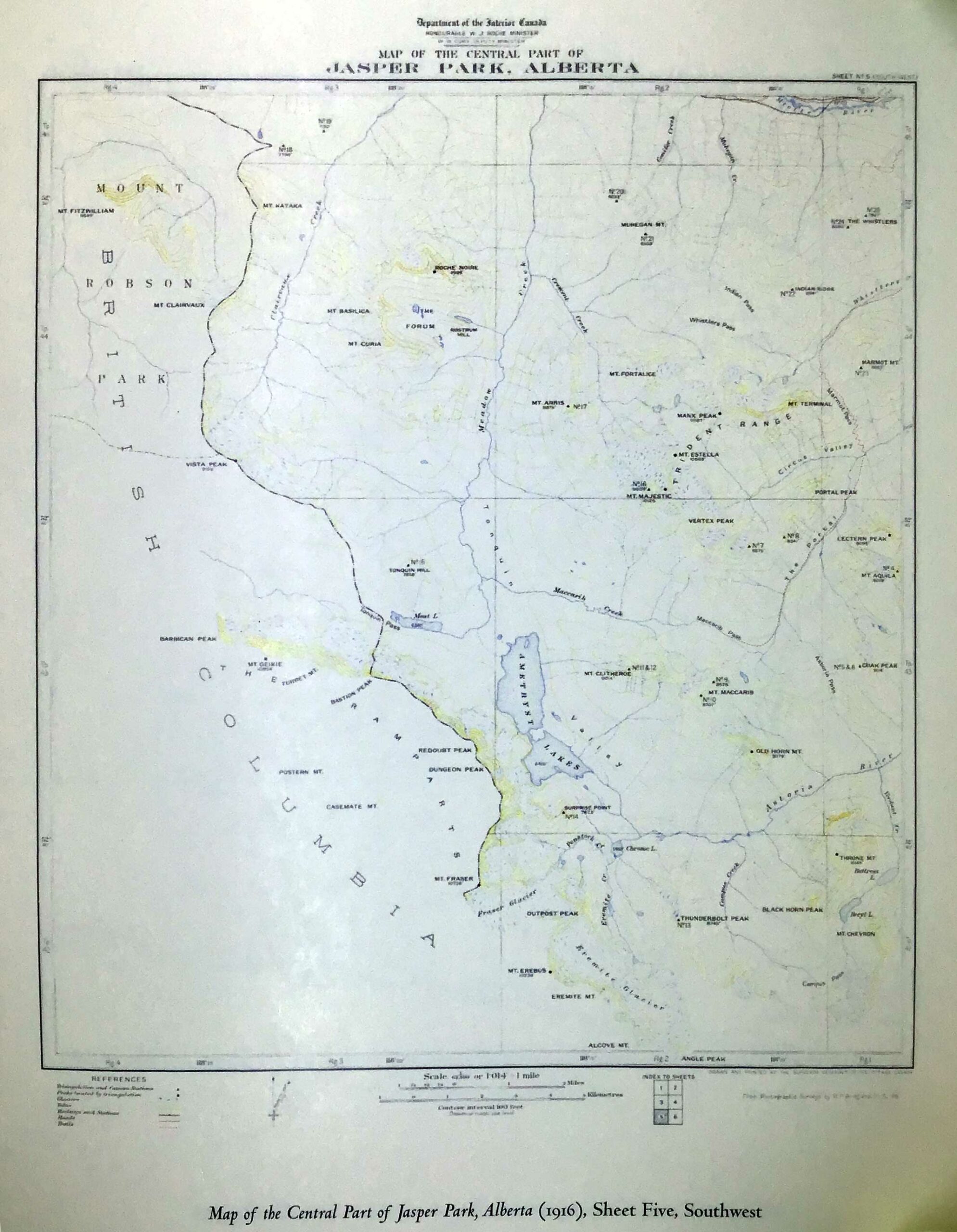
Map of Central Part of Jasper Park, Alberta
Department of the Interior Canada
Sheet Five, Southwest
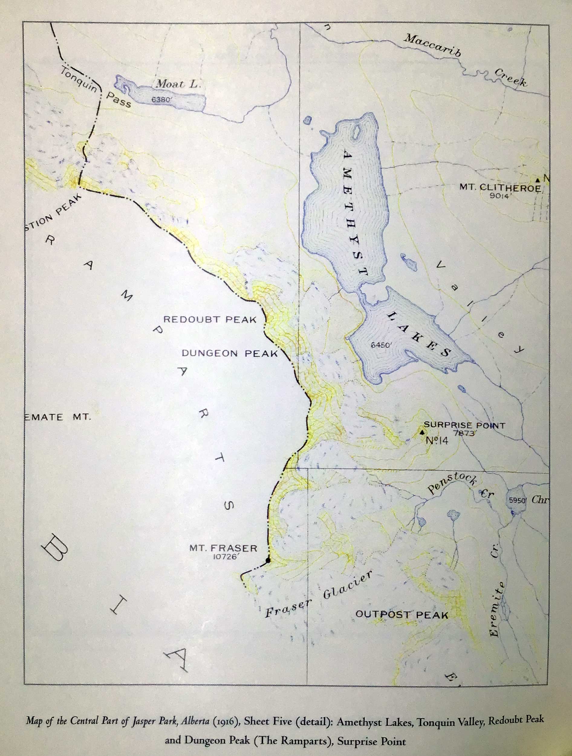
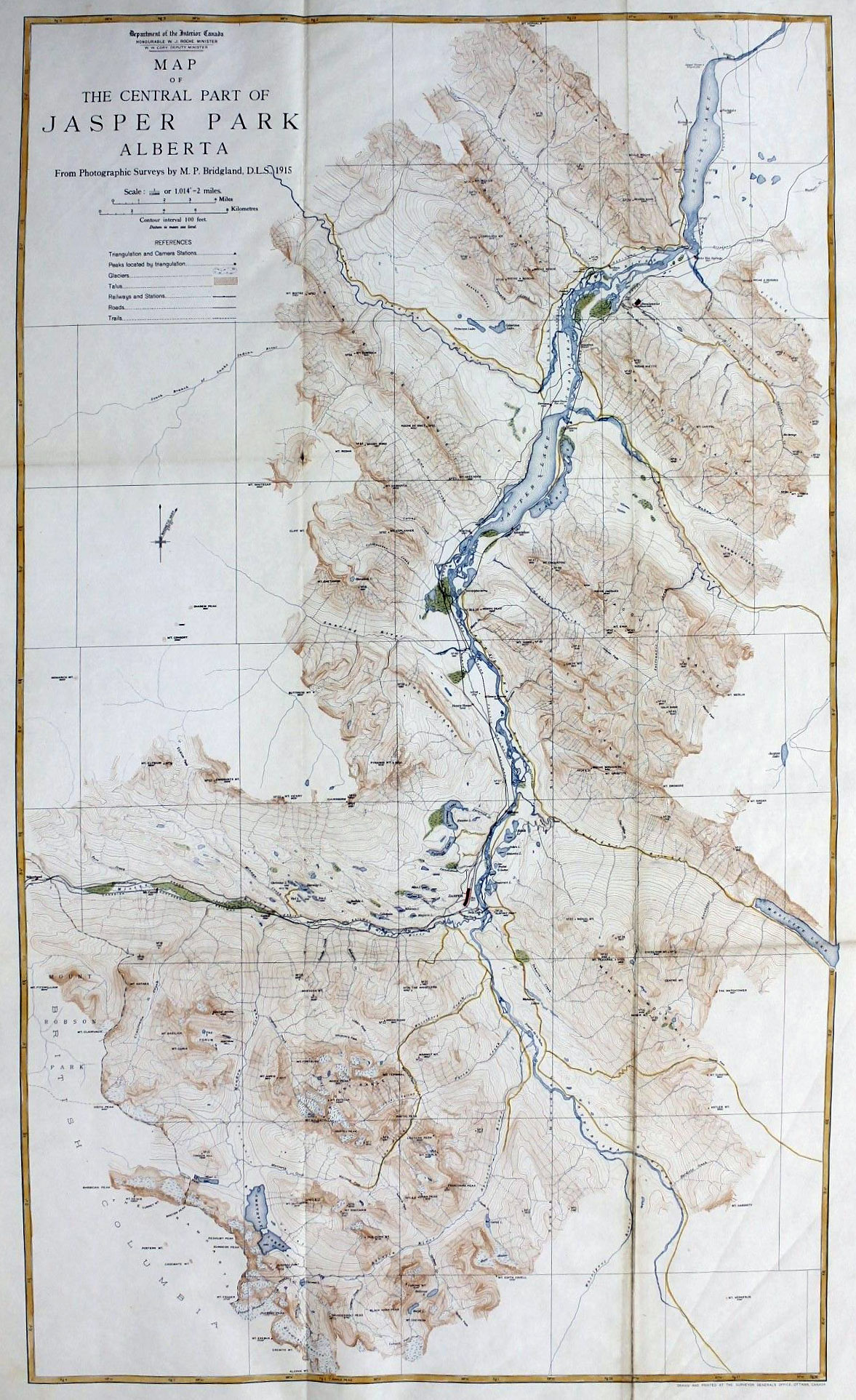
Map of Central Part of Jasper Park, Alberta
Department of the Interior Canada
Sheet Five, Southwest (detail)
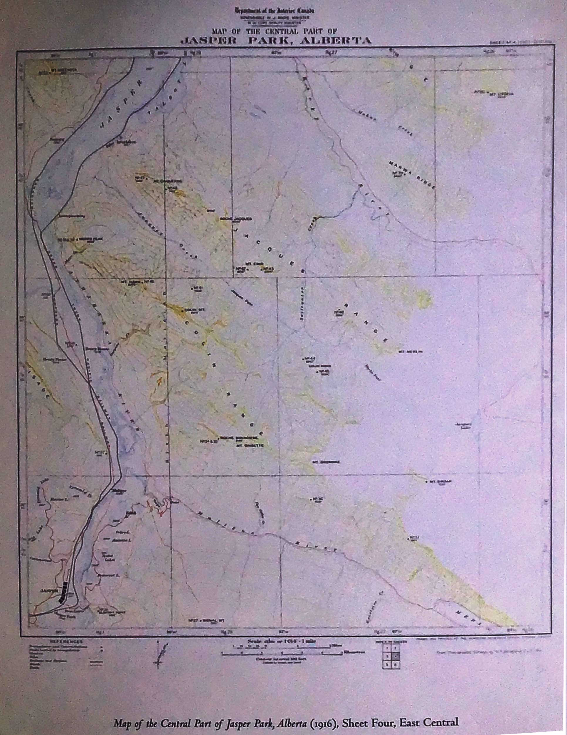
Map of Central Part of Jasper Park, Alberta
Department of the Interior Canada
Sheet Four, East Central
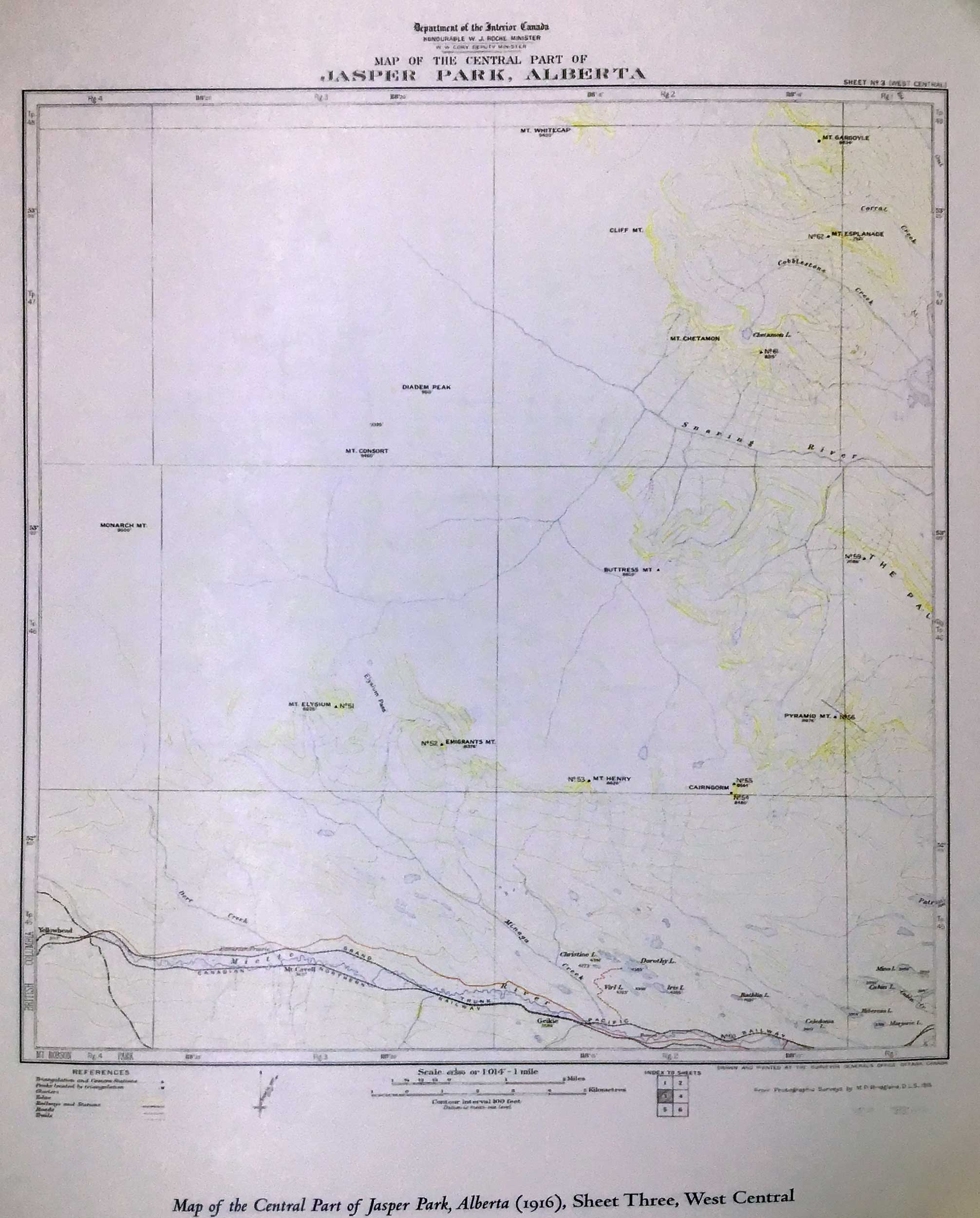
Map of Central Part of Jasper Park, Alberta
Department of the Interior Canada
Sheet Three, West Central
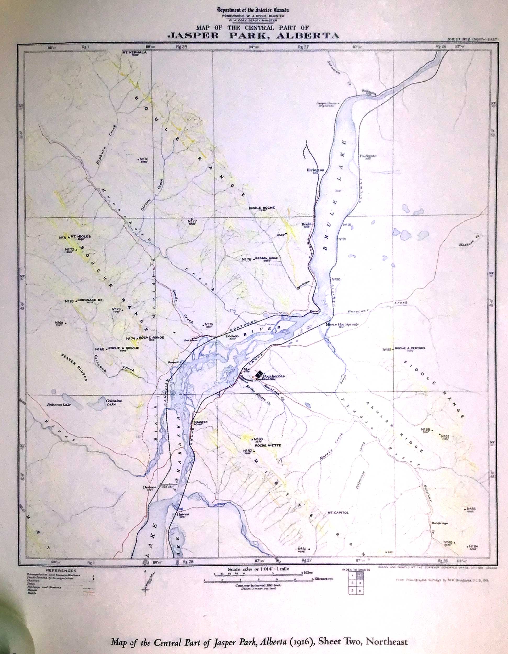
Map of Central Part of Jasper Park, Alberta
Department of the Interior Canada
Sheet Two, Northeast
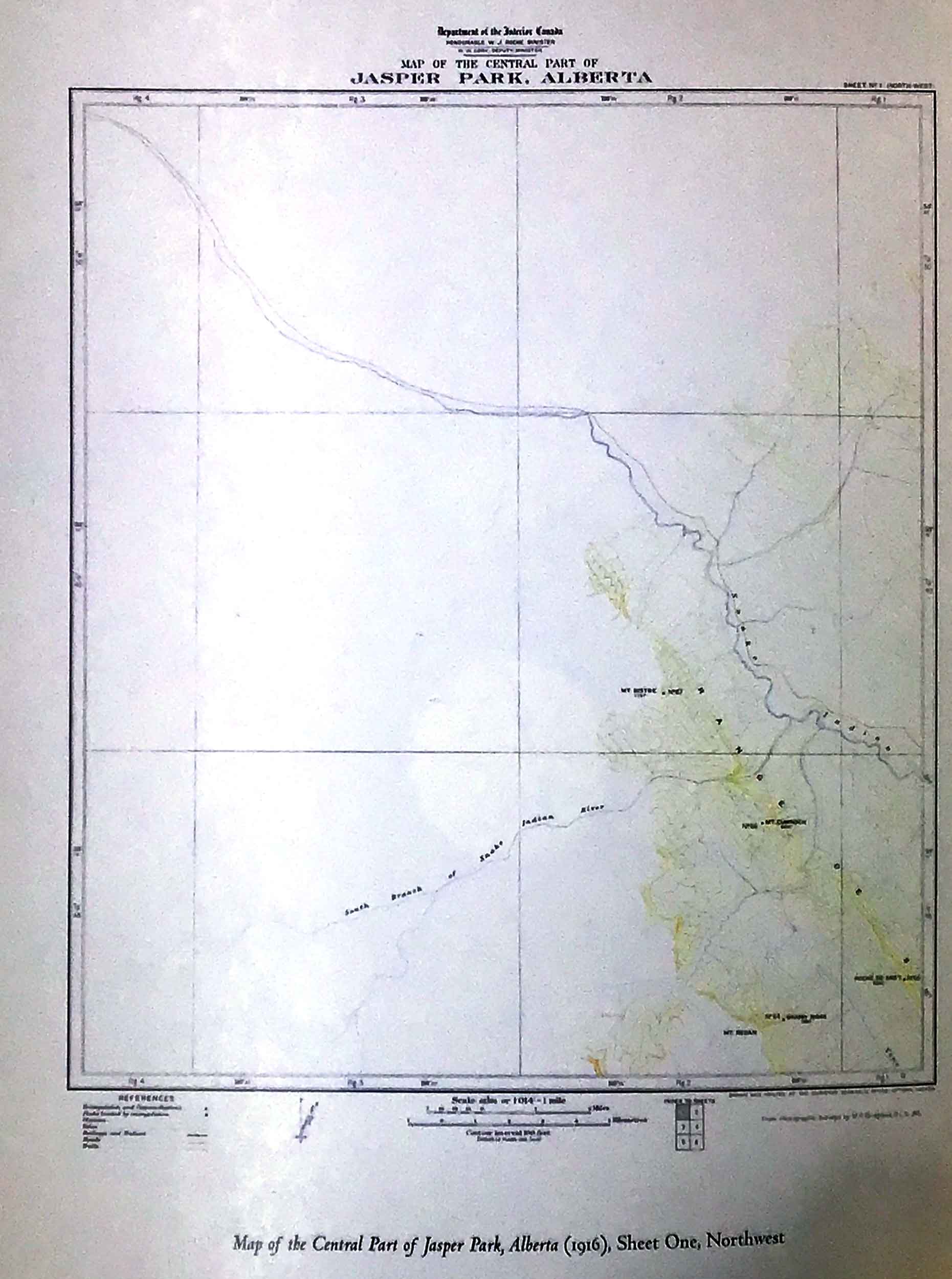
Map of Central Part of Jasper Park, Alberta
Department of the Interior Canada
Sheet One, Northwest
Map of Central Part of Jasper Park, Alberta
Department of the Interior Canada
Based on photographic surveys by M. P. Bridgland, D.L S., in 1915
Whyte Museum
There is also a set of more detailed maps based on the 1915 survey led by Morrison Parsons Bridgland [1878–1948]:
Maps of Central Part of Jasper Park, Alberta.
Department of the Interior Canada, 1916
Sheet One, Northwest
Sheet Two, Northeast
Sheet Three, West Central
Sheet Four, East Central
Sheet Five, Southwest
Sheet Six, Southeast
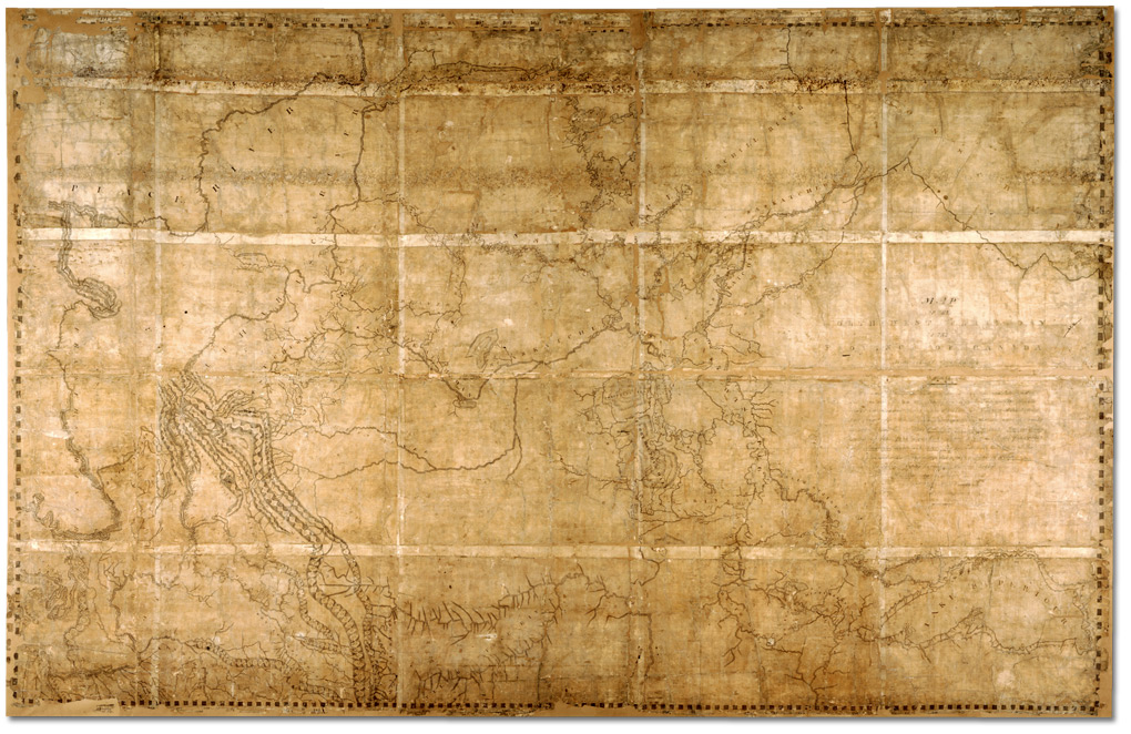
Map of the North-West Territory of the Province of Canada.David Thompson, 1814 Archives of Ontario
Map of the North-West Territory of the Province of Canada from actual Survey during the years 1792-1812. This map made for the North West Company in 1813 and 1814 and delivered to the Honorable William McGillivray then agent Embraces the Region lying between 45 and 60 degrees North Latitude and 84 and 124 degrees West Longitude comprising the Survey’s and Discoveries of 20 years namely the Discovery and Survey of the Oregon Territory to the Pacific Ocean the Survey of the Athabasca Lake Slave River and Lake from which flows Mackenzie’s River to the Arctic Sea by Mr. Philip Turner the Route of Alexander Mackenzie in 1792 down part of Fraser’s river together with the Survey of this River to the Pacific Ocean by the late John Stuart of the North-West Company by David Thompson Astronomer and Surveyor.
Surveying for the North West Company, David Thompson [1770–1857] located the headwaters of the Mississippi River, crossed the Rocky Mountains and mapped the entire length of the Columbia River.
Thompson retired from the fur trade in 1812 and moved his family to Terrebonne near Montreal. He was given a special assignment to plot all the Company’s posts on a comprehensive map of the Canadian West using the astronomical observations he had carefully recorded.
Thompson’s map is approximately 213 centimetres (84″) high by 328 centimetres (129″) long. It gave an accurate depiction of the vast territory traversed by the fur trade and location of Company posts. [1]
Athabasca River
Canoe River
Columbia River
Fraser River
Peace River
Smoky River
Snaring River [as “Snare Indian River”]
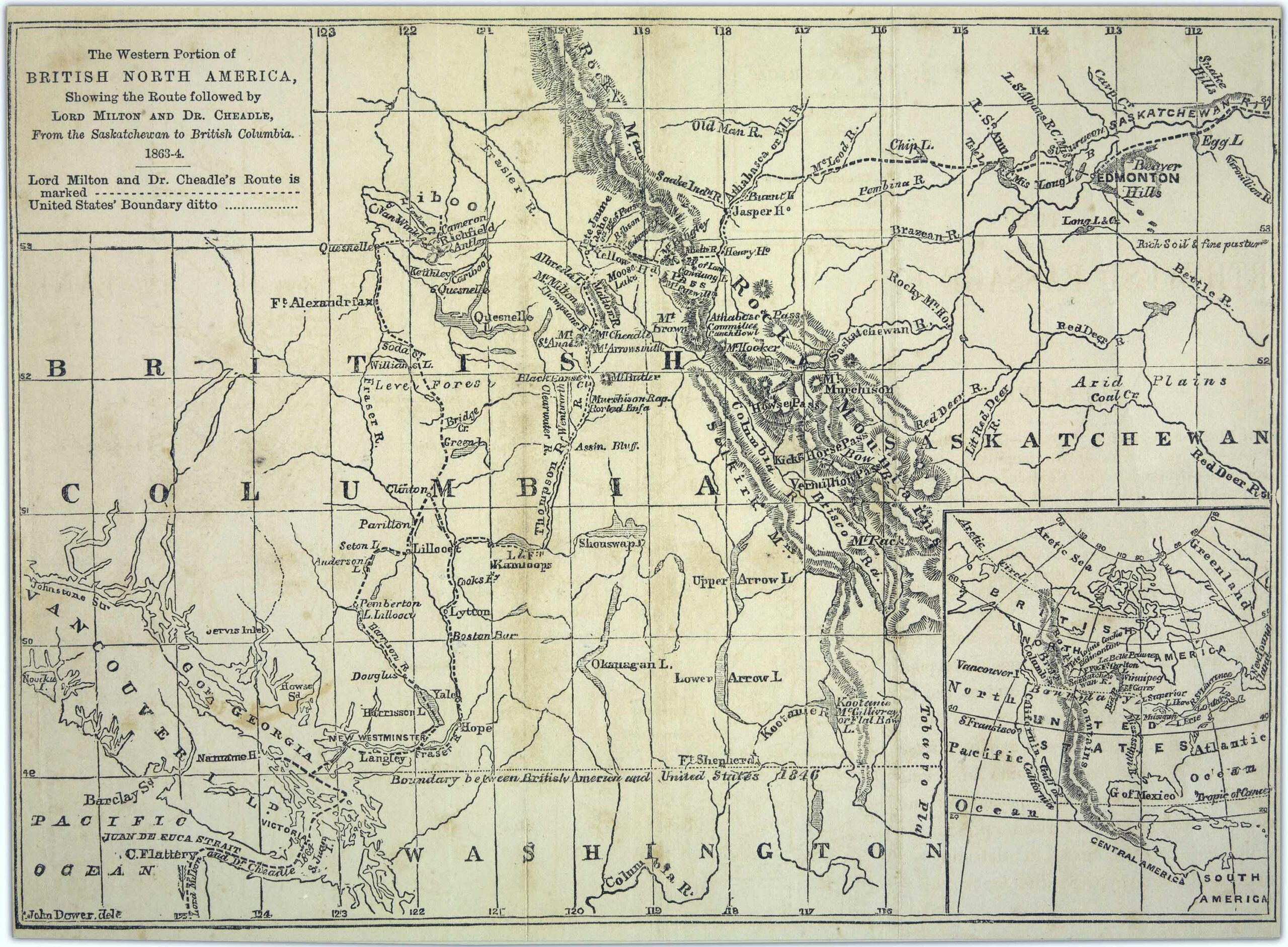
The Western Portion of British North America, showing the Route followed by Lord Milton and Dr. Cheadle, From the Saskatchewan to British Columbia, 1863-4
University of British Columbia Library
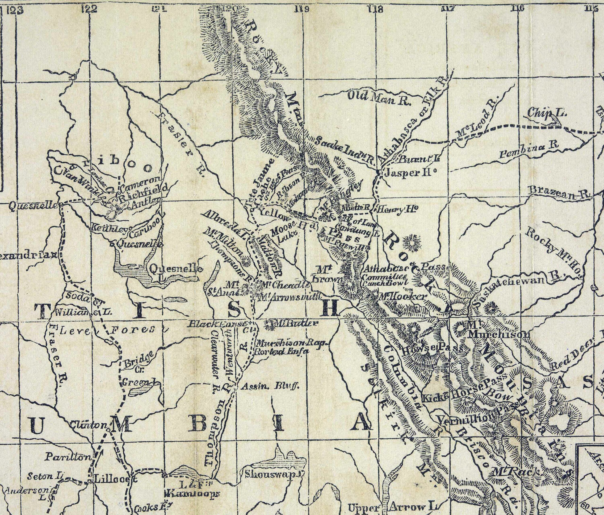
Detail of the route followed by Milton and Cheadle through the Yellowhead Pass.
UBC Library Digital Collections
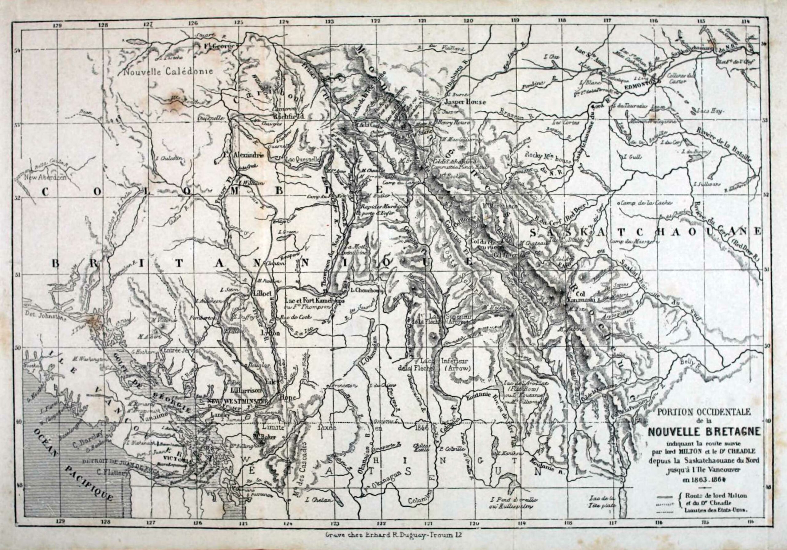
Portion Occidentale de la Nouvelle Bretagne indiquant la route survie par lord Milton et le Dr Cheadle.
Voyage de l’Altantique au Pacifique [accessed 12 February 2026]
The Western Portion of
British North America,
Showing the Route followed by
Lord Milton & Dr. Cheadle,
From the Saskatchewan to British Columbia.
1863-4
In lower left-hand corner: “John Dower” folllowed by illegible characters.
Milton and Cheadle travelled through the Yellowhead Pass in 1863. This map first appears in the 7th edition of Milton and Cheadle’s book North-West Passage by Land:
The Illustrations of this Work are taken almost entirely from photographs and sketches taken on the spot, and will, it is hoped, possess a certain value and interest, as depicting scenes never before drawn by any pencil, and many of which had never previously been visited by any white man, some of them not even by an Indian. Our most cordial thanks are due to Mr. E. P. Leitch, and Messrs. Cooper and Linton, for the admirable manner in which they have been executed; and to Mr. Arrowsmith, for the great care and labour he has bestowed on working out the geography of a district heretofore so imperfectly known [1].
John A. Arrowsmith [1790–1873] was a prominent British cartographer.
John James Dower [1825–1901] was a mapmaker, print seller, and publisher based in London.