Department of the Interior Canada
Honourable Arthur Meighen, Minister
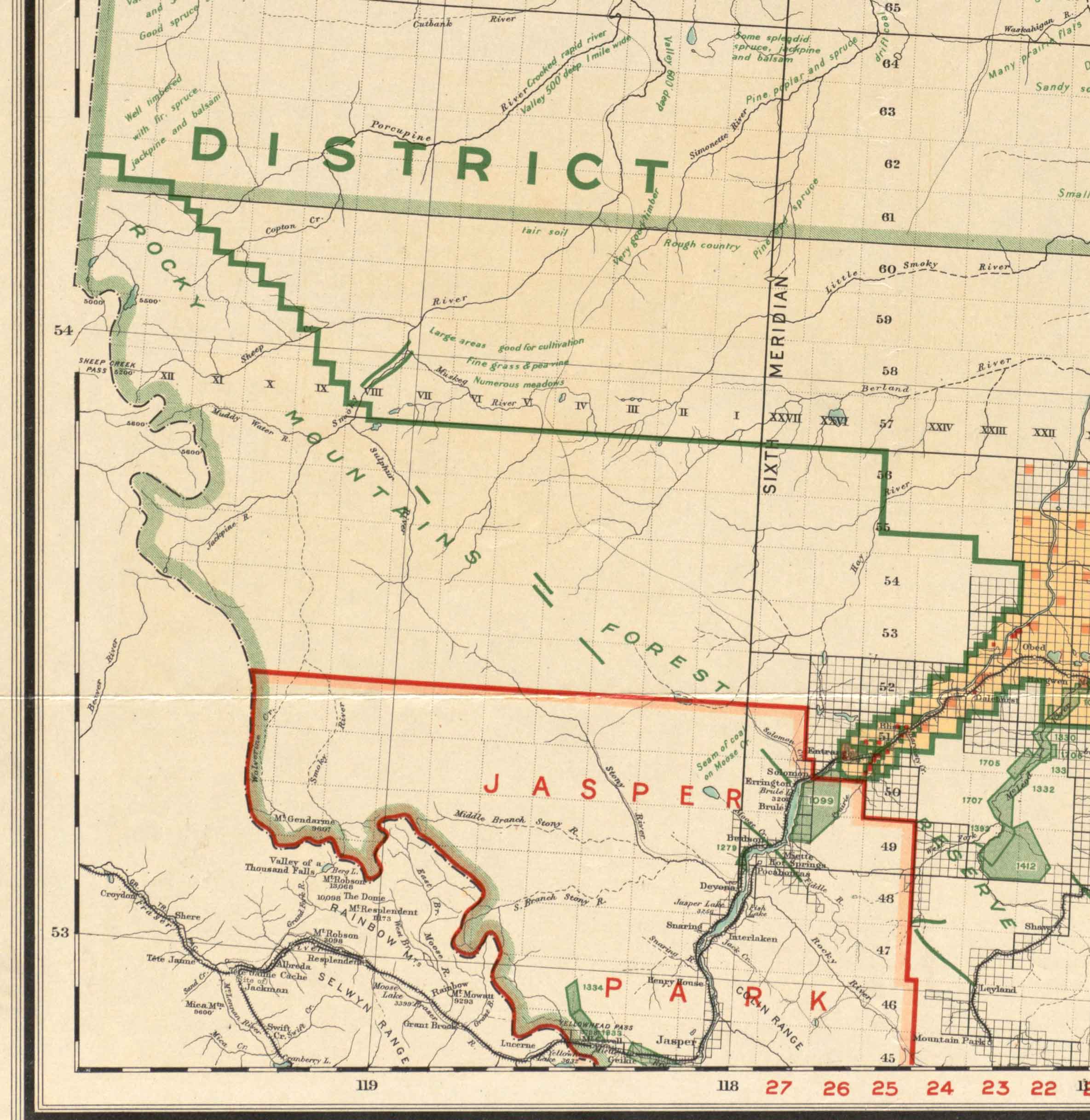
Northern Alberta
Map showing disposition of lands
1919
Including lands reserved for purposes of solider settlement.
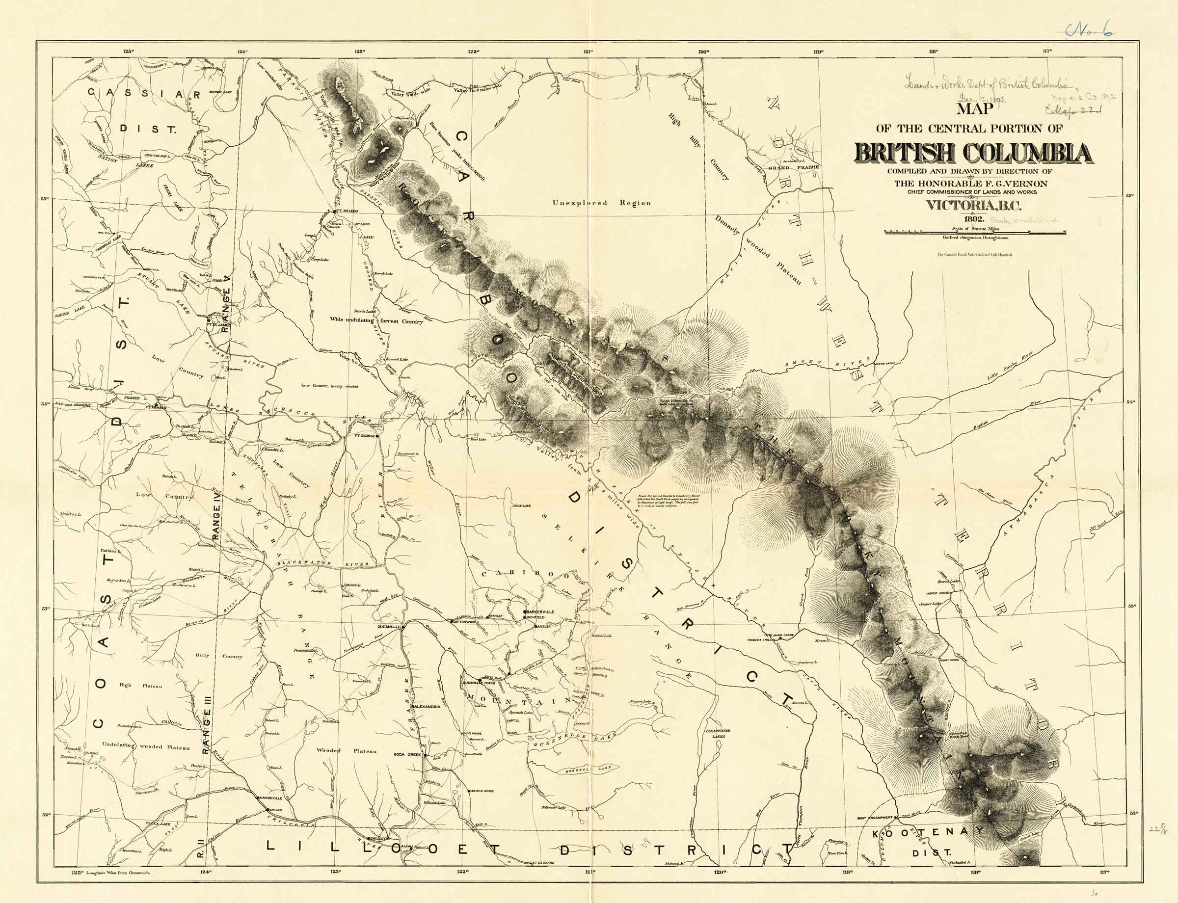
Map of the central portion of British Columbia compiled and drawn by direction of the Honorable F.G. Vernon, Chief Commissioner of Lands and Works
Victoria, B.C.
1892
Gotfred Jorgensen, Draughtsman.
Note along the South Fork of the Fraser River:
From the Grand Rapids to Cranberry River (185 miles) the South Fork might be navigated by steamers of light draft. The fall, 2 feet to a mile, is nearly uniform.
Note at Tête Jaune Cache: Iroquois I. Vill.
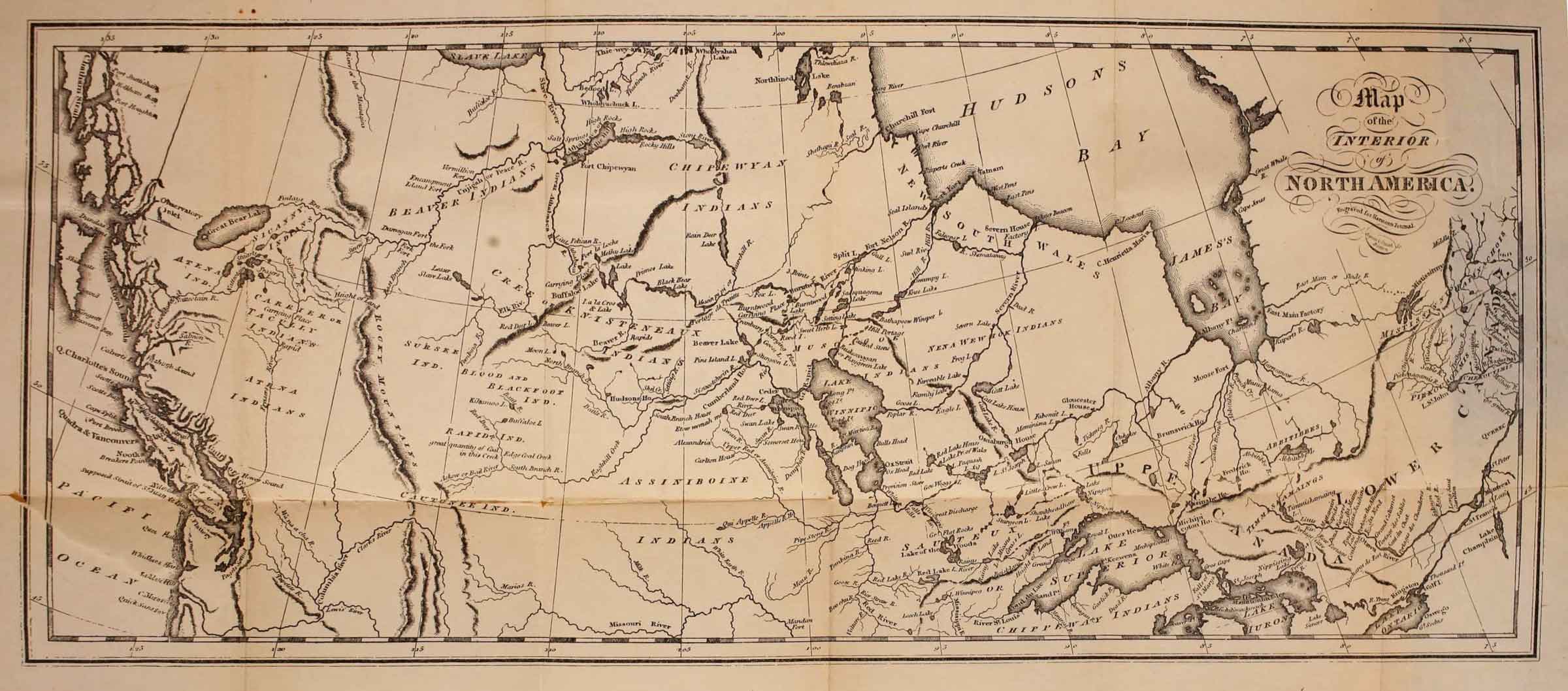
Map of the interior of North America, engraved for Harmon’s Journal Internet Archive
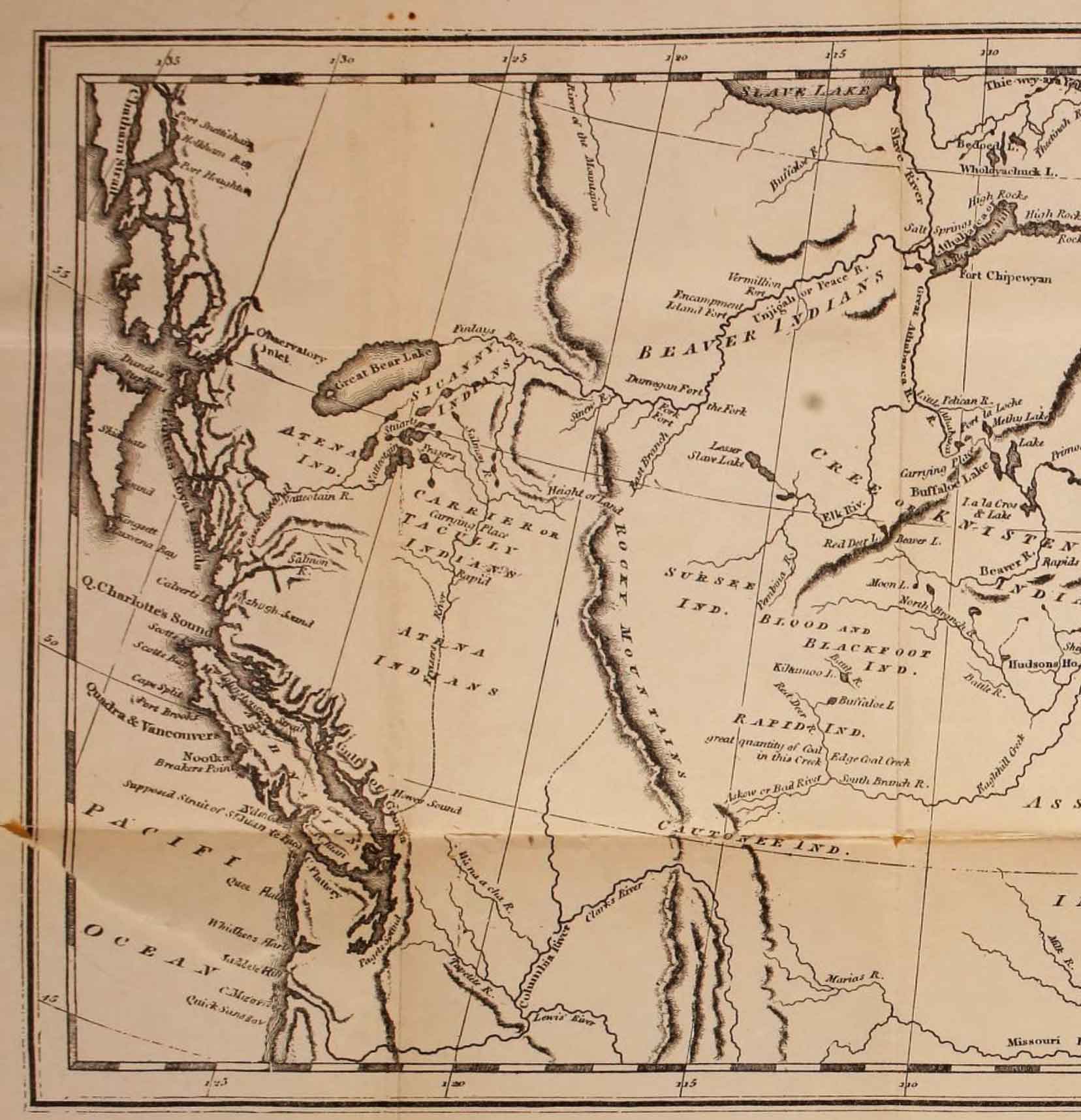
Map of the interior of North America (detail), engraved for Harmon’s Journal
References:
- Harmon, Daniel Williams [1778–1843]. A Journal of Voyages and Travels in the interior of North America between the 47th and 58th degree of North latitude, extending from Montreal nearly to the Pacific Ocean, a distance of about 5000 miles, including an account of the Principal occurrences during a residence of nearly nineteen years in different parts of that country. To which are added A Concise Description of the face of the Country, Its Inhabitants, their manners, customs, laws, etc.. Burlington, Vermont: 1820, endpocket. Internet Archive
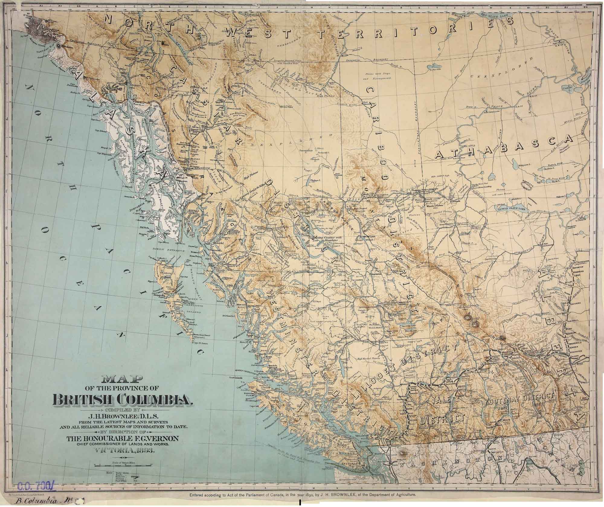
Map of the Province of British Columbia. Compiled by J. H. Brownlee, D.L.S., from the latest Maps and Surveys and all reliable sources of information to date.
UVic Libraries
Map of the Province of British Columbia.
Compiled by J. H. Brownlee, D.L.S.
From the latest Maps and Surveys and all reliable sources of information to date.
By direction of
The Honourable F. G. Vernon,
Chief Commissioner of Lands and Works.
Victoria, 1893.
Lithographed by the Canada Bank Note Co. Limited, Montreal.
Physical repository: National Archives (Great Britain)
References:
- Brownlee, James Harrison, D.L.S. [d. 1934]. Montreal: Map of the province of British Columbia. Compiled by J.H. Brownlee, D.L.S. from the latest maps and surveys and all reliable sources of information to date by direction of the Honourable F.G. Vernon, Chief Commissioner of Lands and Works. (1893). UVic Libraries
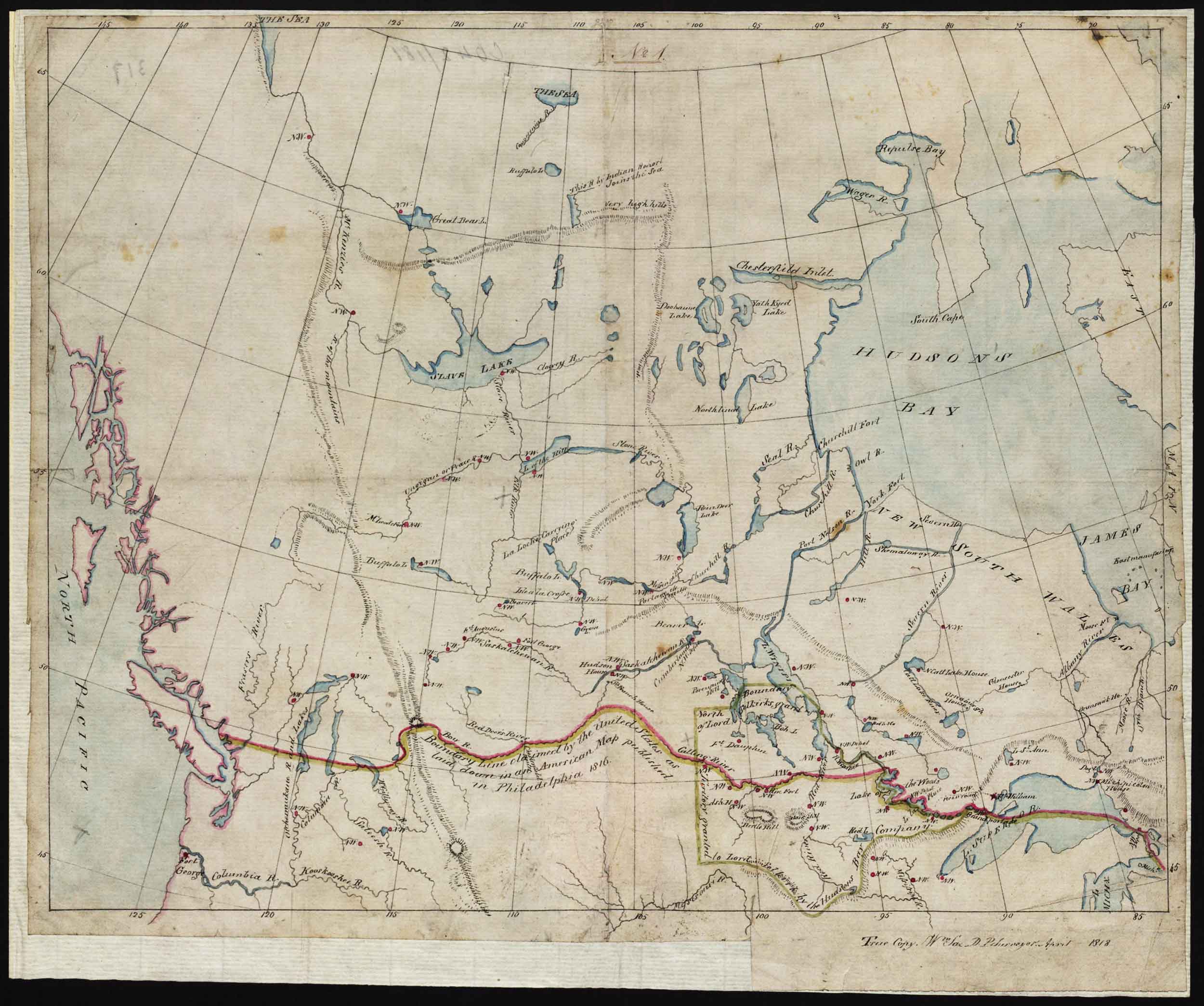
Map of Indian Territories to accompany the report of the Coltman mission. William Sax, 1818. The red horizontal line is “Boundary line claimed by the United States as laid down in an American map published in Philadelphia 1816.”
Library and Archives Canada [accessed 19 February 2025]
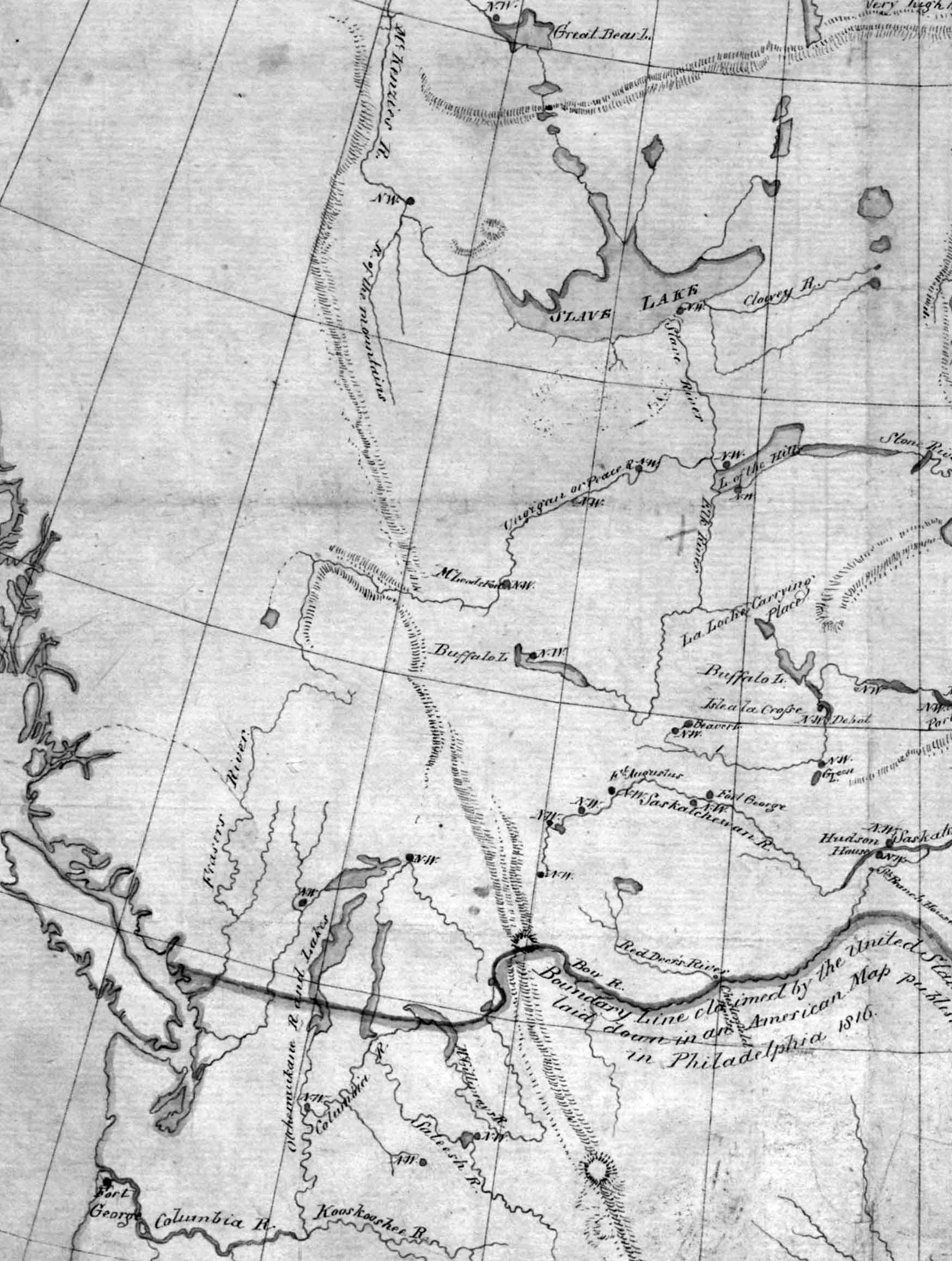
North America. The continent west of the Great Lakes north of about 45°N. Detail
Library and Archives Canada [accessed 19 February 2025]
William Sax [1774–1840], First Clerk in the Surveyor General’s Office of Canada, was active ca. 1795 – 1835. He drafted this map to accompany the 1818 report of William Bacheler Coltman, commission of the peace for the Indian territory of the northwest, regarding the struggle between the
Hudson’s Bay Company and the
North West Company for hegemony in the fur trade.
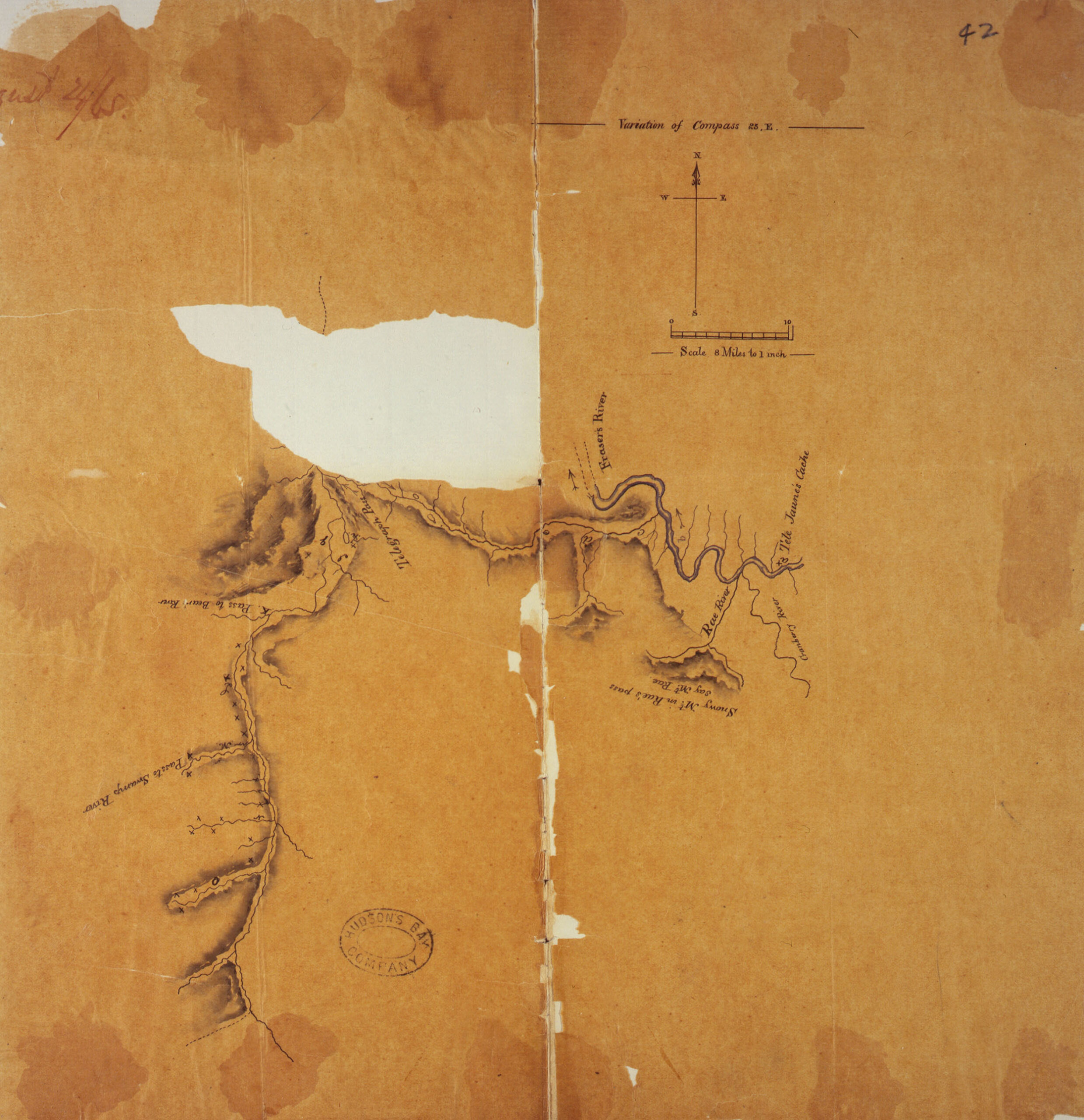
Survey of Telegraph Creek and upper part of Shuswap River near Tete Jaune Cache, May 1865 University of Victoria
J.W. McKay, Survey of Telegraph Creek and upper part of Shuswap River near Tete Jaune Cache, May 1865. Hudson’s Bay Company Archives, E.15/13 fo. 42.
The Colonial Despatches of Vancouver Island and British Columbia 1846-1871, Edition 2.4, ed. James Hendrickson and the Colonial Despatches project. Victoria, B.C.: University of Victoria.
In 1864
References:
- Rae, John [1813–1893]. “Report on telegraph survey to the Pacific, 1864.” Sanford Fleming papers, MG 29 B 1, Vol. 40, File 284, National Archives of Canada, Ottawa (1864)

Section of Canadian Rocky Mountains visited during 1907 and 1908
Internet Archive
![]()
Outline Map of
SECTION OF CANADIAN ROCKY MOUNTAINS.
Visited during 1907 and 1908.
Sources of information : J. McEvoy’s Survey Map of 1900, Dr. J. Norman Collie’s Sketch Map
Insert: Map of Alberta and British Columbia from “Map of Dominion of Canada 1910.” Shows railway routes, constructed and proposed: Canadian Pacific Railway, Grand Trunk Pacific Railway, Canadian Northern Railway.
Mary T. S. Schäffer Warren [1861–1939] explored around Mount Robson in 1908, shortly before the arrival of the Grand Trunk Pacific. This map accompanied the account of her travels, Old Indian Trails.
References:
- Schäffer Warren, Mary T. S. [1861–1939]. Old Indian trails. Incidents of camp and trail life, covering two years’ exploration through the Rocky Mountains of Canada. [1907 and 1908]. New York: Putnam, 1911, p. 361. Internet Archive
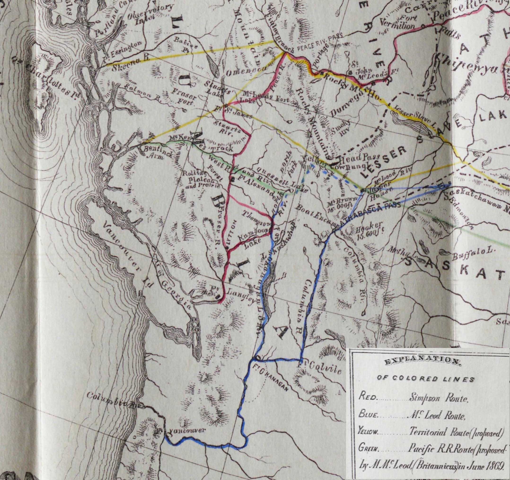
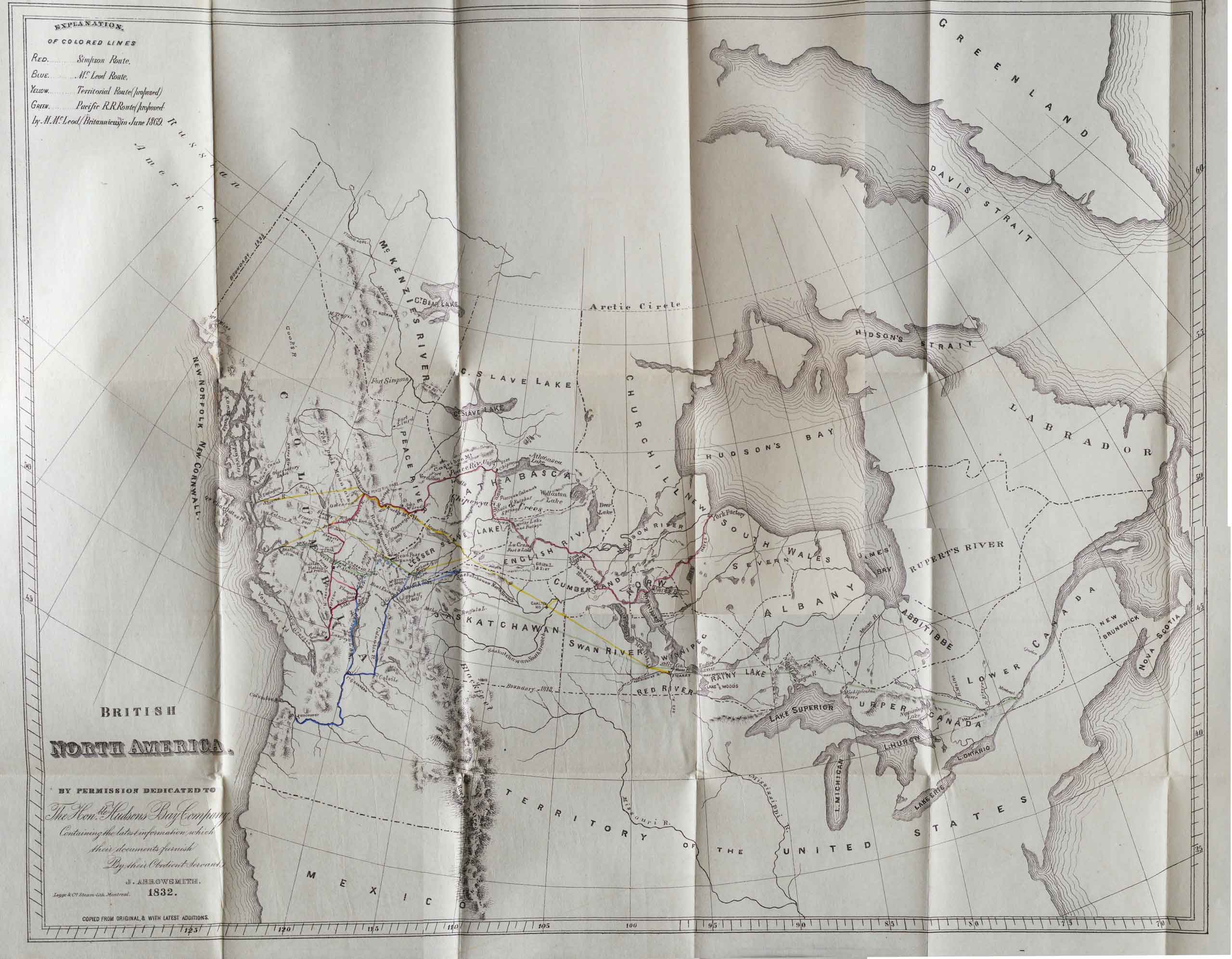
J. Arrowsmith, 1832. British North America (detail)
British North America
By Permission Dedicated to the Hon. Hudsons Bay Company
Containing the latest information which their documents furnish
By their Obedient Servant
J. Arrowsmith 1832.
Legge & Co Steam-lith./ Montreal
This edition of the map is from from Archibald McDonald’s journal of an 1828 trip accompanying George Simpson [1792–1860]. It includes a notice that the map is “Copied from original, & with latest additions.” The latest additions might be the “colored lines,” Red being the Simpson Route, Blue the McLeod Route, Yellow the proposed Territorial Route, and Green the proposed Pacific R.R. route. Additions credited to “M. McLeod (Britannicus) in June 1869.”
On the map the Athabasca River is labelled “McLeod Riv.” Fort George is not named.
Map No. 101 in Voorhis [1].
References:
- 1. Voorhis, Ernest [1859–1933]. Historic forts and trading posts of the French Régime and of the English Fur Trading Companies. Ottawa: Department of the Interior, 1930. University of British Columbia Library [accessed 3 January 2026]
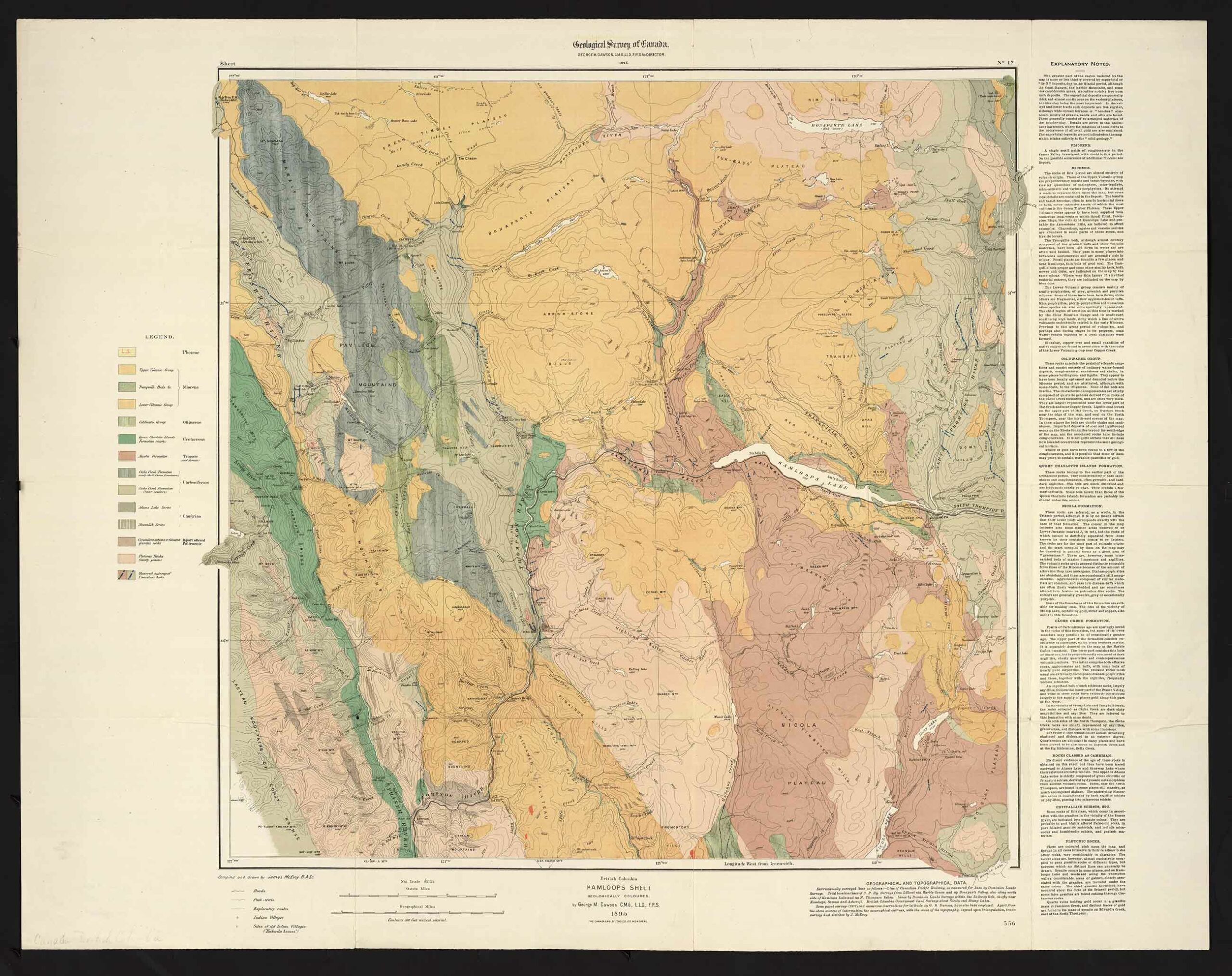
Geological Survey of Canada
British Columbia
KAMLOOPS SHEET
GEOLOGICALLY COLOURED.
by George M. Dawson C.M.G., L.L.D., F.R.S.
1895
Compiled and drawn by James McEvoy B.A.Sc.
George Mercer Dawson [1849–1901] engaged in geological work in the southern inland portion of British Columbia during the years 1877, 1888, 1889 and 1890, frequently accompanied by James McEvoy [1862–1935].
References:
- Dawson, George Mercer [1849–1901]. “Notes on the Shuswap people of British Columbia.” Transactions of the Royal Society Canada, Section 2 (1891). University of British Columbia
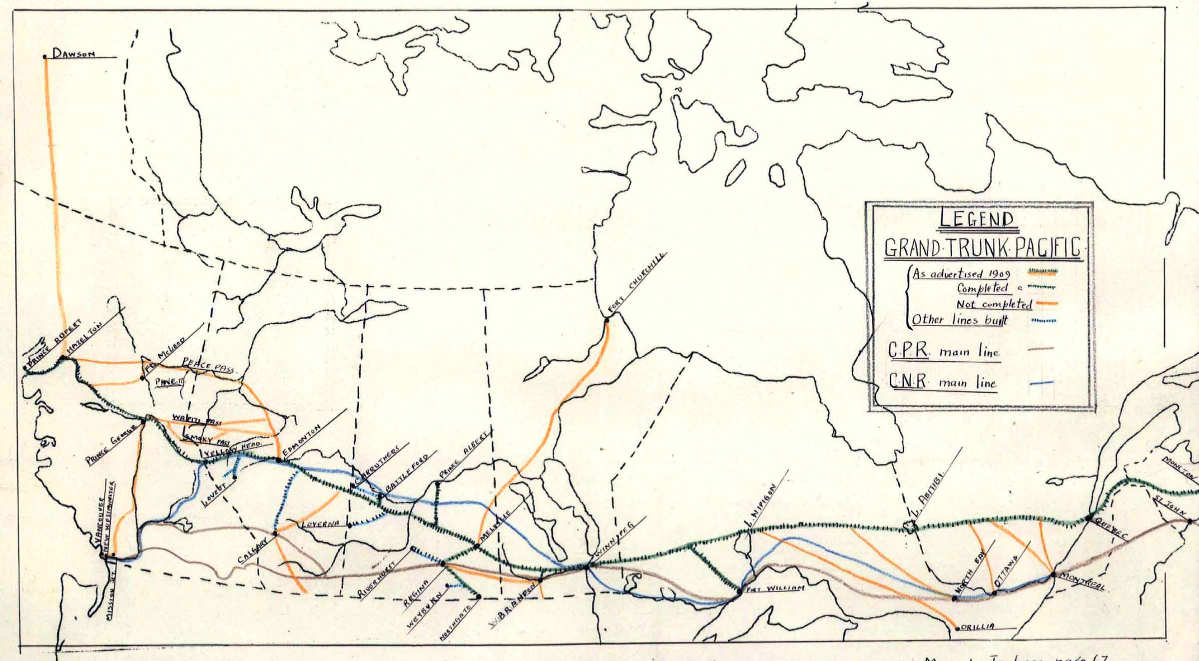
Lower, Joseph Arthur. The Grand Trunk Pacific Railway as projected
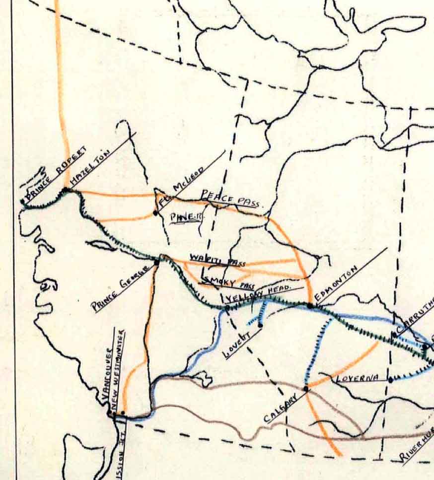
Lower, Joseph Arthur. The Grand Trunk Pacific Railway as projected, detail
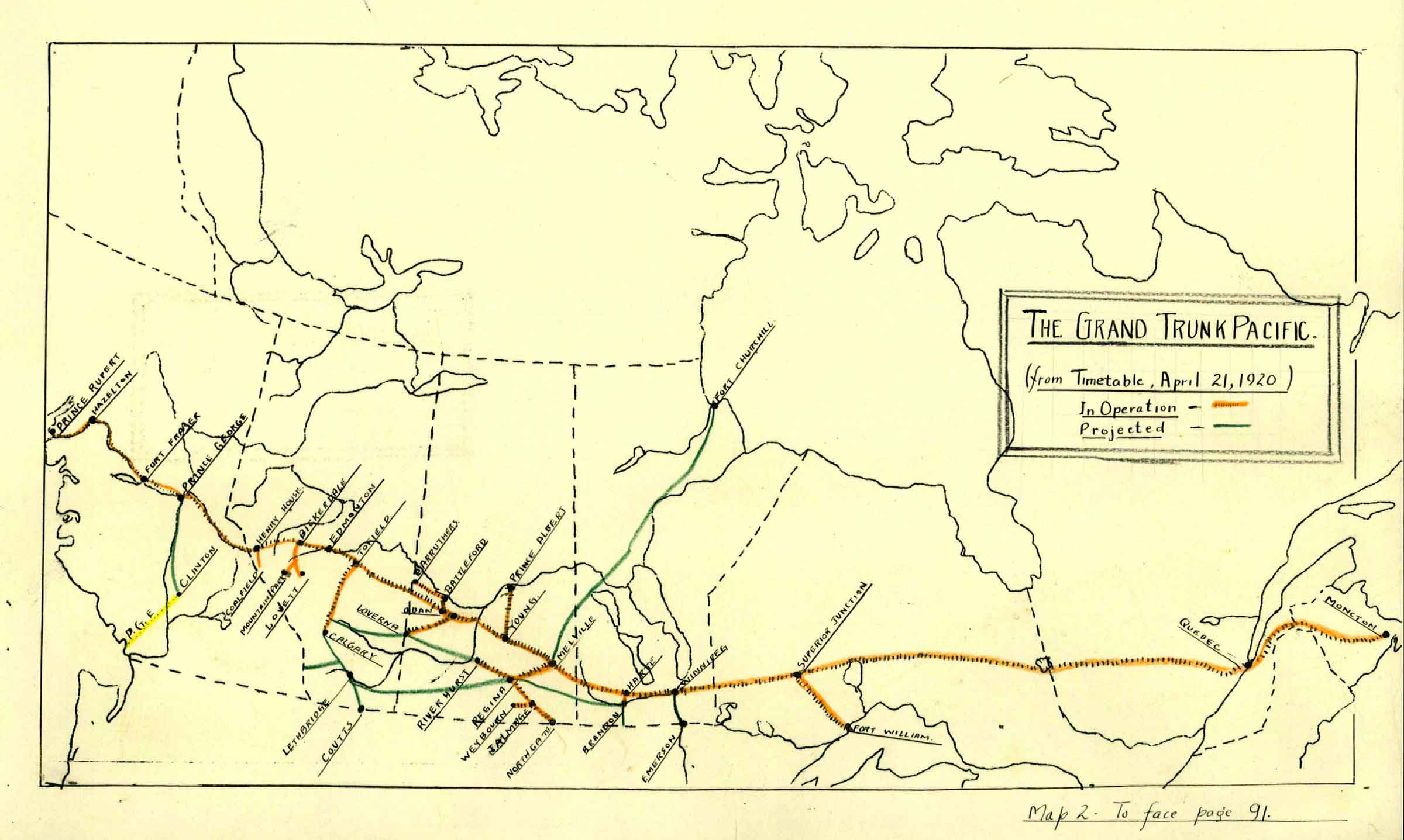
Lower, Joseph Arthur. The Grand Trunk Pacific Railway, projected and operational routes, 1920