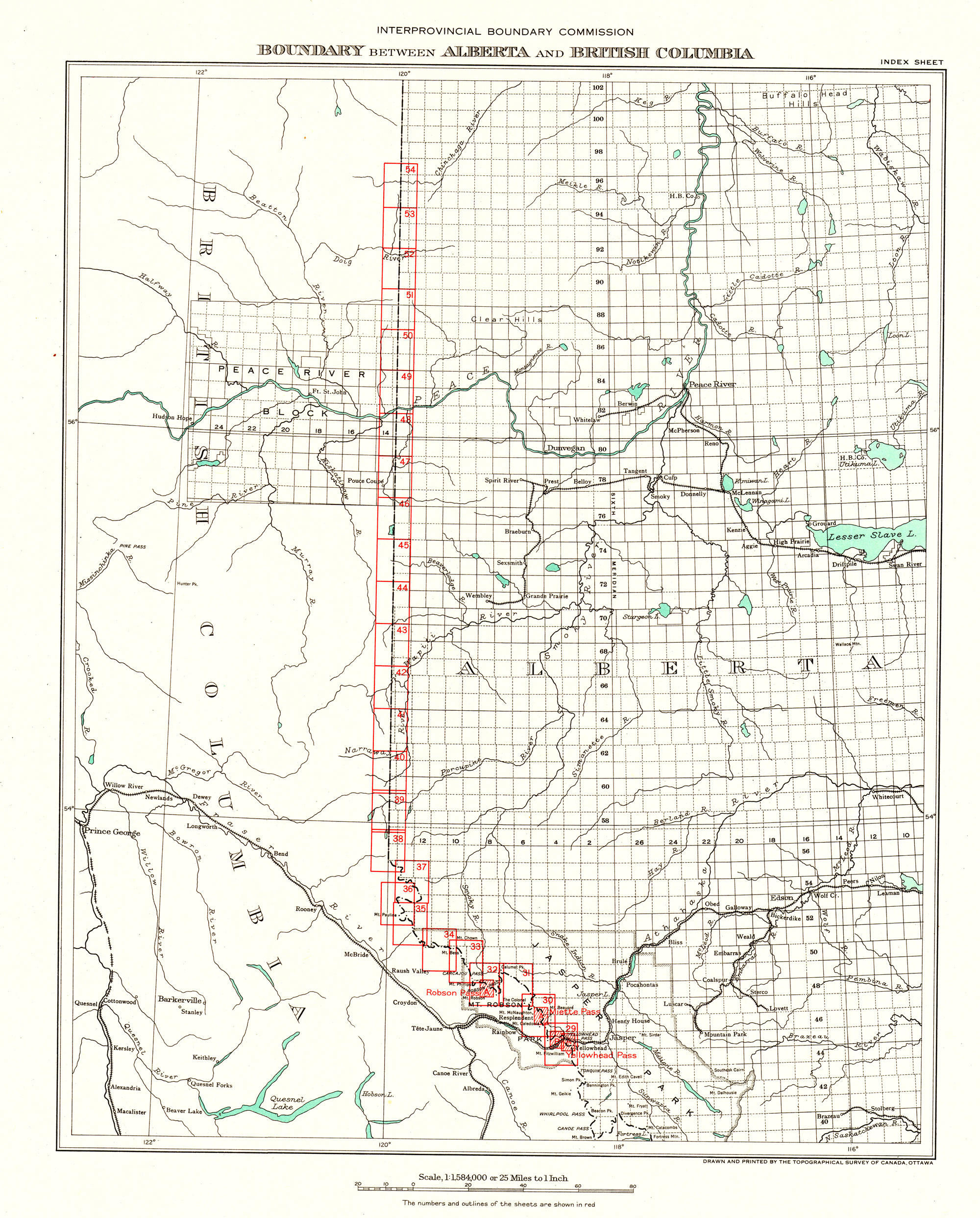
Index sheet 3. Boundary between Alberta and British Columbia. Office of the Surveyor-General, 1924
Internet Archive
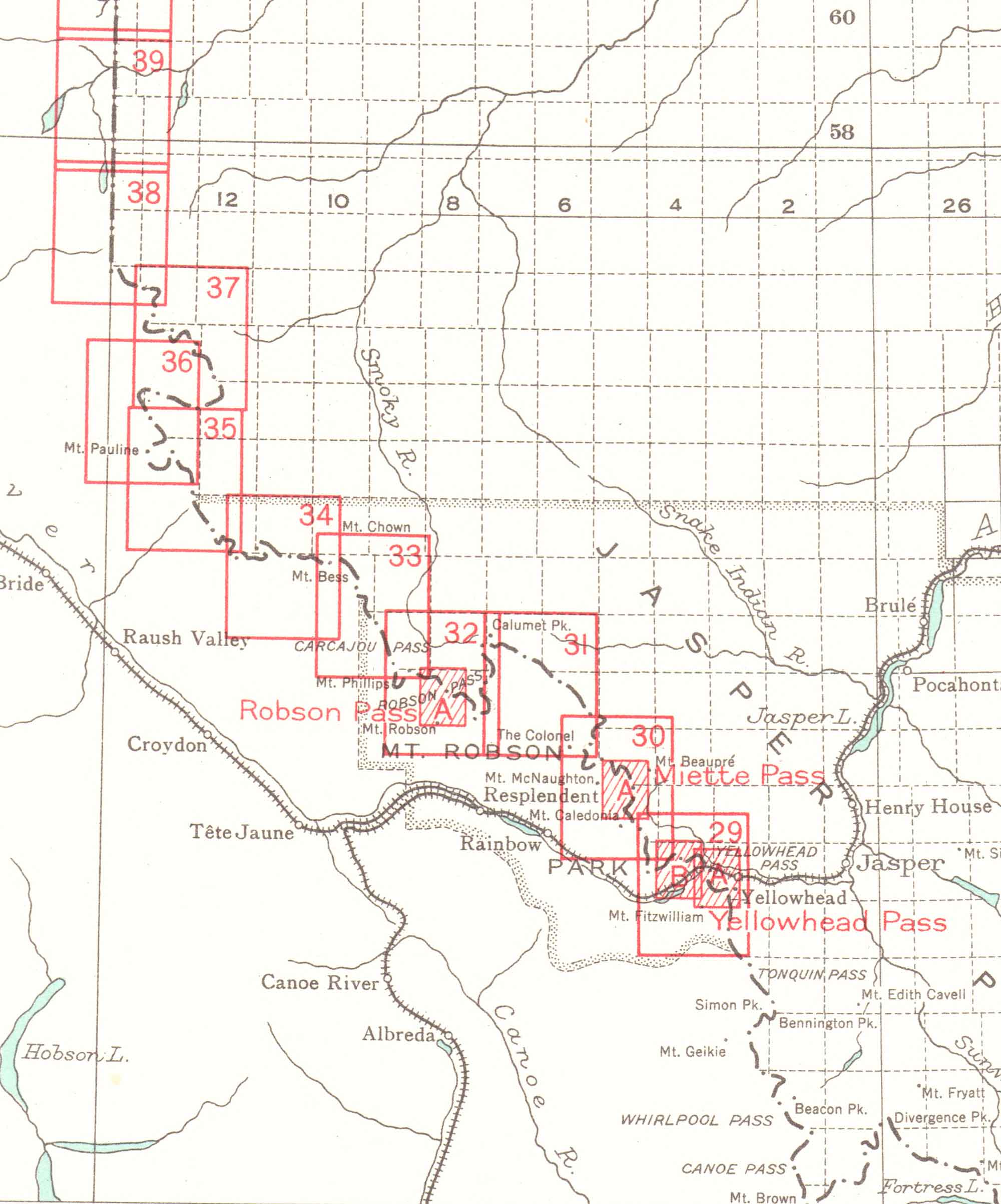
Index sheet 3 (detail). Boundary between Alberta and British Columbia. Office of the Surveyor-General, 1924
Internet Archive
Index Sheet 3 — Yellowhead Pass to Peace River
Sheet 29 — Yellowhead Pass. Surveyed in 1917
Sheet 29 A — Miette Hill to Yellowhead Pass. Surveyed in 1917
Sheet 29 B — Yellowhead Pass to Tête Roche. Surveyed in 1917
Sheet 30 — Mount O’Beirne to Colonel Pass. Surveyed in 1922, 1924
Sheet 31 — Colonel Pass to Moose Pass. Surveyed in 1922
Sheet 32 — Moose Pass to Carcajou Pass. Surveyed in 1922, 1924
Sheet 32 A — Robson Pass. Surveyed in 1924
Sheet 33 — Carcajou Pass to Jackpine Pass. Surveyed in 1923
Sheet 34 — Jackpine Pass to Mount Holmes. Surveyed in 1923
Sheet 35 — Chalco Mountain to Beaverdam Pass. Surveyed in 1923
Sheet 36 — Big Shale Hill to Loren Lake. Surveyed in 1923
Sheet 37 — Avalanche Pass to Casket Pass. Surveyed in 1923, 1924
Sheet 38 — To Intersection Mountain. Surveyed in 1924
Sheet 39 — North of Intersection Mountain to Kakwa River. Surveyed in 1924
- Interprovincial Boundary Commission. Boundary between Alberta and British Columbia. Index Sheet 3. Ottawa: Office of the Surveyor General, 1924. Internet Archive