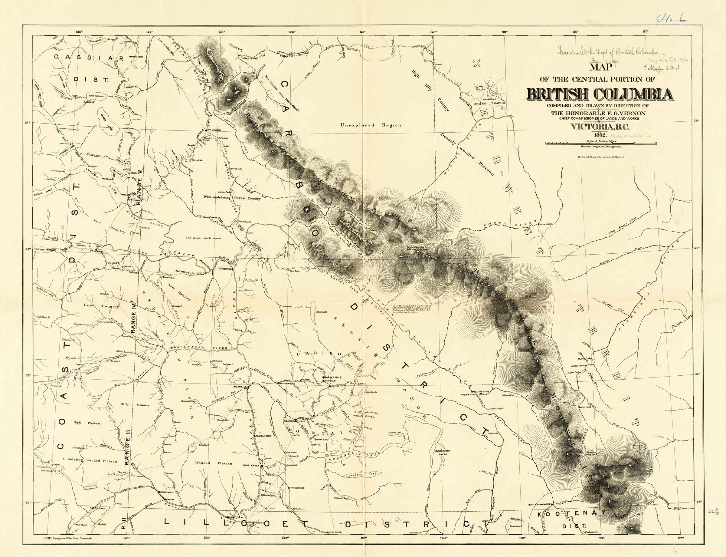
Map of the central portion of British Columbia.
British Columbia Department of Lands and Works, 1892
Norman B. Leventhal Map & Education Center [accessed 12 October 2026]
Map
of the central portion of
British Columbia
compiled and drawn by direction of
The Honorable F. G. Vernon,
Chief Commissioner of Lands and Works
Victoria, B.C.
1892
Gotfred Jorgensen, Draughtsman.
Note along the South Fork of the Fraser River:
From the Grand Rapids to Cranberry River (185 miles) the South Fork might be navigated by steamers of light draft. The fall, 2 feet to a mile, is nearly uniform.
This map includes:
Albreda Lake
Bad River (James Creek)
Baptiste River
Bear River
Boat Encampment
Brûlé Lake [as “Burnt Lake”]
Cariboo District
Canoe River
Committee Punch Bowl
Columbia River
Cowdung Lake
Cranberry Lake
Fort George
Grand Fork
Grand Rapids
Henry House (2)
Jarvis Cache
Jasper House
Jasper Lake
Kinbasket Lake
Little Smoky River (Athabasca)
Maligne River
Miette River
Moose Lake
Moose River
North Branch of North Fork Fraser River
Fraser River North Fork
North Thompson River
Parsnip River
Rau’ Shuswap [as “Rau Shuswap R.”]
Shuswap River [as “Rau Shuswap R.”]
Small Creek [as “Small R.”]
Smoky River
Snake Indian River
South Branch of North Fork Fraser River
Tête Jaune Cache [Note: Iroquois I. Vill]
Wapiti River
Whirlpool River
Willow River
Wood River
Tribes
Iroquois Indians [Village at Tête Jaune Cache]
Albreda Lake
Bad River (James Creek)
Baptiste River
Bear River
Boat Encampment
Brûlé Lake [as “Burnt Lake”]
Cariboo District
Canoe River
Committee Punch Bowl
Columbia River
Cowdung Lake
Cranberry Lake
Fort George
Grand Fork
Grand Rapids
Henry House (2)
Jarvis Cache
Jasper House
Jasper Lake
Kinbasket Lake
Little Smoky River (Athabasca)
Maligne River
Miette River
Moose Lake
Moose River
North Branch of North Fork Fraser River
Fraser River North Fork
North Thompson River
Parsnip River
Rau’ Shuswap [as “Rau Shuswap R.”]
Shuswap River [as “Rau Shuswap R.”]
Small Creek [as “Small R.”]
Smoky River
Snake Indian River
South Branch of North Fork Fraser River
Tête Jaune Cache [Note: Iroquois I. Vill]
Wapiti River
Whirlpool River
Willow River
Wood River
Tribes
Iroquois Indians [Village at Tête Jaune Cache]
Also see