Other name for Rearguard Mountain
Earliest known reference to this name is 1912 (Walcott)
Not currently an official name.
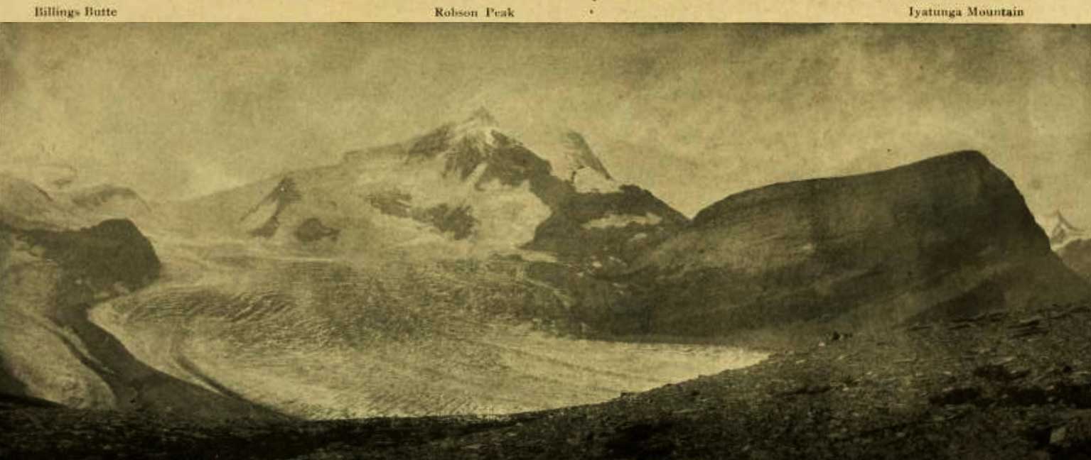
Billings Butte – Robson Peak – Iyatunga Mountain. Panonamic view of the Robson massif and adjoining mountains, with the great Hunga glacier in the foreground.
Photo: Charles D. Walcott, 1912 National Geographic Magazine 1913 [accessed 15 February 2025]
Charles Doolittle Walcott [1850–1927] visited the region in 1912 and gave it the Indigenous name of Iyatunga (Black Rock):
The snow clings to the steep sides of the upper peak in long ribbons quite to the crest, gathering below, it forms a névé, which pushes outward divided into two streams of ice that fall and slip down the steep incline for nearly a mile. The stream on the left forms Blue Glacier (Coleman account of expedition of 1908) and on the right Chupo (Mist) Glacier. Chupo, the glacier of fog and mist, is usually half concealed by clouds and banks of mist that form on the edge of the mountain and drift over it. Directly above Blue Glacier a point of rock was named by Dr. Coleman “The Helmet,” and the great black mountain in the center, which he called the “Rearguard,” is now given the Indian name of Iyatunga (Black Rock) (note: name approved by the Geographical Board of Canada, December, 1912).
- Walcott, Charles Doolittle D. [1850–1927]. “The Monarch of the Canadian Rockies.” National Geographic Magazine, (1913):626. Internet Archive [accessed 2 April 2025]