Monthly Archives: March 2014

Bingley Peak

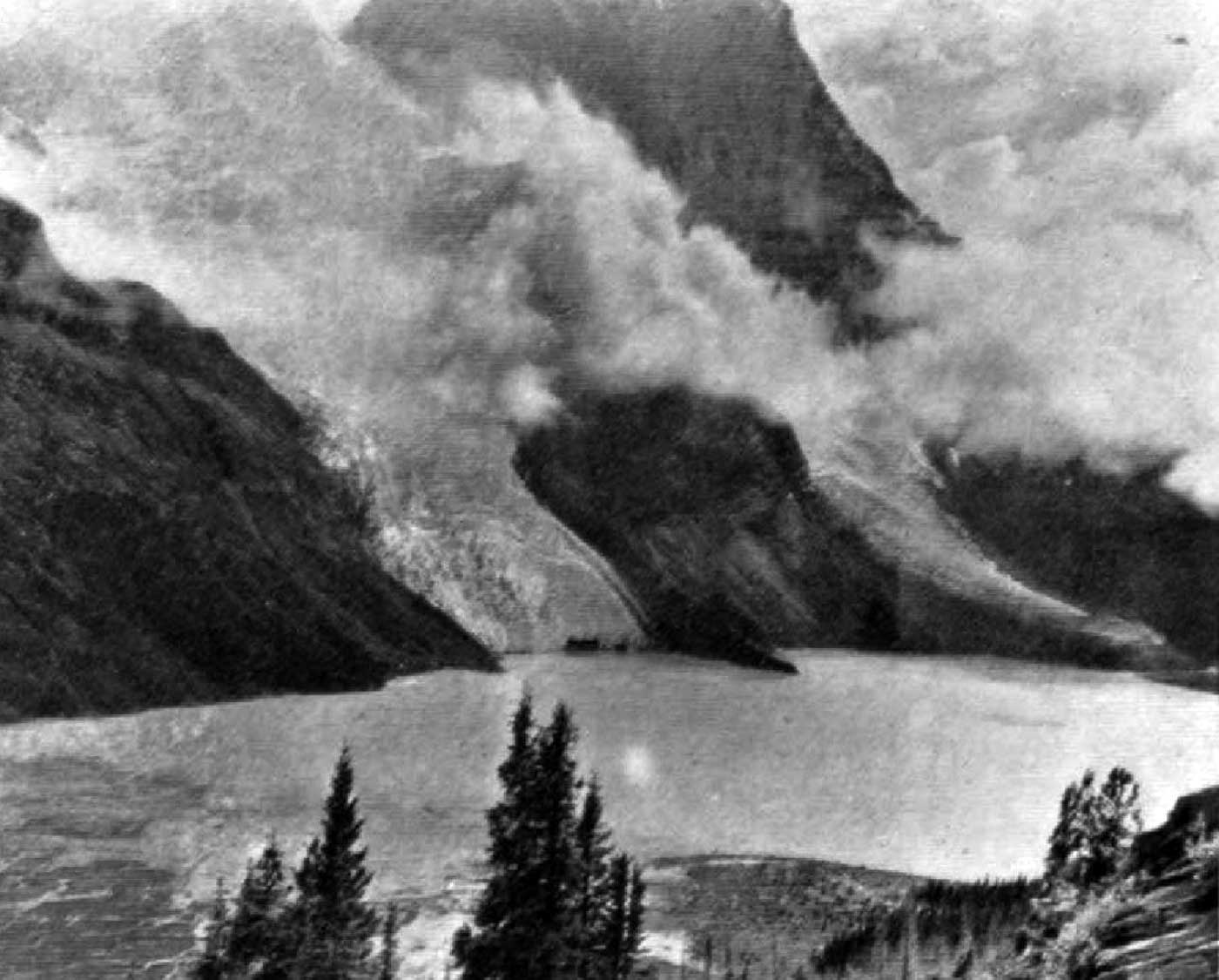
Alberta-BC boundary. Peak
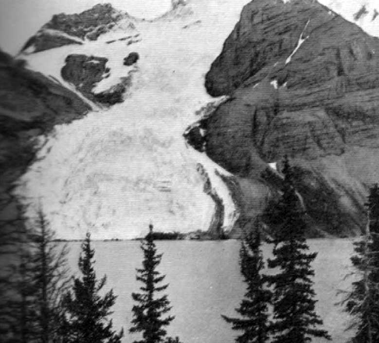
N of Yellowhead Lake
52.8819 N 118.6244 W — Map 083D15 — GoogleGeoHack
Earliest known reference to this name is 1863 (Milton and Cheadle)
Name officially adopted in 1963
Official in BCCanada

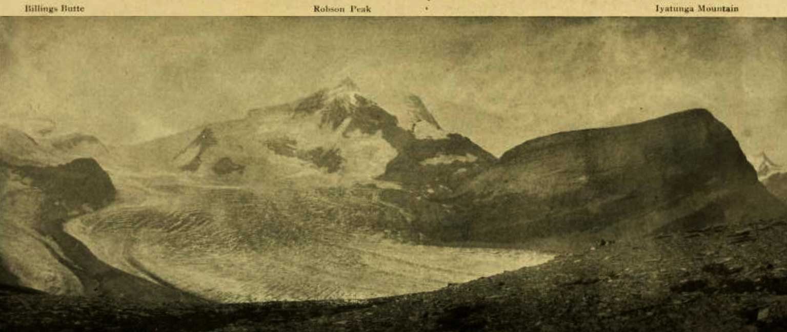
The English town of Bingley was home to Walter Butler Cheadle [1835–1910], who with William Wentworth Fitzwilliam Milton [1839–1877] crossed the Yellowhead Pass Pass in 1863.

While camped on the shore of Buffalo Dung Lake (Yellowhead Lake), their Iroquois guide assured the travelers that two nearby mountains “should be known from that time forth as ‘Le montaigne de Milord’ and ‘Montaigne de Docteur.’ We, however,” wrote Cheadle, “took the liberty of naming them Mount Fitzwilliam and Mount Bingley.”

References:

  • Milton, William Wentworth Fitzwilliam [1839–1877], and Cheadle, Walter Butler [1835–1910]. The North-West Passage by Land. Being the narrative of an expedition from the Atlantic to the Pacific, undertaken with the view of exploring a route across the continent to British Columbia through British territory, by one of the northern passes in the Rocky Mountains. London: Cassell, Petter and Galpin, 1865. Internet Archive

Billings Butte

British Columbia. Unofficial name
Proposed name for Extinguisher Tower
53.1167 N 119.0875 W GoogleGeoHack
Earliest known reference to this name is 1912 (Walcott)
Not currently an official name.
Billings Butte - Robson Peak - Iyatunga Mountain. Panonamic view of the Robson massif and adjoining mountains, with the great Hunga glacier in the foreground. Photo: Charles D. Walcott, 1912

Billings Butte – Robson Peak – Iyatunga Mountain. Panonamic view of the Robson massif and adjoining mountains, with the great Hunga glacier in the foreground.
Photo: Charles D. Walcott, 1912 National Geographic Magazine 1913 [accessed 15 February 2025]

Charles Doolittle Walcott [1850–1927] led a Smithsonian expedition to the Mount Robson area in 1912. Among the many name changes he suggested:

One of the names proposed by Dr. Coleman for a prominent monadnock that is surrounded by ice, east of Mount Robson, is ‘ The Extinguisher ‘ and Mr. Wheeler has adopted the name on his map. I presume Dr. Coleman had in mind the conical extinguisher used in putting out candles in the olden times. It so happens that that particular mass of rock carries a very important bed of Cambro-Ordovician fossils, and will be referred to many times in the future in literature. The name “Billings” is proposed for this butte in honor of E. Billings, the distinguished Canadian paleontologist, who described the famous Cambro-Ordovician fauna of Point Lévis, Province of Quebec, and Western Newfoundland.

His proposal was not accepted by the Geographical Board of Canada.

References:

  • Walcott, Charles Doolittle [1850–1927]. “The Monarch of the Canadian Rockies.” National Geographic Magazine, (1913):626. Internet Archive [accessed 2 April 2025]
  • Walcott, Charles Doolittle [1850–1927]. “Cambrian Formations of the Robson Peak District, British Columbia and Alberta, Canada.” Smithsonian Miscellaneous Collections, Vol. 57, No. 12 (1913):328-343. Smithsonian Institution Archives [accessed 11 April 2025]

Bill Johnson Road

Road. British Columbia: Forks N off Dunster-Croydon Road E of Dunster

Bill Johnson was born in Vaasa, Finland, in1899. He came to Canada at age 24, landing in Halifax, and travelled west to work in logging camps at Shere, Giscome, and Sinclair Spruce. He finally settled in the Dunster area, where he spent 22 years working for the Bert Blackwood farm. He was janitor of the old Dunster Community Hall for many years. When the Blackwoods sold their farm in 1960, Bill moved to a two-room house at top of Dunster Hill.

References:

  • Robson Valley Courier. Weekly newspaper published by Pyramid Press of Jasper from 1968–88 .

Big Shale Hill

Alberta-BC boundary. Hill
S of head of Morkill River, W of Shale Pass
53.6167 N 119.7833 W — Map 83E/12 — GoogleGeoHack
Name officially adopted in 1925
Official in BCCanada
This hill appears on:
Boundary Commission Sheet 35 (surveyed in 1923) [as “Great Shale Hill”]
Boundary Commission Sheet 37 (surveyed in 1923 & 1924) [as “Great Shale Hill”]

Labelled “Great Shale Hill” on BC-Alberta boundary sheets. The summit ridge extends over four miles westward from Shale Pass along the Continental Divide, forming the interprovincial boundary.

Bevier Creek

British Columbia. Creek: Fraser River drainage
Flows SW into Fraser River across from Doré River
53.3425 N 120.2033 W — Map 093H08 — GoogleGeoHack
Name officially adopted in 1983
Official in BCCanada

Sarah Bevier [1861–1927] is buried in the McBride cemetery. Ether Bevier [1882–1959] married George Clarence Monroe [1885 –1974] and settled on Mountainview Road in 1914. George and Ethel were market gardeners, farmers, and preachers. They initiated the McBride Farmer’s Institute and the McBride Fall Fair. They were Mountainview School trustees establishing the school in its permanent location while promoting Mountainview as a place to settle and raise families. They provided housing for settlers answering Ethel’s promotions in The Free Press.

“To think that I helped skid logs for that little shack brought back many memories of the the people I knew around there,” recalled Alex Cadieux de Courville in 1976. “Like the people of the West End: Bevier, Monroe, Emery Olden, and a good many others.”

References:

  • Robson Valley Courier. Weekly newspaper published by Pyramid Press of Jasper from 1968–88 (1968–1988).
  • McBride Cemetary. Grave markers. 2000 Roots and Dirt. Roots and Dirt
  • Foster, Sheilagh. “June 16 marks 100 years of Monroes in the Robson Valley.” The Valley Sentinel, June 13 (2012):15. ISSUU

Mount Bess

Alberta-BC boundary. Mount
Alta-BC boundary, near headwaters of Holmes River
53.3497 N 119.3772 W — Map 083E06 — GoogleGeoHackBivouac
Name officially adopted in 1925
Official in BCCanada
Elevation: 3203 m

This “splendid snow mountain” was christened Mount Bess by guide John Yates [1880– ] of Lac Ste. Anne, Alberta, during the 1910 expedition of John Norman Collie [1859–1942] and Arnold Louis Mumm [1859–1927] to the Mount Robson region, during which they made the first ascent of Mount Bess.

Elizabeth “Bessie” Ann Gunn [1892–1960] was a member of the expedition. She was the daughter of Peter Gunn [1864–1927] and Mary (Ritch) Gunn. Peter Gunn had come to Canada from Scotland in 1883 to work for the Hudson’s Bay Company. His wife-to-be Mary, from the Orkney Islands, followed a few years later. Bess was born while the family lived in Fort St. John, where Peter was factor for the HBC. In 1900, after postings in Grouard and Dunvegan, Peter became factor at Lac Ste. Anne, his last posting. Lac Ste. Anne was was a stop for packers, mountaineers, and trappers heading from Edmonton to Jasper and points north. Yates was a local packer and mail-carrier, and Bess worked at the post office. Old-timers say Yates had a crush on her.

In 1911 Bess married Charles Milton McKeen [1885–1972], a local homesteader and teamster who was later bookkeeper, magistrate, judge, and from 1921 to 1935, member of the Alberta Legislative Assembly for Lac Ste. Anne, representing the United Farmers of Alberta (Peter Gunn had earlier been Liberal MLA for the same riding). Bess spoke fluent Cree and was often called upon as interpreter. She died in the Mayerthorpe, Alberta, hospital.

References:

  • Collie, John Norman [1859–1942]. “On the Canadian Rocky Mountains north of the Yellowhead Pass.” Alpine Journal, Vol. 26 (1912):5-17
  • Holmgren, Eric J., and Holmgren, Patricia M. Over 2,000 place names of Alberta. Saskatoon: Western Producer, 1973
  • Hart, Edward John “Ted” [1946–]. Diamond hitch: the early outfitters and guides of Banff and Jasper. Banff: Summerthought, 1979
  • Holt, Vera E. The lantern era: a history of Cherhill, Rochfort Bridge, Sangudo, and the surrounding school districts. Sangudo, Alberta: Sangudo and District Historic Society, 1979
  • Boles, Glendon Webber [1934–2022]; Laurilla, Roger W. [1959–]; Putnam, William Lowell [1924–2014]. Canadian Mountain Place Names : the Rockies and Columbia Mountains. Calgary: Rocky Mountain Books, 2006. Internet Archive
  • Alberta Legislative Library. Alberta Legislative Library. Edmonton:

Bess Pass

Alberta-BC boundary. Pass
Fraser River and Smoky River drainages
Between Mount Bess and Whiteshield Mountain
53.3167 N 119.35 W — Map 83E/6 — GoogleGeoHack
Name officially adopted in 1956
Official in BCCanada

“Bess Pass, 5,330 feet in altitude and Jackpine Pass, 6,694 feet, are on the route north [of Mount Robson] to Mt. Sir Alexander. The former is situated in very spectacular surroundings between Mt. Bess and Mt. Whiteshield: the latter is much frequented by grizzlies…” — Arthur Oliver Wheeler [1860–1945]

References:

  • Wheeler, Arthur Oliver [1860–1945]. “Passes of the Great Divide.” Canadian Alpine Journal, Vol. 16 (1927–1927):117-135

Berg Lake

British Columbia. Lake: Fraser River drainage
N of Mount Robson
53.1333 N 119.15 W — Map 83E/3 — GoogleGeoHack
Earliest known reference to this name is 1909 (Kinney)
Name officially adopted in 1923
Official in BCTopo map from Canadian Geographical Names
Berg Lake at foot of Mt. Robson. Named by Mr. Kinney. Photo: G. B. Kinney, 1908

Berg Lake at foot of Mt. Robson. Named by Mr. Kinney. Photo: G. B. Kinney, 1908 Canadian Alpine Journal 1909


Tumbling Glacier and Berg Lake N.W. face of Mt. Robson. Photo: A.L. Mumm, 1909

Tumbling Glacier and Berg Lake N.W. face of Mt. Robson. Photo: A.L. Mumm, 1909 Canadian Alpine Journal 1910

Regarding the expedition of Arthur Philemon Coleman [1852–1939] to climb Mount Robson in 1907, expedition member George R. B. Kinney [1872–1961] wrote:

I had said good-bye to my companions and alone started off in the storm to make my high camp. I crossed the gravel bed of the Robson Divide, then scrambled for another mile over the great rocks that strewed the shores of Berg Lake. The short day was nearly done by the time I had passed over the rock-strewn floor of the valley below the lake and bridged its turbulent river; then, for more than two thousand feet, I packed my load of blankets and instruments to a shelf on the cliffs, in mid air.

Arthur Oliver Wheeler [1860–1945] explored the Mount Robson area with a large party in 1911:

From the elevated ice-field, fed by avalanching snows from the sides of Robson, a gigantic ice cascade tumbles down rock precipices and buries its nose in the waters of Berg Lake. At frequent intervals great chunks of ice break off with a report like cannon, and, bonding and rattling down the steep incline, plunge into the clear water of the lake. I have seen one of these enormous ice-blocks send a spout of water fully twenty feet into the air, while the waves caused by the upheaval wash to the farther shore. The incessant ice-falls soon fill the lake with floating blocks which drift hither and thither as the wind directs. Imagine a lake a mile-and-a-half long, three-quarters of a mile wide, of prefect turquoise-blue, filling the whole width of the valley floor, its surface dotted thickly with miniature icebergs, showing snow white against it.

References:

  • Kinney, George Rex Boyer [1872–1961]. “Mount Robson.” Canadian Alpine Journal, Vol. 2 (1909):10-16. Alpine Club of Canada [accessed 2 April 2025]
  • Wheeler, Arthur Oliver [1860–1945]. “The Mountains of the Yellowhead Pass.” Alpine Journal, Vol. 26, No.198 (1912):382
  • Kinney, George Rex Boyer [1872–1961]. London, England: Royal Geographical Society Archives. Letter to Arthur Hinks (1917).
Also see:

Berg Glacier

British Columbia. Glacier: Fraser River drainage
N side Mount Robson, S of Berg Lake
53.1167 N 119.1333 W — Map 83E/3 — GoogleGeoHack
Name officially adopted in 1924
Official in BCCanada
Tumbling Glacier and Berg Lake N.W. face of Mt. Robson. Photo: A.L. Mumm, 1909

Tumbling Glacier and Berg Lake N.W. face of Mt. Robson. Photo: A.L. Mumm, 1909
Canadian Alpine Journal 1910

Adopted 8 January 1924, in association with Berg Lake, into which the glacier falls.

British Columbia Geographical Names identifies “Evelyn”, “Blue,” and “Tumbling” as other early names for Berg Glacier.

References:

  • Kinney, George Rex Boyer [1872–1961], and Phillips, Donald “Curly” [1884–1938]. “To the top of Mount Robson.” Canadian Alpine Journal, Vol. 2, No. 2 (1910):21-44
  • British Columbia Geographical Names. Berg Glacier