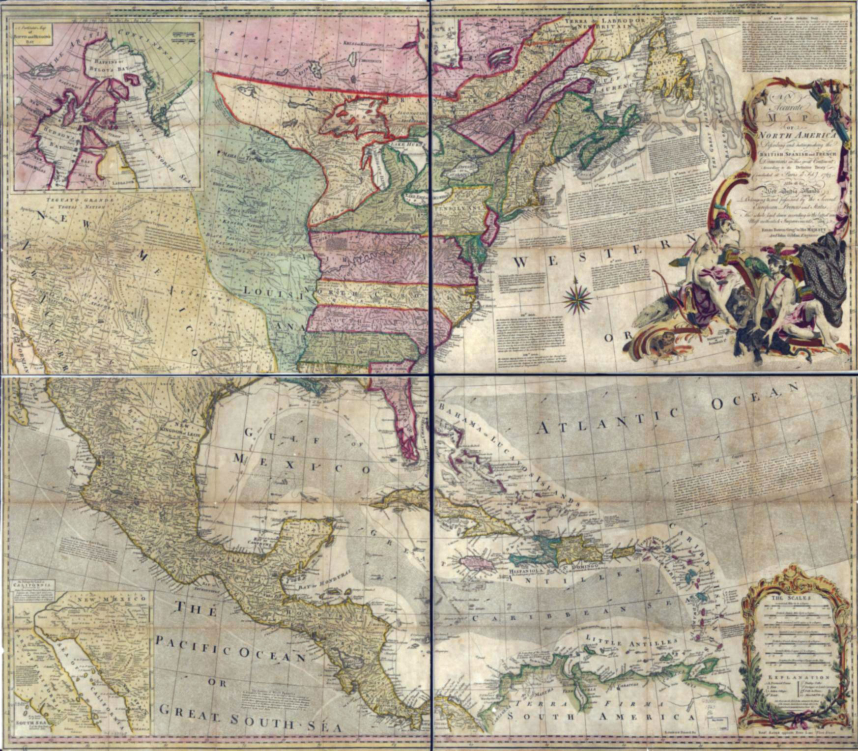
An accurate map of North America.
Describing and distinguishing the British, Spanish and French dominions on this great continent;
according to the definitive treaty concluded at Paris 10th Feby. 1763.
Also all the West India Islands belonging to, and possessed by the several European princes and states. The whole laid down according to the latest and most authentick improvements.
London, Printed for Robt. Sayer.
Attributed to Welsh cartographer Emanuel Bowen [1694–1767].
The Treaty of Paris, also known as the Treaty of 1763, was signed on 10 February 1763 by the kingdoms of Great Britain, France, and Spain, with Portugal in agreement, following Great Britain and Prussia’s victory over France and Spain during the Seven Years’ War. The signing of the treaty formally ended the conflict between France and Great Britain over control of North America (the Seven Years’ War, known as the French and Indian War in the United States), and marked the beginning of an era of British dominance outside Europe. Great Britain and France each returned much of the territory that they had captured during the war, but Great Britain gained much of France’s possessions in North America [1].
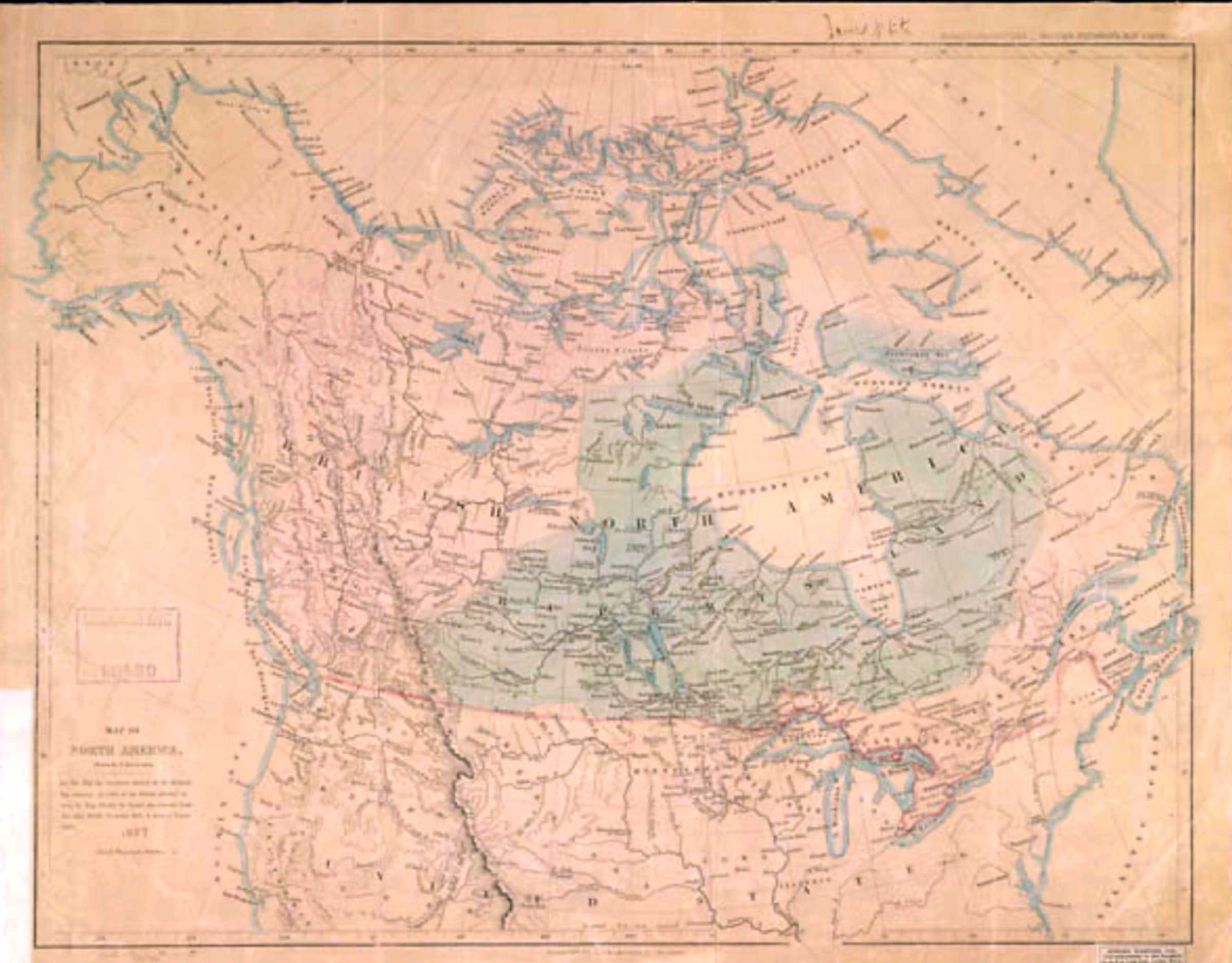
Ernest Voorhis [1859–1933] in Historic Forts and Trading Posts mistakenly says this map shows Jasper House, “built in 1799 at outlet of Brûlé Lake and called Rocky Mountain House” [2].