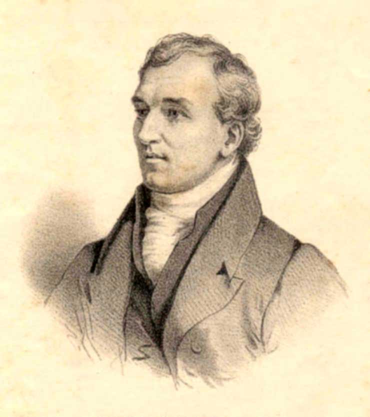
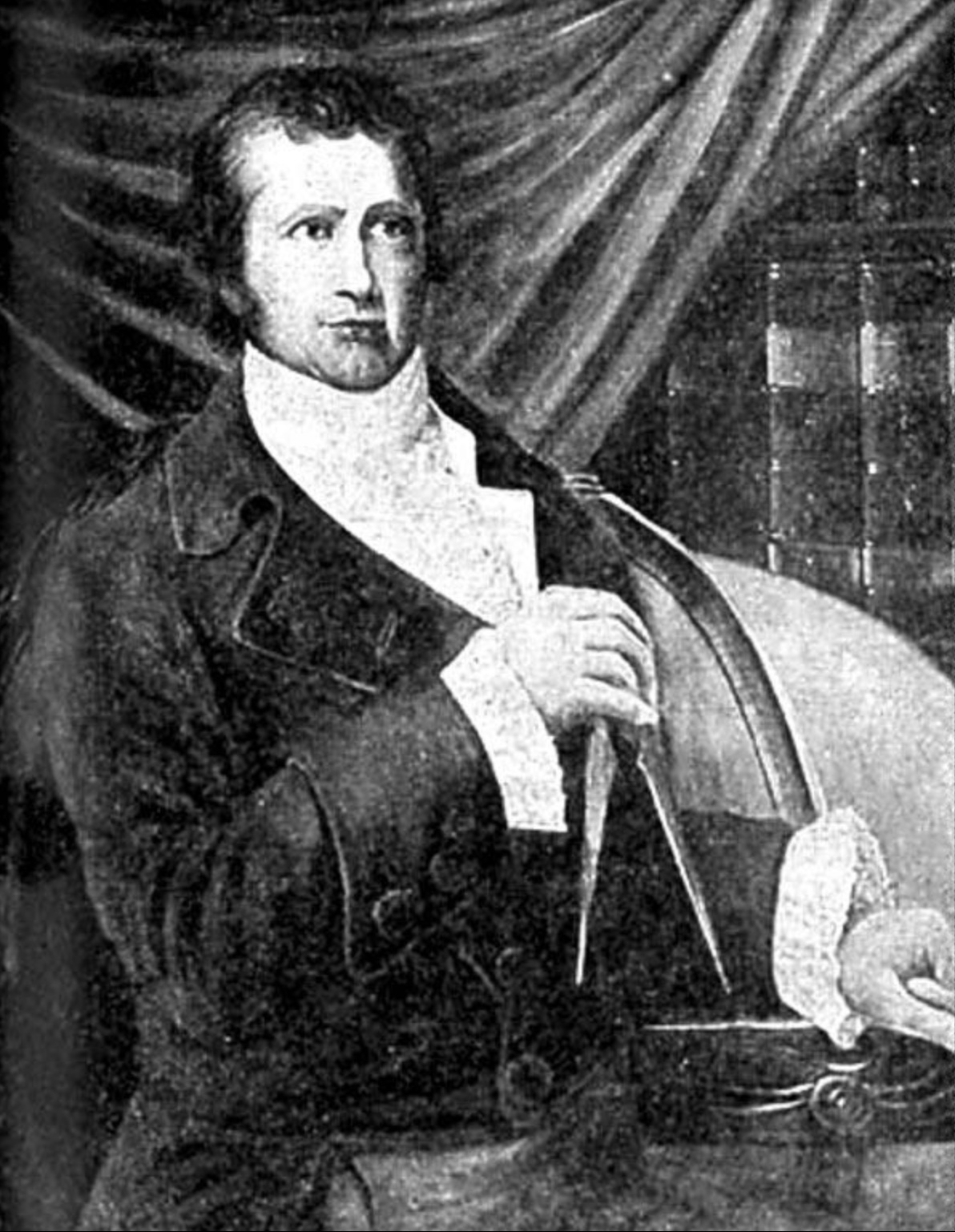
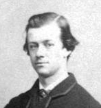
Category Archives: People

Hudson’s Bay Company

Hudson’s Bay Company
Founded 1670 – Dissolved 2025

After incorporation by English royal charter in 1670, the Hudson’s Bay Company was granted a right of “sole trade and commerce” over an expansive area of land known as Rupert’s Land, comprising much of the Hudson Bay drainage basin. [1]

The charter was conferred by Charles II on his “dear and entirely beloved Cousin, Prince Rupert,” and a group of associates incorporated as “The Governor and Company of Adventurers of England trading into Hudson’s Bay.” With the charter the King gave a province named in honor of the cherished kinsman “Rupert’s Land.” The bounds of the province no man knew. The grant was described in the deed as embracing the lands and waters draining into Hudson Bay and Hudson Straits. That meant extension on the east nearly to the shores of Labrador; on the south to the northern watershed of the St. Lawrence, the Great Lakes and the upper Missouri; on the west to the Rocky Mountain divide of the Saskatchewan River and the eastern divide of the Athabasca River, Great Slave Lake and Back’s River; and on the north to the line of the watershed of Hudson Straits. This immense territory was granted free from seignorial reservations; it was given to the Governor and Company to hold as “absolute lords and proprietors” in “free and common soccage.”

— Merk [2]

See also
James Knight, York Fort Journals,1717 [3]
Samuel Hearne, Journey to the Northern Ocean, 1772 [4]
George Simpson, Fur trade and empire, 1825 [5]
James McMillan, Portion of letter to William Connelly, 1825 [6]
Aborigines’ Protection Society, Canada West and the Hudson’s-Bay Company1856, [7]
Edward Ermatinger], York Factory Express Journal, 1828 [8]
Harold Innis, The Fur Trade in Canada 1930 [9]
Ball, Georgina. “Monopoly system of wildlife management, ” 1985 [10]

Events in the Mount Robson region in which Hudson’s Bay Company was involved:

  • 1774 HBC on Saskatchewan
  • 1812 NWC vs. HBC
  • 1820 Permanent HBC post established at Fort George
  • 1824 Simpson recrossing Athabasca Pass
  • 1824 Simpson and Ross cross Athabasca Pass from west
  • 1825 HBC becomes active on the northwest coast
  • 1825 McMillan re Tête Jaune’s Cache
  • 1827 George McDougall crosses YHP
  • 1827 David Douglas Athabasca pass
  • 1828 Chief Factor John McLoughlin takes charge of area west of the Rockies
  • 1828 James Douglas is captured in Carrier territory and released after negotiations
  • 1834 James Douglas becomes a Chief Trader within the HBC
  • 1838 HBC granted 21 year exclusive hunting and trading license to northwest coast
  • 1839 James Douglas becomes a Chief Factor within HBC
  • 1819 Robertson in charge of Fort St Mary
  • 1771 Hearne to Coppermine
  • 1722 La Vérendrye reachs Lk. Winnipeg
  • 1670 HBC charter
  • 1821 Northwest Company and Hudson’s Bay Company merge, known as HBC
  • 1858 HBC trader H. J. Moberly in charge at Jasper
  • 1862 H. J. Moberly at Fort George
  • 1855 HBC trader H. J. Moberly hunting at Jasper
Also see

References:

  • 1. Wikipedia. Hudson’s Bay Company
  • 2. Simpson, George [1792–1860], and Merk, Frederick [1887–1977], editor. Fur trade and empire. George Simpson’s journal entitled Remarks connected with fur trade in consequence of a voyage from York Factory to Fort George and back to York Factory 1824-25. Cambridge, Mass.: Harvard University Press, 1931. University of British Columbia Library [accessed 10 March 2025]
  • 3. Knight, James [1640–1721]. Life and death by the frozen sea: the York Fort journals of Hudson’s Bay Company governor James Knight 1714–1717. Edited by Arthur J. Ray. Toronto: The Champlain Society, 2018
  • 4. Hearne, Samuel [1745–1792]. A journey from Prince of Wales’s Fort in Hudson’s Bay to the Northern Ocean, in the years 1769, 1770, 1771, and 1772. Tyrrell, Joseph Burr, 1858-1957. Totonto: Champlain Society, 1911. Internet Archive
  • 5. Simpson 1824
  • 6. McMillan, James [1783–1858]. Winnipeg: Hudson’s Bay Company archives. Portion of letter James McMillan to William Connelly HBCA B.188/b/4 fo. 9-10 (1825).
  • 7. Aborigines’ Protection Society. Canada West and the Hudson’s-Bay Company. London: William Tweedie, 1856.
  • 8. Ermatinger, Edward [1797–1876], and White, James [1863–1928], editor. Edward Ermatinger’s York Factory express journal, being a record of journeys made between Fort Vancouver and Hudson Bay in the years 1827–1828. Ottawa: Transactions of the Royal Society of Canada, 1912. Internet Archive [accessed 10 March 2025]
  • 9. Innis, Harold [1894–1952]. The Fur Trade in Canada. An Introduction to Canadian Economic History. New Haven: Yale University Press, 1930. Internet Archive
  • 10. Ball, Georgina. “Monopoly system of wildlife management of the Indians and the Hudson’s Bay Company in the early history of British Columbia.” BC Studies, 66 (1985)

North West Company

North West Company
b. 1779 — Montreal, Quebec
d. 1821 — London, England

From Merk’s introduction to Fur Trade and Empire:

Rupert’s Land under this charter was the proprietary colony of the Hudson’s Bay Company [1670–] and as such for two centuries it was held. But it was not held in peace. The gifts of the charter were challenged in England and abroad. France had claims to the territory as part of the province of New France; she had bestowed the region on one of her colonizing companies much before 167o and she was not disposed to give up her rights there without a struggle. This was one of the questions that was fought over in the long Anglo-French duel for mastery in the New World; and Rupert’s Land, or parts of it, changed hands repeatedly with the fortunes of war before its fate was finally determined in 1763 by the expulsion of France from the continent of North America.

But the removal of this foreign threat served only to stimulate domestic challenge to the charter. Almost from the beginning there had been question as to the charter’s validity on the ground that it emanated from royal authority without legislative ratification, and that it granted monopoly rights which, after the Statute of Monopolies of 1623, the crown could not legally bestow. It was argued also in later years that in 167o Rupert’s Land was not Charles Il’s to give, being then the soil of France, that England gained it first in 1763, when it came by conquest and unencumbered by Stuart gifts of monopoly. Supported by such arguments, free traders from England and Canada defied the exclusive privileges of the Hudson’s Bay Company and after 1763 did so with increasing determination and success.

Among the free traders who intruded on Rupert’s Land was a group which in 1787 united to form the North West Company of Montreal. This was a redoubtable organization, characterized on the one hand by the dash and aggressiveness of adventurers, and on the other by the stability and the foresight of men of money. Two classes of shareholders were in it: eastern partners, merchants of substance in Montreal and Quebec, who supplied the capital, and the so-called “wintering partners” who contributed the skill and experience which went into leadership in the field. Zeal on the part of employees was stimulated by holding out to promising young men brought into the service the prospect of promotion to the wintering-partner status. There were in the employ of the Company at one time not far from two thousand men clerks, voyageurs, laborers, interpreters, guides and various other functionaries of the trade. The Company had a route to the interior, less direct, to be sure, than the Hudson Bay passage but advantageous in other respects. This was the southern highway consisting of the broad St. Lawrence and the Ottawa to the Great Lakes, and the Rainy Lake passage thence to the waters of the Saskatchewan. At Montreal and at Fort William on the western shore of Lake Superior the Company had great warehouses assuring to interior posts regularity of supply. This was no mean antagonist for the great British chartered monopoly.

For fifteen years the North West Company and the Hudson’s Bay Company clashed in the forests of Rupert’s Land. It was a bitter war in which each party wielded weapons of trade and of violence mercilessly in turn. Rival posts fought each other at close range; there was undercutting and overbidding; Indians were competitively plied with liquor; there was covert bargaining by each side with faithless employees of the other, and seizure and confiscation of each other’s supplies and furs. Such was the musketry of trade. From the arsenal of war were drawn raids, the levelling of each other’s trading posts, incitation of Indians and of half-breeds to violence, open fighting and secret stabbing and shooting in the shadows of the forest. Red River Colony, established in 18r under the aegis of the Hudson’s Bay Company, was in 1816 the scene of a pitched battle in which Governor Semple of the Hudson’s Bay Company Territories and twenty men fell before the fire of a party of half-breed retainers of the North West Company. Violence was succeeded after this “Battle of Seven Oaks” by a renewal of cut-throat competition and by litigation in the courts of Upper and Lower Canada.

The result of this war was complete disorganization of the northern fur trade. Prices paid to Indians for furs rose to levels which rendered profit out of the question. Ruin faced even the Indians who in competitive traffic were paid for furs in the currency of rum. Game was recklessly wasted. Furs reach prime condition only in the winter, but competition led to the trapping and hunting of pelts in all seasons, which meant not merely defective furs but extermination of the young with the full grown in the breeding season. Discipline among employees became lax; extravagance and waste crept into the conduct of the trade, a disease that spread even to the Oregon Country which lay outside the boundaries of Rupert’s Land and therefore beyond the immediate war zone. By 1820 the struggle had brought the two belligerents to the verge of bankruptcy and to the will to peace.

Peace came by way of a coalition agreement entered into in London in 1821. In the merger the Hudson’s Bay Company retained its identity; it took over the assets of the North West Company, evaluated like its own at €200,000, and to finance the consolidation doubled its outstanding stock. The charter and the ancient privileges of the Hudson’s Bay Company remained undisturbed. To the privileges a princely addition was made. The British government as a reward for the peace and as a means of preventing any future outbreak of war conferred upon the reorganized Company, under an act of Parliament of 1821, exclusive trading rights for twenty-one years in all that part of British North America lying between Rupert’s Land and the Rocky Mountains, and, in addition, the sole British trading rights in the whole of the Oregon Country. Thus the entire area which is now the Dominion of Canada excepting only the valley of the St. Lawrence and the maritime provinces was, after 1821, under the control of the Hudson’s Bay Company, either as proprietor or as possessor of exclusive trading rights, and besides the Company held sole British rights of trade in all of what is now the Pacific Northwest of the United States. [1]

Events in the Mount Robson region in which North West Company was involved:

  • 1778 Pond to Athabasca
  • 1779 NWC Organized
  • 1789 Mackenzie reaches Arctic Ocean and explores Slave & Mackenzie River
  • 1792 Mackenzie sets out
  • 1793 Mackenzie crosses divide
  • 1793 Mackenzie sees Sekani woman among Soda Cree
  • 1804 Fort Simpson established by Northwest Company
  • 1805 Fort St. John established by Northwest Company
  • 1805 Mcleod’s Lake post established by Simon Fraser
  • 1805 Fort Nelson established on Liard River
  • 1805 Hudson Hope post established at Rocky Mountain Portage
  • 1806 Fort St. James established on Stuart Lake
  • 1806 Fort Fraser post established by HBC at Fraser Lake
  • 1807 Fraser founds Fort George
  • 1807 David Thompson visits the Kutenai. Kutenai House established
  • 1808 Fraser descends Fraser
  • 1811 David Thompson crosses Athabasca Pass
  • 1812 NWC vs. HBC
  • 1813 NWC post at Brûlé Lake
  • 1821 Northwest Company and Hudson’s Bay Company merge, known as HBC
Also see

References:

  • 1. Simpson, George [1792–1860], and Merk, Frederick [1887–1977], editor. Fur trade and empire. George Simpson’s journal entitled Remarks connected with fur trade in consequence of a voyage from York Factory to Fort George and back to York Factory 1824-25. Cambridge, Mass.: Harvard University Press, 1931. University of British Columbia Library [accessed 10 March 2025]

David Thompson

David Thompson (1770-1857) Canadian cartographer and explorer

David Thompson (1770-1857) Canadian cartographer and explorer
Wikipedia

David Thompson
b. 30 April 1770 — Westminster, England
d. 10 February 1857 — Longueuil, Canada East

Thompson, a charity pupil at Grey Coat School, London, was apprenticed to the Hudson’s Bay Company in 1784. He joined the North West Company [1779–1821]> as a surveyor in 1797. In 1811 he explored the length of Columbia River, making the first recorded crossing of the Continental Divide via the Athabasca Pass.

Thompson was a member of the British-American Boundary survey from 1815 to 1824. He died of poverty at Longuineil, Quebec, in 1857, age 87. He was never on any of the three Thompson Rivers.

Works pertinent to the Mount Robson region of which Thompson was author or co-author:

  • —   David Thompson’s Narrative of his explorations in western America, 1784-1812. Joseph Burr Tyrrell, editor. Toronto: Champlain Society, 1916. University of British Columbia [accessed 3/10/2025]
  • Henry, Alexander [1739–1824]; — and Coues, Elliott, Editor. The Manuscript Journals of Alexander Henry, Fur Trader of the Northwest Company. And of David Thompson, Official Geographer and Explorer of the same Company, 1799-1814. Exploration and Adventure among the Indians on the Red, Saskatchewan, Missouri, and Columbia Rivers. Volume 2 of 3. New York: Francis P. Harper, 1897
Thompson is the namesake of the following places in the Mount Robson region:

Thompson is credited with naming the following places:

Events in the Mount Robson region in which Thompson was involved:

  • 1807 David Thompson visits the Kutenai. Kutenai House established
  • 1811 David Thompson crosses Athabasca Pass
  • 1857 David Thompson dies. Most maps are lost and fur trails forgotten.
References:

  • Nesbit, Jack [1949–]. Mapmaker’s Eye: The Mapmaker’s Eye: David Thompson on the Columbia Plateau. Pullman: Washington State University Press, 2006
  • David Thompson. Map Maker, Explorer and Visionary. 2021. Archives of Ontario
  • Gottfred, J. How David Thompson Navigated. 2000. Northwest Journal
  • Wikipedia. David Thompson (explorer)

Walter Butler Cheadle

Dr. Walter B. Cheadle, ca.1863

Dr. Walter B. Cheadle, ca.1863
British Columbia Archives


Dr. Walter Cheadle, photographed in San Francisco, 1863 (detail)

Dr. Walter Cheadle, photographed in San Francisco, 1863 (detail)
British Columbia Archives

Walter Butler Cheadle
b. October 1835 — Colne, Lancashire, England
d. 22 March 1910 — London, England

Cheadle accompanied William Wentworth Fitzwilliam Milton [1839–1877] on a journey across Canada in 1862–63. They crossed the Rocky Mountains through Yellowhead Pass, almost starved in the North Thompson country, and eventually straggled into Kamloops. They visited the Cariboo gold fields before returning to England by ship from Victoria.

Cheadle, the older and more resourceful of the two, assumed most of the responsibility for their journey. He spelled out their story in two books, Journal of a Trip across Canada and The North West Passage by Land, which has gone through ten editions. In 1865, Cheadle resumed medical practice in London, and married in the following year. He met with great success in his career, and served as dean of St. Mary’s Medical School from 1869 to 1873. In the face of much opposition, he stood among the early supporters of women’s claims to a right to practice medicine.

Milton and Cheadle named numerous features in the Yellowhead Pass area.

Works pertinent to the Mount Robson region of which Cheadle was author or co-author:

  • —  and Milton and Cheadle. Cheadle’s Journal of Trip Across Canada 1862-63. Ottawa: Graphic Publishers, 1931. University of British Columbia Library
  • Milton and Cheadle; Milton, William Wentworth Fitzwilliam [1839–1877]; —   The North-West Passage by Land. Being the narrative of an expedition from the Atlantic to the Pacific, undertaken with the view of exploring a route across the continent to British Columbia through British territory, by one of the northern passes in the Rocky Mountains. London: Cassell, Petter and Galpin, 1865. Internet Archive [accessed 3/10/2025]
  • Milton and Cheadle; Milton, William Wentworth Fitzwilliam [1839–1877]; —   Voyage de l’Atlantique au Pacifique, à travers le Canada, les montagnes Rocheuses et la Colombie anglaise. Paris: Hachette, 1872
Cheadle is the namesake of the following places in the Mount Robson region:

Events in the Mount Robson region in which Cheadle was involved:

  • 1863 Milton and Cheadle through YHP
References:

William Wentworth Fitzwilliam, Viscount Milton

Viscount Milton, photographed in San Francisco, 1863

Viscount Milton, photographed in San Francisco, 1863
British Columbia Archives

Viscount William Wentworth Fitzwilliam Milton
b. 27 July 1839 — London, England
d. 17 January 1877 — Rouen, France

Viscount Milton was a British nobleman, explorer of British North America, and Liberal Party politician.
Fitzwilliam was the eldest son of William Wentworth-FitzWilliam, 6th Earl FitzWilliam, and his wife Lady Frances Harriet, daughter of George Douglas, 17th Earl of Morton, and was educated at Eton and Trinity College, Cambridge [1].

In 1860 Milton visited the Red River Settlement and the trip whetted his appetite for more travel in British North America. According to a lecture he gave to a number of British scientific and literary societies in 1864, he was the initiator of a second and more important journey: “In the spring of 1862 I resolved to investigate for myself the nature of the country between the Red River Settlement and the Rocky Mountains; and to penetrate, if possible, by the shortest route to the gold regions of Cariboo.” He rightly considered himself “fortunate to obtain the assistance” of a friend, Dr. Walter Butler Cheadle, who proved to be the real leader of the expedition [2].

‘The favourable effect upon his health produced by the invigorating climate of the Great Plains, and the charm of the wild life there, induced Lord Milton to return there the following year, in company with Dr. Walter Butler Cheadle [1835–1910], with the view of making a more extensive exploration of the North-West Territory. At that time the gold mines of Cariboo, in British Columbia, were attracting much attention, and the only practicable route to them was the extremely circuitous one by Panama, or the little less indirect and more toilsome journey through United States territory by way of California. Although the rich mining districts of British Columbia lie almost in the direct line across the Continent through British territory, the way was barred by the great chain of the Rocky Mountains; and on each side of the main range lay wide extent of rugged country, covered with dense forest, and in great part unexplored. Lord Milton and Dr. Cheadle determined to make the attempt to discover a way through this difficult and trackless region which separated the plains of the Saskatchewan from the mining districts of British Columbia, and they set out on this expedition in the spring of 1863. The story of this adventurous and toilsome journey, graphically related by Lord Milton and his companion in The North-West Passage by Land, is probably familiar to most of us. Provided with very inadequate resources for such an arduous undertaking, the party endured great hardships and privations before they succeeded in forcing their way by the Yellow Head or Leather Pass, and through the dense forest of the North Thompson River, to the plains of Kamloops. Had Lord Milton enjoyed the full vigour of health, his enterprising spirit would have led him to further geographical research. But the renewed strength, which, in spite of its hardships, he eventually obtained from this journey, did not endure. After the lapse of a few years, he was compelled by increasing illness to resign the seat in Parliament to which he had been elected after his return, and he once more crossed the Atlantic to North America. The last few years of his life he spent chiefly in the highlands of Virginia; returning to England, however, shortly before his death [3].

Works pertinent to the Mount Robson region of which Milton was author or co-author:

  • Milton and Cheadle; — and Cheadle, Walter Butler [1835–1910]. The North-West Passage by Land. Being the narrative of an expedition from the Atlantic to the Pacific, undertaken with the view of exploring a route across the continent to British Columbia through British territory, by one of the northern passes in the Rocky Mountains. London: Cassell, Petter and Galpin, 1865. Internet Archive [accessed 3/10/2025]
  • Milton and Cheadle; — and Cheadle, Walter Butler [1835–1910]. Voyage de l’Atlantique au Pacifique, à travers le Canada, les montagnes Rocheuses et la Colombie anglaise. Paris: Hachette, 1872
Milton is the namesake of the following places in the Mount Robson region:

Events in the Mount Robson region in which Milton was involved:

  • 1863 Milton and Cheadle through YHP
References:

James McEvoy

James E. McEvoy, P.L.S.
b. 7 February 1862 — Carleton County, Ontario
d. 13 July 1935 — Corbin, British Columbia

McEvoy, on the staff of the Geological Survey of Canada, made a reconnaissance of the route west of Edmonton through the Yellowhead Pass in 1898, during which he took the first photograph of Mount Robson.

McEvoy’s father was James McEvoy [b. 1818, County Kildare, Ireland – d. 1896, Ottawa, Ontario], a farmer who arrived in Canada before 1833. The elder McEvoy married Margaret McNamara [b. 1820, Tipperary, Ireland—d. 1900] in Ottawa in 1848 [1, 2].

James Jr. was educated in Ottawa public schools and McGill University, graduating in science in 1883. For a short time he taught school and then accepted a position on the staff of the Geological Survey of Canada, where he remained for 15 years [3]. As a young man, he became interested in military affairs, was an officer in the Governor General’s Foot Guards, Ottawa, later a captain in the Kootenay Rifles, having organized two companies in that regiment. In the First World War, with the rank of Major, he was on the staff of the chief instructor in trench warfare at Niagara, London, and border camps [4].

In 1889 he accompanied George Mercer Dawson [1849–1910], the assistant director of the Geological Survey, on geological investigations in British Columbia [5]. In 1898 he made a geological survey of the Yellowhead Pass route from Edmonton to Tête Jaune Cache, passing by Mount Robson:

When we first caught sight of it, a shroud of mist partially enveloped the summit, but this presently rolled away, and we saw its upper portion dimmed by a necklace of feathery clouds, beyond which its pointed apex of ice, glittering in the morning sun, shot up far into the blue heaven above. The top of the mountain is usually completely hidden and rarely indeed is it seen entirely free from clouds. The actual height of the peak is 13,700 feet, or 10,750 feet above the valley.… Although Robson Peak has been long known, its height had never been determined, nor was it supposed to be particularly notable in that respect, but now since the height of Mts. Brown, Hooker and Murchison have been proved to be greatly exaggerated, it has the distinction of being the highest known peak in the Canadian Rockies. [p. 16]

His report included a map showing the Yellowhead Pass route from Edmonton to Tête-Jaune Cache [6]. Arthur Oliver Wheeler [1860–1945] wrote in 1912 [7]:

The splendid report of James McEvoy, published by the Geological Survey of Canada in 1900, dealing with the geology and natural history resources of the country traversed by the Yellowhead Pass route from Edmonton to Tête-Jaune Cache, contains the most comprehensive and reliable geographical information that has yet been published, and also contains the only geographical map published of that route on a sufficiently large scale to be of value.

In 1901 McEvoy became geologist for the Crow’s Nest Pass Coal Company at Fernie, B.C. He married Florence Ray [1876 – d. 1942] in 1902. In 1906 he was appointed chief engineer of the company, but relinquished the position soon afterwards to commencial practice in Toronto. He was regarded as one of the best authorities on coal and his services had been retained for numerous enterprises in connection with coal, iron, and oil operations, not only in Canada but in all parts of the world. He was a member of the Canadian Institute of Mining and Metallurgy, the Engineering Institute of Canada, the American Association for the Advancement of Science, and of the Mining and Metallurgy Institute, London, England [8].

EARLY CITIZEN DIES SUDDENLY

James E. McEvoy, geologist and mining engineer, of Ottawa, died at Corbin on Friday inst. from a heart attack. Deceased had been reporting on some phosphate claims about six or seven miles from Corbin.

The death of James McEvoy recalls the early days of Fernie when he was one of our leading citizens and an official of the Crow’s Nest Pass Coal Co. He was a very clever geologist and made a lot of early surveys of the Crow’s Nest Pass coal fields. Had the C.P.R. paid attention to his reports on the Hosmer coal property they would have been a million or so to the good, his report was that the coal seams at that point could not be mined profitably.

During the time he spent in Fernie he took an active interest in local affairs. He was Instrumental in the forming of two companies of the Kootenay Rifles and was appointed captain of A company.

He severed his connection with the C.N.P. Coal Co. about 1907 and took up his residence in Toronto and later on moved to Ottawa.

Fernie Free Press, July 26, 1935 [9]

He was survived by his widow and one daughter, Dorothy Ray McEvoy. McEvoy was buried in Beechwood Cemetery, Ottawa.

Works pertinent to the Mount Robson region of which McEvoy was author or co-author:

  • —   Report on the geology and natural resources of the country traversed by the Yellowhead Pass route from Edmonton to Tête Jaune Cache comprising portions of Alberta and British Columbia. Ottawa: Geological Survey of Canada, 1900. Natural Resources Canada
  • —   “Map Showing Yellowhead Pass Route From Edmonton To Tête-Jaune Cache.” (1900). Natural Resources Canada [accessed 3/10/2025]
McEvoy is credited with naming the following places:

Events in the Mount Robson region in which McEvoy was involved:

  • 1898 McEvoy through Yellowhead Pass, Robson estimated 13,500 feet
References:

  • 1. Rooney, Joan McEvoy. The History of the Family of James and Margaret McEvoy of Bowesville. 2020. davidalexanderthomas
  • 2. James McEvoy (1818 – 1896). 2024. WikiTree
  • 3. Whittaker, John A., editor. Early Land Surveyors of British Columbia (P.L.S. Group). Victoria, B.C.: The Corporation of Land Surveyors of the Province of British Columbia, 1990
  • 4. “James McEvoy (obituary).” Ottawa Journal, 22 July (1935)
  • 5. Dawson, George Mercer, D.S. [1849–1901]. “Notes on the Shuswap people of British Columbia.” Transactions of the Royal Society Canada, Section 2 (1891). University of British Columbia
  • 6. McEvoy, James E., P.L.S. [1862–1935]. Report on the geology and natural resources of the country traversed by the Yellowhead Pass route from Edmonton to Tête Jaune Cache comprising portions of Alberta and British Columbia. Ottawa: Geological Survey of Canada, 1900. Natural Resources Canada
  • 7. Wheeler, Arthur Oliver [1860–1945]. “The Alpine Club of Canada’s expedition to Jasper Park, Yellowhead Pass and Mount Robson region, 1911.” Canadian Alpine Journal, Vol. 4 (1912):9-80. Alpine Club of Canada [accessed 2 April 2025]
  • 8. Whittaker 1990
  • 9. Fernie Free Press. 1935, July 26, 1935. British Columbia Regional Digitized History

Frederick Arthur Ambrose Talbot

Frederick Talbot

Frederick Talbot
Montreal Gazette

Frederick Arthur Ambrose Talbot [1880–1924]

b. 1880 — London, England
d. 1924 — Quebec, Canada

I was one of a party of six which set out from the western fringe of civilisation in Alberta to make the “North-West Passage” by land, threading 1,200 miles of wonderful, practically unknown country-the interior of New Caledonia, or, as it is now officially called, New British Columbia. The party consisted of Harry R. Charlton, Montreal ; Robert C. W. Lett, Winnipeg ; H. D. Lowry, Washington, U.S.A.; G. Horne Russell, Montreal; a photographer, and myself. The first and third left the party at Tête Jaune Cache to return. The object of my investigations was to form some notion of the economic and scenic value of the country traversed.

My best thanks are due to the Grand Trunk and Grand Trunk Pacific Railways for their valuable assistance in regard to facilities for making the journey and their courteous provision of the photographer, and for placing at my service the copyright photographs that embellish this volume; also to the hardy, hospitable frontiersmen and sourdoughs who, having themselves got in on the ground floor,” readily afforded me all possible information for the guidance of those who are bent upon wooing Fortune in a country which is being unlocked and rendered more accessible every day.

Sources of biographical information about Talbot:

  • Schukov, Victor. “Meet Frederick Talbot, one of Pointe-Claire’s long forgotten celebrities.” Montreal Gazette, November 17 (2014) Montreal Gazette
Events in the Mount Robson region in which Talbot was involved:

  • 1910 Talbot through YHP with GTP party
Works pertinent to the Mount Robson region of which Talbot was author or co-author:

  • —   The new garden of Canada. By pack-horse and canoe through undeveloped new British Columbia. London: Cassell, 1911
  • —   The making of a great Canadian railway. The story of the search for and discovery of the route, and the construction of the nearly completed Grand Trunk Pacific Railway from the Atlantic to the Pacific with some account of the hardships and stirring adventures of its constructors in unexplored country. London: Seely, 1912
  • —   Making Good in Canada. London: Adam and Charles Black, 1912

Stanley Washburn

Stanley Washburn,1916
(Passport Application)

Stanley Washburn,1916
(Passport Application)
Find a Grave


Major Stanley Washburn, 1923

Major Stanley Washburn, 1923
Library of Congress

Stanley Washburn [1878–1950]

b. 1878 — Minneapolis, Minnesota, USA
d. 1950

Journalist. Was born at Minneapolis, Feb. 7, 1878; son of William Drew and Elizabeth M. (Muzzy) Washburn. Educated at Williams Colloge, Mass., class of 1901, also short time at the Harvard Law School. Received degrees: A.B.Honorary Member Japanese Red Cross Society: Decorated by Emperor of Japan with order of the Imperial Crown. Was in local journalism in Minneapolis from 1901 to Jan., 1904, serving as police reporter, market editor, Sunday editor and editorial writer. Went to the Far East and became special war correspondent of the Chicago Daily News, commanding their despatch boat Fawan for four months in front of Port Arthur, being twice captured by the Russians. Later jointed the Third Japanese Army under Nogi at the siege of Port Arthur. Covered a war scare in the Balkans, and in 1905 (Jan.) was at St. Petersburg for the Revolution. Rejoined Army in Manchuria, where he remained until end of hostilities. Commanded despatch boat France in the Black Sea during late fall of 1905, on the occasion of Russian Revolution, carrying dispatches and mails for four powers and bringing out cargo of refugees from Batuum, then in state of anarchy. Occasional contributor to magazines. Member Delta Psi Fraternity, Masons, Minneapolis Club, Commercial Club and numerous other organizations.

Buried in Arlington National Cemetery, Virginia, USA, tombstone inscribed:
“Major, U. S. Army, Lt. Col. Military Intelligence Reserves.”

Author of several books, including Trails, Trappers and Tenderfeet in the New Empire of Western Canada, chronicling trips in the Yellowhead Pass area in 1901 and 1909. Stanley’s friend psychologist Lydiard Horton, his classmate at Williams, was the “Mountain Philosopher” of Trails Trappers and Tenderfeet.

Sources of biographical information about Washburn:

  • Motter, H. L. The International Who’s Who: Who’s Who in the World 1912. A Biographical Dictionary of the World’s Notable Living Men and Women. New York: International Who’s Who Publishing, 1911 Google Books p. 1072
  • Stanley Washburn papers M350 (1912–1923). Whyte Museum
Events in the Mount Robson region in which Washburn was involved:

  • 1901 Stanley Washburn YHP
  • 1909 Washburn YHP
Works pertinent to the Mount Robson region of which Washburn was author or co-author:

  • —   Trails, Trappers and Tenderfeet in the New Empire of Western Canada. New York and London: Henry Holt, Andrew Melrose, 1912. Hathi Trust

John Norman Collie

John Norman Collie [1859–1942]

b. 1859 — Alderley Edge, Cheshire, England
d. 1942 — Sligachan, Isle of Skye, Scotland

Collie was a chemist and mountaineer who lived at London, England. Between 1897 and 1911, Collie pioneered climbing in the Canadian Rockies, making twenty-one first ascents including Mount Victoria and Mount Athabasca.

Sources of biographical information about Collie:

  • Taylor, William C. The Snows of Yesteryear. J. Norman Collie, Mountaineer. Toronto: Holt, Rinehart and Wilson, 1973
  • Wikipedia. J. Norman Collie
Events in the Mount Robson region in which Collie was involved:

  • 1898 Stutfield, Collie, Woolley explore upper Athabasca
  • 1908 Collie to Robson
  • 1910 Mumm and Collie at Robson
  • 1911 Collie and Mumm Mt Bess
Works pertinent to the Mount Robson region of which Collie was author or co-author:

  • —   “Climbing in the Canadian Rocky Mountains.” Alpine Journal, Vol. 19 (1898–1899):5-17
  • Stutfield, Hugh Edward Millington [1858–1929], and —   Climbs and Explorations in the Canadian Rockies. London: Longmans, Green, 1903. University of British Columbia Library
  • —   “On the Canadian Rocky Mountains north of the Yellowhead Pass.” Alpine Journal, Vol. 26 (1912):5-17
  • —   “Exploration in the Rocky Mountains North of the Yellowhead Pass.” The Geographical Journal (London), 39 (1912):223-233. JSTOR
  • —   “Early Expeditions of the Rocky Mountains.” Alpine Journal, Vol. 33 (1920–1921):319
  • —   “The Canadian Rocky Mountains a quarter of a century ago.” Canadian Alpine Journal, Vol. 14 (1924):80-87

Elizabeth Parker

Elizabeth Parker [1856–1944]

b. 1856 — Colchester County, Nova Scotia
d. 1944 — Winnipeg, Manitoba, Canada

Parker was a Canadian journalist in the early 1900s. She attended school in Truro, Nova Scotia, obtained her teaching certificate, married Henry John Parker at the age of 18, moved to Halifax, Nova Scotia and then to Winnipeg. She co-founded the Alpine Club of Canada in 1906 with Arthur Oliver Wheeler [1860–1945].

Sources of biographical information about Parker:

Events in the Mount Robson region in which Parker was involved:

  • 1913 ACC Camp – Mount Robson
Works pertinent to the Mount Robson region of which Parker was author or co-author:

  • —   V14/AC55P/35 photo album. Banff: 1906–1912. Whyte Museum
  • —   “Alpine Club Notes.” Canadian Alpine Journal, Vol. 1 (1907):122
  • —   “The Upper Columbia.” Canadian Alpine Journal, Vol. 3 (1911):100-106
  • —   “A new field for mountaineering.” Scribner’s Magazine, 55 (1914)
  • —   “Early explorers of the West (Part 1).” Canadian Alpine Journal, Vol. 29 (1944–1945):26–38
  • —   “Early Explorers of the West (Part 2).” Canadian Alpine Journal, Vol. 30 (1947):118-123
  • —   “Early Explorers of the West (Part 3).” Canadian Alpine Journal, Vol. 31 (1948):95–105