Place Names
Leave a reply
Named in association with Mount Chown.
Named in association with Mount Chown.
Jackpine River is shown on the map of the area north and west of Mount Robson by Donald “Curly” Phillips [1884–1938]. Bert Wilkins mentions that Phillips trapped along the Jackpine in 1912.
A name proposed by water licence applicant William F. (Duke) Peterson of Holmes Hydro Inc., likely because of juxtaposition with Jackpine River, whose headwaters are just over the divide in Alberta.
On the west side of the [Athabasca] river a tributary of good size joins it, called Snaring River, after a tribe of Indians that at one time lived here, dwelling in holes dug in the ground, and subsisting on animals which they captured with snares of green hide, in which manner they used to kill the big-horn, small deer, and even moose.
Fur tader Walter Moberly [1832–1915] crossed the Yellowhead Pass with Canadian Pacific Railway chief engineer Sandford Fleming [1827–1915] in 1872. He reported:
From a very old but active woman named Marguerite, whom I afterwards saw at Jasper House, I heard the following story: Many years ago, before the introduction of firearms in the mountains, there was a small tribe of Indians, who captured the mountain sheep, the wood buffalo, and the bear by snaring them, and had their principal residence on this river, which gave it the name of “Snaring River.” A party of Assineboines, who had obtained firearms from the traders in the east, invaded this little band, and shooting all the Indians, they carried off the women and children, and having skinned the dead Indians took their skins to trade with the whites, but the old lady was unable to inform me if they made a profitable trade with the skins.
James Grierson MacGregor [1905–1989] states in Overland by the Yellowhead:
At times, too, a few of the Carrier Indians from the area below McBride came in to trade and in small bands even lived in the Jasper valley. Judging from the information that Father De Smet has left, they were the same people whom the traders referred to as Snaring Indians. J. Shand-Harvey, an old forest ranger who entered the Jasper area in 1907, stated that the Iroquois told him that the Snaring Indians caught mountain sheep, bear and buffalo by snaring them. In any event, early in Colin Fraser’s sojurn in the valley (ca. 1835) the Indians who came crowding in from the east practically wiped them out in a massacre which took place near Jasper.
Roman Catholic missionary Pierre-Jean De Smet [1801–1873] crossed the Athabasca Pass in 1846.
![Giant's Bath tub, Source of the Smokey [sic]. Mount Robson.
William James Topley, 1914](/wp-content/uploads/2022/11/topley-giants-bath-tub.jpg)
Giant’s Bath tub, Source of the Smokey [sic]. Mount Robson.
William James Topley, 1914
Library and Archives Canada
Translation of a native name, after smouldering beds of coal in the river banks; in Cree, kas-ka-pi-te; in Stoney swo-da (Joseph Burr Tyrrell [1858–1957]).
The Smoky River originates in the northern area of Jasper National Park from Adolphus Lake. It then flows north east through the Willmore Wilderness Park until it passes near the town of Grande Cache. It continues north, passes through the hamlet of Watino and merges into the Peace River south of the town of Peace River, Alberta.
Perhaps the “Boucanne or Smoke River” referred to by Gabriel Franchère [1786–1863], respecting his voyage through the Athabasca Pass in 1814:
The hunters attached to this post were then absent in the direction of the Boucanne or Smoke River; as far as I could learn it was called by voyageurs who, having seen a volcano belching forth heavy smoke in the nearby mountains gave it this name.
On Turnor map, 1790, as “Beaver Indian river by the Canadians called the Peace River” (18th Report of the Geographic Board of Canada, 31 March 1924). Identified as “Unjigah or Peace River” in the journals of Alexander Mackenzie [1764–1820]. Identified as “the great Unjigah or Peace River” by G. M. Dawson (Geological Survey Report 1879-80, p51B).
“..we came to the Peace Point [near Lake Athabasca in NE Alberta] from which, according to the report of my interpreter, the river derives its name. It was the spot where the Kristeneaux [Cree] and Beaver Indians settled their dispute. The real name of the river and point being that of the land which was the object of contention. When this country was formerly invaded by the Knisteneaux, they found the Beaver Indians inhabiting the land about Portage la Loche; and the adjoining tribe were those whom they called Slavey. They drove both these tribes before them; when the latter proceeded down the river from the Lake of the Hills [Lake Athabasca], in consequence of which that part of it obtained the name of the Slave River. The former proceeded up the river, and when the Kristeneaux made peace with them, this place was settled to be the boundary.” (Alexander Mackenzie, Voyage to the Pacific.. 1793, partially reprinted in the 18th Report of the Geographic Board of Canada, 31 March 1924.)
Peter Pond’s maps of 1785 and 1787 refer to it as the “River of Peace”. Other names have included Un-ja-ga/Unjigah, as recorded on a map to accompany Mackenzie’s “Voyage to the Pacific.. 1793”. It apparently means Large River in the Beaver language. In 1927, Father Morice, OMI, corroborates this translation by saying the Peace River was known to the Sekani Indians as Thû-tcî-Kah, or Water Great (or Important) River. Another source stated it was a translation of the Slavey word Chin-ch-ago, meaning Beautiful River. The Fort Chipewyan Hudson’s Bay Company post journal of 1822 also refers to it as Rivière de Brochet, referring to the northern pike which were likely found in the river.
Peace River was known as the unijigah of which “peace” is the translation. The Sekani, who dwelt further up the river, knew it as isetaieka, “the river which runs by the rocks,” a reference to its passage through the Rockies. (see “Peace River Was Old Indian Boundary Line” National Resources Canada, December 1927 clipping). Headwaters in British Columbia at 56º01′ – 122º12′ on map 94 B/1. Mouth in Alberta at 59º00′ – 111º25′ on map 74 L/14.
“The exact original meaning of the Indian word “Unchaga” or “Unchagah” or “Unjigah” is not certain. “Unchagah” as the word is usually given, has crept into the everyday language of the Peace River country. In its English translation, “Peace” it is both the name of a great river and of a vast territory. Apparently it is accepted by both of the peoples now known as Beaver Indians and by the Crees, although the last “prophet” of the Halfway Reserve, Charlie Yahey, did not recognize it. One would assume, then that the Western Beavers were not involved in the incident that conferred the name on the region. The name “Unjaga” was first officially used, as far as we know, by an Anglican Missionary who built a small mission near the old 1803 trading post close to present day Fort Vermilion. Reverend Garrioch, a true son of the country, liked the Indian name, meaning “Peace”. Bishop Young renamed the place the Irene Mission, since, being a classical scholar from England, he knew that “Irene” also meant “Peace”. Fortunately “Irene” didn’t stick!.. In the form “unajigaensis” it appears in the scientific or Latinized names of natural history or fossil specimens meaning that the form was first found or identified in this area, or is peculiar to it. It is a “Peace River area thing,” and as such names are recognized worldwide in science.. The location of Peace Point, still so-called on maps of the lower Peace River, marks the scene of the great conference where the pipe of peace was smoked, ending the active wars (but not the local squabbles and hostilities) of the Beavers and the Crees. The Peace River runs almost north-south in the vicinity of Peace Point. The Crees agreed to hunt only on the east side, leaving the west side as the Beavers’ hunting grounds. In ensuing years many Crees occupied the area south of the Peace as the Beavers withdrew further and further west…” (excerpt from: “The Kelly Lake Metis Settlement” by Dorthea Calverley, published as article 01-068 in History is Where You Stand: a history of the Peace, a project of the Dawson Creek Municipal Library, School District 59, South Peace Historical Society, et al, based on materials in the Calverley collection: www.calverley.ca)
—-
Alberta Place Names:
Peace; point, Peace river; in the account of his voyage to thé Pacific in 1792-93, Mackenzie narrates that he entered the Peace river on 12 October and continues: “On the 13th at noon we came to the Peace Point, from which, according to the report of my interpreter, the river derives its name; it was the spot where the Knisteneaux [Crees] and Beaver Indians settled their dispute; the real name of the river and point being that of the land which was the object of contention. When this country was formerly invaded by the Knisteneaux, they found the Beaver Indians inhabiting the land about Portage la Loche; and the adjoining tribe were those whom they called slaves. They drove both these tribes before them; when the latter proceeded down the river from the Lake of the Hills [lake Athabaska] in consequence of which that part of it obtained the name of the Slave River. The former proceeded up the river; and when the Knisteneaux made peace with them, this place was settled to be the
1 boundary.’
Peace; river, Mackenzie river; the river has always been known to white men by this name and is so called by Alex. Henry, Peter Pond, Philip Turnor and Sir Alexander Mackenzie. Turnor’s map, 1790, has the inscription “Beaver Indian River, by the Canadians called Peace River,” and describes the land on both sides as “Beaver Indian country.” In Cree, Beaver Indian river is amiskwemoo sipi. Unjigah, meaning “large river”, is another Beaver Indian name mentioned by Mackenzie. The Sekani Indians, who dwell on its upper waters, call the river isetaieka-“the river which runs by the rocks,’ in allusion to its passage of the Rocky mountains.
“Peace River / Rivière de la Paix” is among the 75 “Pan-Canadian names,” large and well-known Canadian features and areas designated in Treasury Board Circular 1983-58 to require presentation in both official languages of Canada on federal maps.
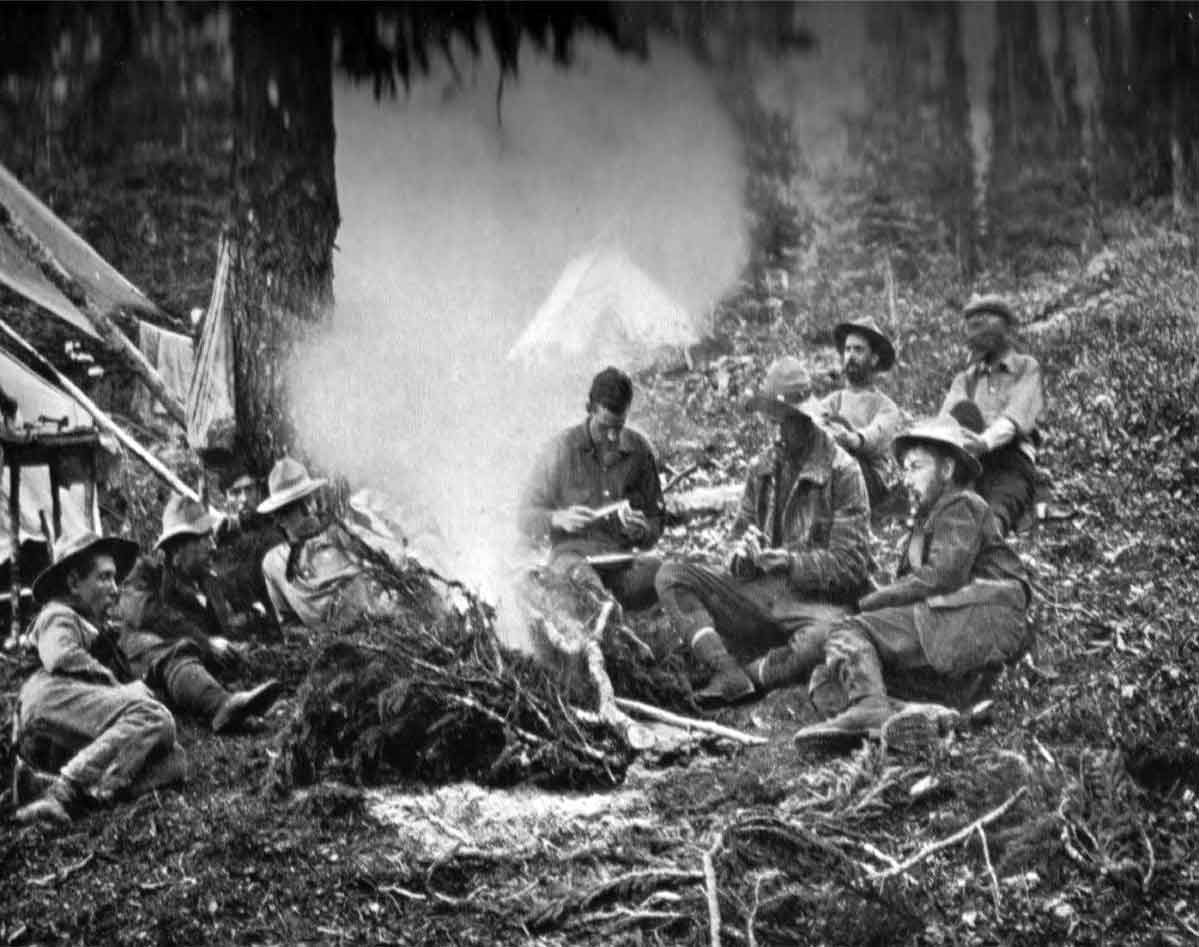
Camp on Calumet Creek, below Moose Pass. Photo: Byron Harmon, 1911. Canadian Alpine Journal 1912, p. 34. Original negative:
Whyte Museum of the Canadian Rockies
Describing the route of the 1911 expedition, A. O. Wheeler wrote:
The general line of travel may be described as follows: Commencing at Henry House, the eastern extremity of the survey, the route lay up the valleys of the Athabaska and Miette Rivers to the summit of the Continental Divide at the Yellowhead Pass. Thence down the valley of Yellowhead Lake and Fraser River for seventeen miles to the junction of the Moose River with the Fraser. Then up the Moose River Valley to the Moose Pass, where the Continental Divide was again crossed, and down the valley of Calumet Creek (local name Pipestone Creek), to the Smoky River Valley.… The defile opens to the valley of Pipestone Creek, as it is called locally, some little distance from the head. It is suggested that this tributary of the Big Smoky be known as “Calumet Creek” to distinguish it from another Pipestone Creek near Laggan in the southern Rockies.
A calumet is kind of tobacco pipe used by North American Indians, 1660s, from Canadian French calumet (1630s), from Norman French calumet “pipe, reed pipe” (Old French chalemel, 12c., Modern French chalumeau), from Latin calamellus, diminutive of calamus “reed; something made of reed or shaped like a reed.”
“Other names [for Yellowhead Pass] noted in the literature include Cowdung Pass, Leatherhead Pass, Jasper Pass, Jasper House Pass, Tête Jaune Passe, and Rocky Mountain Pass…”. (early map/document dates not cited)