Harmon’s map interior of North America 1820 [as “Carrier or Tacully Indians”]
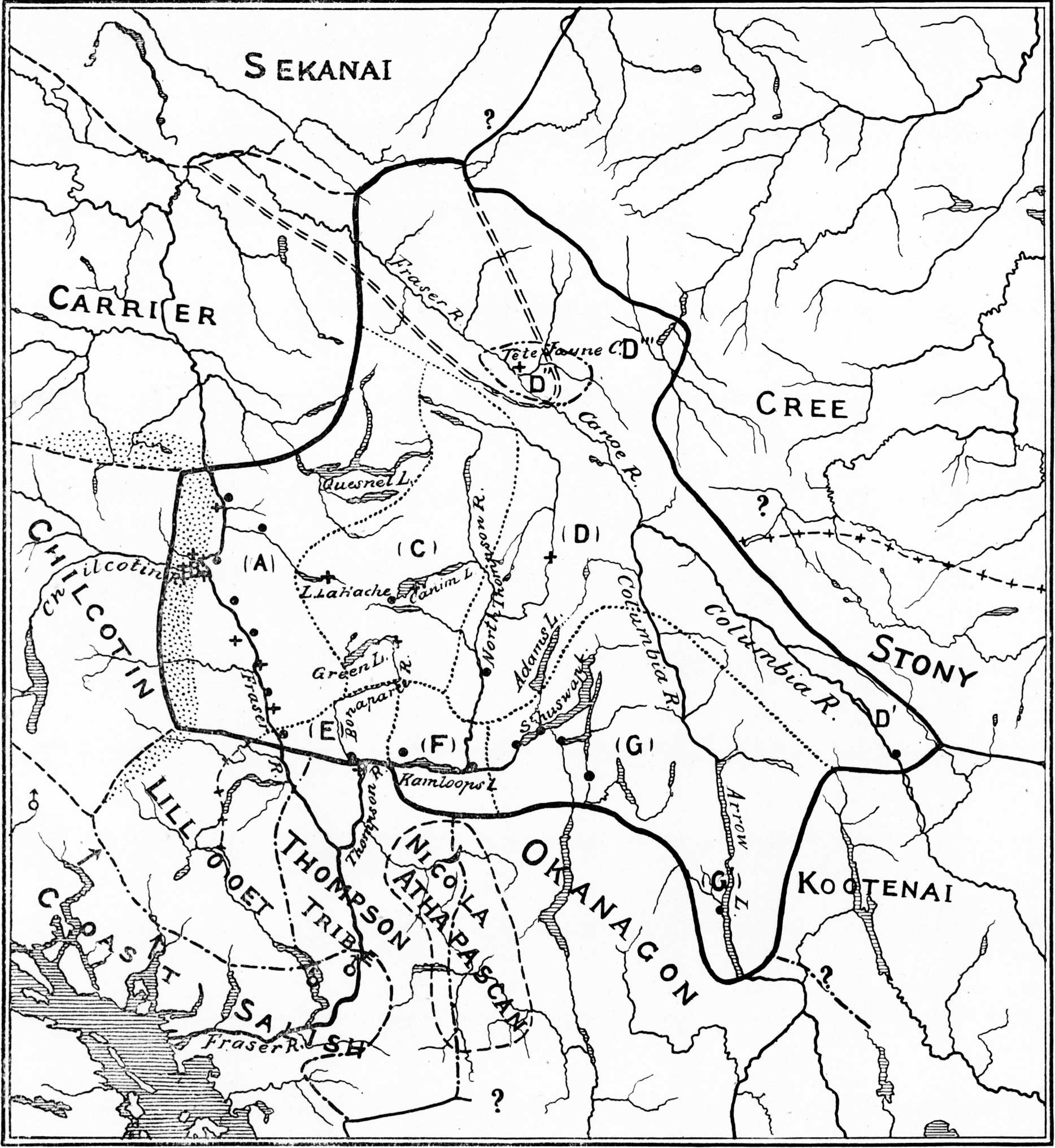
James Teit’s map of Shuswap Territory 1909
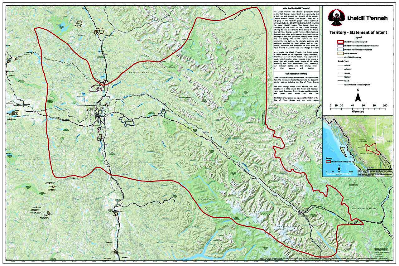
Lheidli T’enneh Territory Lheidli T’enneh First Nation
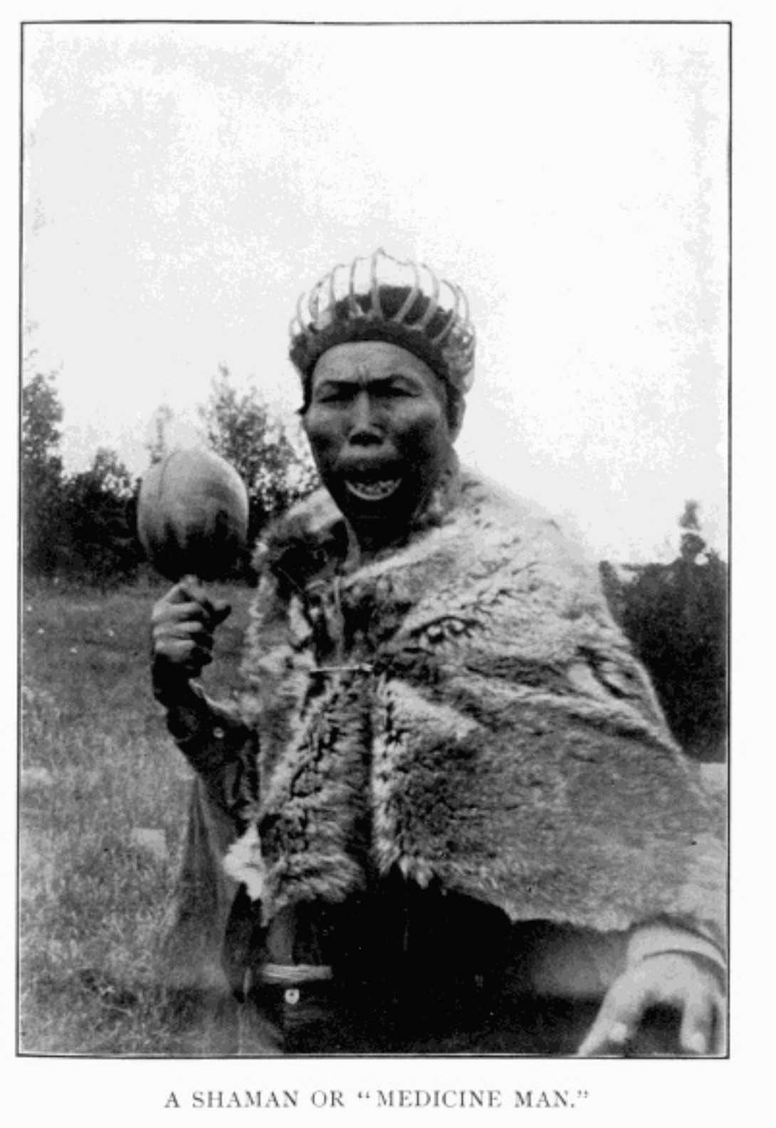
A Shaman or “Medicine Man.” Morice 1904, p. 10 Internet Archive
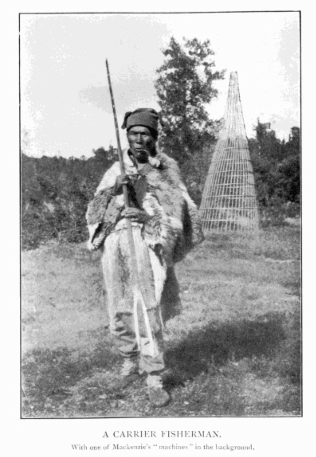
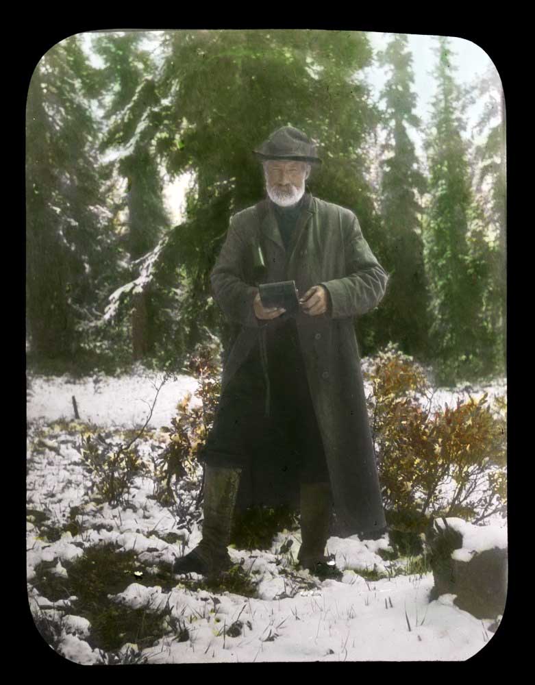
A Carrier Fisherman. Morice 1904, p. 40 Internet Archive
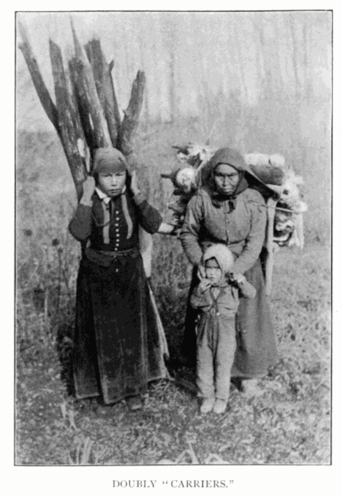
Doubly “Carriers.” Morice 1904, p. 163 Internet Archive
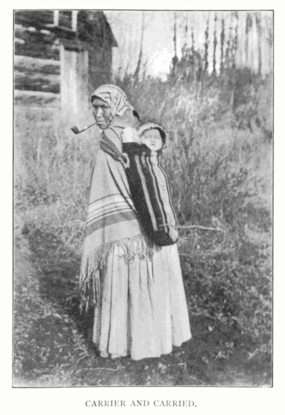
Carrier and Carried. Morice 1904, p. 218 Internet Archive4
The Carrier or Dakelh are the indigenous people of a large portion of the Central Interior of British Columbia, belonging to the Northern Athabascan or Dene group of First Nations.
Among the Carriers, the widow of a deceased warrior used to pick up from among the ashes of the funeral pyre the few charred bones which would escape the ravages of fire and carry them on her back in a leathern satchel—hence the name of the tribe—until the co-clansmen of the deceased had amassed a sufficient quantity of eatables and dressed skins to be publicly distributed among people of different clans, in the course of an ostentatious ceremony called “potlatch,” a ceremony which prevailed among all but the Sekanais and the Eastern Nahanais tribes.
— Morice 1904, p. 6 [1]
The Carrier lived directly north of the Chilcotin, in the valleys of the upper Fraser, Blackwater, Nechako, and Bulkley rivers, and around Stuart and Babine lakes up to the borders of Bear lake. Their name (English, Carrier; French, Porteur, said to be a translation of the term applied to them by their eastern neighbours, the Sekani) refers to their peculiar custom of compelling widows to carry on their backs the charred bones of their dead husbands. They had no common name for themselves, only names for the independent sub-tribes into which they were divided. In the nineteenth century, however, they adopted for themselves the obscure title Takulli, bestowed on them apparently by Europeans.
— Jenness 1932 [2]
Dakelh territories include along Fraser River from south of Quesnel upstream to the Yellowhead Pass, as well as the upper North Thompson and Canoe River valleys.
The traditional Dakelh way of life is based on a seasonal round, with the greatest activity in the summer when berries are gathered and fish caught and preserved. The mainstay of the economy is centered on harvesting activities within each family keyoh (territory, village, trapline) under the leadership of a hereditary chief, known as a Keyoh holder or keyoh-whudachun. Fish, especially the several varieties of salmon, are smoked and stored for the winter in large numbers. Hunting and trapping of deer, caribou, moose, elk, black bear, beaver, and rabbit provided meat, fur for clothing, and bone for tools. Other fur-bearing animals are trapped to some extent, but until the advent of the fur trade, such trapping is a minor activity.
The Dakelh engaged in extensive trade with the coast along trails known as “grease trails”. The items exported consisted primarily of hides, dried meat, and mats of dried berries. Imports consisted of various marine products, the most important of which was “grease”, the oil extracted from eulachons (also known as “candlefish”) by allowing them to rot, adding boiling water, and skimming off the oil. This oil is extremely nutritious and, unlike many other fats, contains desirable fatty acids. [3]
The band located near Prince George is the Lheidli T’enneh Band, [4] historically known as the Fort George Indian Band. The Lheidli T’enneh did not have permanent settlements in what is modern day Prince George until the arrival of the Hudson’s Bay Company post Fort George. Temporary and seasonal settlements were used across the traditional territory and archeological evidence of fishing camps along the Nechako and Fraser rivers.
- 1. Morice, Adrien-Gabriel [1859–1939]. The history of the Northern Interior of British Columbia (formerly New Caledonia). Toronto: William Briggs, 1904. Internet Archive
- 2. Jenness, Diamond. The Indians of Canada. Ottawa: King’s Printer, 1932
- 3. Wikipedia. Dakelh (Carrier)
- 4. Wikipedia. Lheidli T’enneh Band