Flows SE into Moose River, near Trio Mountain
53.0586 N 118.8844 W — Map 083E02 — Google — GeoHack
Name officially adopted in 1973
Official in BC – Canada
George R. B. Kinney [1872–1961], a member of the 1911 Alpine Club of Canada–Smithsonian Robson Expedition to the Mount Robson region in 1911, discovered the cave in the Arctomys Valley in 1911.
“In the valley where the stream has its origin, Kinney discovered a rock opening which seemed to lead into the bowels of the earth,” wrote expedition leader Arthur Oliver Wheeler [1860–1945]. “It is evidently a rift in the strata, which here dips steeply. This through the action of water, has been widened into a deep shaft leading down, goodness knows how deep. …
“The shaft, it can hardly be called a cave, was examined with candle, rope and barometer. The opening, a slit in a shallow depression, at one time undoubtedly furnished a water exit to lower levels. It is only large enough to admit one at a time. We descended 250 feet by barometer measurements to a point where a small stream of water tumbles through a tributary crack. Beyond that the going is wet and the exploration was not carried further, as there was no change in the character of the subterranean shaft. Kinney claimed that, at the time of his discovery, he had gone some distance beyond the fall. The crack descends at an angle of about 65 deg. or 70 deg. from the horizontal. The rock is hard and rough, and affords food hand and foot holds. In places the width is ten to twenty feet and minor cracks lead off here and there. The walls are a dark limestone, dun colored on the outside surface from seepage of the lime. There were no stalactites more than two or three inches length, and, generally speaking, it was unattractive. It appeared to be one of these subterranean waterways that are frequently encountered in mountains of a limestone formation.”
There is no record of subsequent visitation until 1971–1973 when cavers from the McMaster University Climbing and Caving Club, Guelph University Caving Club, Alberta Speleological Society and some visiting British cavers explored and surveyed the cave to its maximum depth of -522 metres. Passages above the entrance were surveyed by British and Canadian cavers in 1983 resulting in the current vertical range of 536 metres. Arctomys Cave was the deepest known cave in Canada for many years, until surpassed by Bisaro Anima Cave in 2017 with its depth of 670 metres.
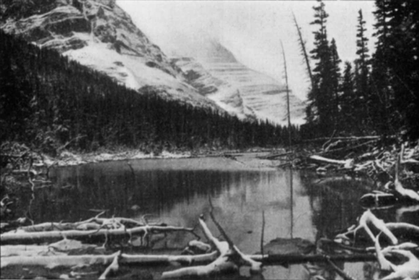
Arctomys Cave is formed in the steeply-dipping Mural Formation limestone of the Early Cambrian Gog Group. The top half of the cave (The Endless Climb) descends relatively steeply, but at a depth of about 400 metres the cave becomes more horizontal with several pools, and ends at a sump. Despite its great depth, the cave includes only five pitches up to 15m deep. Although most of the cave is undecorated, the Straw Gallery has flowstone and relatively long soda straws.
Arctomys Cave is the site of Canada’s most extensive cave rescue attempt. On October 17, 1991, Rick Blak, an experienced caver and park ranger at Mount Robson Park, was struck by a falling boulder deep in the cave and perished. One hundred and ten people were involved in the complex recovery of his body.
According to the the Mount Robson Park management plan (2011), “Arctomys Cave holds some attraction to both domestic and international cavers, but it receives only very light use, largely owing to its remote location. Caving is not promoted in the park; however, it is recognized as an appropriate activity.”

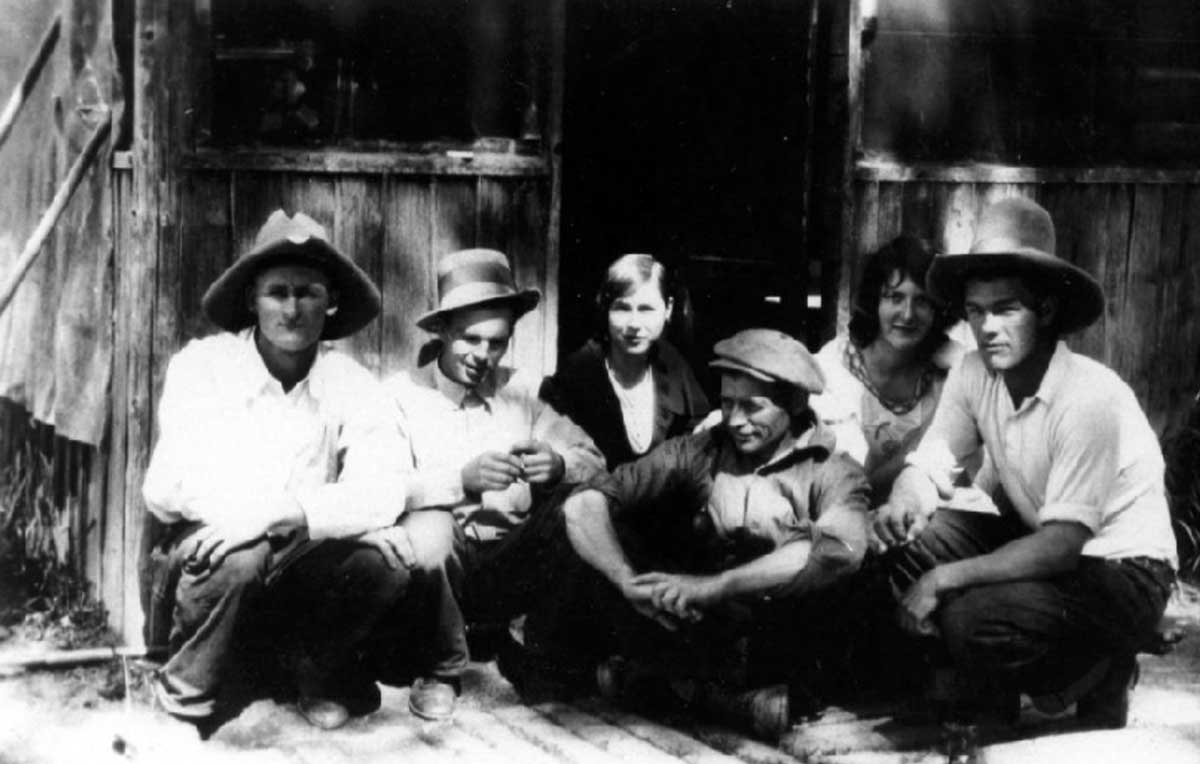
Mount Robson Ranch staff, 1930: Art Allen, Chuck Chesser, Anne Chesser, Frank Hargreaves, Rose Saladana and Ted Schieve.
Valemount & Area Museum
Anne Chesser (1910–1986) and Alice Wright (1904–1982) together climbed this peak near Berg Lake in 1939 and named it after themselves. As they found no evidence of previous climbers they built a stone cairn at the summit, and claimed first ascent.
Anne Christine Chesser (MacLean) was born in Nova Scotia, and joined her sister Sophia Hargreaves at the Mount Robson Ranch in 1913. That same year she married Charles Alfred Chesser (1905–1975), a worker at the ranch. Anne and Chuck became partners with ranch owners Roy and Sophia Hargreaves. Chuck later worked for the Canadian National Railway, eventually becoming roadmaster at Smithers. In 1969 he retired and the Chessers moved back to Valemount.
Alice Wright was born in New York, and earned a degree in marine biology at Barnard College and Cornell University. In 1936, while vacationing in the Rockies with her mother, she stayed at Mount Robson Ranch. When ranch owner Roy Hargreaves retired in 1959, Wright purchased the ranch. To the international fraternity of mountain climbers, Wright was known as “the mother confessor of Mount Robson.”
Origin/significance not known. Possibly refers to surveyor Hugh Drummond Allan [1887–1917], who worked in the Canoe River area in 1913.

Lake Robson Pass. J. Norman Collie, 1910 The Geographical Journal
“Nestling in a setting of dark green spruce and scintillating like a royal blue gem is the delightfully picturesque little Lake Adolphus, which forms the source of the Big Smoky River flowing from Robson Pass,” wrote surveyor and explorer Arthur Oliver Wheeler [1860–1945] in 1911.[1] The lake is in Alberta, a few hundred metres from the Alberta-British Columbia Boundary.
Arthur Philemon Coleman [1852–1939] named the lake after his Métis guide Adolphus Moberly [b. ca. 1887]: “Brawny Adolphus was ignorant but a mighty hunter and a born leader.” [2] Adolphus guided Coleman from Jasper to Robson Pass on the geology professor’s 1908 attempt to climb Mount Robson.
“Adolphus was the most typical and efficient savage I ever encountered,” Coleman wrote, “a striking figure, of powerful physique and tireless muscles, and thoroughly master of everything necessary for the hunter in the mountains. Mounted erect on his horse, with gay clothing and trappings, he was the ideal centaur.” Adolphus led Coleman’s party up the Moose River valley, and left the group after pointing out the way to Robson Pass.
Adolphus’s family was among the six or seven Métis families who were forced to leave the Jasper area after the establishment of Jasper Forest Park in 1907. “The fall of 1909 there was Adam Joachim, Tommy Groat, William, Adolphus, if I remember rightly where were four men came from Jasper House,” recalled James Shand Harvey [1880–1968]. “William and Adolphus Moberly, and there was Tommy Groat, he was just going to get married, no, he was married then, to his wife Clarice (Clarice Moberly, Ewan’s daughter), and Adam Joachim. Old Ewan and John, they both stayed on the place, figured they were too old to work, the younger fellows could build the houses. They put the houses up and some time before New Year they moved in. They stayed there at Rat Lake. And the only one of the bunch that did not go to Grande Cache was Isadore Finley.”
The name was adopted in 1954 as a long-established local name, and rescinded in 1974 due to flooding of McNaughton (now Kinbasket) Lake
A mountain prominent in the McBride skyline. Some say the rock formation at the summit resembles a beaver. This rock formation may be the reason that the adjacent Holmes River was first called “Beaver River.”
Designated as “Mammoth Mountain” on the Preliminary map of the Canadian Rocky Mountains between Jarvis Pass and Yellowhead Pass (Bull. Amer. Geog. Soc. Vol. XLVII, No. 7, 1915), showing the route followed by Mary Lenore Jobe Akeley [1878–1966] in August 1914, with guide Donald “Curly” Phillips [1884–1938].
Frederick William (1886–1979) and Jessie Sterling (Gray) (1888–1975) Barnett were natives of Glasgow, Scotland, who lived in Croydon from 1922 until 1973. Fred came to Canada in 1905, moving from Calgary to Manitoba to Saskatchewan. When her mother died in 1907, Jessie also immigrated to Canada, settling in Montréal. Fred and Jessie, who had known each other since childhood, were married in 1910. Their daughters Nora and Louise were born in Saskatchewan. In the early 1920s the Barnetts read an article in the Winnipeg Free Press about homesteads in the Croydon-Dunster area. In 1922, after 12 years of fighting hailstorms and grasshoppers on the prairies, they moved to Croydon and started clearing land. Fred shipped strawberries to Jasper and raised mink and fox until the Depression put an end to these small businesses. They sold the homestead in 1939 and Jessie started a small store, also continuing as postmistress of Croydon, a position she had started in 1926. Fred worked as carpenter on the construction of the Alaska Highway. Jessie retired from the post office in 1968, at the age of 81, and the office was closed. In 1973, they sold the one-and-a-half acre property and moved to McBride.
Possibly named for Ross Bailey [d. 1962], an employee ofCanadian National Railway for 15 years, working at various points between Jasper and Vancouver. At the time of his death he lived in Red Pass Junction (1).