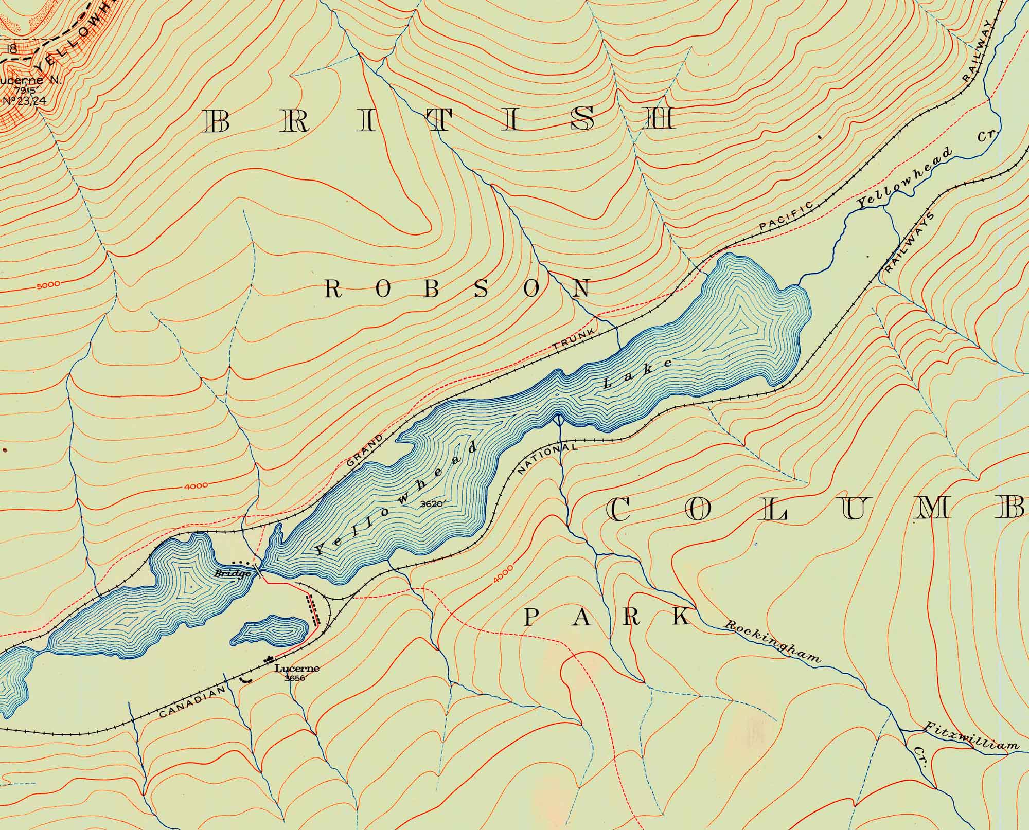
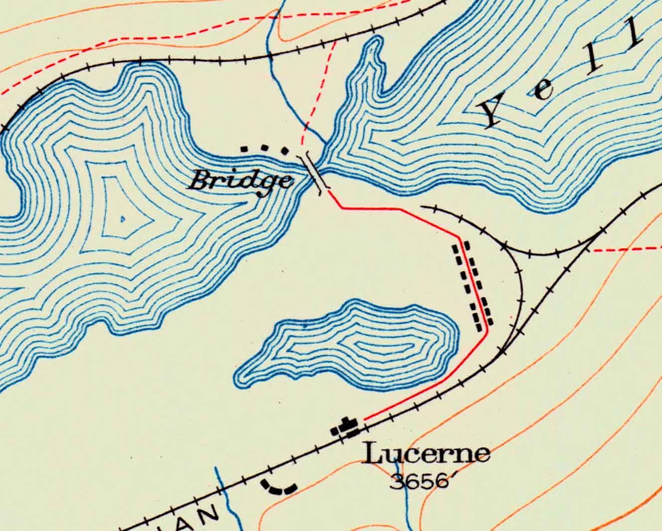
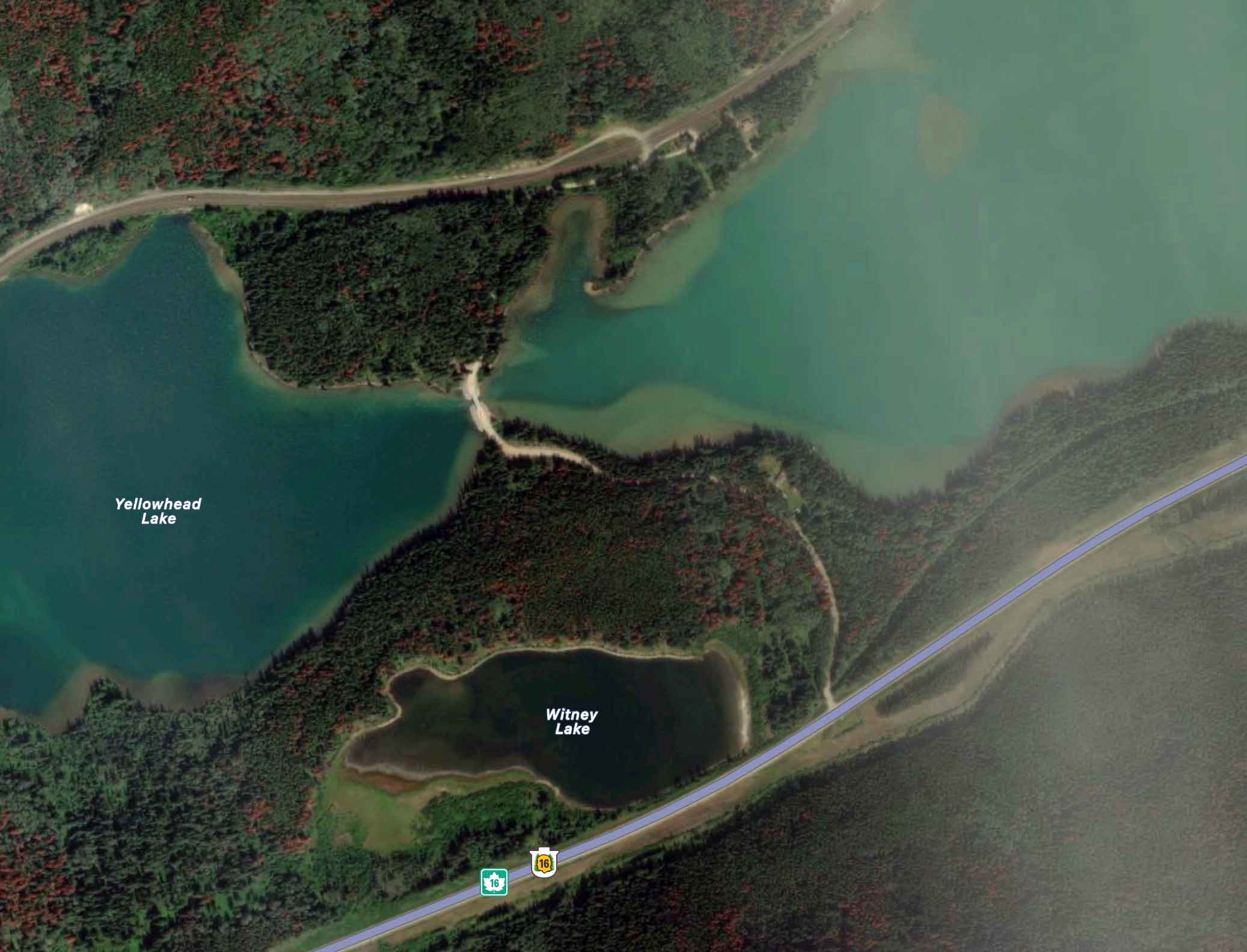
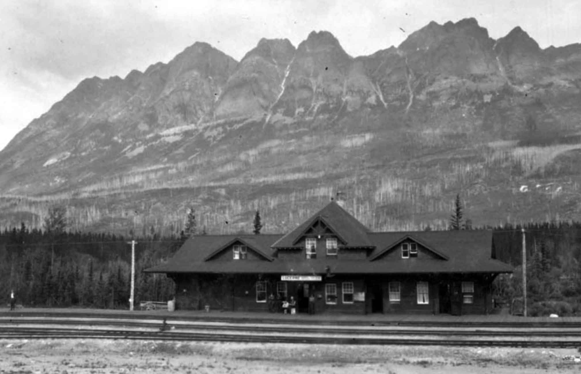
Category Archives: Place

Loren Lake

British Columbia. Lake: Fraser River drainage
Headwaters of Chalco Creek near Alberta-British Columbia Boundary
53.4833 N 119.85 W — Map 83E/5 — GoogleGeoHack
Name officially adopted in 1925
Official in BCCanada

Origin of the name unknown.

References:

  • Interprovincial Boundary Commission. Boundary between Alberta and British Columbia. Sheet 36. Ottawa: Office of the Surveyor General, 1924. Internet Archive
Also see:

Loos

British Columbia. Locality
On Canadian National Railway, NW of Crescent Spur
53.6 N 120.7 W — Map 093H10 — GoogleGeoHack
Earliest known reference to this name is 1911 (GTP map)
Name officially adopted in 1983
Official in BCTopo map from Canadian Geographical Names
124 miles west of the Yellowhead Pass on the Canadian National Railway
Mile 34 in Fraser Subdivision (McBride to Prince George as of 1977)
Grand Trunk Pacific Railway station built in 1904
Original settlement at Loos, formerly Crescent Isle. Florence Leboe Byman photo.
Olson, Ghost Towns

Original settlement at Loos, formerly Crescent Isle. Florence Leboe Byman photo.
Olson, Ghost Towns

In 1916, the name of the Crescent Island Grand Trunk Pacific Railway station was changed to Loos, in honour of Loos, a town in France near the Belgium border, occupied by Germany in the First World War. In September of 1915, there was a particularly bloody battle at Loos, when ten thousand Allied and German soldiers were killed in less than four hours. The Loos post office was open from 1916 to 1951.

In August 1913, Foley, Welch and Stuart, railway contractors, moved their distribution depot from Tete Jaune to Mile 129, in the vicinity of present day Loos. As the rail steel moved west, the work for the paddle wheelers diminished and eventually ceased once the rail bridges at Dome Creek and Hansard were built. These bridges were constructed without swing or draw spans thus restricting navigation.

The Leboe Lumber Company sawmill was the reason that Loos grew from a mere station beside the tracks into a community. The Leboe Lumber Company went into bankruptcy in 1921. Subsequent mills upstream from this location were run by Ole’s sons Bert and Wilfred, and eventually the sawmill was relocated two miles east and a new community was founded in 1940 called Crescent Spur. Most of the population of Loos then relocated to Crescent Spur, however the school remained at Loos as well as the homes of a number of the Leboe family.

— Olson 2011

LOOS
Post office and station on the G.T.P. Ry. 37 miles west of McBride. Population 85. Local resources: Lumbering and a few settlers and mixed farms.
Bracket Chas trapper and sawyer
Bryanton Chas farming
Cooper Albert scaler
Dolly T section foreman at Urling
Gareckey laborer
Gibbs Joe section foreman
Gunderson Gus farming
Holte Ole farming
Johnson L B mgr Loos Lumber Co
Longury Joseph farming
Lonsdale lineman
LOOS LUMBER CO., Lars B. Johnson, Manager Sawmill
McGlothin laborer
Martensen Mat farming
Martin A S section foreman
MARTIN, MRS. A. S. Postmistress, General Store and Hotel.
Nosek Geo working a copper mine
O’Connell Pat farming
O’Connell David secion foreman
Olson Ole sawmill foreman
Peart Wm farming
Ranshaw farming
Ryan Wm farming
Sampson laborer
Shaik Van farming
Simonson Sam sawmill mgr
Sjolie Oscar engineer
Songery Joe farming
Twasuk Paul section foreman
Welsh Edward farming
Westaway & Waldron shingle mill
Westgard laborer
Westgrade Thos financier Loos Lumber Co

Wrigley’s British Columbia Directory, 1918
References:

  • Wrigley Directories, Limited. Wrigley’s British Columbia Directory. Vancouver: 1918. Internet Archive [accessed 6 February 2025]
  • Munro, Iain R. Canada and the World Wars. Toronto: Wiley, 1979
  • Topping, William. A checklist of British Columbia post offices. Vancouver: published by the author, 7430 Angus Drive, 1983
  • Olson, Raymond W. From Liaboe to Loos and Beyond. Prince George, B.C.: Raymond W. Olson, 2011
  • Olson, Raymond W. Ghost Towns on the East Line. Prince George, B.C.: Raymond W. Olson, 2017
  • British Columbia Geographical Names. Loos

Lonsdale Street

Feature type: street
Province: British Columbia
Location: McBride
Latitude: 53.3017 N
Longitude: 120.1701 W
Google Maps

Freeman (Friday) Lonsdale, 1963

Freeman (Friday) Lonsdale, 1963
Valley Museum & Archives Society

Freeman (Friday) Lonsdale (1893-1986) came to McBride in 1912, when there were only two buildings in town. In 1915, when Friday was a lineman with the railroad, he married Helena M. Renshaw (1899-1985). Helena was born in Washington Territory and came to Canada from Idaho with her parents in 1908. They followed the construction of the railroad from Edmonton through Wolf Creek, Bickerdyke, Tête Jaune Cache, and then to McBride in 1914. In 1919, Friday and Helena moved to Loos where they homesteaded for twenty five years. They returned McBride in 1944 and purchased the Tommy Ricardson store which they operated along with the taxi business and a rooming house. The store and the taxi business were sold in 1963, the rooming house in 1964. The Lonsdales moved to Chase in 1970.

Mrs. Lonsdale was a charter member of the Royal Purple (1948). She was active in the Hospital Auxiliary and Board of Trade.

Mr. Lonsdale was active in the Elks, the school board, the board of trade, and the McBride Parks Board. He was the Appointee from the Village of McBride on the McBride and District Hospital Board of Directors. Friday was one of the main workers in the development of the Doré River Park. He was on the village council for 14 years.

Description of interviews with Freeman and Aileen Lonsdale in the BC Archives

Freeman Lonsdale interview
Recorded in Chase, B.C., by Kreg O. Sky, 1983

Burial of George Hargreaves on Sheep Creek. Description of area and trails near Sheep Pass. Used Alberta guides from Grand Cache. Eating porcupine. Guided for Jim Smith out of Snowshoe (Crescent Spur), 1926. Put in original trail up Morkill River. Trip to Jarvis Lakes via McGregor River. Fossils. Accident curtailed guiding in 1940. Jimmy Smith killed by horse in 1944. Homesteaded in 1924. Indian drying racks. Caribou populations and decline. Came along Continental Divide. Grizzly stalked him. First camp and features on Morkill River and Forget-Me-Not Creek. Mustards worked out of McBride. Hookers from Dome Creek. Account of sixty-five day collecting trip for Peabody Museum, 1931. Specimens, people, taxidermist, areas, 52 horses.

Big Shale Hill. Boundary trail. Fishing at Kakwa (Porcupine) Falls. Usually at lunch in the saddle. A grizzly prank. Duration of most trips. Almost snowbound on the Divide. Plane wreck at Kakwa Lake. A 32 year old reunion in the wilderness with Archie Clark. Camp equipment and organization described. Handling the horses. Clients and costs. Working on GTP Railway in 1911. Floated upper Fraser River on a scow in 1912 en route to Vancouver. Took stage from Soda Creek. Speaker: Freeman Lonsdale.

Aileen Lonsdale interview
Recorded by Imbert Orchard, location unknown, 1960s

Aileen Lonsdale was born in the Washington Territory and moved around all her childhood; moved to Wolf Creek in 1909. She describes what was happening in Wolf Creek when she moved there, including her father’s stopping house; she describes her family, Renshaw, including her brothers and her father, Robert Haldane Renshaw; she describes the area; steel mining; locations of railway stations; Mile 52; Valemount; Mile 49; railway construction camps; a description of Tete Jaune; bootlegging and smuggling during prohibition; some anecdotes about what life was like; moving to McBride in 1914; a description of McBride and life there when she arrived. Mrs. Lonsdale continues with a description and anecdotes about the Indians at Tete Jaune; she describes Tete Jaune Cache and the surrounding area; Tete Jaune Mary.

References:

  • Robson Valley Courier. Weekly newspaper published by Pyramid Press of Jasper from 1968–88 .

Longworth

British Columbia. Locality
On Canadian National Railway, NW of Penny
53.9167 N 121.4667 W — Map 093H14 — GoogleGeoHack
Earliest known reference to this name is 1911 (GTP map)
Name officially adopted in 1983
Official in BCCanada
168 miles west of the Yellowhead Pass on the Canadian National Railway
Mile 79 in Fraser Subdivision (McBride to Prince George as of 1977)
Grand Trunk Pacific Railway station built in 1914. Removed 1963

The name was submitted to the Geographical Board of Canada by Sir Alfred Smithers, chairman of the Grand Trunk Pacific Railway during construction of the rail link. The post office opened in October, 1915.

Longworth is located 80 miles west of McBride, it was quite possibly named after an English village in Oxfordshire, UK., (speculation on my part). It may have been one of the place names suggested by Josiah Wedgwood.

— Olson

Wrigley Directories for 1918 lists Longworth as a post office and station on the Grand Trunk Pacific Railway. Population 30. Local resources: Timber, prospecting, and a few small farms. There are no sawmills here and the district offers 25,000,000 feet which may be purchased cheaply from pre-emptors, while twice the amount is available on Government land adjacent to rail. Arthur E. Read was postmaster and ran the general store,and was also the first president of the Yellowhead Association around 1930.

The town of Longworth is on the map to stay. The place now boasts of a population of 100 residents, a good school, church, dance hall, store, post office and pool room. For awhile the settlement had a cabaret but it has been closed up and the piano taken away for repairs. In 1920 the post office was moved into the Toneko Lodge, a majestic wooden structure which also served as a hotel and general store.

Prince George Citizen, February 28, 1924. Quoted by Olson
References:

  • Wrigley Directories, Limited. Wrigley’s British Columbia Directory. Vancouver: 1918. Internet Archive
  • Olson, Raymond W. Ghost Towns on the East Line. Prince George, B.C.: Raymond W. Olson, 2017
  • British Columbia Geographical Names. Longworth

Little Shuswap Creek

British Columbia. creek: Fraser River drainage
Former name for Kiwa Creek
53.0217 N 119.5636 W GoogleGeoHack
Not currently an official name.

In his “Notes on the Cariboo Range” of 1925, Munday wrote, “The local name of the Big Shuswap conflicts with the Shuswap River further south and appears on recent government maps as Raushwap or Rausch River (from Riviere au Shuswap). Kiwa Creek is known locally as Little Shuswap.”

References:

  • Munday, Walter Alfred Don [1890–1950]. “In the Cariboo Range – Mt. David Thompson.” Canadian Alpine Journal, Vol. 15 (1925):130-136
Also see:

Little Grizzly

British Columbia. Former name
Former name of Cinnamon Peak
53.0797 N 119.2572 W GoogleGeoHack
Not currently an official name.

In 1911, Arthur Oliver Wheeler [1860–1945] named this mountain Little Grizzly Peak “on account of its resemblance, on a small scale, to Mount Grizzly in the Selkirks.” Cinnamon is a coloration of the grizzly bear.

References:

  • Wheeler, Arthur Oliver [1860–1945]. “The mountains of the Yellowhead Pass.” Alpine Journal, Vol. 26, No.198 (1912):382

Lindup

British Columbia. Railway Point
Canadian National Railway, SE of Longworth, NW of Guilford
53.8833 N 121.3667 W — Map 93H/14 — GoogleGeoHack
Earliest known reference to this name is 1911 (GTP map)
Name officially adopted in 1984
Not currently an official name
163 miles west of the Yellowhead Pass on the Canadian National Railway
Mile 75 in Fraser Subdivision (McBride to Prince George as of 1977)
Grand Trunk Pacific Railway station built in 1914. The Lindup station was moved to Penny in 1947.

LINDUP: a settlement on the G. T. P. Ry., 5 miles west of Penny, no agent, in Prince George Provincial Electoral District. Has Canadian Express. Charges must be prepaid; tele- graph office.

Population 5. Local resources: Saw mills and mixed farming. Heavily timbered unbroken land about 3 miles distant from the mountains.

Address mail Lindup via Penny or Longworth.

Bochscski M section hand
Hall Harold farming
Jardine Carl section foreman
Jardine Chas farming
Lehman F farming
Persons G homesteader
Segel G lineman G T P

— Wrigley 1918

Torsten Berg was the only one to operate a sawmill at Lindup. The mill operated from 1949 to 1952, at which time his timber supply ran out and he moved the mill to Longworth. The timber at Lindup was of nice quality and of good size. Torsten was awarded the contract to supply planks 26 feet long, for the podium for Queen Elizabeth’s coronation in 1952.

The population of Lindup peaked at about 50 people in 1929 and dwindled dramatically the Depression. In 1931 the Prince George Citizen reported that a large relief camp of 100 men were clearing and grubbing road right of way.

Lindup in 2014 does not have any residents and is on a seasonal road that is susceptible to weather restrictions.

— Olson
References:

  • Wrigley Directories, Limited. Wrigley’s British Columbia Directory. Vancouver: 1918. Internet Archive
  • Olson, Raymond W. Ghost Towns on the East Line. Prince George, B.C.: Raymond W. Olson, 2017