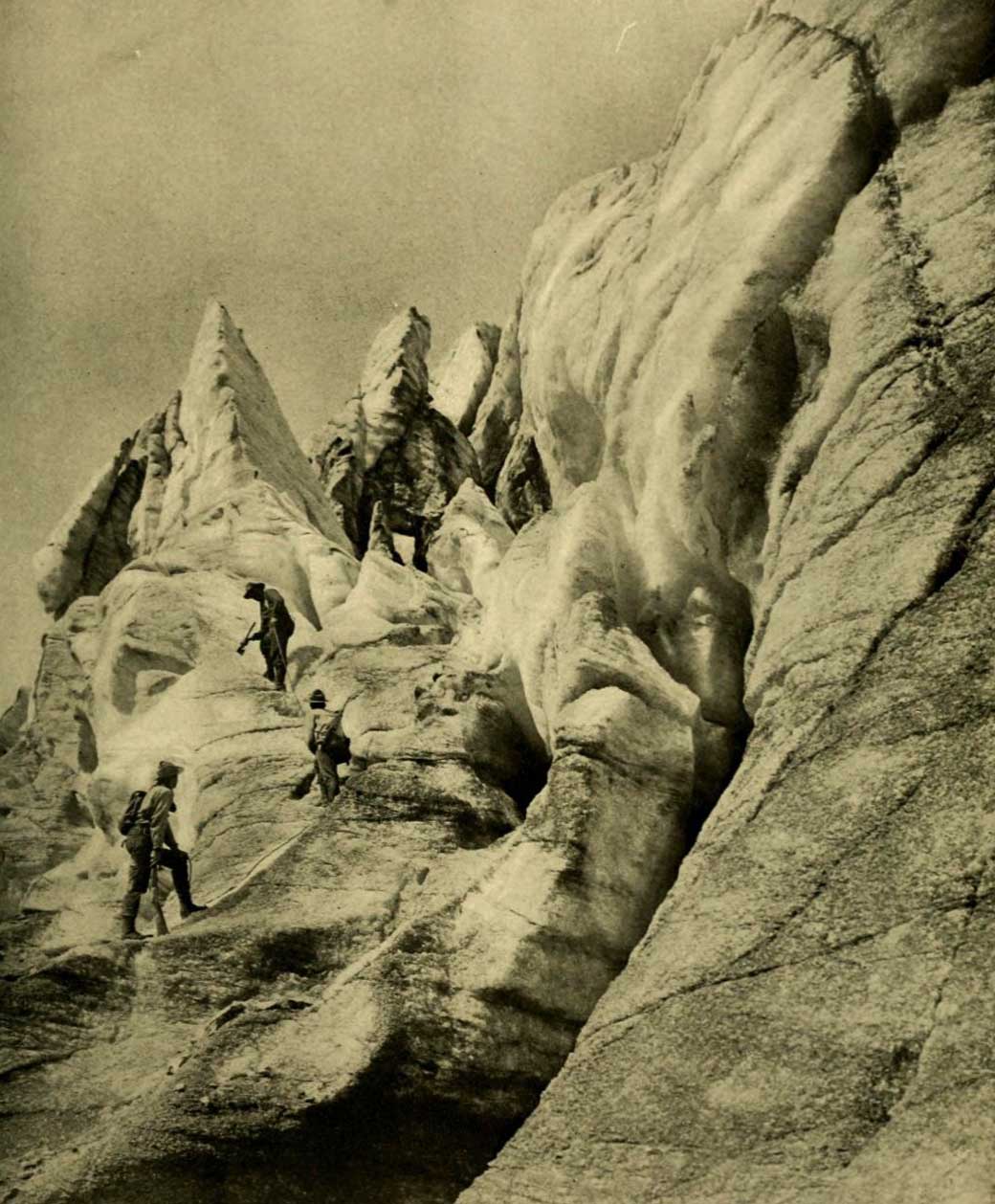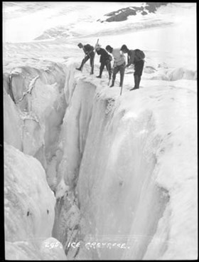
Robson Glacier six miles in length. The watershed between Alberta and British Columbia lies up its centre. Photo: George Kinney, 1908 Canadian Alpine Journal 1909
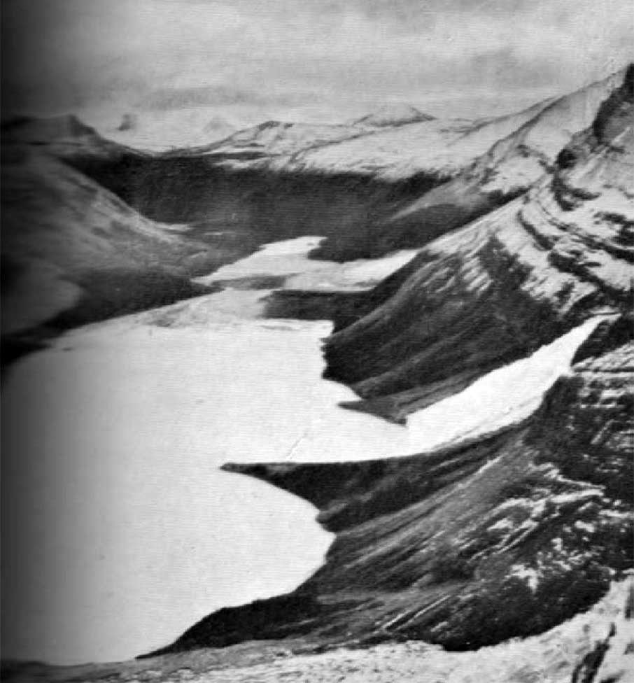
Shows forefoot of Robson Glacier sending its waters northward to Lake Adolphus and southward to Berg Lake. The Great Divide lies between. Photo: Rev G.B. Kinney, 1908 Canadian Alpine Journal 1910
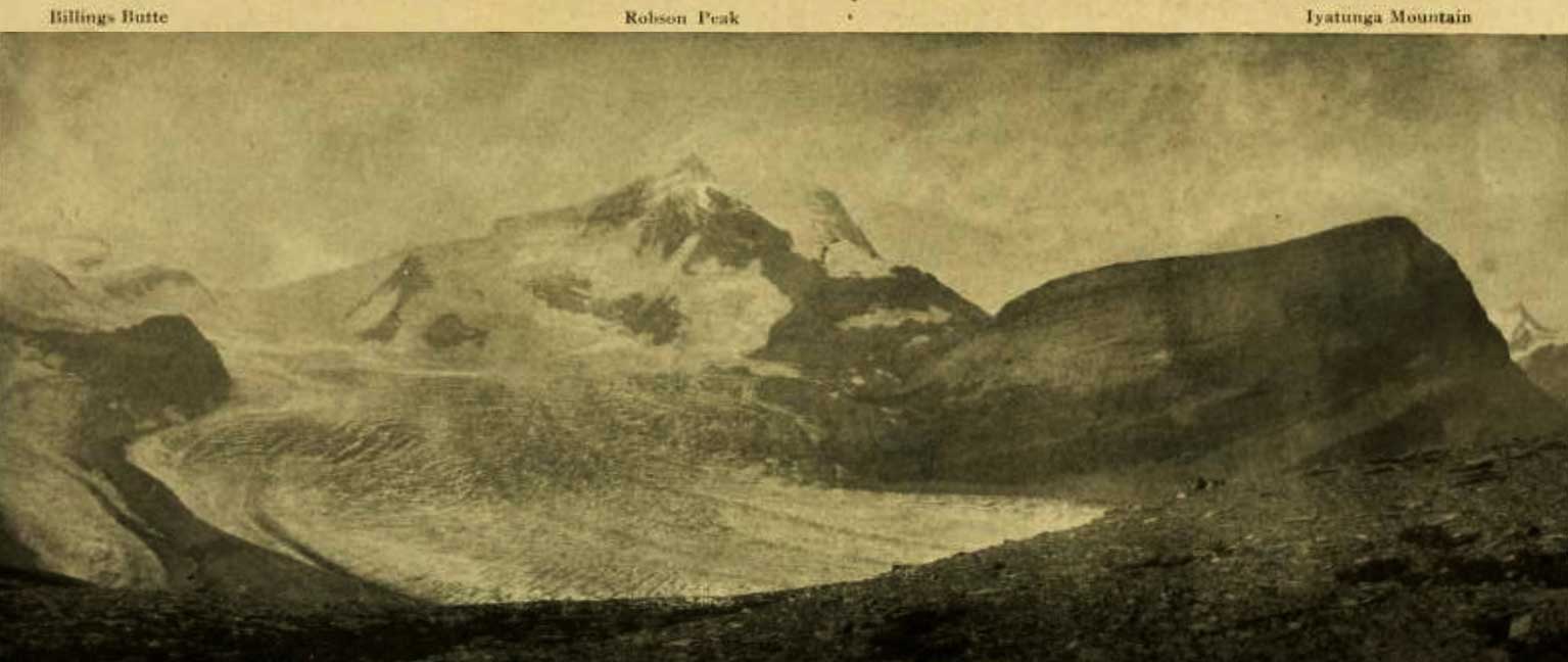
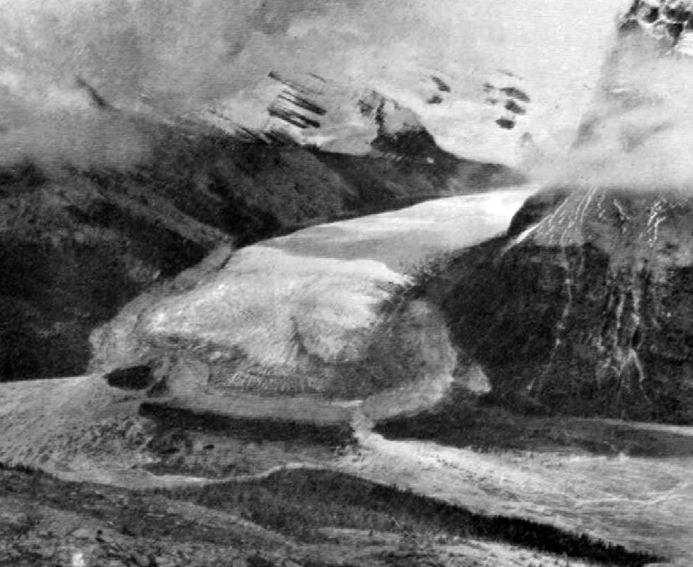
Billings Butte – Robson Peak – Iyatunga Mountain. Panonamic view of the Robson massif and adjoining mountains, with the great Hunga glacier in the foreground.
Photo: Charles D. Walcott, 1912 National Geographic Magazine 1913 [accessed 15 February 2025]
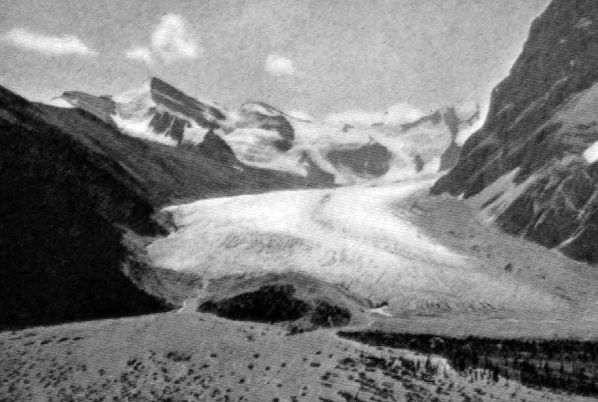
The Robson Glacier and Pass showing streams flowing east and west.
Photo: P.L. Tait, 1913 Canadian Alpine Journal 1915
In 1917, while serving in the Canadan Army Medical Corps in France,
George R. B. Kinney [1872–1961] wrote to Arthur Hinks, the secretary of the Royal Geographical Society in London, that he would be pleased to deliver a lecture on mountaineering in the Canadian Rockies, illustrated by “100 choice colored lantern slides, second to none (by report), and taken from my own negatives.… Mine are the original photographs taken of these hither to unexplored regions, and names like ‘Berg Lake,’ ‘Tumbling Glacier,’ ‘Robson Glacier,’ ‘Mt. Rearguard,’ ‘the Helmet,’ and ‘the Extinguisher’ that now have a permanency, were my suggestions.” [
1]
Kinney accompanied Arthur Philemon Coleman [1852–1939] on his 1907 and 1908 mountaineering expeditions to Mount Robson, and claimed to have ascended Robson in 1909.
“Between Rearguard and Titkana Peak, leading from the wonderful snow-filled cirque, seen in its entirety from our station on the Lynx Range, flows the Robson Glacier,” wrote Arthur Oliver Wheeler [1860–1945] during the 1911 Alpine Club of Canada–Smithsonian Robson Expedition. “It describes a circular sweep around Rearguard, and, though much crevassed in its upper reaches, it generally easy to travel over.” [2]
Charles Doolittle Walcott, who visited the area in 1912, referred to Robson Glacier as “the great Hunga (Chief) glacier.” [3]
References:
- 1. Kinney, George Rex Boyer [1872–1961]. London, England: Royal Geographical Society Archives. Letter to Arthur Hinks (1917).
- 2. Wheeler, Arthur Oliver Oliver [1860–1945]. “The Alpine Club of Canada’s expedition to Jasper Park, Yellowhead Pass and Mount Robson region, 1911.” Canadian Alpine Journal, Vol. 4 (1912):9-80
- 3. Walcott, Charles Doolittle D. [1850–1927]. “The monarch of the Canadian Rockies.” National Geographic Magazine, (1913):626. Internet Archive