Monthly Archives: March 2014

Monroe Creek

British Columbia. Creek: Fraser River drainage
Flows SW into Fraser River, NE of Lamming Mills
53.35 N 120.25 W — Map 93H/8 — GoogleGeoHack
Name officially adopted in 1965
Official in BCCanada

The Monroe family has been in the McBride area since before 1912. George Monroe (1885-1974) was born in Idaho and graduated from high school in West Virginia. George taught school in Washington state before immigrating to Canada in 1903. After a few years in Alberta, where he and brother Adrian started cattle ranching, he came west with the advance crew of the Grand Trunk Pacific railroad. He was hired to pack supplies for the GTP by horseback. In the fall of 1912 he came to McBride looking for a homestead. He built a raft and set out from Burns Landing. Initially he poled upstream and found what he thought was good agricultural land but the Fraser River floodline on the trees was higher than he could reach so he decided to float downstream and find a homestead on a bench above the Fraser River. He drifted down the Fraser until he came to the mouth of Monroe Creek. (Tumbledick Creek is a smaller branch of Monroe Creek.) In 1913 he gazetted his homestead claim on land nearby. He returned to his family in Alberta to organize settler effects. in 1914 with a friend, Alex Farquarson, he returned to Tumbledick Creek to build his home. His wife Ethel and children Warner and Sadie arrived Christmas Eve that year. Son, Everett was born in 1917. George’s brother Adrian (1889-1950) and father David Taylor Monroe (1844-1933), a veteran of the American Civil War, also moved to the valley. Many descendants live in the area.

Over the years the Monroes farmed, raised sheep, trapped and made posts and poles. George was foreman at Wally Jeck’s first mill at Mile 5 in 1918. In 1926, so the children could attend school, the family moved back to the United States. George attended a seminary in Indiana and held pastorates in Michigan and Colorado. In 1930 they returned to their farm near McBride. For many years their greenhouse, gardens and fruit trees helped supply fresh fruit and vegetables to McBride. They also sold lambs and chickens. In the early days George acted as minister and occasionally as undertaker.


Sadie Frye and Warner Monroe : interviews — BC Archives

Recorded by Imbert Orchard, location unknown, 1974

Mrs. Sadie Frye [neé Monroe] tells a story of how her mother became a bootlegger around 1910 at Albreda. She offers her first memories of coming to McBride. She describes travelling by river and by horse to McBride; fishing for trout in the streams; Bridal Creek; picking raspberries; a general description of the landscape; her memories of McBride and experiences as a child; the road between McBride and Prince George, offered as an election promise in 1916, when women were allowed to vote; Pat Burns Landing; steamships and supplies; the building of the bridge; her grandchildren are the fifth generation of their family, Monroe, to farm the same land; a fire on the property. TRACK 2: Mrs. Frye continues by discussing the naming of the Mountain View district; a story about shooting a bear who was after their sheep; another story about a grouse chase where her brother played a trick on her; baking bread and using it as bait to catch a bear (unsuccessfully); and a description of her mother’s character. Then Mrs. Frye’s brother, Warner Monroe, offers his memories about coming to McBride.

>
Moccasin Flats

Feature type: settlement
Province: British Columbia
Location: Mountainview Road

During construction of the Grand Trunk Pacific Railway in the early 1910s, fill for the roadbed was often moved by wheelbarrow. Contracts for the work were given to small groups. A number of Indians who worked in such way near McBride camped in the area on Mountainview Road that is still known as Moccasin Flats.

References:

  • Wheeler, Marilyn. The Robson Valley Story. McBride, B.C.: Robson Valley Story Group, 1979

Moat Pass

Alberta-BC boundary. Pass
Headwaters of Tonquin Creek and Moat Creek
52.7333 N 118.3333 W — Map 083D09 — GoogleGeoHack
Name officially adopted in 1956
Official in BCCanada
This pass appears on:
Boundary Commission Sheet 28 (surveyed in 1921) [as “Moat Passage”]

“Your Commissioners suggest that the name of Moat Passage should be given to the lower summit of Tonquin Pass, in reference to Moat Lake, a pretty sheet of water, one mile long, which approaches within a few chains of the summit on the Alberta side.”

The Commissioners were Arthur Oliver Wheeler [1860–1945] and Richard William Cautley [1873–1953] of the Alberta-British Columbia Boundary Commission in 1921.

References:

  • Cautley, Richard William [1873–1953], and Wheeler, Arthur Oliver [1860–1945]. Report of the Commission appointed to delimit the boundary between the Provinces of Alberta and British Columbia. Part II. 1917 to 1921. From Kicking Horse Pass to Yellowhead Pass.. Ottawa: Office of the Surveyor General, 1924. Whyte Museum
  • Cautley, Richard William [1873–1953], and Wheeler, Arthur Oliver [1860–1945]. Report of the Commission Appointed to Delimit the Boundary between the Provinces of Alberta and British Columbia. Parts IIIA & IIIB, 1918 to 1924. From Yellowhead Pass Northerly. Ottawa: Office of the Surveyor General, 1925. Whyte Museum

Mist Glacier

British Columbia. Glacier
S of Berg Lake
53.1283 N 119.1667 W — Map 083E03 — GoogleGeoHack
Name officially adopted in 1982
Official in BCCanada

Adopted in 1982 on Mount Robson Park map as an established local name. Mist Glacier is the westerly arm of Berg Glacier (sometimes called Tumbling Glacier).

References:

Mintz Road

British Columbia. Road
Forks off Hinkelman Road, N of Holmes River
53.25876 N 120.06361 W GoogleGeoHack
Roads are not in the official geographical names databases

Jack Mintz, a locomotive foreman for the Canadian National Railway, moved with his family from Moose Jaw to the McBride area in 1914.

Carl and Helen Mintz were early settlers at Tête Jaune. Their fourth child was born the morning Carl was killed in a logging accident, in the early 1950s.

References:

  • Robson Valley Courier. Weekly newspaper published by Pyramid Press of Jasper from 1968–88 (1968–1988).
  • Wheeler, Marilyn. The Robson Valley Story. McBride, B.C.: Robson Valley Story Group, 1979
  • Valemount Historic Society. Yellowhead Pass and its People. Valemount, B.C.: 1984

Minotaur Peak

British Columbia. Peak
S of Geikie Creek
52.65 N 118.385 W — Map 083D09 — GoogleGeoHack
Name officially adopted in 1951
Official in BCCanada

The minotaur was a monster of Greek mythology, having the body of a man and the head of a bull. The peak was named by alpinist Cyril G. Wates [1883–1946] in 1929, according to Putnam. I haven’t found any record of this in Wates’s articles in the Canadian Alpine Journal.

References:

  • Wates, Cyril G. [1883–1946]. “Mount Geikie.” Canadian Alpine Journal, Vol. 13 (1923):47-53
  • Wates, Cyril G. [1883–1946]. “The Geikie Valley in 1923.” Canadian Alpine Journal, Vol. 14 (1924):51-59
  • Wates, Cyril G. [1883–1946], and Gibson, E. Rex [1892–1957]. “The Ramparts in 1927.” Canadian Alpine Journal, Vol. 16 (1927):85-95
  • Wates, Cyril G. [1883–1946]. “The Eremite and beyond.” Canadian Alpine Journal, Vol. 22 (1933):64-70
  • Wates, Cyril G. [1883–1946]. “Following the footsteps of the fur traders.” Canadian Alpine Journal, Vol. 25 (1937):59-68
  • Putnam, William Lowell [1924–2014]; Boles, Glendon Webber [1934–2022]; Laurilla, Roger W. [1959–]. Placenames of the Canadian Alps. Revelstoke, B.C.: Footprint, 1990
  • Boles, Glendon Webber [1934–2022]; Laurilla, Roger W. [1959–]; Putnam, William Lowell [1924–2014]. Canadian Mountain Place Names : the Rockies and Columbia Mountains. Calgary: Rocky Mountain Books, 2006. Internet Archive

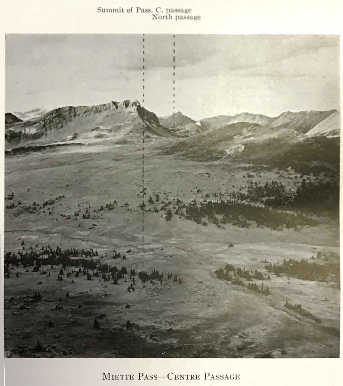
Miette Pass

Alberta-BC boundary. Pass
Athabasca River and Fraser River drainages
Headwaters of Grant Brook and Miette River
53 N 118.65 W — Map 83D/15 — GoogleGeoHack
Name officially adopted in 1912
Official in BCCanada
Miette Pass — Centre Passage.
Report of the Commission Appointed to Delimit the Boundary between the Provinces of Alberta and British Columbia, III. 1925

Miette Pass — Centre Passage.
Report of the Commission Appointed to Delimit the Boundary between the Provinces of Alberta and British Columbia, III. 1925

Baptiste Millette, an employee of the fur-trading North West Company, was the namesake of Roche Miette and other “Miette” place names in the vicinity.

References:

  • Franchère, Gabriel [1786–1863], and Lamb, William Kaye [1904–1999], editor. Journal of a Voyage to the Northwest Coast of America, in the years 1811, 1812, 1813, and 1814. Toronto: Champlain Society, 1969. Internet Archive
  • Cautley, Richard William [1873–1953], and Wheeler, Arthur Oliver [1860–1945]. Report of the Commission Appointed to Delimit the Boundary between the Provinces of Alberta and British Columbia. Parts IIIA & IIIB, 1918 to 1924. From Yellowhead Pass Northerly. Ottawa: Office of the Surveyor General, 1925, p. 10. Whyte Museum

Miette Hill

Alberta-BC boundary. Hill
E of Yellowhead Lake
52.85 N 118.3833 W — Map 83D/16 — GoogleGeoHack
Name officially adopted in 1951
Official in BCCanada

Baptiste Millette, an employee of the fur-trading North West Company, was the namesake of Roche Miette and other “Miette” place names in the vicinity.

Miette Hill on the Continental Divide drains into Clairvaux Creek on the Alberta side. Clairvaux Creek is a tributary of Miette River in the Athabasca River drainage.