Alberta. Glacier: Smoky River drainage
Head of Smoky River
53.1781 N 119.0478 W — Map 083E03 — Google — GeoHack
Name officially adopted in 1956
Topo map from Canadian Geographical Names
Head of Smoky River
53.1781 N 119.0478 W — Map 083E03 — Google — GeoHack
Name officially adopted in 1956
Topo map from Canadian Geographical Names
This glacier appears on:
Wheeler’s map Mount Robson 1912
Wheeler’s map Mount Robson 1912
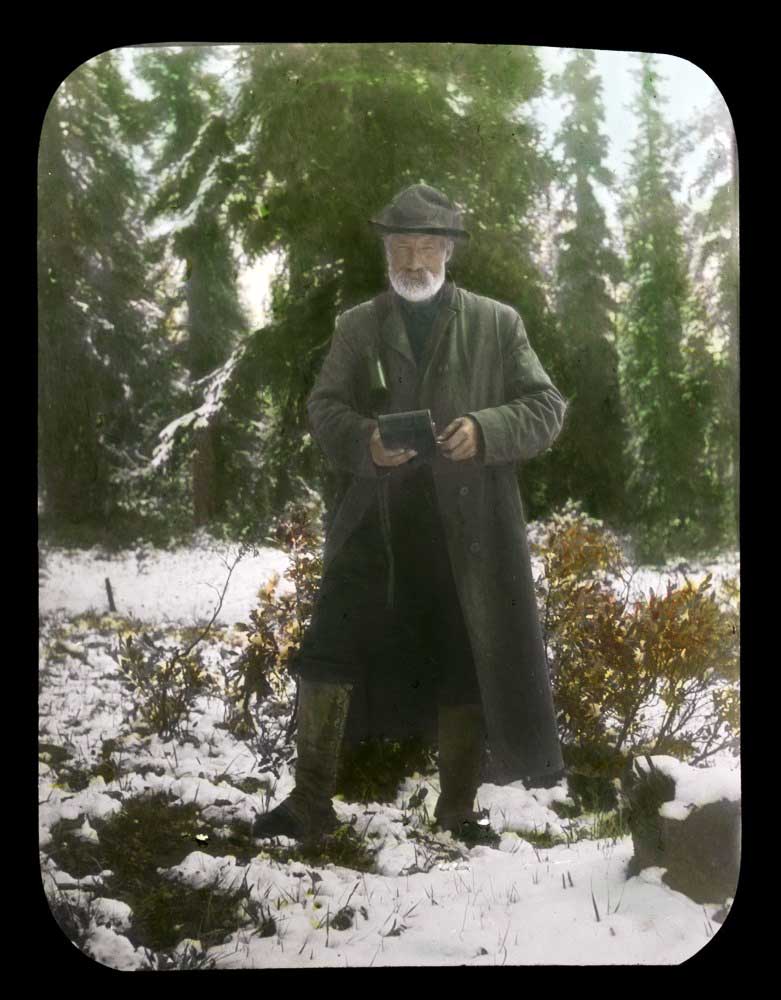
Dr. A. P. Coleman. Lantern slide by Mary T. S. Schäffer Warren, 1907. Whyte Museum of the Canadian Rockies, Moore family fonds
Arthur Philemon Coleman [1852–1939], a professor of geology at the University of Toronto, was the first person of European descent to attempt to climb Mount Robson, mounting unsuccesful attempts in 1907 and 1908.
The first mention of the name is in the report of Arthur Oliver Wheeler [1860–1945] on the Alpine Club Of Canada’s 1911 expedition to Jasper Park, Yellowhead Pass and the Mount Robson region:
The Yates trail comes out in an open at the highest point. It might well be called “Exclamation Point.” Looking south in the V of the valley, Mt. Resplendent stands a great white cone, clad from head to foot in eternal snows. Below, to the left, Yates Torrent issues from the forefoot of Coleman Glacier, a splendid icefall, the main northern outflow of Reef Névé.
References:
- Coleman, Arthur Philemon [1852–1939]. “Expedition to Mt. Robson.” Canadian Alpine Journal, Vol. 1, No. 2 (1908):100-103. Alpine Club of Canada
- Coleman, Arthur Philemon [1852–1939]. “Mount Robson, the Highest Point in the Canadian Rockies.” The Geographical Journal (London), Vol. 36, No. 1 (July 1910). JSTOR [accessed 3 March 2025]
- Wheeler, Arthur Oliver [1860–1945]. “The Alpine Club of Canada’s expedition to Jasper Park, Yellowhead Pass and Mount Robson region, 1911.” Canadian Alpine Journal, Vol. 4 (1912):9-80. Alpine Club of Canada