Approximately 12 km north of Jasper
52.9867 N 118.0628 W — Map 083D16 — Google — GeoHack
Name officially adopted in 1951
Official in Canada
Canadian Northern Railway station built in 1914
The Canadian Northern Railway’s (CNoR) owned subsidiary running between the Alberta–British Columbia border and Vancouver was formally called the Canadian Northern Pacific Railway, but there were no cars or locomotives lettered “Canadian Northern Pacific”. As far as the public and most workers were concerned, it was just a part of the CNoR.
The Canadian Northern Pacific was incorporated in 1910. The last spike was driven at Basque, British Columbia, near Ashcroft, in January 1915. This event completed Canada’s third transcontinental railway, which ran from Quebec City to Vancouver.
The line from Edmonton to Vancouver was approved for operation in October 1915. The first westbound passenger train left Edmonton on November 23, 1915. The first eastbound passenger train left Vancouver on November 25, 1915. Initial main line through service was three trains per week in each direction.
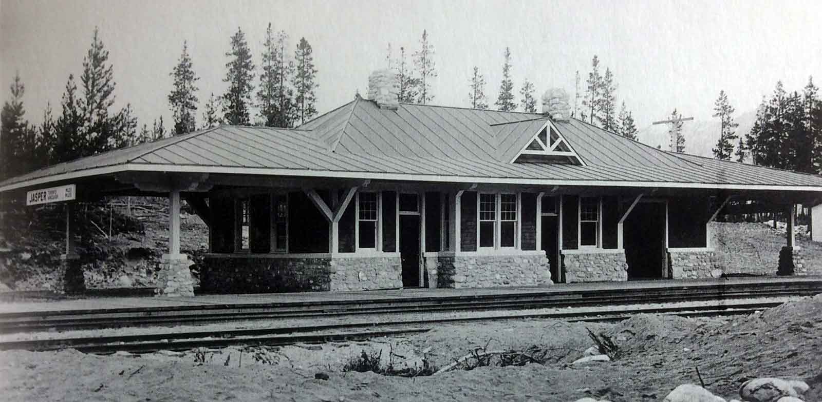
Canadian Northern Railway station at Jasper, ca. 1916
Provincial Archives of Alberta, Photo A-1360 (Bohi 1977 p. 37)
The town of Jasper is named after the
North West Company fur brigade post established in 1813 on Brûlé Lake. It was first mentioned in by Gabriel Franchère [1786–1863] in his Relation d’un voyage à la Côté du Nord-Ouest de l’Amérique Septentrionale (1820). The post was a “provision depot with the view of facilitating the passage of the mountains through Athabasca Pass.” Franchère called the post “Rocky Mountain House,” managed by Francois Décoigne, whom some have identified with Pierre Bostonais dit “Tête Jaune” [d. 1827].
In 1817, the position was filled by Jasper Hawse, whose name was adopted to distinguish the post from the new Rocky Mountain House established on the North Saskatchewan River. In 1821, the Hudson’s Bay Company and the North West Company amalgamated and by 1824, Michael Clyne was in charge of the post. In 1829, Clyne built a new post at the junction of the Athabasca River and the Snake Indian River. From 1835 to 1849, Colin Fraser [1805–1867] ran the post.
In the early 1850s, it was closed as it was losing money. It was then reopened by Henry John Moberly and then closed in the late 1850s.
The Jasper Forest Reserve, later Jasper Forest Park, was named for the original fur brigade post. The confluence of the Miette and Athabasca rivers was selected by the Grand Trunk Pacific Railway as the location for their divisional point. This crew-changing station was given the name “Fitzhugh” in 1911, after a prominent Grand Trunk Pacific official. The following years, the name was changed to assume that of the new national park in which it was situated.
Bohi:
The Grand Trunk Pacific and Canadian Northern railways serviced many resorts in the West. Not surprisingly, the GTP utilized standard structures at these locations, for example at Nakina, Ontario; Watrous, Saskatchewan; Cooking Lake, Wabamun, and Jasper, Alberta. In contrast, many CNoR resorts had special depots. In 1910 R. B. Pratt designed a simple station for Westside, Manitoba, later renamed James. It was comprised of a single storey building canopies on each end. Inside was a large waiting room, a small office with a bay window, and a freight and baggage room. This became the prototype for at least four other depots, including the one built at Jasper in 1915, shown above. The Jasper station virtually repeated Westsides floor plan, but was finished to a higher standard, with a stone plinth and metal roofing. [p. 37]
The former Grand Trunk Pacific station at Jasper burned down late 1924. In keeping with its reputation as world-class tourist destination, Canadian National Railway Architect Schofield designed a replacement station that was a masterpiece. Its massing borrowed freely from English rural residential architecture and featured a plinth of local cobblestones capped with a course of Tyndall stone. The walls above were of brick, finished on the exterior with rough-cast stucco. The plaster and oak-beamed, vaulted ceiling in the general waiting room was naturally lighted by clerestory glazing. Other services included a restaurant and a dining room, with a feature fireplace and massive cobble chimney. Living accommodation for station staff was provided on the second level. The Jasper station was restored under the auspices of Parks Canada in 2001. [p. 42]
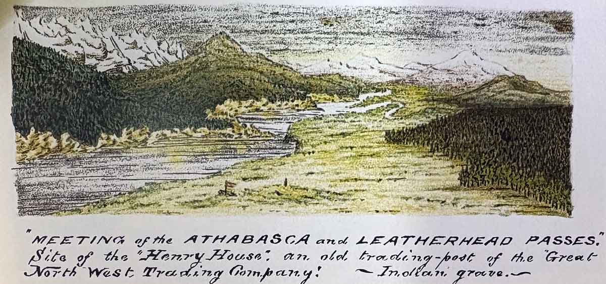
“Meeting of the Athabasca and Leatherhead Passes. Site of the ‘Henry House,’ an old trading-post of the Great North West Trading Company! — Indian grave— Rylatt p. 131
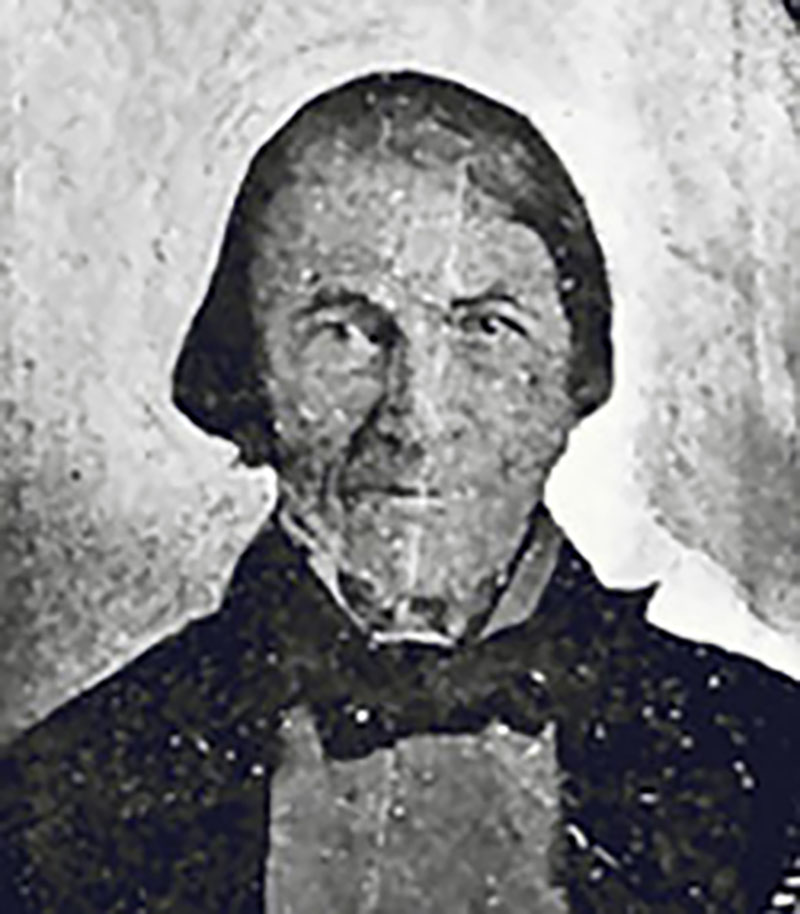
William Henry (1784-1864). From “Travels and Adventures” (Bain, ed., Boston, 1901 Red River Ancestry
“Henry’s House” or “William Henry’s Old House” was a minor North West Company [1779–1821] trading post on the route to Athabasca Pass. In 1811, while David Thompson [1770–1857] was making the first recorded crossing the pass, William Henry, the eldest son of Alexander Henry [1739–1824], provided support on the eastern side of the mountains.
Henry built a post on the Athabasca River near the mouth of the Miette River, where the trails from the Athabasca and Yellowhead passes reached the head of navigation.
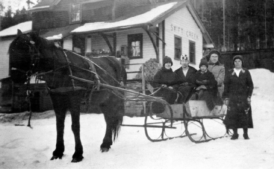
Katherine Blackman, Betty Cox, Mrs. Minnard and Mrs. Couture outside Swift Creek station, 1924
Valemount & Area Museum
The Cranberry Lake post office was changed to Swift Creek in 1918. In 1927, the Canadian National Railway decided to move the Swift Creek railway station and name it Valemount, the “valley in the mountains.”
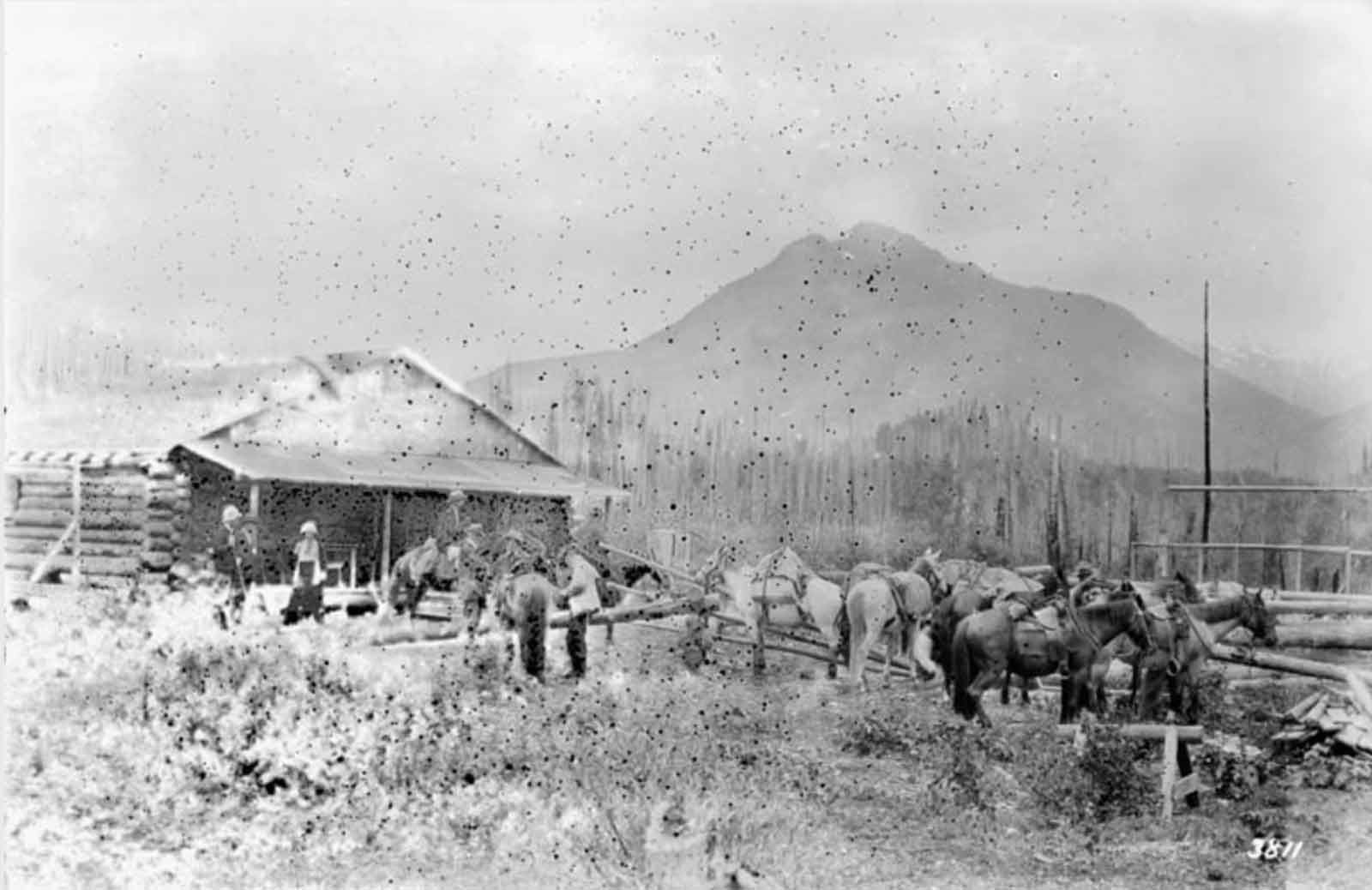
Leaving Donald Phillips’s Camp near Robson Railway Station. William James Topley, 1914
Library and Archives Canada
There was a Grand Trunk Pacific Railway station at Mount Robson in 1911 when Arthur Oliver Wheeler [1860–1945] surveyed the area for his topographical map of Mount Robson
According to Charles W. Bohi there was also a Canadian Northern Railway station in 1915, later renamed Foster . A “Mt. Robson” station was built at a second location in 1922.
Even at an obscure station such as Mt. Robson, BC, train time could be a major event. A trio of adventurers awaits the arrival of the eastbound passenger train; Mt. Robson was a world-famous centre for packing and hiking and for mountaineers seeking to conquer the tallest mountain in the Canadian Rockies. The others, lacking baggage of any kind, could be the family members of a local section crew going into Redpass to shop, or they could be from the Robson Ranch — a resort just down the valley — waiting to exchange mail. Mt. Robson station was originally located about three mile east of here, where the CNoR erected a Type C depot in 1915. A disastrous snow slide on 26 February 1921 covered the tracks just beyond the tram in this photograph, killing three people. As a result, in conjunction with the construction of a snow shed, in 1922 the CNR established a new station at this location, naming it Mt. Robson and re-naming the former point Foster. A Standard Portable Station and a Standard Freight and Passenger Shelter were installed at the new station in 1922. The local operator and a watchman who patrolled the tracks on either side of the new snow shed ensured that the tragic results of the 1921 snowslide would not recur. Still prominent on the Mt. Robson station here is the cantilever bracket for the train-order signal, which has been removed. The Portable Station was removed in the 1940s, leaving only the shelter. Until October 1963, employee operating timetables instructed passenger trains to stop for five minutes to let on-board patrons catch a glimpse of the station’s namesake mountain, to the right and behind the photographer.
— Bohi 2002
Named after one of the workers on the construction of this section of the Canadian Northern Railway in the 1910s.
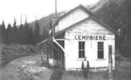
Lempriere Station, from the late 1970s/early 1980s. Photo by Brian Lempriere
Real Royal Engineers
Arthur Reid Lempriere [1835–1927], a lieutenant in the Royal Engineers, arrived in Esquimalt in 1859 with the main body of the Columbia Detachment, the third and largest group of Royal Engineers to come to British Columbia. In 1859 he explored the route from Hope to Lytton via the Coquihalla. Lempriere returned to England in 1863, and retired as Major General in 1882.
The Canadian Northern Railway laid tracks through the Valemount area in 1915 and Lempriere first appears on a map of 1917. The Lempriere post office was open from 1942 to 1945. Less than ten cancellation marks are known in collections. There was a Japanese internment camp here during World War II.
![R.E. Gosnell, Legislative Librarian [1894 to 1897]](/wp-content/uploads/2022/09/r-e-gosnell.jpg)
R.E. Gosnell, Legislative Librarian [1894 to 1897]
British Columbia Archives
Perhaps named after Robert Edward Gosnell [1860–1931], a historian and journalist. Born in Québec and educated in Ontario, he came to British Columbia as a newspaperman in 1888. He was the first librarian of the British Columbia legislative library (1893-98), editor of the Victoria Colonist, and the first provincial archivist (1908–1910). He was secretary to James Dunsmuir and succeeding premiers. In later years he was a freelance journalist. Gosnell was the author of several history books, including A History of British Columbia (1906) and co-authored Sir James Douglas (1908).
Settlement at Gosnell came with the construction of the Canadian Northern Railway in 1913. There was a Japanese internment camp here during World War II. The Gosnell post office operated from 1960 to 1964.