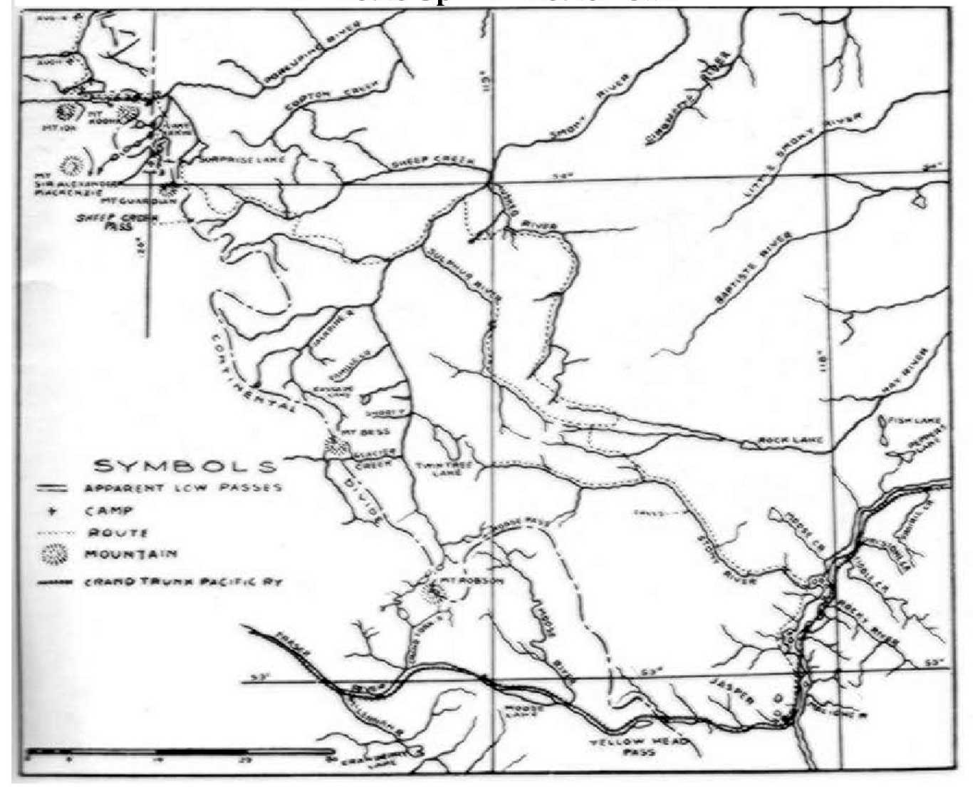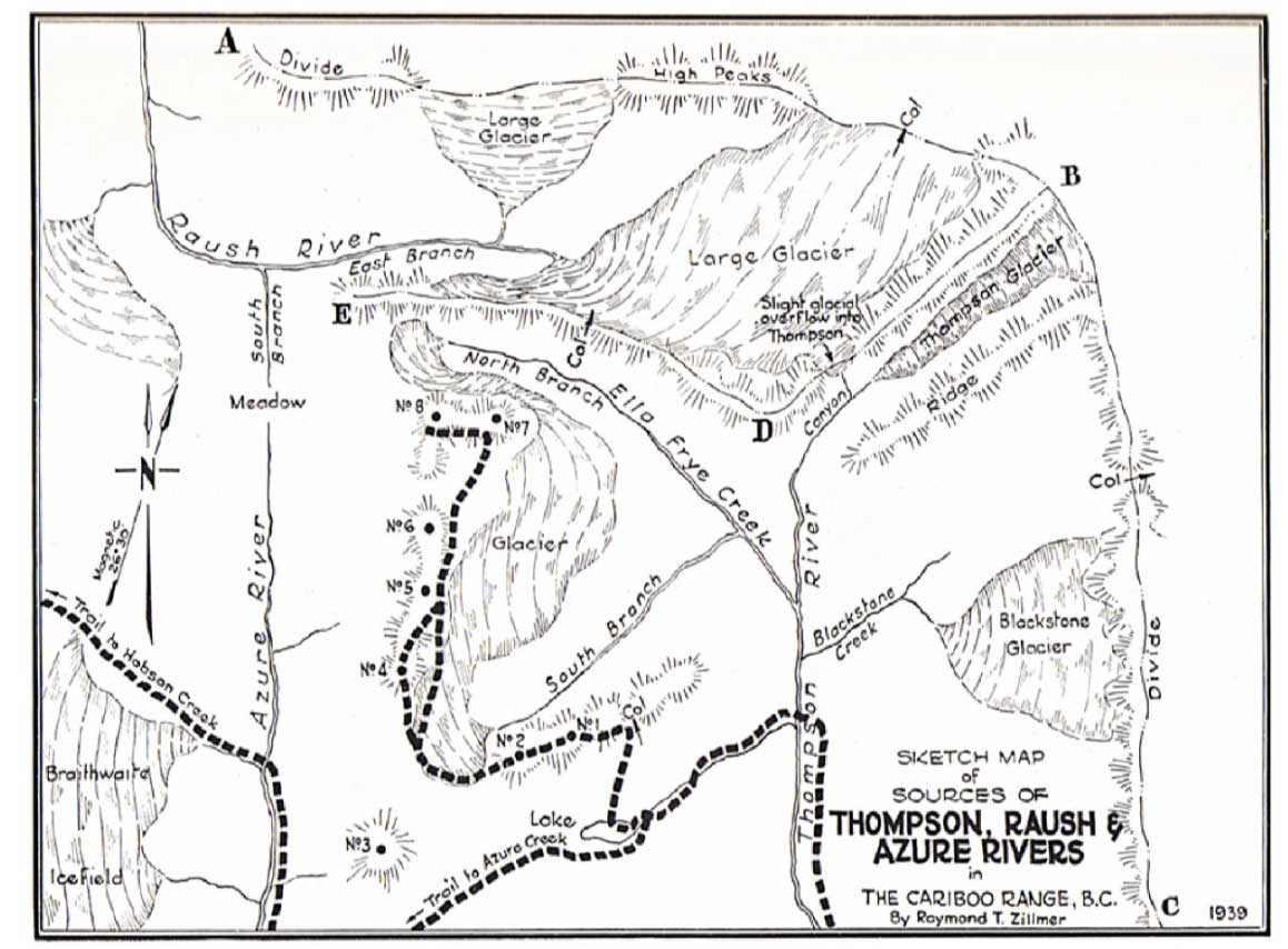
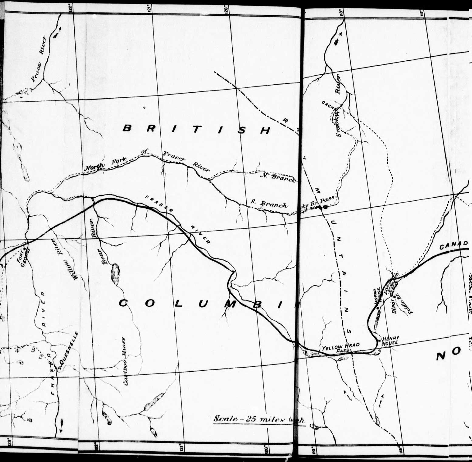
Sketch map of sources of Thompson, Raush and Azure rivers in the Cariboo Range, B.C.
Raymond T. Zillmer 1939
Canadian Alpine Journal 1939
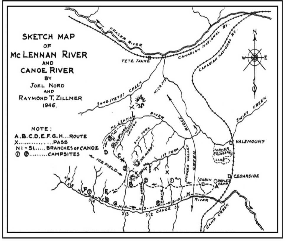
Sketch map of McLennan River and Canoe River
By Joel Nord and Raymond T. Zillmer 1946.
Canadian Alpine Journal 1947
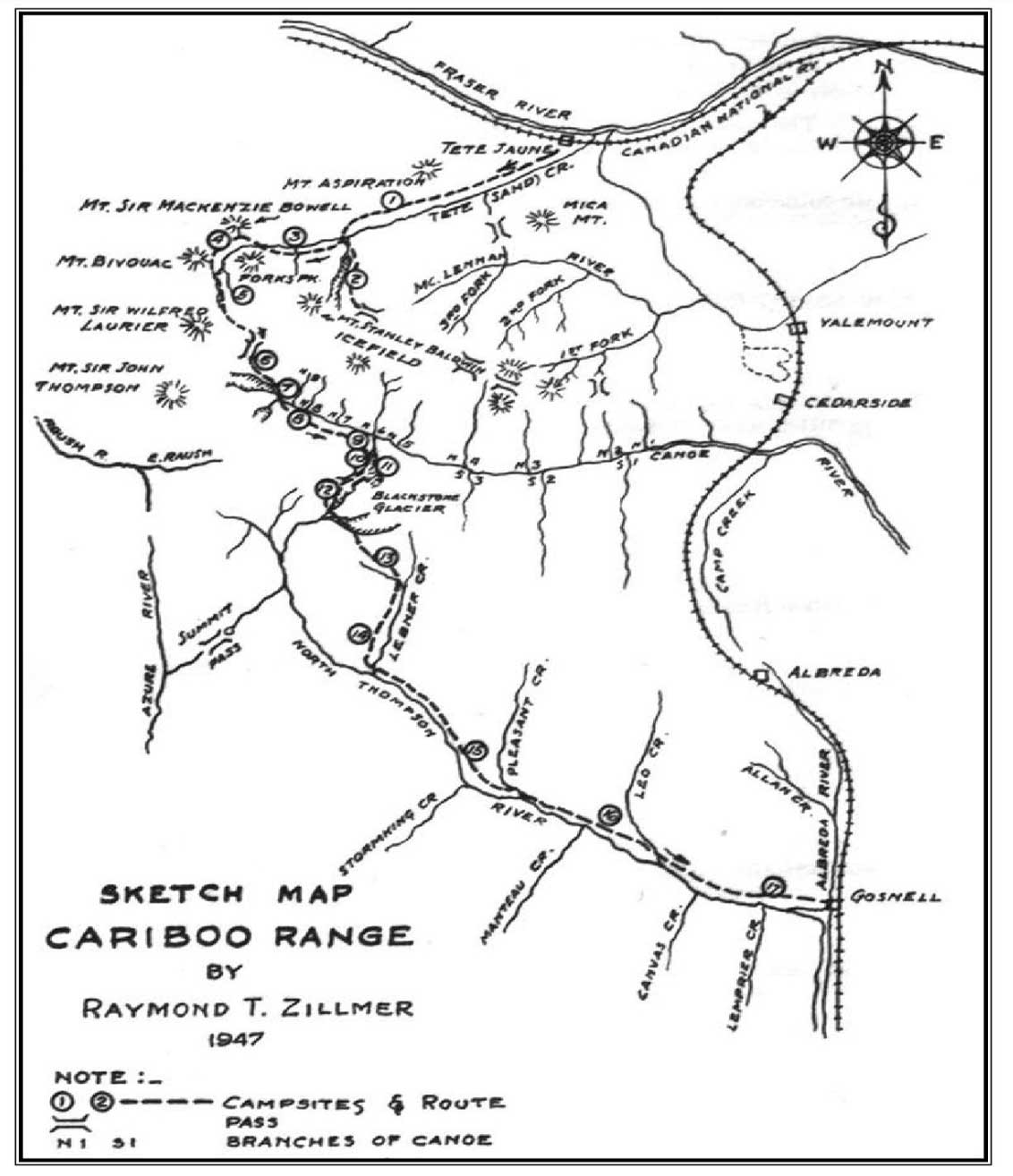
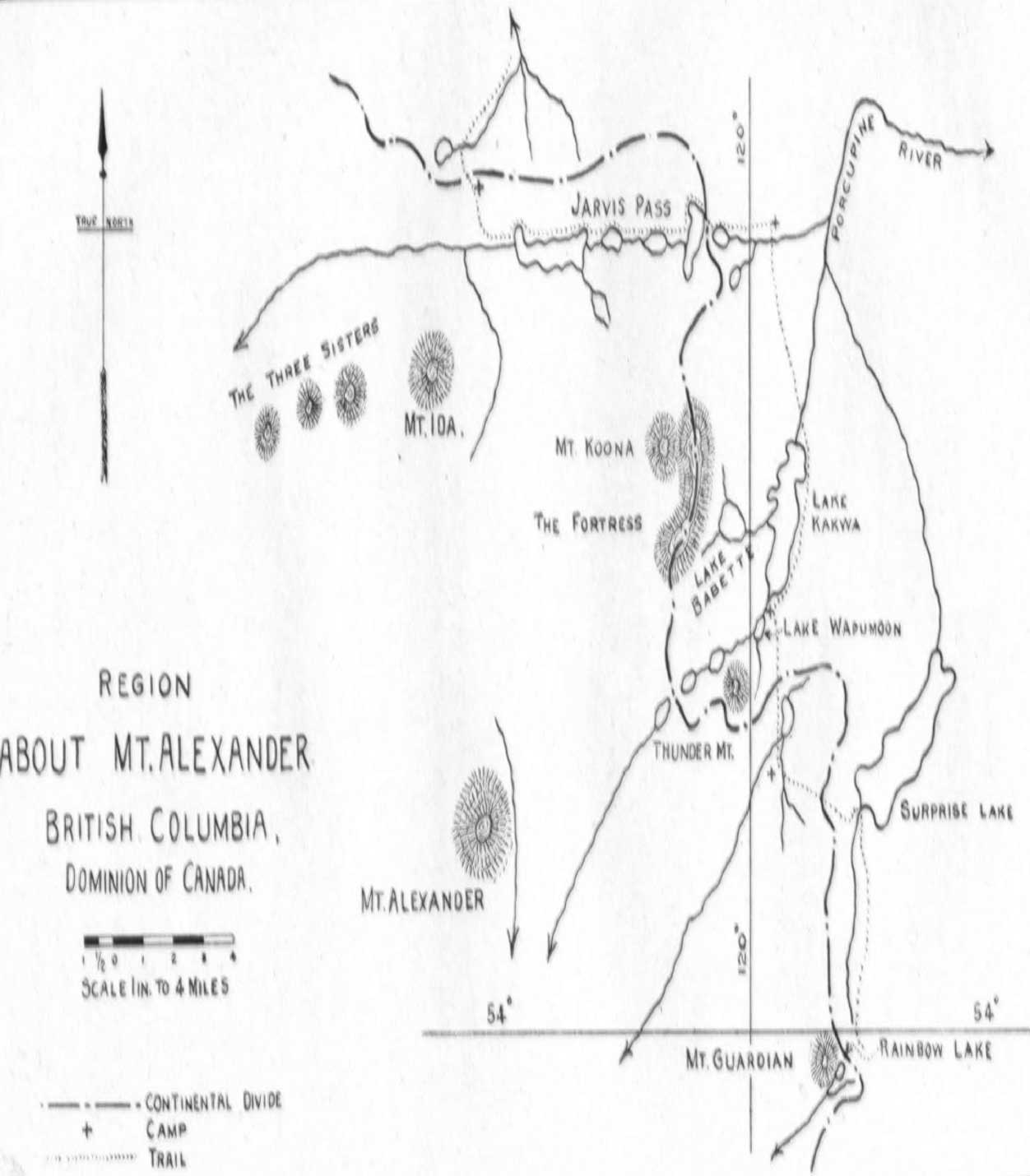
Sketch map Cariboo Range
Raymond T. Zillmer, 1947
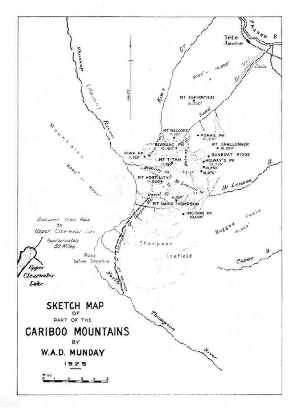
Canadian Alpine Journal 1948
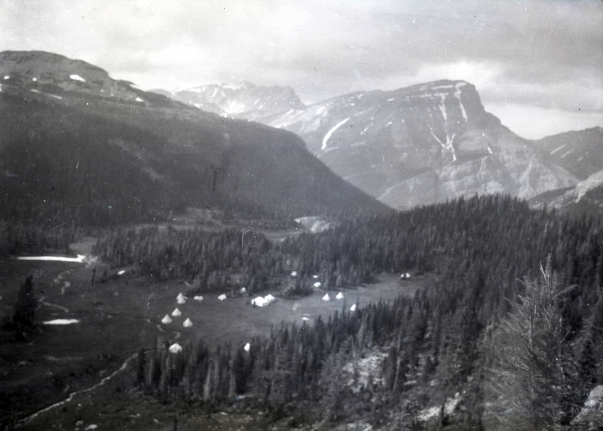
Ray Zillmer [1887–1960 was an American attorney, mountaineer, and conservationist who made a number of explorations in the Cariboo Mountains in the 1930s and 40s.
This map includes:
North Thompson River [1947]
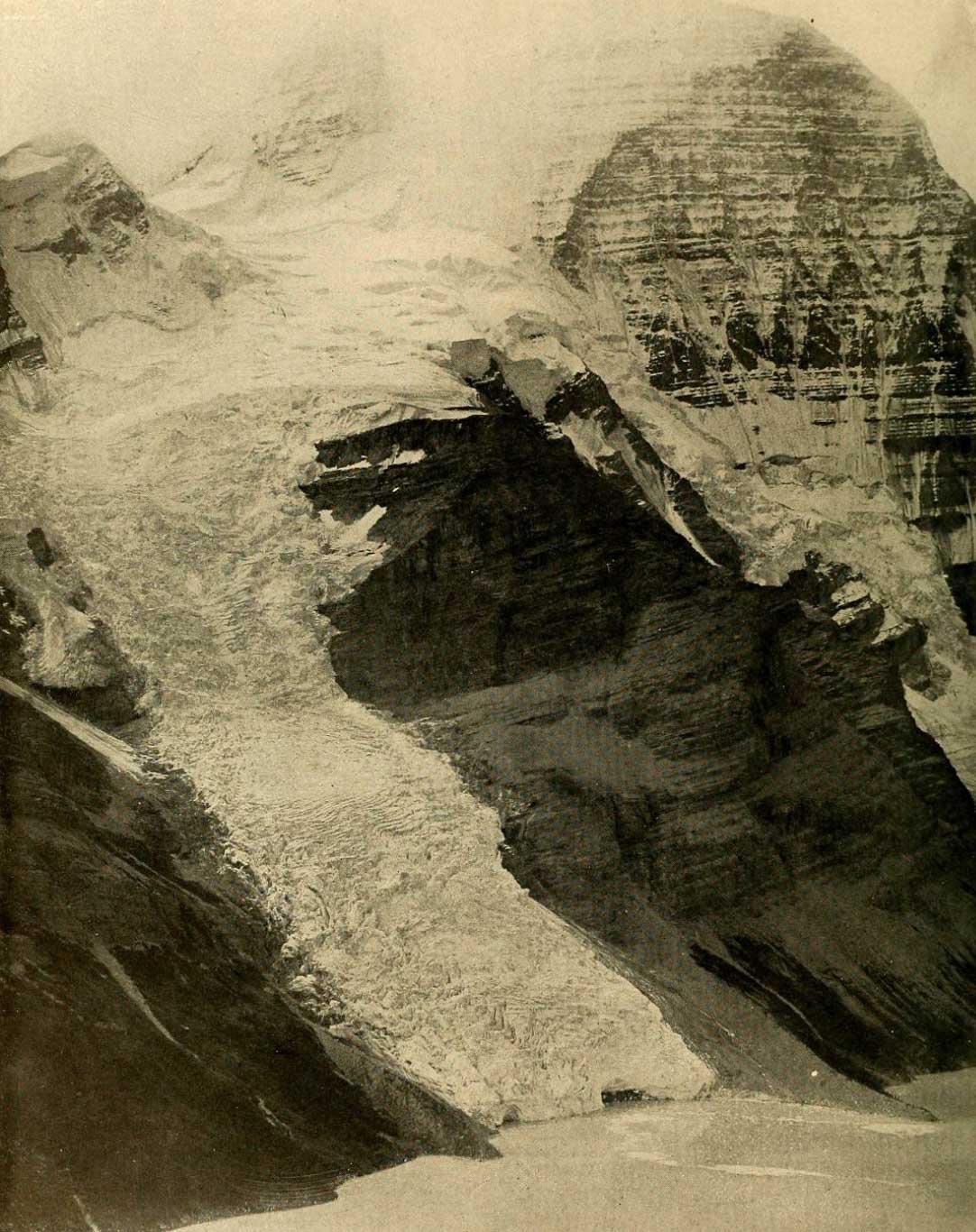
Blackstone Glacier [1939]
Blackstone Creek [1939]
Canvas Creek [1947]
Cedarside [1946]
Cranberry Lake [1946 Location of former lake]
Ella Frye Creek [1939]
Mount Joel [1946]
Lebher Creek [1947]
Lempriere Creek [1947]
Manteau Creek [1947]
Mount Nord [1946]
Pleasant Creek [1947]
Stormking Creek [1947]
North Thompson River [1947]
Blackstone Glacier [1939]
Blackstone Creek [1939]
Canvas Creek [1947]
Cedarside [1946]
Cranberry Lake [1946 Location of former lake]
Ella Frye Creek [1939]
Mount Joel [1946]
Lebher Creek [1947]
Lempriere Creek [1947]
Manteau Creek [1947]
Mount Nord [1946]
Pleasant Creek [1947]
Stormking Creek [1947]
References:
- Zillmer, Raymond T. [1887–1960]. “Explorations in the Southern Cariboos.” Canadian Alpine Journal, Vol. 27 (1939):48-61
- Zillmer, Raymond T. [1887–1960]. “The exploration of the source of the Thompson River in British Columbia.” American Alpine Journal, Vol. 4, No. 1 (1940):69–81. American Alpine Club
- Zillmer, Raymond T. [1887–1960]. “Exploration of the McLennan completed.” Canadian Alpine Journal, Vol. 30 (1947):85-95
- Zillmer, Raymond T. [1887–1960]. “The first crossing of the Cariboo Range.” Canadian Alpine Journal, Vol. 31 (1948):26–37
- Wikipedia. Ray Zillmer
Also see:
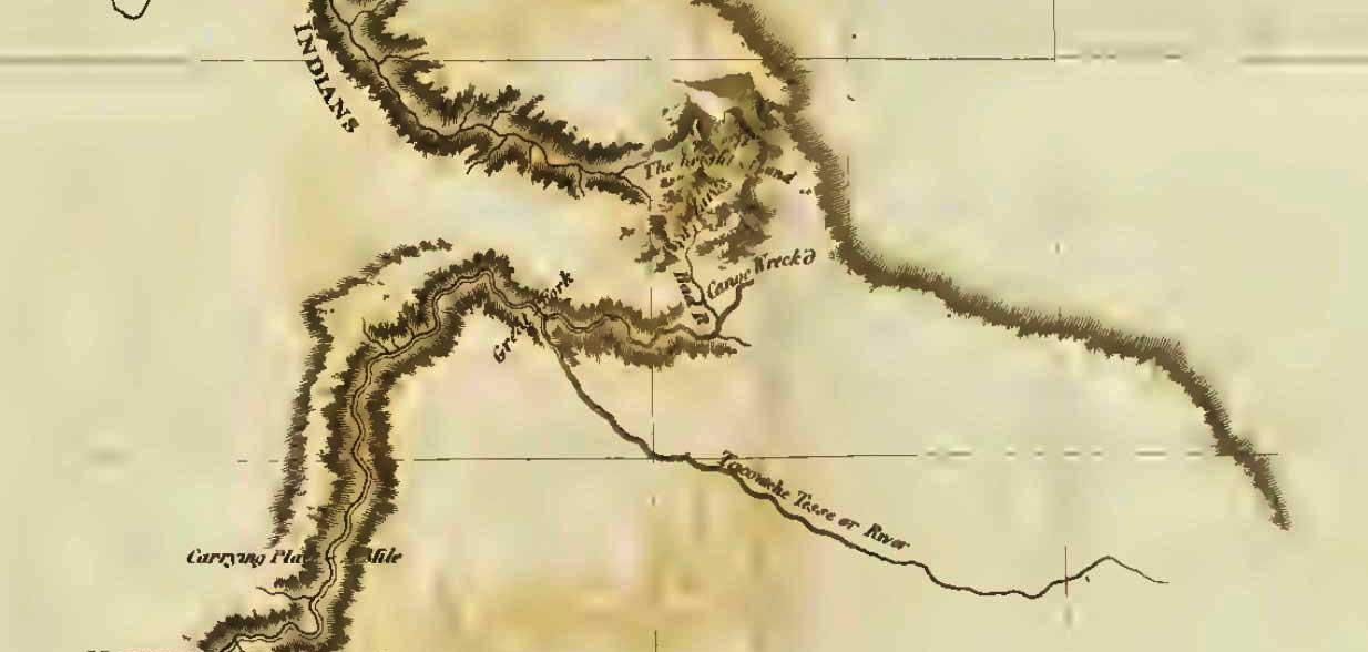
![[Map to accompany Winter conditions north and west of Mt. Robson]
Donald Phillips, 1915](/wp-content/uploads/2022/01/phillips-map-robson-caj1915.jpg)