Category Archives: Place

Bess Pass

Alberta-BC boundary. Pass
Fraser River and Smoky River drainages
Between Mount Bess and Whiteshield Mountain
53.3167 N 119.35 W — Map 83E/6 — GoogleGeoHack
Name officially adopted in 1956
Official in BCCanada

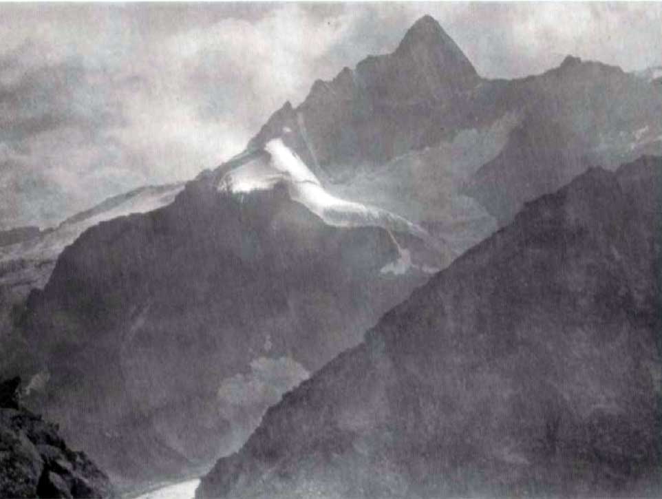
“Bess Pass, 5,330 feet in altitude and Jackpine Pass, 6,694 feet, are on the route north [of Mount Robson] to Mt. Sir Alexander. The former is situated in very spectacular surroundings between Mt. Bess and Mt. Whiteshield: the latter is much frequented by grizzlies…” — Arthur Oliver Wheeler [1860–1945]

References:

  • Wheeler, Arthur Oliver [1860–1945]. “Passes of the Great Divide.” Canadian Alpine Journal, Vol. 16 (1927–1927):117-135
Berg Lake

British Columbia. Lake: Fraser River drainage
N of Mount Robson
53.1333 N 119.15 W — Map 83E/3 — GoogleGeoHack
Earliest known reference to this name is 1909 (Kinney)
Name officially adopted in 1923
Official in BCTopo map from Canadian Geographical Names
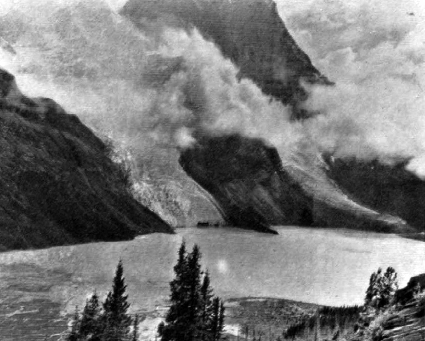
Berg Lake at foot of Mt. Robson. Named by Mr. Kinney. Photo: G. B. Kinney, 1908

Berg Lake at foot of Mt. Robson. Named by Mr. Kinney. Photo: G. B. Kinney, 1908 Canadian Alpine Journal 1909


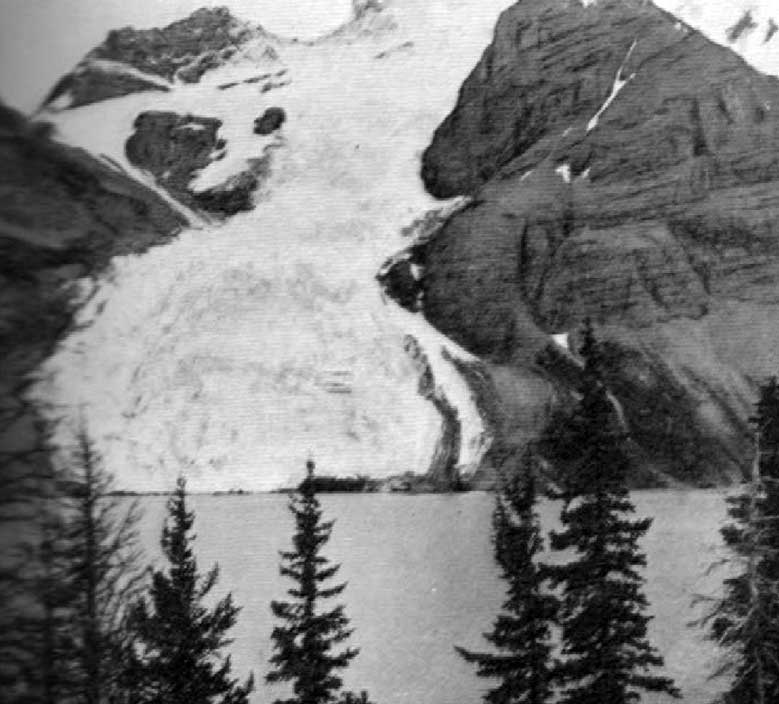
Tumbling Glacier and Berg Lake N.W. face of Mt. Robson. Photo: A.L. Mumm, 1909

Tumbling Glacier and Berg Lake N.W. face of Mt. Robson. Photo: A.L. Mumm, 1909 Canadian Alpine Journal 1910

Regarding the expedition of Arthur Philemon Coleman [1852–1939] to climb Mount Robson in 1907, expedition member George R. B. Kinney [1872–1961] wrote:

I had said good-bye to my companions and alone started off in the storm to make my high camp. I crossed the gravel bed of the Robson Divide, then scrambled for another mile over the great rocks that strewed the shores of Berg Lake. The short day was nearly done by the time I had passed over the rock-strewn floor of the valley below the lake and bridged its turbulent river; then, for more than two thousand feet, I packed my load of blankets and instruments to a shelf on the cliffs, in mid air.

Arthur Oliver Wheeler [1860–1945] explored the Mount Robson area with a large party in 1911:

From the elevated ice-field, fed by avalanching snows from the sides of Robson, a gigantic ice cascade tumbles down rock precipices and buries its nose in the waters of Berg Lake. At frequent intervals great chunks of ice break off with a report like cannon, and, bonding and rattling down the steep incline, plunge into the clear water of the lake. I have seen one of these enormous ice-blocks send a spout of water fully twenty feet into the air, while the waves caused by the upheaval wash to the farther shore. The incessant ice-falls soon fill the lake with floating blocks which drift hither and thither as the wind directs. Imagine a lake a mile-and-a-half long, three-quarters of a mile wide, of prefect turquoise-blue, filling the whole width of the valley floor, its surface dotted thickly with miniature icebergs, showing snow white against it.

References:

  • Kinney, George Rex Boyer [1872–1961]. “Mount Robson.” Canadian Alpine Journal, Vol. 2 (1909):10-16. Alpine Club of Canada [accessed 2 April 2025]
  • Wheeler, Arthur Oliver [1860–1945]. “The Mountains of the Yellowhead Pass.” Alpine Journal, Vol. 26, No.198 (1912):382
  • Kinney, George Rex Boyer [1872–1961]. London, England: Royal Geographical Society Archives. Letter to Arthur Hinks (1917).
Also see:

Berg Glacier

British Columbia. Glacier: Fraser River drainage
N side Mount Robson, S of Berg Lake
53.1167 N 119.1333 W — Map 83E/3 — GoogleGeoHack
Name officially adopted in 1924
Official in BCCanada
Tumbling Glacier and Berg Lake N.W. face of Mt. Robson. Photo: A.L. Mumm, 1909

Tumbling Glacier and Berg Lake N.W. face of Mt. Robson. Photo: A.L. Mumm, 1909
Canadian Alpine Journal 1910

Adopted 8 January 1924, in association with Berg Lake, into which the glacier falls.

British Columbia Geographical Names identifies “Evelyn”, “Blue,” and “Tumbling” as other early names for Berg Glacier.

References:

  • Kinney, George Rex Boyer [1872–1961], and Phillips, Donald “Curly” [1884–1938]. “To the top of Mount Robson.” Canadian Alpine Journal, Vol. 2, No. 2 (1910):21-44
  • British Columbia Geographical Names. Berg Glacier

Bennington Peak

Alberta-BC boundary. Peak
S of Amethyst Lakes
52.6547 N 118.2981 W — Map 083D09 — GoogleGeoHackBivouac
Name officially adopted in 1951
Official in BCCanada
Elevation: 3260 m
Mt. Bennington From Surprise Point

Mt. Bennington From Surprise Point
Canadian Alpine Journal 1927

This mountain near the headwaters of the Fraser River was named for North West Company explorer Simon Fraser [1776–1862]. Fraser was born in Bennington, Vermont. The peak was named by the Alberta-British Columbia Boundary Commission in 1921.

The afternoon of Sunday, August 1st [1926], Messrs. Henry Hall, of Boston, J. E. Johnson, of Scarsdale, N.Y., and the writer started from the main camp at Moat Lake to the camp at Surprise Point with the intention of starting from there early Monday morning for an attempt at the Easterly “Fraser” Peak, or Mt. Bennington. However, we failed to awaken in the morning (due to late attendance at the camp-fire the previous evening), and had to give up the attempt for that day, which, of course, turned out to be perfect, and was spent in scrambling up Surprise Point!

— N. W. Spadavecchia
References:

  • Cautley, Richard William [1873–1953], and Wheeler, Arthur Oliver [1860–1945]. Report of the Commission appointed to delimit the boundary between the Provinces of Alberta and British Columbia. Part II. 1917 to 1921. From Kicking Horse Pass to Yellowhead Pass.. Ottawa: Office of the Surveyor General, 1924. Whyte Museum
  • Cautley, Richard William [1873–1953], and Wheeler, Arthur Oliver [1860–1945]. Report of the Commission Appointed to Delimit the Boundary between the Provinces of Alberta and British Columbia. Parts IIIA & IIIB, 1918 to 1924. From Yellowhead Pass Northerly. Ottawa: Office of the Surveyor General, 1925. Whyte Museum
  • Spadavecchia, N. W. “Mt. Bennington.” Canadian Alpine Journal, Vol. 16 (1927):58-62
Also see:

Bennington Glacier

Alberta-BC boundary. Glacier
Athabasca River and Fraser River drainages
Headwaters of Geikie Creek and Penstock Creek
52.675 N 118.3167 W — Map 83D/9 — GoogleGeoHack
Earliest known reference to this name is 1924 (Boundary Survey)
Name officially adopted in 1951
Official in BCCanada
Great amphitheatre at the head of Bennington Glacier.
Photo: Cyril Wates, 1926

Great amphitheatre at the head of Bennington Glacier.
Photo: Cyril Wates, 1926
Canadian Alpine Journal 1927

Named in association with Bennington Peak.

References:

  • Cautley, Richard William [1873–1953], and Wheeler, Arthur Oliver [1860–1945]. Report of the Commission appointed to delimit the boundary between the Provinces of Alberta and British Columbia. Part II. 1917 to 1921. From Kicking Horse Pass to Yellowhead Pass.. Ottawa: Office of the Surveyor General, 1924. Whyte Museum
  • Wates, Cyril G. [1883–1946], and Gibson, E. Rex [1892–1957]. “The Ramparts in 1927.” Canadian Alpine Journal, Vol. 16 (1927):85-95
  • British Columbia Geographical Names. Bennington Glacier

Bend

British Columbia. Railway point
On Canadian National Railway NW of Dome Creek
53.7667 N 121.0667 W — Map 93H/14 — GoogleGeoHack
Earliest known reference to this name is 1911 (GTP map)
Name officially adopted in 1959
Official in BCCanada
146 miles west of the Yellowhead Pass on the Canadian National Railway
Mile 58 in Fraser Subdivision (McBride to Prince George as of 1977)
Grand Trunk Pacific Railway station built in 1914. Removed 1968


The 1918 Wrigley’s Directory lists Bend as “a station on Grand Trunk Pacific Railway, 2 miles from Dome Creek and 12 from Penny. Dome Creek is the post office.” The Bend post office was open from 1930 to 1942.
References:

  • Wrigley Directories, Limited. Wrigley’s British Columbia Directory. Vancouver: 1918. Internet Archive
  • Topping, William. A checklist of British Columbia post offices. Vancouver: published by the author, 7430 Angus Drive, 1983
  • Wikipedia. Bend

Big Bell Mountain

British Columbia. Mountain
Between Doré River and McIntosh Creek
53.2903 N 120.3556 W — Map 93H/8 — GoogleGeoHack
Name officially adopted in 1994
Official in BCTopo map from Canadian Geographical Names

Canadian Pacific Railway surveyor Henry Purden Bell [c. 1841–1910] passed the winter of 1875-76 surveying the Fraser River above Fort George. Born in County Atrim, Ireland, Bell was a civil engineer and pioneer surveyor and miner in British Columbia. It’s possible this mountain was named after him, although the name doesn’t appear on early maps.

Some say that Bell Mountain was named in the 1960s because of its resemblance to a bell. The BC Geographical Names office says the name refers to its shape. It was also known as Mount Baldy.

In 1988, McBride Village Council received a development proposal for a ski hill on the mountain, to be called “Belle.” Council endorsed the historic spelling “Bell” in 1992, but as of 2020, a sign for “Belle Mountain Ski Area” appears at the foot of Bell Mountain Road.

References:

  • MacGregor, James Grierson [1905–1989]. Overland by the Yellowhead. Saskatoon: Western Producer, 1974. Internet Archive
  • British Columbia Geographical Names. Big Bell Mountain

Beaverdam Pass

Alberta-BC boundary. Pass
Fraser River and Peace River drainages
Alta-BC boundary, E of Renshaw Creek
53.5667 N 119.8833 W — Map 083E12 — GoogleGeoHack
Earliest known reference to this name is 1914 (Mary Jobe)
Name officially adopted in 1925
Official in BCCanada

The pass was named by members of the expedition of Mary Lenore Jobe Akeley [1878–1966] and Donald “Curly” Phillips [1884–1938] to Mount Kitchi (Mount Sir Alexander) in 1914.

From Jones Pass we cut our way through dense woods down a steep declivity to broad open muskeg on the West Branch of the Jack Pine. After traveling about six miles through this meadow we came to a low pass, 5,300 feet, filled with beaver dams and houses. We named this pass Beaver Dam Pass. It separates Fraser and Peace waters.

“The name is due to evidence of beaver-dams and houses seen at the time of their exploration in 1914,” wrote boundary surveyor Arthur Oliver Wheeler [1860–1945]. “No signs of beavers were now seen around the small tarn close to the summit of the pass on the Alberta side of the watershed, or in the small stream flowing from it. They seem to have either been trapped out or to have left the locality.” Beaverdam Pass was a camera station on the survey, which worked through the Yellowhead Pass in 1917.

References:

  • Jobe Akeley, Mary Lenore [1878–1966]. “Mt. Kitchi: A New Peak in the Canadian Rockies.” Bulletin of the American Geographical Society, Volume 47, No. 7 (1915):481-497. JSTOR
  • Cautley, Richard William [1873–1953], and Wheeler, Arthur Oliver [1860–1945]. Report of the Commission appointed to delimit the boundary between the Provinces of Alberta and British Columbia. Part II. 1917 to 1921. From Kicking Horse Pass to Yellowhead Pass.. Ottawa: Office of the Surveyor General, 1924. Whyte Museum

Beaver River

British Columbia. Unofficial name: Fraser River drainage
Historical and local name of Holmes River
53.25 N 120.0667 W GoogleGeoHack
Earliest known reference to this name is 1910
Not currently an official name.
Journalist Stanley Washburn [1878–1950] travelled through the Yellowhead Pass and down the Fraser River in 1909:

The first thing [Bill and Mort Teare] heard on reaching the settlements was that the Yellowhead Pass was the route finally selected by the survey [for the Grand Trunk Pacific Railway.
Not in the least discouraged, they went to work trapping that winter and snaring wild horses for their pack-train, and when the snow was off the mountains, they were at it again, this time working the side streams of the Fraser valley. On the Beaver, they had located an enormous ledge of quartz, and it was to look at this ledge that we had come.

— Washburn 1910 [1]

Surveyor and Alpine Club of Canada president Arthur Oliver Wheeler [1860–1945] wrote of the 1911 Alpine Club of Canada–Smithsonian Robson Expedition:

The wide valley of the Big Smoky could be seen for many miles and, between Mt. Bess and the great white mountain, a large tributary valley which leads across the Continental Divide at its head to the Beaver River, a tributary of the Fraser. Donald Phillips, who, with Konrad Kain, spent part of the past winter (1911-12) trapping and exploring in the locality, writes me: “We did a lot of exploring this winter up in that country and found two more passes to the Stony River, but they are too rough at present to go over with horses. We also discovered two passes from the Smoky to the Beaver River, that flows into the Fraser. The Beaver River is about forty miles long.”

— Wheeler 1911 [2]

References:

  • 1. Washburn, Stanley [1878–1950]. Trails, Trappers and Tenderfeet in the New Empire of Western Canada. New York and London: Henry Holt, Andrew Melrose, 1912, p. 268. Hathi Trust
  • 2. Wheeler, Arthur Oliver Oliver [1860–1945]. “The Alpine Club of Canada’s expedition to Jasper Park, Yellowhead Pass and Mount Robson region, 1911.” Canadian Alpine Journal, Vol. 4 (1912):9-80