E of Jackpine River
53.4461 N 119.6003 W — Map 083E05 — Google — GeoHack
Name officially adopted in 1927
Topo map from Canadian Geographical Names
Boundary Commission Sheet 34 (surveyed in 1923)
Dalby Brooks Morkill [1880–1955]
b. 1880 — Sherbrooke, Québec, Canada
d. 1955 — Vancouver, B.C., Canada
Morkill came to British Columbia in 1898. He received his commission as a British Columbia Land Surveyor in 1910. Morkill was employed in 1912 by the British Columbia government making surveys on the Fraser River between Horsey Creek and Holmes River. In 1913, with Alan S. Thompson, Morkill surveyed between the Goat River and Catfish Creek. Morkill worked on the Alberta-British Columbia Boundary Commission surveys north of Yellowhead Pass in the early 1920s. Subsequently Morkill surveyed in several other areas of the Province. During his last years he spent summers at his residence at Barkerville and winters in Vancouver. He was president of the Association of BC Land Surveyors in 1928.
Named in association with Calumet Creek.
In a note in the Geographical Journal, Charles Ernest Fay [1846–1923] wrote that during the 1913 Alpine Club of Canada camp at Mount Robson, Calumet was one of five virgin summits to be occupied.
Named in association with Calumet Creek.
Samuel Prescott Fay [1884–1971]
b. 1884
d. 1971
“Pete” Fay as he was known to his friends had been a member of the [American Alpine] Club for 59 years at the time of his death last August [1971]. His qualifications for election in 1912 were four seasons in the Canadian Rockies beginning in 1906. In 1914 he joined a Smithsonian expedition which left Jasper, Alberta in June for the purposes of exploration, mapping and the collection of birds and mammals in the northern Rockies. Reports were filed with the Biological Survey in Washington. In mid-October the party met a trapper who showed them an old newspaper with reports of the first weeks of World War I of which they had no inkling. For the next three or four days they traveled non-stop to reach Hudson Hope on the Peace River.
Pete graduated from Harvard in 1907. During World War I he joined the American Field Service to drive an ambulance in France and later served with the Air Force in France and Belgium. Afterwards he was associated with an investment counseling firm in Boston for many years. Aside from two years on the Council (1930-1932), he did not take an active part in Club affairs, though he attended frequent meetings. Frail health confined him to his home for the last ten or more years.

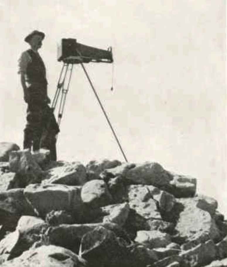
Walcott ready to take a panoramic view from the summit of Mount Field. Photo by Sidney S. Walcott. National Geographic Magazine, 1911. Internet Archive
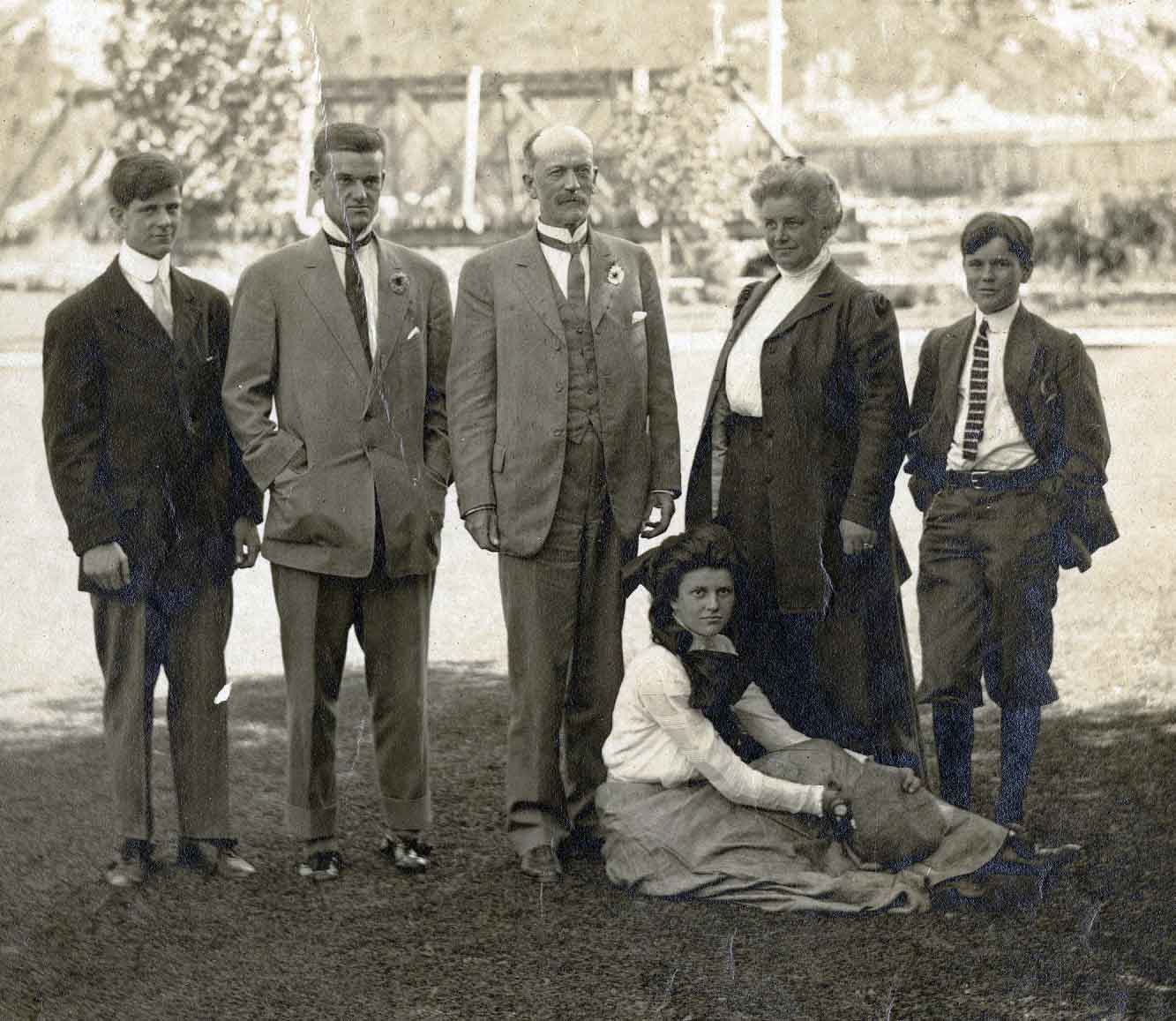
Standing, from left to right, is Sidney Stevens Walcott (1892-1977), Charles Doolittle Walcott, Jr. (1889-1913), Walcott, Sr., Helena Stevens Walcott (d. 1911), Benjamin Stuart Walcott (1895-1917); and seated, Helen Breese Walcott (1894-1965). Smithsonian Institution Archives
Charles Doolittle Walcott
b. 1850 — New York Mills, New York
d. 1927 — Washington, D.C.
Walcott was married three times — to Lura Ann Rust [1843-1876], to Helena Breese Stevens [1858-1911], and to Mary Morris Vaux [1860-1940]. By his second wife he had four children: Charles Doolittle Jr. [1889-1913], Sidney Stevens [1892-1977], Helena Breeze [1894-1965], and Benjamin Stuart [1896–1917]. Charles died while a student at Yale, and Benjamin was killed in action in France in 1917 flying for the Lafayette Flying Corps.
When Walcott traveled to the Canadian Rockies during the summer in search of fossils, often his wife and children would accompany him on his expeditions.
The Victoria Cross Ranges (52°55′N 118°18′W to 53°05′N 118°30′W) are a set of mountain ranges located to the northwest of Jasper. Of the 19 peaks contained within this range, five are named after Canadian recipients of the Victoria Cross, the highest and most prestigious decoration of the British honours system. It is awarded for valour in the presence of the enemy to members of the British Armed Forces and may be awarded posthumously.
The tribute to these soldiers in 1951 was made possible by the co-operation of the federal and provincial governments. However, at the time, the proposal created controversy. The issue’s resolution would bring about the creation of the Victoria Cross Ranges and an agreement between the Governments of Alberta and Canada still governs geographical naming.
Snaring Mountain
Mount Bridgland [Morrison Bridgland (not VC recipient)]
Mount Mahood
Consort Mountain
Mount Oliver
Mount Beaupré
Monarch Mountain
Pyramid Mountain
Mount McKean [George Burdon McKean, VC]
Buttress Mountain
Mount Griesbach [William Antrobus Griesbach (not VC recipient)]
Mount Kinross [Cecil John Kinross, VC]
Mount Zengel [Raphael Louis Zengel, VC]
Mount Henry [Henry A.F. MacLeod, CPR engineer]
Cairngorm
Mount Kerr [John Chipman Kerr, VC]
Emigrants Mountain
Elysium Mountain
Mount Pattison [John George Pattison, VC]
Located in the Victoria Cross Ranges, Mount Mahood is above Miette Lake at the headwaters of the Miette River. The peak is named after Canadian Pacific Railway engineer, land surveyor, and explorer James Adams Mahood [1840–1901], born in New Brunswick, who was a member of the 1872 party of Sandford Fleming [1827–1915] that did the initial surveys for the CPR. Mount Mahood and Mahood Lake are also named after him.