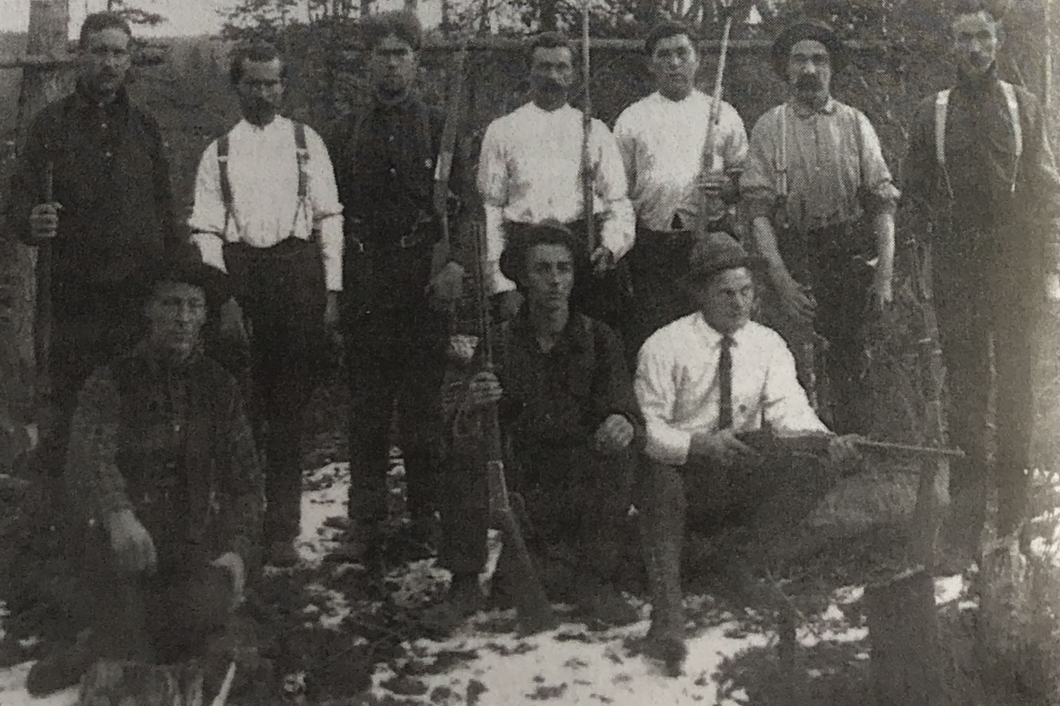
Hunters for the Grand Trunk Pacific Railway at Dome Creek, 1913.
![Surveyors camp at Dome Creek circa 1912 I.B. Guest photo. [Olson 2017 p. 105]](/wp-content/uploads/2025/02/olson-dome-creek.jpg)
Surveyors camp at Dome Creek circa 1912 I.B. Guest photo. [Olson 2017 p. 105]
Named in association with Dome Mountain. The Dome Creek watercourse appears on the 1919 Pre-emptor’s map Tête Jaune Sheet but not the community.
Dome Creek was located 55 miles from McBride and may have reached a population peak of 2000 during construction of the Grand Trunk Pacific Railway‘s “Second Crossing” bridge over the Fraser River just west of the community.
Dome Creek is situated between the Grand Canyon and Goat River, about roughly midway between Prince George and Tête Jaune Cache. The land is beautifully situated on the Fraser River, and commands a magnificent view. During the construction of the Grand Trunk Pacific Railway, Dome Creek was referred to as Mile 142 to Mile 145, Mile 142 being the campsite and Mile 145, where the bridge crosses the Fraser River.
Fort George Herald, March 3rd , 1911: “Another Townsite: A section of land at the mouth of Dome Creek was sold in Vancouver recently to some well known local men who, we are informed, intend to townsite the property.
Fort George Herald, July 22, 1911: The primal necessity for the up-building of the future city of Dome Creek arrived here this week on the steamer B. X. In the shape of an engine for the sawmill that is to be installed there by the Northern Lumber Co. Dome Creek, when put on the market, will be a thriving burg in a hurry. The site is ideally situated in the heart of the timber country, 134 miles up-river from here.
Later issues of the same paper describe the mill as capable of a 35,000 board feet per day output, also a shingle mill and a sash and door factory “right in the choicest of the cedar timber belt.” The mill owner was W.F. Cooke, one of the principals involved in purchasing and developing the townsite.
Fort George Herald, May 1913; The Foley Welch and Stewart boats were launched this week at Dome Creek where they were wintered… and will commence distributing men and supplies in the camps.
— Quoted in Olson
Wrigley’s Directory for 1918:
DOME CREEK: a post office and lumbering settlement at Mile 1190 G.T.P. west at junction of Dome Creek and Fraser River, in Fort George Provincial Electoral District. Nearest station is Bend on the G.T.P. Ry. distant 2 miles, and nearest telegraph G.T.P. at McBride, 55 miles, with local telephones. Population 250. Local resources: Lumbering and homesteading.
Albrecht A ranching
Attoff D mixed farming
Benson O ranching
Brennan Jack ranching
Casler F ranching
Cattle Mrs J W ranching
Conture F ranching
Dayton D ranching
Dayton M ranching
Dome Creek Lumber Co. Ltd. Chas. Neilson, Pres.; A. M. Neilson, Sec’y-treas. Mfrs. Fir and Pine Lumber.
Dufour Jos farming
Gale E T ranching
Hooker ranching
Jensen E W ranching
Johnson Oscar ranching
Johnson Richard D ranching
Kendall Jas O manager Upper Fraser Lumber Co Ltd
Langton F ranching
Logan George ranching
MacNeill Jas A mixed farming
McCIarty Archie ranching and logger
Mainwarning Ed ranching
Neilson A M manager Dome Creek Lumber Co Ltd
Schiescer Jacob ranching
Shernie A ranching
Smith Mrs Lottia ranching
Upper Fraser Lumber Co Ltd J O Kendall mgr mfrs fir & cedar lumber
Webber E L accountant
Westerway & Waldron shingle mill
Wylie R J ranching
The 1922 Wrigley’s lists:
Albright A ranching
Atoff David farming
Benson O ranching
Blaikie Chas mgr Dome Creek Lbr Co Ltd
Brennan Jack E ranching
Brown Sidney D saw-filer
Campbeil Geo teamster
Campbell Jas laborer
Carter F A ranching
Conway J Finlay edgerman
Crassweller Harold J laborer
Dayton Martin prospector
Dome Creek Farmers’ Inst E L Gale sec
Dufour Jos farming
Edward J C ranching
Gale E L ranching and sec Dome Creek Farmers’ Inst
Gordon Wm G R lumberman
Gordy W ranching
Green Percival A bookkeeper
Hooker J B ranching
Jensen E trapper rancher
Jensen E W trapper
Johnson Oscar ranching
Johnson Richard D ranching
Langton F ranching
McClarty Archie farming
McDowell Reginald H scaler
MacNeill Jas A mixed farming
Miller F ranching
Miller Henry farming
Nason Ithiel B laborer
Peterson C W ranching
Reade Wm farming
Robinson Harry sawmill man
Ryan Fred laborer
Schlesser Jacob ranching
Sims Jos W farming
Stewart A laborer
Stewart James ranching pool general store and PM
Strong Leslie H engineer
Thrasher A timekeeper
Tyhunt R I mgr Upper Fraser Lumber Co Ltd
Upper Fraser Lumber Co Ltd R I Tyhunt mgr
Waddell Jas H laborer
Walsh Patrick J engineer
Westerlund H laborer
Wilde Geo H P emp GTP
Wylie R J ranching