Tag Archives: Mount Robson Provincial Park

Mastodon Mountain

Alberta-BC boundary. Mountain
S of Mount Fraser
52.6072 N 118.3344 W — Map 083D09 — GoogleGeoHack
Name officially adopted in 1963
Official in BCCanada
This mountain appears on:
Boundary Commission Sheet 28 (surveyed in 1921) [as “Mount Mastodon”]

“Mastodon Peak” adopted in 1924, derived from name on BC-Alberta Boundary sheet 28, 1921. Form of name changed to “Mastodon Mountain” in 1962 by Alberta and 1963 by British Columbia.

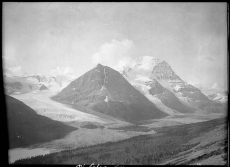
Named in 1922 by the Alberta-British Columbia Boundary Commission survey party because of a resemblance to the extinct form of elephant.

References:

  • Cautley, Richard William [1873–1953], and Wheeler, Arthur Oliver [1860–1945]. Report of the Commission appointed to delimit the boundary between the Provinces of Alberta and British Columbia. Part II. 1917 to 1921. From Kicking Horse Pass to Yellowhead Pass.. Ottawa: Office of the Surveyor General, 1924. Whyte Museum
  • Cautley, Richard William [1873–1953], and Wheeler, Arthur Oliver [1860–1945]. Report of the Commission Appointed to Delimit the Boundary between the Provinces of Alberta and British Columbia. Parts IIIA & IIIB, 1918 to 1924. From Yellowhead Pass Northerly. Ottawa: Office of the Surveyor General, 1925. Whyte Museum

Smoky River (Alberta)

Alberta. River: Peace River drainage
Adolphus Lake to Peace River
56.1825 N 117.3331 W — Map 084C03 — GoogleGeoHack
Name officially adopted in 1949
Official in Canada
Giant's Bath tub, Source of the Smokey [sic]. Mount Robson.
William James Topley, 1914

Giant’s Bath tub, Source of the Smokey [sic]. Mount Robson.
William James Topley, 1914
Library and Archives Canada

Translation of a native name, after smouldering beds of coal in the river banks; in Cree, kas-ka-pi-te; in Stoney swo-da (Joseph Burr Tyrrell [1858–1957]).

The Smoky River originates in the northern area of Jasper National Park from Adolphus Lake. It then flows north east through the Willmore Wilderness Park until it passes near the town of Grande Cache. It continues north, passes through the hamlet of Watino and merges into the Peace River south of the town of Peace River, Alberta.

Perhaps the “Boucanne or Smoke River” referred to by Gabriel Franchère [1786–1863], respecting his voyage through the Athabasca Pass in 1814:

The hunters attached to this post were then absent in the direction of the Boucanne or Smoke River; as far as I could learn it was called by voyageurs who, having seen a volcano belching forth heavy smoke in the nearby mountains gave it this name.

References:

  • Franchère, Gabriel [1786–1863], and Lamb, William Kaye [1904–1999], editor. Journal of a Voyage to the Northwest Coast of America, in the years 1811, 1812, 1813, and 1814. Toronto: Champlain Society, 1969. Internet Archive
  • Canadian Board on Geographical Names. Place-names of Alberta. Published for the Geographic Board by the Department of the Interior. Ottawa: Department of the Interior, 1928. Hathi Trust
  • Wikipedia. Smoky River

The Helmet

British Columbia. Peak
NE of Mount Robson SE of Berg Lake
53.115 N 119.1417 W — Map 083E03 — GoogleGeoHackBivouac
Earliest known reference to this name is 1908 (Kinney)
Name officially adopted in 1951
Official in BCTopo map from Canadian Geographical Names
East face of Mount Robson and The Helmet (background right). Photo: Byron Harmon [1918]

East face of Mount Robson and The Helmet (background right). Photo: Byron Harmon [1918]
Whyte Museum of the Canadian Rockies

In 1917, while serving in the Canadan Army Medical Corps in France, George R. B. Kinney [1872–1961] wrote to Arthur Hinks, the secretary of the Royal Geographical Society in London, that he would be pleased to deliver a lecture on mountaineering in the Canadian Rockies, illustrated by “100 choice colored lantern slides, second to none (by report), and taken from my own negatives.… Mine are the original photographs taken of these hither to unexplored regions, and names like ‘Berg Lake,’ ‘Tumbling Glacier,’ ‘Robson Glacier,’ ‘Mt. Rearguard,’ ‘the Helmet,’ and ‘the Extinguisher’ that now have a permanency, were my suggestions, while Dr. Coleman gave the name of Lake Kinney on Mt. Robson’s western foot” (1). Kinney delivered the lecture in January 1919, and was subsequently elected a Fellow of the RGS (2).

Kinney had accompanied Arthur Philemon Coleman [1852–1939] and Coleman’s brother Lucius on the first mountaineering expedition to Mount Robson in 1907, when they approached from the Fraser River side and got little further than Kinney Lake. They returned in 1908, guided by Adolphus Moberly [1887– ?] and John Yates [1880– ?], who took them up the Moose River valley and approached Robson from the north. They became the first people to report on Berg Lake, Tumbling Glacier, Robson Glacier, Rearguard Mountain, The Helmet, and Extinguisher Tower, features Kinney named after their appearances.

During the 1911 Alpine Club of Canada–Smithsonian Robson Expedition, director Arthur Oliver Wheeler [1860–1945] said he “looked at the north-east face of the Mount Robson massif. On the north shoulder rests a mighty ice-field, crevassed and broken in every direction. From its centre a rugged ridge protrudes, of which the culminating apex has been named by Coleman ‘The Helmet,’ from the resemblance to the old Roman headpiece when seen from the valley below”(3). In his writings Coleman mentions The Helmet but does not claim to have named it (4, 5).

References:

  • 1. Kinney, George Rex Boyer [1872–1961]. London, England: Royal Geographical Society Archives. Letter to Arthur Hinks (1917).
  • 2. Kinney, George Rex Boyer [1872–1961]. London, England: Royal Geographical Society Archives. Letter to Doctor Hinks (1936).
  • 3. Wheeler, Arthur Oliver [1860–1945]. “The Mountains of the Yellowhead Pass.” Alpine Journal, Vol. 26, No.198 (1912):382
  • 4. Coleman, Arthur Philemon [1852–1939]. “Geology and glacial features of Mt. Robson.” Canadian Alpine Journal, Vol. 2, No. 2 (1910):73-78
  • 5. Coleman, Arthur Philemon [1852–1939]. The Canadian Rockies: New and Old Trails. London: T. Fisher Unwin, 1911. Internet Archive

Rearguard Mountain

British Columbia. Mountain
E of Berg Lake, NE of Mount Robson
53.1439 N 119.1264 W — Map 083E03 — GoogleGeoHack
Name officially adopted in 1923
Official in BCTopo map from Canadian Geographical Names
Robson Glacier, Rearguard Mountain and Mount Robson. Smithsonian-Alpine Club of Canada Mount Robson expedition.Photo: Byron Harmon, 1911

Robson Glacier, Rearguard Mountain and Mount Robson. Smithsonian-Alpine Club of Canada Mount Robson expedition.Photo: Byron Harmon, 1911
Whyte Museum of the Canadian Rockies

In 1917, while serving in the Canadan Army Medical Corps in France, George R. B. Kinney [1872–1961] wrote to Arthur Hinks, the secretary of the Royal Geographical Society in London, that he would be pleased to deliver a lecture on mountaineering in the Canadian Rockies, illustrated by “100 choice colored lantern slides, second to none (by report), and taken from my own negatives.… Mine are the original photographs taken of these hither to unexplored regions, and names like ‘Berg Lake,’ ‘Tumbling Glacier,’ ‘Robson Glacier,’ ‘Mt. Rearguard,’ ‘the Helmet,’ and ‘the Extinguisher’ that now have a permanency, were my suggestions, while Dr. Coleman gave the name of Lake Kinney on Mt. Robson’s western foot” (1). Kinney delivered the lecture in January 1919, and was subsequently elected a Fellow of the RGS (2).

Kinney had accompanied Arthur Philemon Coleman [1852–1939] and Coleman’s brother Lucius on the first mountaineering expedition to Mount Robson in 1907, when they approached from the Fraser River side and got little further than Kinney Lake. They returned in 1908, guided by Adolphus Moberly [1887– ?] and John Yates [1880– ?], who took them up the Moose River valley and approached Robson from the north. They became the first people to report on Berg Lake, Tumbling Glacier, Robson Glacier, Rearguard Mountain, The Helmet, and Extinguisher Tower, features Kinney named after their appearances.

By walking a hundred yards from our camp into the valley Mount Robson came into view during the rare intervals when the clouds drifted away, disclosing an imposing dome of white rising eight thousand feet above our valley, the lower part banded with courses of rock. Immediately behind our little grove a half-mile of glacier flowed, separating us from the cliffs of the Rearguard, one of the subordinate peaks, which reached a height of about nine thousand feet.

— Coleman (3)

From his vantage on Mumm Peak during the 1911 Alpine Club of Canada–Smithsonian Robson Expedition, Arthur Oliver Wheeler [1860–1945] described the rugged ridge running from the centre of Mount Robson’s north-east face. “The ridge ends in a semi-detached rock mass, aptly named by Coleman ‘Rearguard.’”

Coleman did not claim to have named Rearguard.

Paleontologist Charles Doolittle Walcott [1850–1927] explored in the Mount Robson area in 1912:

Directly above Blue Glacier a point of rock was named by Dr. Coleman “The Helmet,” and the great black mountain in the center, which he called the “Rearguard,” is now given the Indian name of Iyatunga (Black Rock) (note: name approved by the Geographical Board of Canada, December, 1912) (4)

“Iyatunga” is no longer official. No one seems to have used it except Walcott.

References:

  • 1. Kinney, George Rex Boyer [1872–1961]. London, England: Royal Geographical Society Archives. Letter to Arthur Hinks (1917).
  • 2. Kinney, George Rex Boyer [1872–1961]. London, England: Royal Geographical Society Archives. Letter to Doctor Hinks (1936).
  • 3. Coleman, Arthur Philemon [1852–1939]. The Canadian Rockies: New and Old Trails. London: T. Fisher Unwin, 1911, p. 315. Internet Archive
  • 4. Walcott, Charles Doolittle [1850–1927]. “The monarch of the Canadian Rockies.” National Geographic Magazine, (1913):626. Internet Archive

Goodair Peak

British Columbia. Peak
S of headwaters of Geikie Creek
52.6583 N 118.3833 W — Map 83D/9 — GoogleGeoHack
Name officially adopted in 1951
Official in BCCanada

Jasper Park warden Percy Hamilton Goodair (died 1928 at the age of 52) was killed by a grizzly bear and buried near his cabin in the Tonquin Valley. Goodair was an educated Englishman who traveled extensively in South Africa and Australia before coming to Jasper and joining the warden service.

In September 1928, after Goodair failed to contact Parks headquarters for over a week, wardens went in to search. Their dog found Goodair’s snow-covered body lying on a trail near the cabin. He had claw marks on his face and a handkerchief stuffed under his arm in an attempt to stop bleeding from an opened artery.

An attendee who had met Goodair at the 1926 Alpine Club of Canada camp in the Tonquin stated, “So died, where he would have liked to, one of the most delightful and cultivated gentlemen I have known. He was in no sense a climber, although he could mount the hills faster than I care to do; but he had an intense love of the mountains surpassed by no man. You know the setting of his Maccarib Creek Cabin faces towards the Ramparts. Of that glorious outlook he never tired. We spent five nights with him and he would call us our again and again to see the magnificent and ever-changing light effects on the peaks.”

In Goodair’s files was a letter stating, “If anything happens to me I want to be buried in the mountains.” The wardens made a coffin with floor-boards from the cabin veranda. A number of Goodair’s Masonic brothers went in with the doctor and police, who were holding an inquest, and conducted the funeral. “He was one of our best wardens and loved the outside life and disliked the town,” said a Parks report.

The was formerly known as “Warden Peak” in association with Portcullis Peak. After the Goodair, the new name suggested in his memory by the Alpine Club of Canada.

References:

  • Jasper-Yellowhead Historical Society Archives. J. B. Snape, Dominion Government Engineer, Jasper National Park, 1921–1949 (1921–1949).
  • “P. H. Goodair.” Canadian Alpine Journal, Vol. 18 (1929):106

Dennison Pit

British Columbia. Gravel pit
S of Highway 16 on Shale Hill near Mount Robson viewpoint
53.0299 N 119.2116 W GoogleGeoHack
Not currently an official name.

British-born George Middleton Dennison [d. 1943] and Flora Elizabeth Dennison , née MacLaurin [d.1951], ran stopping places for teamsters hauling freight for the construction of the Grand Trunk Pacific Railway and Canadian Northern Railway. They settled in the Mount Robson area around 1910, and were granted a homestead in 1913. With his nephew Harold Britton [d. 1943], George ran a guide and outfitting business until the 1940s. He occasionally worked for guide Jack Brewster out of Jasper.

George Dennison was a major in the British calvary during the Boer War. He was presented to King George VI and Queen Elizabeth during the royal stop at Mount Robson in 1939. George died in 1943 when he was hit by a train while on guard duty at the Japanese internment camp. He is buried at Mount Robson. Florence died in 1951 at Surrey, British Columbia.

The original automobile road from Tête Jaune Cache to Jasper followed the old railway tote road as far as Moose Lake, and then followed the abandoned Canadian Northern Railway grade to Jasper. According to Tom Carr, “There were two hills between Mount Robson and the Pass that took some doing to get up in any kind of adverse weather, because of the steep grade, crooked road, and dirt base. The first hill was directly in front of Dennison’s property. Because of the trouble it caused travelers by car, it warranted a name other than *&!%$!@. More politely it became known as Dennison Hill.” When the Yellowhead Highway was being built a gravel pit was opened on the top of Dennison hill.

References:

  • Wheeler, Marilyn [1932–2016]. The Robson Valley Story. McBride, B.C.: Robson Valley Story Group, 1979
  • Valemount Historic Society. Yellowhead Pass and its People. Valemount, B.C.: 1984
  • Jeck, Lloyd. “Dennison & Brittain 1927. Part 1.” Rocky Mountain Goat, July 31 (2023). Rocky Mountain Goat