Author Archives: Swany
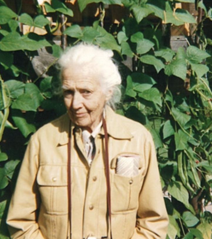
Mary Jobe

Mary Jobe posed in winter amoungst trees in beaded buckskin clothing. n.d.
Whyte Museum of the Canadian Rockies
Mary Lenore Jobe Akeley [1878–1966]
b. 1878 — Tappan, Ohio, USA
d. 1966 — Mystic, Connecticut, USA
Jobe Akeley was an American explorer, author, mountaineer, and photographer. She undertook expeditions in the Canadian Rockies and in the Belgian Congo. She worked at the American Museum of Natural History creating exhibits featuring taxidermy animals in realistic natural settings. She worked on behalf of conservation efforts, including being one of the first advocates for the creation of game preserves. She also founded Camp Mystic, an outdoor camp for girls.
Jobe Akeley explored the Mount Sir Alexander area in 1914 and 1915, on expeditions guided by Donald “Curly” Phillips [1884–1938] of Jasper.
In 1924, Mary Jobe became the second wife of Carl Akeley (1864–1926), an explorer, natural scientist, sculptor, inventor, and “father of modern taxidermy”. On their first visit to Africa in 1926, Akeley died of disease in the remote mountains of the Congo. Jobe remained to take charge of his work, collecting specimens, and when she returned to the United Stated in 1927 she succeeded her husband as advisor in the development of the African Hall at the American Museum of Natural History in New York. In the same year, King Albert of Belgium awarded her with the Cross of the Knight, Order of the Crown, in recognition of her courage and service.
She revisited the Congo in 1946 to study the development of the parks system. Between her travels she lectured and wrote several books on her African experiences. She died in 1966, never returning to the mountains of western Canada.
- Smith, Cyndi. Off the Beaten Track. Women adventurers and mountaineers in western Canada. Jasper: Coyote Books, 1989
- Taylor, William C. Tracks across my trail. Donald “Curly” Phillips, guide and outfitter. Jasper: Jasper-Yellowhead Historical Society, 1984
- Wikipedia. Mary Jobe Akeley
- 1914 Jobe-Phillips expedition Mt. Kitchi
- 1915 Jobe-Phillips to Kitchi
- 1915 Jobe’s second expedition to Mount Sir Alexander (leader)
- 1917 Jobe trip to Wapiti
- — “The expedition to ‘Mt. Kitchi:’ A new peak in the Canadian Rockies.” Canadian Alpine Journal, Vol. 6 (1914–1915):135-143
- — “Mt. Kitchi: A New Peak in the Canadian Rockies.” Bulletin of the American Geographical Society, Volume 47, No. 7 (1915):481-497. JSTOR
- — “Mt. Alexander Mackenzie.” Canadian Alpine Journal, Vol. 7 (1916):62–73
- — “A winter journey to Mt. Sir Alexander and the Wapiti.” Canadian Alpine Journal, Vol. 9 (1918):58-65
Fort Chipewyan
Hamlet on western tip of Lake Athabasca
58.7144 N 111.1583 W — Map 074L11 — Google — GeoHack
Name officially adopted in 1954
Official in Canada
Mackenzie left Fort Fork on 9 May 1793, following the route of the Peace River.[15] He crossed the Great Divide and found the upper reaches of the Fraser River, but was warned by the local natives that the Fraser Canyon to the south was unnavigable and populated by belligerent tribes.[16] He was instead directed to follow a grease trail by ascending the West Road River, crossing over the Coast Mountains and descending the Bella Coola River to the sea. He followed this advice and reached the Pacific coast on 20 July 1793, at Bella Coola, British Columbia, on North Bentinck Arm, an inlet of the Pacific Ocean.[17] Having done this, he had completed the first recorded transcontinental crossing of North America north of Mexico, 12 years before Lewis and Clark. He had unknowingly missed meeting George Vancouver at Bella Coola by 48 days.[citation needed]
He had wanted to continue westward out of a desire to reach the open ocean, but was stopped by the hostility of the Heiltsuk people.[18] Hemmed in by Heiltsuk war canoes, he wrote a message on a rock near the water’s edge of Dean Channel, using a reddish paint made of vermilion and bear grease, and turned back east. The inscription read: “Alex MacKenzie / from Canada / by land / 22d July 1793” (at the time the name Canada was an informal term for the former French territory in what is now southern Quebec and Ontario).[19]: 418 The words were later inscribed permanently by surveyors. The site is now Sir Alexander Mackenzie Provincial Park and is designated First Crossing of North America National Historic Site.[20] In 2016, Mackenzie was named a National Historic Person.[21]
- Wikipedia. Fort Chipewyan
Arnold Louis Mumm

A. L. Mumm and guide Moritz Inderbinen. Mount Robson Camp on Snowbird Pass.
Photo by Frank W. Freeborn, 1913
Canadian Alpine Journal 1915
Arnold Louis Mumm [1859–1927]
b. 1859 — London, England
d. 1927 — Bay of Biscay, Atlantic Ocean
Mumm, a London publisher, first came to Canada in 1909, at the invitation of Alpine Club of Canada director Arthur Oliver Wheeler [1860–1945]. After attending the 1909 ACC camp at Lake O’Hara, Mumm, along with Leopold Charles Maurice Stennett Amery [1873–1955], Geoffrey Hastings [1860–1941], and Moritz Inderbinen [1856–1926], made an attempt on Mount Robson. On their way to the mountain, they met George R. B. Kinney [1872–1961], who reported that he and Donald “Curly” Phillips [1884–1938] had been successful on their own attempt (a claim later disputed). Mumm’s party, hobbled by difficulties of the route and lack of time, was not successful.
Mumm returned with British professor John Norman Collie [1859–1942] in July, 1910, when the Grand Trunk Pacific Railway’s steel had been laid as far as Wolf Creek, about one hundred miles east of theYellowhead Pass. The party spent some time about Mount Robson, but there was so much snow on the mountains and the weather was so stormy that climbing was out of the question, and they were able to ascend only some of the lesser peaks.
The next summer, 1911, Collie and Mumm made another trip, the first to go north of the Athabasca to explore and climb. They ascended the Stoney River, crossed a high pass to the Smoky River, then up Glacier Creek, which they ascended to Mount Bess.
In 1913 Mumm decided to climb Mount Geikie, which three years earlier, when on Yellowhead Mountain, he had seen rising far above its fellows. He was turned back by a storm. Mumm made many climbs in the Alps, Canada, Japan and New Zealand, in addition to accompanying Tom George Longstaff [1875–1964] to the Himalayas.
- Wheeler, Arthur Oliver [1860–1945]. “A. L. Mumm — An Appreciation.” Canadian Alpine Journal, Vol. 16 (1927–1927):173-175
- 1906 ACC organized, Mount Robson attempt proposed
- 1909 English party at Robson
- 1909 ACC Camp – Lake O’Hara (guest)
- 1910 Mumm and Collie at Robson
- 1911 Collie and Mumm Mt Bess
- 1913 Mumm explores Whirlpool River, Athabasca Pass
- 1913 ACC Camp – Mount Robson
- — “An attempt on Mount Robson.” Alpine Journal, Vol. 25 (1910–1911):90
- — “An expedition to Mount Robson.” Canadian Alpine Journal, Vol. 2, No. 2 (1910):10-20
- — “Mount Robson District. Mumm and Collie’s 1910 Journey.” Alpine Journal, Vol. 25 (1910–1911):466
- — “A trip up the Whirlpool River.” Alpine Journal, Vol. 28 (1914):355
Simon Fraser
Simon Fraser
b. 20 May 1776 — Mapletown, New York, USA
d. 18 August 1862 — St. Andrews West, Ontario
During May and June of 1808, with a party of nineteen French Canadian voyageurs, two clerks, and two Native Americans, Fraser made his journey down the Fraser River from just upstream of present-day Prince George to present-day Vancouver. It was a bitter disappointment for him to discover that the river was not the Columbia, and that it was not a practical canoe route to the coast.
- — and Lamb, William Kaye [1904–1999], editor. The letters and journals of Simon Fraser, 1806-1808. Toronto: MacMillan, 1960. Internet Archive [accessed 3/10/2025]
- 1805 Fraser into New Caledonia
- 1807 Fraser founds Fort George
- 1808 Fraser descends Fraser
- Fraser, Simon [1776–1862], and Lamb, William Kaye [1904–1999], editor. The letters and journals of Simon Fraser, 1806-1808. Toronto: MacMillan, 1960. Internet Archive [accessed 10 March 2025]
- Wikipedia. Simon Fraser
Continental Divide
Wikipedia. Continental Divide
- Wikipedia. Continental Divide
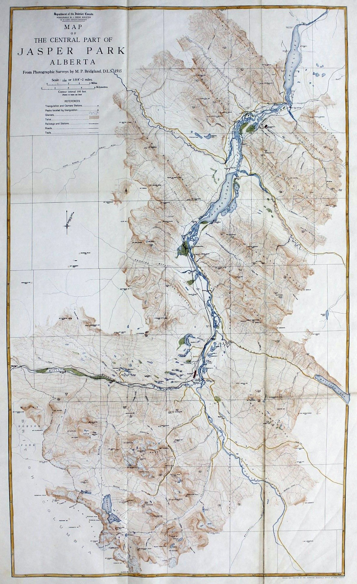
Jasper National Park
52.9833 N 118.1 W — Map 083D16 — Google — GeoHack
Name officially adopted in 2001
Official in Canada
Boundary Commission Sheet 29 A (surveyed in 1917) [as “Jasper Park”]
- Gainer, Brenda. The human history of Jasper National Park, Alberta. Manuscript report 441. Ottawa: Parks Canada, 1981. Parks Canada
- Jasper-Yellowhead Historical Society. Jasper, Alberta: Jasper-Yellowhead Historical Society. Jasper-Yellowhead Museum and Archives . Jasper-Yellowhead Museum and Archives
- Wikipedia. Jasper National Park of Canada
Pierre Bostonais dit “Tête Jaune”
d. 1827 — Finlay’s Branch, New Caledonia
According to Milton and Cheadle, who crossed the Yellowhead Pass in 1863, Bostonais’s original cache was at the confluence of the Robson River and Fraser River. The present location of Tête Jaune Cache is near the site selected during the construction of the Grand Trunk Pacific Railway, at the head of navigation on the Fraser River.
“Bostonais” was a name applied by Indigenous people to Americans of European descent, “Boston Men.” Normally a nickname, Pierre Bostonais may have acquired it as a family name after his family moved from American territory to the Montreal area. (As early as 1670, a number of Iroquois, converted by French priests, left what is now New York State to live near Montreal.) Iroquois were brought out west by the fur trade companies in the late eighteenth and early nineteenth centuries, as voyageurs, hunters, guides, and trappers. Many Iroquois stayed in the west when their contracts with the fur companies expired, settling east of the Rockies between the Athabasca and Peace Rivers.
Pierre Bostonais first appears in the archives of the Hudson’s Bay Company in January 1805, when the factor at the fur trading post of St. Croix (now in Minnesota) wrote, “This afternoon Tête Jaune’s son expired after a long and painful malady of upwards of three months.” In 1810 Tête Jaune was for a time employed by the North West Company, perhaps arriving at Rocky Mountain House, on the North Saskatchewan River. By 1816, when he is mentioned in the North West Company ledger, Tête Jaune was a “free” Iroquois, not engaged to any fur trade company. Twice in Hudson’s Bay Company books from 1821 to 1823 there are entries of “Pierre Bostonais dit Tête Jaune.”
Colin Robertson [1783–1842], in charge of Fort St. Mary (near the present-day town of Peace River, British Columbia), recorded in his journal for December 1819, “Tête Jaune, the free Iroquois, has given me a chart of that country across the Rocky Mountains.” Tête Jaune guided a party across the mountains the next spring and returned at the end of October. “Tête Jaune and Brother Baptiste arrived — the Iroquois all enjoyed themselves with a booze.” Tête Jaune and Baptiste appear again in 1825, when the Hudson’s Bay Company required a guide over the Yellowhead Pass, then a little-known route. (There is no record that this pass was used by either company prior to 1824, when chief trader Joseph Felix LaRocque tried to establish a post at “Moose or Cranberry Lake.”)
In 1825, Hudson’s Bay Company governor George Simpson [1792–1860] ordered chief trader James McMillan [1783-1858] to explore the pass. At Jasper House, McMillan hired Tête Jaune as guide. They left Jasper House on 18 October, and by October 24, after a trip of about 120 miles, reached Tête Jaune Cache. In his report to William Connolly, McMillan specifically mentioned “Tête Jaune’s Cache,” the first recorded reference to this place name.
Tête Jaune probably spent the winter of 1825-26 at Fort Alexandria, on the Fraser River north of Quesnel. In early May 1826, just before the departure of the fur brigade from Fort St. James for Fort Vancouver, Connolly received word about the “Iroquois guide who remains sick at Alexandria.”
In early November 1826, Tête Jaune and Baptiste arrived at Fort St. James. “In the evening that old rogue Tête Jaune, and his brother, arrived from below, dread of the Carriers who threaten vengeance for the death of their relatives, is the cause of their coming this way. These people brought nearly one Pack of Beaver between them.”
Tête Jaune and Baptiste apparently spent the winter of 1826–27 with the Carriers (Dakelh). The brothers returned to Fort St. James in mid-April. Connolly wrote, “I never saw two more wretched beings in my life — since the Fall they have not Killed one Marten between them. They are however good Beaver Trappers & being well furnished with Traps they may perhaps do well — But they are such notorious rascals that no dependence whatever Can be placed in them.” That fall, the brothers were at Bear Lake (Fort Connelly). “I am glad this district is rid of them,” wrote Connolly. “They are brothers who seldom do any good. And very frequently do Mischief.”
In the spring of 1828 word reached Connolly that Tête Jaune, Baptiste, and their families had been “cut off by the Beaver Indians, as a punishment for Hunting upon their lands.” Connolly wrote that “this Melancholy Occurrence took place last fall at Finlay’s Branch, but by whom perpetrated could not be ascertained — The natives throughout the District have for a long While past looked upon the Iroquois as Robbers and despoilers of their lands, and it is only in Consideration for us that they have not long before this taken the only means in their power to rid themselves of their depredators.”
- 1824 Tête Jaune crosses YHP
- McMillan, James [1783–1858]. Winnipeg: Hudson’s Bay Company archives. Portion of letter James McMillan to William Connelly HBCA B.188/b/4 fo. 9-10 (1825).
- Milton and Cheadle; Milton, William Wentworth Fitzwilliam [1839–1877]; Cheadle, Walter Butler [1835–1910]. The North-West Passage by Land. Being the narrative of an expedition from the Atlantic to the Pacific, undertaken with the view of exploring a route across the continent to British Columbia through British territory, by one of the northern passes in the Rocky Mountains. London: Cassell, Petter and Galpin, 1865. Internet Archive [accessed 10 March 2025]
- Gates, Charles Marvin. Five fur traders of the Northwest : being the narrative of Peter Pond and the diaries of John Macdonell, Archibald N. McLeod, Hugh Faries, and Thomas Conner . Minneapolis: University of Minnesota Press, 1933
- Smyth, David. “Tête Jaune.” Alberta History, 32, no. 1 (1984)
- Klan, Yvonne Mearns. “That old Rogue, the Iroquois Tête Jaune.” British Columbia Historical News, Vol 34 No. 1 (Winter 2000/2001):19–22. University of British Columbia Archives
Haile Creek
SW into Fraser downstream of Horsey Creek
53.1053 N 119.7431 W — Map 083E04 — Google — GeoHack
Name officially adopted in 1979
Official in BC – Canada
Origin of the name unknown.