Monthly Archives: March 2014

Mount Richard Bennett

British Columbia. Mount
S of headwaters of Kiwa Creek
52.8311 N 119.7928 W — Map 083D13 — GoogleGeoHack
Name officially adopted in 1962
Official in BCCanada
Bennett c. 1930–1935

Bennett c. 1930–1935
Wikipedia

Richard Bedford Bennett (1870-1947) was prime minister of Canada from 1930 to 1935.

Bennett was born in New Brunswick, where he was a school teacher and lawyer before moving to Alberta. He was elected to the House of Commons in 1911, and was prime minister from 1930 to 1935, interrupting Mackenzie King’s term. He died, unmarried, in England.

This feature was known as “Mount Goodell” in Climbers Guide to the Interior Ranges of British Columbia, 1937. But it had previously been renamed in the 1927 Premier Range proclamations.

References:

  • Thorington, James Monroe [1895–1989]. A Climber’s Guide to the Interior Ranges of British Columbia. New York: American Alpine Club, 1937
Also see:

Mount Renshaw

British Columbia. Mount
Near headwaters of McKale River
53.4947 N 120.0025 W — Map 093H08 — GoogleGeoHack
Name officially adopted in 1925
Official in BCCanada

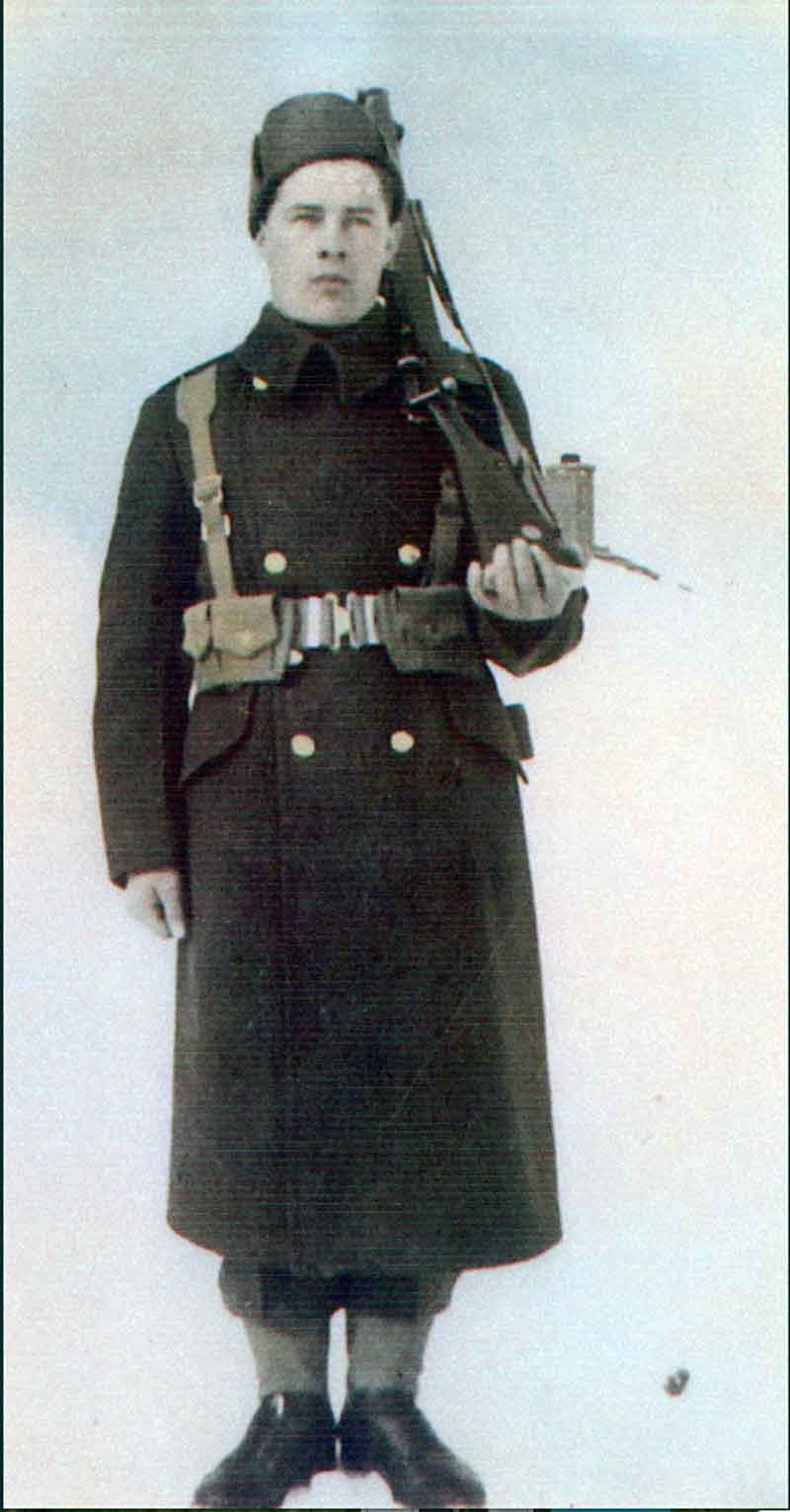
John Haldane (Jack) Renshaw [1884-1955], a guide and outfitter by summer, and a trapper by winter, worked out of McBride He was the eldest son of Robert Haldane Renshaw [1853-1931] and Laura Helen Renshaw (Thacker) [1863-1946). Robert was born in California, Laura in Oregon, and they were married in Lake Tahoe, Nevada. Their other children were George, Winnie (MacFayden), Emera [1897-1980], Helena (Lonsdale) [1899-1985], and Robert Haldane, Jr. [1906-1986]. The family came to Canada from Idaho in 1908.

“My father, mother and family followed the building of the Grand Trunk Pacific from Edmonton to Tête Jaune,” wrote Helena Lonsdale in 1977. “I say followed, we were always ahead of the steel, my father ran eating houses, they were never referred to as restaurants or cafes except the first one and that was in Edmonton in 1908. When Tête Jaune closed down in 1913 we moved to 49 (Henningville), which thrived for about a year. We moved from 49 to McBride in the early fall of 1914.”

In 1929 Emera Renshaw married Alexina Roe (b. 1906), a Scottish-born schoolteacher he met at Loos. After homesteading at Loos, they moved to McBride in 1946. Emera, a government log scaler, owned and operated the only pool room in McBride, a business he kept for 20 years. He was a veteran of World War One and was a member of the Canadian Legion and Elks. Alexina ran a cafe, and sold insurance and real estate. She was active in the Royal Purple, the Chamber of Commerce, and the McBride and District Hospital Board. In 1970 the Renshaws and the Lonsdales left McBride for Chase, B.C.

References:

  • Cautley, Richard William [1873–1953], and Wheeler, Arthur Oliver [1860–1945]. Report of the Commission appointed to delimit the boundary between the Provinces of Alberta and British Columbia. Part II. 1917 to 1921. From Kicking Horse Pass to Yellowhead Pass.. Ottawa: Office of the Surveyor General, 1924. Whyte Museum
  • Cautley, Richard William [1873–1953], and Wheeler, Arthur Oliver [1860–1945]. Report of the Commission Appointed to Delimit the Boundary between the Provinces of Alberta and British Columbia. Parts IIIA & IIIB, 1918 to 1924. From Yellowhead Pass Northerly. Ottawa: Office of the Surveyor General, 1925. Whyte Museum
  • Robson Valley Courier. Weekly newspaper published by Pyramid Press of Jasper from 1968–88 (1968–1988).
  • MacGregor, James Grierson [1905–1989]. Overland by the Yellowhead. Saskatoon: Western Producer, 1974. Internet Archive
  • Wheeler, Marilyn [1932–2016]. The Robson Valley Story. McBride, B.C.: Robson Valley Story Group, 1979
  • Wheeler, Marilyn [1932–2016]. The Robson Valley Story. McBride, B.C.: Robson Valley Story Group, 1979

Mount Quanstrom

British Columbia. Mount
Between headwaters of Castle Creek and Raush River
52.9347 N 120.1683 W — Map 093A16 — GoogleGeoHack
Name officially adopted in 1966
Official in BCCanada
Flying Officer William Quanstrom
Submitted for the project Operation Picture Me

Flying Officer William Quanstrom
Submitted for the project Operation Picture Me
Canadian Virtual War Memorial

Named to remember Royal Canadian Air Force Flying Officer William Quanstrom, J26350, from Quesnel. Serving with 12 (RAF) Squadron when his plane was shot down during air operations over the North Sea on 10 April 1944, age 27. With no known grave, his name is inscribed on the Runnymede Memorial, Surrey, UK, panel 248. Parents were Julius and Emma Elizabeth Quanstrom, Quesnel.

References:

Mount Pierrway

British Columbia. Mount
S of Mount Quanstrom, head of Castle Creek
52.875 N 120.14 W — Map 093A16 — GoogleGeoHack
Name officially adopted in 1966
Official in BCCanada

Named to remember Canadian Army gunner Alfred Pierrway, K 601413, from Quesnel, serving with the Royal Canadian Artillery when he was killed at Fort Garry on 12 July 1942, age 22. Buried at Prince George Cemetery, grave 4. 2. H. Survived by mother Lily Miller, Quesnel.

Soldier found dead in bush after storm

Possibly a victim of Saturday night’s violent electrical storm, Pte. Alfred Pierway, of the Artillery Training centre, Fort Garry, was found dead in the bush near the barracks early Sunday morning.

There is nothing to lead police to believe there was any foul play but the initial examination revealed that Pte. Pierway died of shock. “There is a strong possibility he may have been struck by lightning.” Dr. O. C. Trainor, pathologist of Misericordia hospital, who is conducting the post mortem, told The Tribune today.

“Lightning may leave extensive marks or none at ail on the body.”

Dr. Trainor said the body showed traces of alcoholism.

The only mark found on Pte. Pierway was a bruise on his left side. Pte. Pierway, formerly of Quesnel, B.C. had returned to Fort Garry shortly after midnight Saturday following a trip to Winnipeg. At 7 a.m. Sunday a university student discovered the body near the bus stop and notified Cpl. I. Morrison, on sentry duty.

Chief Alex Martin, of Fort Garry, is investigating the case. It is not known whether an inquest will be held or not until more results are reported from the postmortem.

— Winnipeg Evening Tribune
References:

Mount Phillips

Alberta-BC boundary. Mount
NW of Mount Robson
53.175 N 119.2597 W — Map 83E/3 — GoogleGeoHackBivouac
Earliest known reference to this name is 1912
Name officially adopted in 1923
Official in BCCanada
Elevation: 3246 m
Donald Phillips on Mt. Robson at altitude 12,000 feet.
Photo: Rev. G. B. Kinney, 1909

Donald Phillips on Mt. Robson at altitude 12,000 feet.
Photo: Rev. G. B. Kinney, 1909
Canadian Alpine Journal, 1910

“Back on the horizon line between Iyatunga and Titkana is a fine point that I am calling Phillips Mountain, in recognition of Donald Phillips, who made the ascent of Robson with Dr. Kinney,” wrote Charles Doolittle Walcott [1850–1927] of his 1912 trip to the Robson area.

Donald “Curly” Phillips [1884–1938] was a Jasper guide and outfitter who accompanied George R. B. Kinney [1872–1961] almost to the top of Mount Robson in 1909. They made several ascents, finally reaching, on Friday, August 13, what Kinney claimed was the peak. Phillips later stated that the highest point had not been reached.

References:

  • Walcott, Charles Doolittle [1850–1927]. “The monarch of the Canadian Rockies.” National Geographic Magazine, (1913):626. Internet Archive
  • Wheeler, Arthur Oliver [1860–1945]. “The Alpine Club of Canada’s expedition to Jasper Park, Yellowhead Pass and Mount Robson region, 1911.” Canadian Alpine Journal, Vol. 4 (1912):9-80
  • Swanson, James L. [1947–]. Banff: George Kinney and the first ascent of Mount Robson (1999). Spiral Road

Mount Pelee

British Columbia. Former name
Former name of Mount Fitzwilliam
52.8306 N 118.4569 W GoogleGeoHack
Not currently an official name.
Mount Peelee and the Yellowhead Lakes. Yellowhead Pass, sentineled by Mount Peelee and the Yellowhead Mountains, offers for the transcontinental railroads the lowest and easiest gateway through the Canadian Rockies. Photo by Rev. George Kinney. National Geographic 1911.

Mount Peelee and the Yellowhead Lakes. Yellowhead Pass, sentineled by Mount Peelee and the Yellowhead Mountains, offers for the transcontinental railroads the lowest and easiest gateway through the Canadian Rockies. Photo by Rev. George Kinney. National Geographic 1911.

Also see

References:

  • Walcott, Charles Doolittle [1850–1927], and Walcott Jr., Charles Doolittle [1889–1913]. “A Geologist’s Paradise.” National Geographic Magazine, 22, no. 6 (1911). Internet Archive

Mount Pauline

Alberta-BC boundary. Mount
Fraser River and Smoky River drainages
Near headwaters of Renshaw and Beaverdam creeks
53.535 N 119.8989 W — Map 083E12 — GoogleGeoHack
Earliest known reference to this name is 1925
Name officially adopted in 1925
Official in BCCanada

Frederick Arthur Pauline [1861-1955] was the new Agent-General for British Columbia at the time of this mountain’s naming in 1925. The mountain was formerly known as “Curly Mountain”, after Donald “Curly” Phillips [1884–1938], a local guide, but the present name was chosen to avoid duplication.

During the Alberta-British Columbia Boundary Commission surveys in 1923 a geodetic station “Curly” was established here. “Mount Pauline (not Curly Mtn)” identified in the 1930 BC Gazetteer.

References:

  • Cautley, Richard William [1873–1953], and Wheeler, Arthur Oliver [1860–1945]. Report of the Commission appointed to delimit the boundary between the Provinces of Alberta and British Columbia. Part II. 1917 to 1921. From Kicking Horse Pass to Yellowhead Pass.. Ottawa: Office of the Surveyor General, 1924. Whyte Museum
  • Cautley, Richard William [1873–1953], and Wheeler, Arthur Oliver [1860–1945]. Report of the Commission Appointed to Delimit the Boundary between the Provinces of Alberta and British Columbia. Parts IIIA & IIIB, 1918 to 1924. From Yellowhead Pass Northerly. Ottawa: Office of the Surveyor General, 1925. Whyte Museum
  • Karamitsanis, Aphrodite [1961–]. Place names of Alberta. Volume 1: Mountains, Mountain Parks and Foothills. Calgary: University of Calgary Press, 1991
  • British Columbia Geographical Names. Mount Pauline

Mount Mowat

British Columbia. Mount
E of Moose Lake
52.9422 N 118.7325 W — Map 083D15 — GoogleGeoHack
Name officially adopted in 1912
Official in BCTopo map from Canadian Geographical Names
Oliver Mowat

Oliver Mowat Wikipedia

In 1911, Arthur Oliver Wheeler [1860–1945] gave this mountain its name “owing to a resemblance seen from a certain point of view to the well known features of Sir Oliver Mowat” [1]. Kingston-born Oliver Mowat (1820-1903) was premier of Ontario from 1872 to 1896.

James Monroe Thorington and Howard Palmer state that “Mount Mowatt” was climbed in 1911 by Wheeler and Conrad Kain [1883–1934] “via Grant Brook from Grant Brook railway station” [2].

References:

  • 1. Wheeler, Arthur Oliver [1860–1945]. “The Alpine Club of Canada’s expedition to Jasper Park, Yellowhead Pass and Mount Robson region, 1911.” Canadian Alpine Journal, Vol. 4 (1912):9-80. Alpine Club of Canada [accessed 2 April 2025]
  • 2. Thorington, James Monroe [1895–1989], and Palmer, Howard [1883–1944]. A Climbers Guide to the Rocky Mountains of Canada. New York: American Alpine Club, 1921, p. 159. Internet Archive

Mount Morkill

Alberta-BC boundary. Mount
Near headwaters of Morkill River
53.7 N 119.8333 W — Map 83E/12 — GoogleGeoHack
Official in BCCanada

The camera station “Morkill” was established on this summit in 1923 (BC-Alberta boundary sheet #37, and Report Part III, p.62); so-named by the Interprovincial Boundary Commission in association with Morkill River and Morkill Pass.

References:

  • Fay, Samuel Prescott [1884–1971]. The Forgotten Explorer: Samuel Prescott Fay’s 1914 Expedition to the Northern Rockies. Edited by Charles Helm and Mike Murtha. Victoria, B.C.: Rocky Mountain Books, 2009
  • Interprovincial Boundary Commission. Boundary between Alberta and British Columbia. Sheet 37. Ottawa: Office of the Surveyor General, 1924. Internet Archive
  • Cautley, Richard William [1873–1953], and Wheeler, Arthur Oliver [1860–1945]. Report of the Commission Appointed to Delimit the Boundary between the Provinces of Alberta and British Columbia – Part III – from 1918 to 1924. Atlas. Ottawa: Office of the Surveyor General, 1925
  • British Columbia Geographical Names. Mount Morkill

Mount Monroe

British Columbia. Mount
N of McBride, S of McKale River
53.3972 N 120.1789 W — Map 93H/8 — GoogleGeoHack
Name officially adopted in 1965
Official in BCCanada
Stanley James Monroe

Stanley James Monroe
Canadian Virtual War Memorial

Named in remembrance of Canadian Army Lance Corporal Stanley James Monroe, K41218, from McBride, who was serving with the Canadian Forestry Corps when he was killed 1 July 1942, age 24.

Cpl. Stanley Monroe, 24, son of Adrian A. Monroe and Lela A. Monroe of McBride, B.C., formerly of Edmonton and more recently of Czar and Camrose, who was drowned recently in Lake St. Joseph, Quebec, while on routine duty. Funeral was held at McBride with military honors.

References:

  • McBride Cemetary. Grave markers. 2000
  • British Columbia Geographical Names. Mount Monroe
Also see: