British Columbia. Mount
N of junction of North Thompson River and Albreda River
52.6 N 119.1833 W — Map 83D/11 — Google — GeoHack
Earliest known reference to this name is 1863
Name officially adopted in 1961
Official in BC – Topo map from Canadian Geographical Names
N of junction of North Thompson River and Albreda River
52.6 N 119.1833 W — Map 83D/11 — Google — GeoHack
Earliest known reference to this name is 1863
Name officially adopted in 1961
Official in BC – Topo map from Canadian Geographical Names
This mount appears on:
Milton and Cheadle’s map 1865
Milton and Cheadle’s map 1865
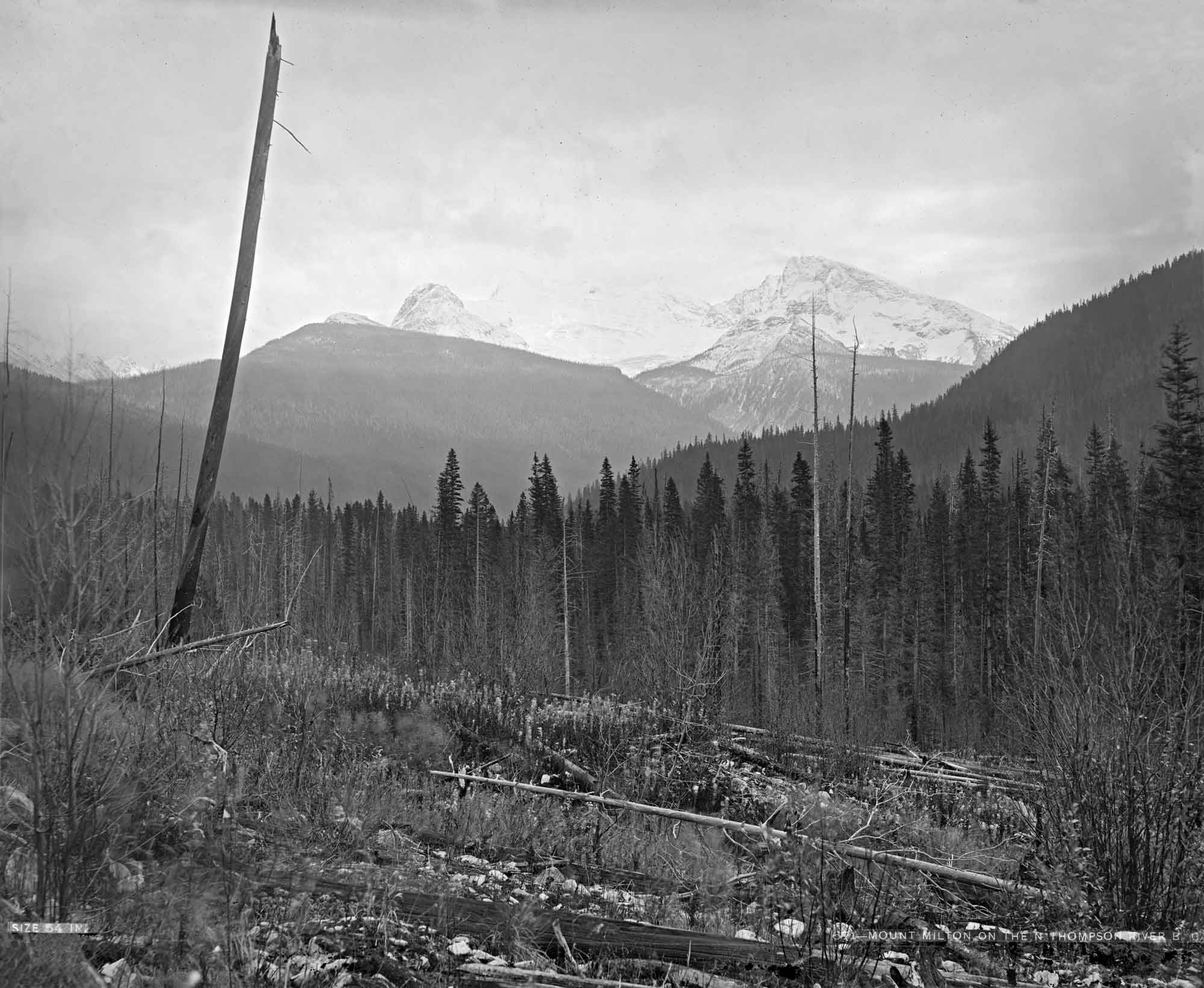
Mount Milton from Albreda Lake, on north branch of North Thompson River. Benjamin F. Baltzly, 1871
McCord Stewart Museum
William Wentworth Fitzwilliam Milton [1839–1877] journeyed across the northwest to the Pacific coast in 1862-63, accompanied by his physician, Walter Butler Cheadle [1835–1910].
In The North-West Passage by Land (London, 1865), the joint account of this expedition, they wrote, “We continued to follow the stream thus formed flowing south from Lake Albreda, which was reinforced by several branches from the westward, and saw before us a magnificent mountain, covered with glaciers, and apparently blocking up the valley before us. To this Cheadle gave the name of Mount Milton.”
References:
- Milton, William Wentworth Fitzwilliam [1839–1877], and Cheadle, Walter Butler [1835–1910]. The North-West Passage by Land. Being the narrative of an expedition from the Atlantic to the Pacific, undertaken with the view of exploring a route across the continent to British Columbia through British territory, by one of the northern passes in the Rocky Mountains. London: Cassell, Petter and Galpin, 1865. Internet Archive
- Zillmer, Raymond T. [1887–1960]. “The location of Mt. Milton and the restoration of the names ‘Mt. Milton and Mt. Cheadle’.” American Alpine Journal, Vol. 5, No. 1 (1943). American Alpine Club
- Wikipedia. William Wentworth-Fitzwilliam, Viscount Milton