Monthly Archives: March 2014

Clairvaux, Mount

Alberta-BC boundary. Mount
SE of Yellowhead Lake
52.8 N 118.4 W — Map 83D/16 — GoogleGeoHack
Earliest known reference to this name is 1917 (BC-Alberta Boundary sheet #29)
Name officially adopted in 1928
Official in BCCanada

“Clairvaux Mountain” adopted in Place Names of Alberta, 1928. Form of name changed to Mount Clairvaux in 1976, as originally labelled on BC-Alberta Boundary sheet 29, 1917.
Intended to express its situation at the head of a “clear valley.”

References:

Cinnamon Peak

British Columbia. Peak
SW of Mount Robson
53.0797 N 119.2572 W — Map 083E03 — GoogleGeoHack
Earliest known reference to this name is 1911 (Wheeler)
Name officially adopted in 1934
Official in BCCanada

In 1911, Arthur Oliver Wheeler [1860–1945] named this mountain Little Grizzly Peak “on account of its resemblance, on a small scale, to Mount Grizzly in the Selkirks.” Cinnamon is a coloration of the grizzly bear.

The well-known Cinnamon family of Robson Valley did not arrive in the area until the 1950s.

References:

  • Wheeler, Arthur Oliver [1860–1945]. “The Mountains of the Yellowhead Pass.” Alpine Journal, Vol. 26, No.198 (1912):382
  • British Columbia Geographical Names. Cinnamon Peak
Also see:

Chushina Ridge

Alberta-BC boundary. Ridge
Between Snowbird Pass and Lynx Mountain
53.1342 N 119.0486 W — Map 083E03 — GoogleGeoHack
Earliest known reference to this name is 1912 (Walcott)
Name officially adopted in 1924
Official in BCCanada

“Chushina” is a Stoney word signifying “small” and was thought to be descriptive of this ridge when members of a 1911 Alpine Club of Canada–Smithsonian Robson Expedition named this feature.

[From the crest of Phillips Mountain] a glacier slopes down for a mile and a half to the edge of the cliffs west of Snowbird Pass. It is such a fine example of a small and complete glacier from névé to foot that I think it worthy of the name Chushina.

Charles Doolittle Walcott [1850–1927]

Walcott applied his name to the glacier, but now it applies to the ridge.

“Chushina Ridge” is listed at Indigenous Geographical Names dataset as a word of undetermined language.

References:

  • Walcott, Charles Doolittle [1850–1927]. “The monarch of the Canadian Rockies.” National Geographic Magazine, (1913):626. Internet Archive
  • British Columbia Geographical Names. Chushina Ridge

Chushina Glacier

Alberta-BC boundary. Former name: Fraser River drainage
Between Snowbird Pass and Lynx Mountain
53.1417 N 119.05 W — Map 83E/3 — GoogleGeoHack
Not currently an official name.

From the crest of Phillips Mountain “a glacier slopes down for a mile and a half to the edge of the cliffs west of Snowbird Pass. It is such a fine example of a small and complete glacier from névé to foot that I think it worthy of the name Chushina,” wrote Charles Doolittle Walcott [1850–1927] after his 1912 reconnaissance of the Robson region.

References:

  • Walcott, Charles Doolittle [1850–1927]. “The monarch of the Canadian Rockies.” National Geographic Magazine, (1913):626. Internet Archive

Chilkst Peaks

British Columbia. Peaks
Premier Range
52.7047 N 119.6261 W — Map 083D12 — GoogleGeoHack
Name officially adopted in 1962
Official in BCCanada

The name was adopted in 1962 as submitted by mountaineer Gertrude Smith. “This is a ridge with 5 peaks … chilkst is the Shuswap word for 5.”

References:

Charles

British Columbia. Railway Point
Canadian National Railway N of Valemount
52.8694 N 119.2917 W — Map 83D/14 — GoogleGeoHack
Name officially adopted in 1989
Official in BCCanada
54 miles west of the Yellowhead Pass on the Canadian National Railway
Mile 72 in Albreda Subdivision (Jasper to Blue River as of 1977)
John Leslie Charles, 1914

John Leslie Charles, 1914
Wikipedia

This station on the Canadian National Railway is named for Major John Leslie Charles [1892–1992], long-time chief engineer of Canadian National Railway’s former western division in Winnipeg.

Charles was born in 1892 in Weybridge, Surrey, England, and moved to Winnipeg in 1910. He began working for the Grand Trunk Pacific Railway survey party in their Mountain division. Except during the World War I, Charles worked on the Hudson Bay Railway until its completion at Churchill, Maitoba, in 1930. He then worked for the Canadian National Railway for 55 years, progressing to the position of chief engineer of the Western Region.

Charles served in both World Wars. During World War I, he was promoted to the rank of major and was awarded the Distinguished Service Order. In World WarII, he recruited and commanded the 20th field company of the Royal Canadian Engineers. He also served with the American Army, surveying for a military railway connecting Alaska and Canada.

References:

Chappell Creek

British Columbia. Creek: North Thompson River drainage
Flows E into North Thompson River, S of junction with Albreda River
52.3833 N 119.1833 W — Map 83D/6 — GoogleGeoHack
Name officially adopted in 1962
Official in BCCanada
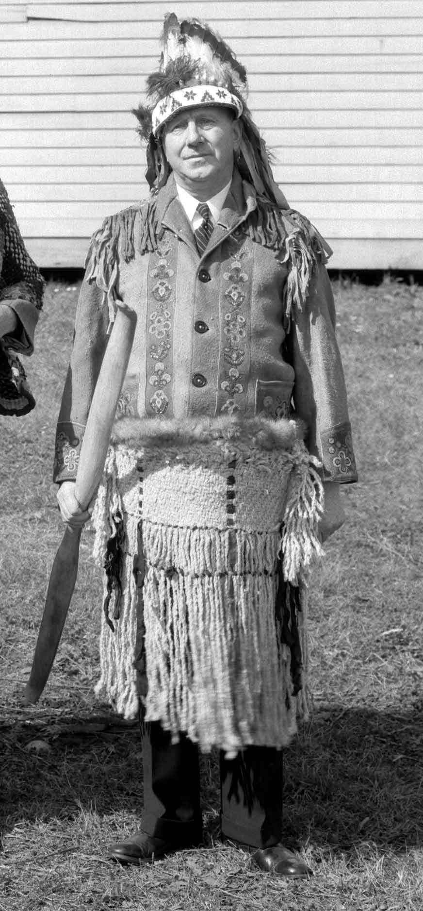
B. T. Chappell dressed as Chief Iron Horse at Canadian Pacific Exhibition.1935

B. T. Chappell dressed as Chief Iron Horse at Canadian Pacific Exhibition.1935
City of Vancouver Archives CVA 99-4710

Labelled “Gravel Creek” on 1911 survey plan and on BC map 3J, 1917; labelled “Pleasant Stream” on CNR plan, 1912. “Gravel Creek” adopted in the 1930 BC Gazetteer. Name changed to “Chappel [sic] Creek” 29 January 1962 Renamed Chappell Creek 25 January 1944 by F. C. Green, Surveyor-General of British Columbia, after Benjamin Thomas Chappell, superintendant of various western districts for Canadian National Railways. He started his railway career as news agent at Charlottetown on ICR in 1892; supervised the construction of the CNR line into Vancouver; appointed superintendant of Mountain Division, CNR, 1915; retired in 1942 as General Superintendant of Manitoba District with headquarters at Winnipeg. January 1944 letter from B.T. Chappell (file M.1.60)

— British Columbia Geographical Names

Chappell was honoured as Chief Iron Horse during a ceremonial function by eight Cree chiefs before leaving his Saskatchewan CNR post to assume his new position in British Columbia.

References:

Channell Road

Feature type: road
Province: British Columbia
Location: Forks N off Dunster-Croydon Road

Leslie S. (1891–1977) and Blanche A. (1898–1975) Channel moved from Edmonton to Dunster in 1914. Les was born in Kansas City, Missouri. and married Blanche in Edmonton in 1911. With his father Samuel Moire Channell (1863–1961) and brother John Raymond (1890–1960), Les was in the contracting business in Edmonton, hauling gravel by horse and sleigh for the High Level Bridge. Les and Blanche, Ray (d. 1960) and his wife Minnie (1891–1969) (born Springfield, Missouri) and parents Sam and Lulu all settled in the Dunster-Croydon area, where they logged poles and posts, ran a sawmill, and farmed. In 1925 the family moved to their homestead. Les was a farmer and blacksmith until 1972, when he retired to McBride.

References:

  • McBride cemetary. Grave markers.
  • Personal correspondence.
  • Robson Valley Courier. Weekly newspaper published by Pyramid Press of Jasper from1969–88.

Chamberlin Peak

British Columbia. Peak
SW of Mount Robson
52.6708 N 119.6031 W — Map 083D12 — GoogleGeoHack
Name officially adopted in 1963
Official in BCCanada
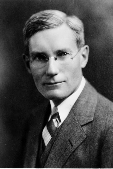
Rollin Thomas Chamberlin

Rollin Thomas Chamberlin
Smithsonian


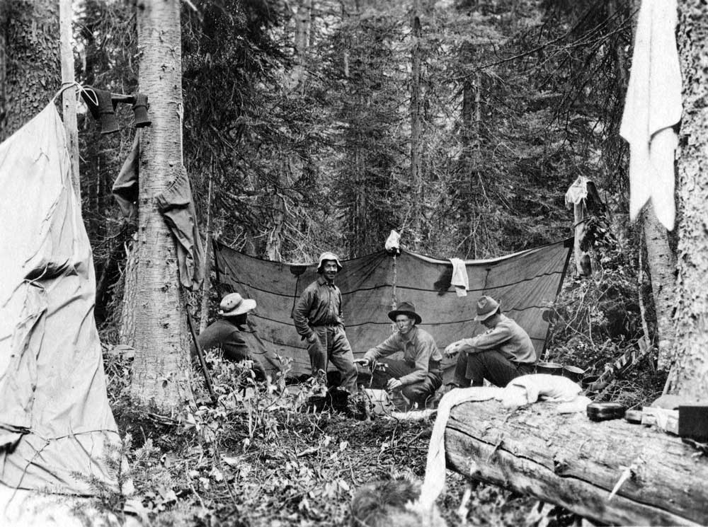
Rollin T. Chamberlin, L. E. “Slim” Goodell, Allen Carpe, A. L. Withers, George Burns

Rollin T. Chamberlin, L. E. “Slim” Goodell, Allen Carpe, A. L. Withers, George Burns
University of Chicago

The name “Mount Chamberlin” was suggested by the 1949 mountaineering party of Sterling Brown Hendricks [1902–1981] and Andrew John Kauffman [1920–2002]. “Chamberlin Peak” was adopted in 1963 by the British Columbia Geographical Names Office, as there was already a Mount Chamberlin, named in 1917 for the unrelated Edson Chamberlin, about 50 kilometres to the north near Mount Robson.

The name was submitted by Alpine Club of Canada [1906–] to recognize Rollin T. Chamberlin (1881–1948), geologist and mountaineer. Chamberlin ascended Tête Creek in 1924, and made several climbs in that area of the Cariboo Mountains, including the first ascent of Mount Sir Wilfrid Laurier (called Mount Titan at the time). Chamberlin, a professor of geology at the University of Chicago, was author of The Gases in Rocks.

The lower photo shows the Cariboo expedition conducting fieldwork. From left: Rollin T. Chamberlin, L. E. “Slim” Goodell (horse-packer), Allen Carpé [1894–1932] (explorer), A. L. (Pete) Withers , George Burns (horse-packer).

References:

  • Chamberlin, Rollin Thomas [1881–1948]. Rollin T. Chamberlin fonds V22. 1910–1927. Whyte Museum
  • Chamberlin, Rollin Thomas [1881–1948]. “Exploration of the Cariboo Mountains of British Columbia.” Bulletin of the Geographical Society of Philadelphia, 25 (1925):59-76
  • Carpé, Allen [1894–1932]. “Albreda Mountain.” Canadian Alpine Journal, Vol. 16 (1927–1927):177
  • Zillmer, Raymond T. [1887–1960]. “The exploration of the Cariboo Range from the east.” American Alpine Journal, 5:2 (1944):261-274. American Alpine Club
  • Hendricks, Sterling Brown [1902–1981], and Kauffman, Andrew John [1920–2002]. “Cariboo Climbing.” American Alpine Journal, 7:2 (1950). American Alpine Club
  • Pettijohn, F. J. “Rollin Thomas Chamberlin: a Biographical Memoir.” (1970). National Academy of Sciences