Feature type: creek
Province: British Columbia
Location: Flows SW into Fraser River near Doré River
Province: British Columbia
Location: Flows SW into Fraser River near Doré River
Frederick William (1886–1979) and Jessie Sterling (Gray) (1888–1975) Barnett were natives of Glasgow, Scotland, who lived in Croydon from 1922 until 1973. Fred came to Canada in 1905, moving from Calgary to Manitoba to Saskatchewan. When her mother died in 1907, Jessie also immigrated to Canada, settling in Montréal. Fred and Jessie, who had known each other since childhood, were married in 1910. Their daughters Nora and Louise were born in Saskatchewan. In the early 1920s the Barnetts read an article in the Winnipeg Free Press about homesteads in the Croydon-Dunster area. In 1922, after 12 years of fighting hailstorms and grasshoppers on the prairies, they moved to Croydon and started clearing land. Fred shipped strawberries to Jasper and raised mink and fox until the Depression put an end to these small businesses. They sold the homestead in 1939 and Jessie started a small store, also continuing as postmistress of Croydon, a position she had started in 1926. Fred worked as carpenter on the construction of the Alaska Highway. Jessie retired from the post office in 1968, at the age of 81, and the office was closed. In 1973, they sold the one-and-a-half acre property and moved to McBride.
Possibly named for Ross Bailey [d. 1962], an employee ofCanadian National Railway for 15 years, working at various points between Jasper and Vancouver. At the time of his death he lived in Red Pass Junction (1).
“Mt. Bagg” appears on the “Preliminary Map of the Canadian Rocky Mountains between Jarvis Pass and Yellowhead Pass” showing the route followed by Mary Lenore Jobe Akeley [1878–1966] in August 1914 with guide Donald “Curly” Phillips [1884–1938].
The name was adopted in 1965 as labelled on BC Lands’ map 1G, 1916. Origin/significance not recorded.
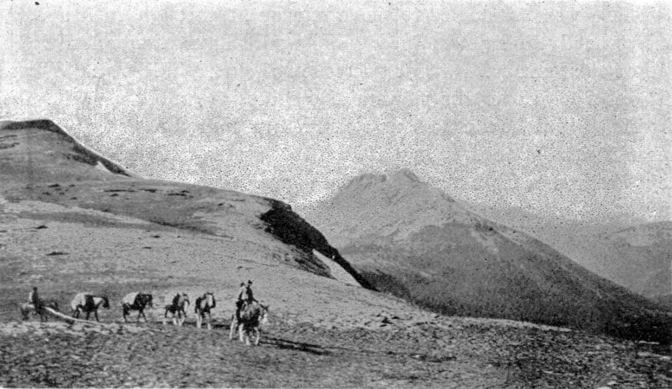
Alpland above Avalanche Pass, 1914.
Bulletin of the American Geographical Society
The pass was named by members of the 1914 expedition to Mount Sir Alexander (then know as Mount Kitchi) led by Mary Lenore Jobe Akeley [1878–1966] and Donald “Curly” Phillips [1884–1938].
From Jones Pass we cut our way through dense woods down a steep declivity to broad open muskeg on the West Branch of the Jack Pine. After traveling about six miles through this meadow we came to a low pass, 5,300 feet, filled with beaver dams and houses. We named this pass Beaver Dam Pass. It separates Fraser and Peace waters. Another broad stretch of muskeg and we reached another pass, on which a huge avalanche of trees and rocks had descended. At Avalanche Pass our aneroid registered 5,300 feet. Our further progress was here checked by dense woods filled with an undergrowth of devils’ club and rhododendron of the British Columbia variety.
— Jobe 1914
“The reason for the name is unknown,” wrote boundary surveyor Arthur Oliver Wheeler [1860–1945] in 1924, “but may be due to a snow-slide that happened close by the summit of the pass many years ago and has left some rotting debris of the timber it swept down at the time. It is not a spectacular slide and but slight indication of it is left to tell the tale. There are no other indications of avalanches in the immediate vicinity.”
Adopted in 1951 on Jasper Park (North) sheet (file J.1.34), as identified on Canadian National Railway timetables; name cancelled in 1989.
Grand Trunk Pacific Railway station Mount Robson (railway point) had originally been located here, but the station by that name was relocated southward and the Canadian National Railway renamed the facility at this location “Alpland” in 1924.
Adopted 31 December 1973 in the 1973 Cumulative Supplement to the 1966 BC Gazetteer, as recommended March 1972 by BC Parks “…the ridge lies above the railway station of Alpland.”
Louie Knutson [1891-1982] was one of the first persons of European descent to settle in the Robson valley. Born in Norway, Knutson emigrated to Canada from the United States in 1910. After a short stint logging on Vancouver Island, he bought two pack horses in Edmonton and headed for the North Thompson valley. He spent the summer in the hills and in the fall came out the Raush River valley to McBride.
After surveying the tar sands for the Alberta government, in 1911 he returned to McBride and went to work for the Grand Trunk Pacific Railway. He was soon back trapping the North Thompson. On a trip out he married Francis Rose Frye [1905–1992], sister of Ella and Mike Frye. Francis was born in North Dakota and had come with her family to the Valemount area in 1911.
Louie and Francis spent their honeymoon on the trapline. Louis discovered a deposit of high-grade ore at the headwaters of the Azure and Hobson rivers in 1916. He built trails and worked this property until he was unable to walk, but failed to get anything out of it. The site was closed to development when it became part of Wells Grey Provincial Park.
Adolph Anderson was a guide and trapper on the North Thompson River. The creek was named in 1932 in association with War Colt Group of mineral claims in this vicinity, owned by Adolph Anderson and Louis Knutson of Albreda.
Pinkney Bee Abernathy [1900–1961] and his wife Elizabeth [b. 1905] arrived at Red Pass from Gainford, Alberta, in 1949. Abernathy, a native of North Carolina, set up a lumber mill at Swift Current Creek, which he operated until 1960.
A supporter of the Yellowhead Route, he worked on the construction of the highway through Mount Robson Park. Before there was year-round maintenance of this section of Highway 16, Abernathy kept the road open to obtain mail and freight from Red Pass and to reach a long-distance phone at Jasper.