Monthly Archives: March 2014

Ptarmigan Peak

British Columbia. Former unofficial name
Former name for Titkana Peak
52.05 N 119.2333 W — Map 83D/3 — GoogleGeoHack
Not currently an official name.
Grouse - Ptarmigan, Mount Robson
William James Topley, 1914

Grouse – Ptarmigan, Mount Robson
William James Topley, 1914
Library and Archives Canada

“My brother one day climbed Ptarmigan Mountain to have a look over that side of Mount Robson, but saw little through the clouds,” wrote Arthur Philemon Coleman [1852–1939] of his 1908 expedition to Mount Robson with his brother Lucius Quincy Coleman [1854–1935] and George R. B. Kinney [1872–1961].

The name was changed to “Titkana Peak” to avoid duplication.

References:

  • Coleman, Arthur Philemon [1852–1939]. The Canadian Rockies: New and Old Trails. London: T. Fisher Unwin, 1911, p. 377. Internet Archive
Also see:

Premier Range

British Columbia. Range
Columbia River and Fraser River and North Thompson River drainages
Headwaters of the Raush, North Thompson, McLennan, Albreda, Camp, and Canoe rivers
52.75 N 119.55 W — Map 83D/12 — GoogleGeoHack
Earliest known reference to this name is 1927 (as “Premier Group”)
Name officially adopted in 1962
Official in BCCanada

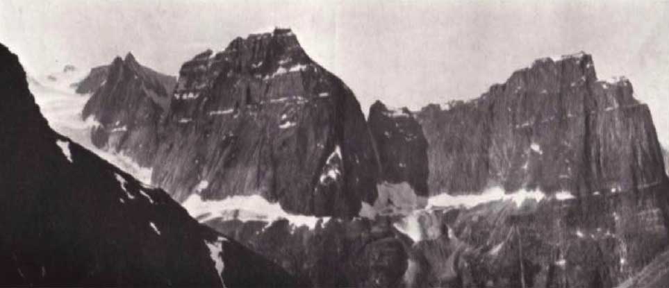
“Premier Group” of mountains, later “Premier Range,” was proclaimed in 1927 to commemorate prime ministers of Canada and Great Britain and premiers of British Columbia. The occasion of the proclimation was the Diamond Jubilee of Confederation. Canada celebrated 60 years of Dominion in 1927.

The range was in initially designated “Premier Group” by Order in Council, as arraigned by the government of British Columbia and the Geographic Board of Canada. The form of the name was changed to “Premier Range” in 1962, and it was declared that those peaks over 10,000 feet would be named after deceased former prime ministers of Canada.

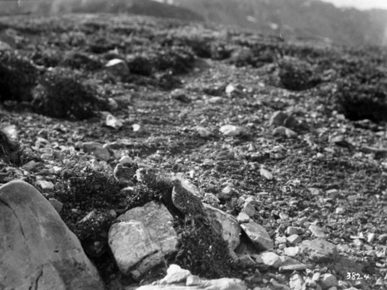
Most of the mountains already had unofficial names bestowed by early explorers, recognizing people, features, and events. Those names, many of them featured on maps published in the Canadian Alpine Journal, were replaced by the names of mostly distant politicians. John Oliver came close when he visited McBride in 1925, where his daughter taught school and was principal. Laurier visited Kamloops in 1910, when, learning that he was in favour of larger reserves and recognition of aboriginal title, the chiefs of the Shuswap, Okanagan, and Thompson tribes presented him with a petition condemning BC land policies and game laws and rejecting BC’s takeover of their lands.

Several peaks had unofficial names that were superseded:

Laurier Glacier — not Hostility Glacier
Mount Arthur Meighen — not Mount Carpé
Mount Richard Bennett — not Mount Goddell
Mount Mackenzie King — not Hostility Mountain
Tête Glacier — not Holway Glacier
Penny Mountain — not Holways Peak

As well, the following names were no longer to be used:

Chamberlin, Mount
Withers, Mount
Crescent Mountain
Mount David
Forks Peak
Pyramid Peak
Mount Zillmer
Incisor Peak

Mount Zillmer, however, remains in official use.

There are 16 peaks above 9800 feet still unnamed in the Premier Range, of which 7 peaks exceed 10,000 feet. Other than the 1927 decision to name the highest peak (11,750 feet) after Sir Wilfrid Laurier, the relative elevation and location have not been considered when designating the peaks in this range.

References:

  • Anon. “Place names in the Premier Range, Cariboo Mountains, B.C.” Canadian Alpine Journal, Vol. 46 (1963):20
  • British Columbia Geographical Names. Premier Range
  • Wikipedia. Premier Range

Postern Mountain

British Columbia. Mountain
Headwaters of Geikie Creek
52.7 N 118.3667 W — Map 83D/9 — GoogleGeoHack
Earliest known reference to this name is 1921 (Boundary Survey)
Name officially adopted in 1951
Official in BCCanada
Mt. Casemate (left) and Mt. Postern (right) looking across the Geikie Valley from Drawbridge
Cyril G. Wates, 1926

Mt. Casemate (left) and Mt. Postern (right) looking across the Geikie Valley from Drawbridge
Cyril G. Wates, 1926
Canadian Alpine Journal 1927

Postern means “placed at the back.” The feature was named by the commissioners of the Alberta-British Columbia Boundary Survey in 1921.

References:

  • Cautley, Richard William [1873–1953], and Wheeler, Arthur Oliver [1860–1945]. Report of the Commission appointed to delimit the boundary between the Provinces of Alberta and British Columbia. Part II. 1917 to 1921. From Kicking Horse Pass to Yellowhead Pass.. Ottawa: Office of the Surveyor General, 1924. Whyte Museum
  • Cautley, Richard William [1873–1953], and Wheeler, Arthur Oliver [1860–1945]. Report of the Commission Appointed to Delimit the Boundary between the Provinces of Alberta and British Columbia. Parts IIIA & IIIB, 1918 to 1924. From Yellowhead Pass Northerly. Ottawa: Office of the Surveyor General, 1925. Whyte Museum
  • Wates, Cyril G. [1883–1946], and Gibson, E. Rex [1892–1957]. “The Ramparts in 1927.” Canadian Alpine Journal, Vol. 16 (1927):85-95
Also see:

Poser

British Columbia. Railway point
Canadian National Railway siding, between Legrand and Goat River (railway point)
53.4306 N 120.4125 W — Map 93H/8 — GoogleGeoHack
Name officially adopted in 1989
Official in BCCanada
105 miles west of the Yellowhead Pass on the Canadian National Railway
Mile 15 in Fraser Subdivision (McBride to Prince George as of 1977)

Charles Poser was resident engineer of construction on the Grand Trunk Pacific Railway between McBride and Prince George during 1912 and 1913.

References:

  • CN (Canadian National Railway). Transportation planning branch, Edmonton, and historical office, Montréal. 2000

Portcullis Peak

British Columbia. Peak
S of Geikie Creek
52.675 N 118.4 W — Map 083D09 — GoogleGeoHack
Name officially adopted in 1951
Official in BCCanada

A portcullis is a strong frame or grating, formed of vertical and horizontal bars of wood or iron, suspended by chains, and made to slide up and down in vertical grooves at the sides of the gateway of a fortress, so as to be capable of being quickly let down as a defence against assault. The feature was named by the survetors of the Alberta-British Columbia Boundary Commission in 1921.

References:

  • Cautley, Richard William [1873–1953], and Wheeler, Arthur Oliver [1860–1945]. Report of the Commission appointed to delimit the boundary between the Provinces of Alberta and British Columbia. Part II. 1917 to 1921. From Kicking Horse Pass to Yellowhead Pass.. Ottawa: Office of the Surveyor General, 1924. Whyte Museum
  • Cautley, Richard William [1873–1953], and Wheeler, Arthur Oliver [1860–1945]. Report of the Commission Appointed to Delimit the Boundary between the Provinces of Alberta and British Columbia. Parts IIIA & IIIB, 1918 to 1924. From Yellowhead Pass Northerly. Ottawa: Office of the Surveyor General, 1925. Whyte Museum