Alberta-BC boundary. Ridge
E of head of Moose River
53.2067 N 118.8903 W — Map 083E02 — Google — GeoHack
Name officially adopted in 1923
Official in BC – Canada
E of head of Moose River
53.2067 N 118.8903 W — Map 083E02 — Google — GeoHack
Name officially adopted in 1923
Official in BC – Canada
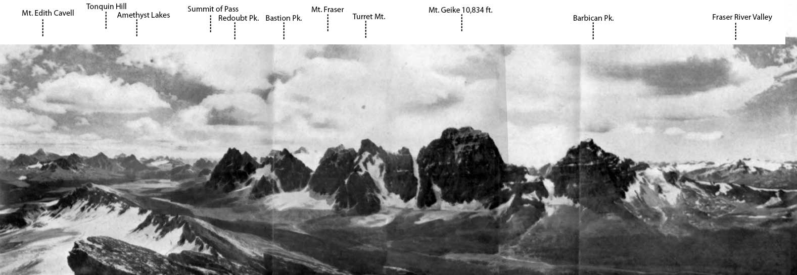
This ridge appears on:
Boundary Commission Sheet 31 (surveyed in 1922)
Boundary Commission Sheet 31 (surveyed in 1922)
A treadmill is a horizontal cylinder made to revolve by persons walking on its periphery. Though doing work, they do not gain any distance.
The feature was named by the Alberta-British Columbia Boundary Commission in 1922.
References:
- Cautley, Richard William [1873–1953], and Wheeler, Arthur Oliver [1860–1945]. Report of the Commission appointed to delimit the boundary between the Provinces of Alberta and British Columbia. Part II. 1917 to 1921. From Kicking Horse Pass to Yellowhead Pass.. Ottawa: Office of the Surveyor General, 1924. Whyte Museum
- Cautley, Richard William [1873–1953], and Wheeler, Arthur Oliver [1860–1945]. Report of the Commission Appointed to Delimit the Boundary between the Provinces of Alberta and British Columbia. Parts IIIA & IIIB, 1918 to 1924. From Yellowhead Pass Northerly. Ottawa: Office of the Surveyor General, 1925. Whyte Museum