Category Archives: People

Hugh Edward Millington Stutfield

Hugh Edward Millington Stutfield [1858–1929]

b. 1858 — Turriff, county of Banff, Scotland
d. 1929

Stutfield was a solicitor, an alpine climber, and an author. He accompanied John Norman Collie [1859–1942] on some of his trips to Canada. Stutfield’s talent as a first-rate marksman saved the party from starvation on many an occasion.

He is listed in Foster’s Men-at-the-Bar (p. 453):

Stutfield, Hugh Edward Millington, B.A., Trin. Coll., Camb., 1881, a student of the Inner Temple 12 April, 1880 (then aged 22), called to the bar 17 Nov., 1884 (3rd son of William Stutfield, of Turriff, N.B.); born 1858.

which volume also contains this fragment about Stutfield’s elder brother:

… 1881 (2nd son of William Stutfield, Esq., of Netherdale, Turriff, co. Banff); born y – 19, Old Buildings, Lincoln’s Inn, W.C.

The location Turriff, county Banff, “N.B.”, presumably refers to “North Britain”, or Scotland, as it was sometime called. Netherdale is the name of the particular dwelling, still extant.

The three adventurers associated with the discovery of the Columbia Icefield were Hugh Millington Stutfield, Hermann Woolley and John Norman Collie. Stutfield was a wealthy British stockbroker who through careful and considered investment was able to retire early from the London Stock Exchange and pursue his interest in travel. He was also a crack shot with a rifle and shotgun, a talent that later allowed him to save his fellow climbers from a difficult predicament in Canada with respect to supplies. It was this same talent, however, that caused him to be hunting instead of climbing when the full extent of the Columbia Icefield was discovered in 1898.

— Sandford
Events in the Mount Robson region in which Stutfield was involved:

    1898 Stutfield, Collie, Woolley explore upper Athabasca
Sources of biographical information about Stutfield:

  • Foster, Joseph. Men-at-the-Bar: A Biographical Hand-List of the Members of the Various Inns of Court. London: Hazell, Watson, and Viney, 1885 Google Books
  • Sandford, Robert W. Ecology & Wonder in the Canadian Rocky Mountain Parks World Heritage Site.
    Athabasca University Press, 2010 Google Books
Works pertinent to the Mount Robson region of which Stutfield was author or co-author:

  • —   “Mountain exploration in the Canadian Rockies.” S.L., S.N. (1899). Hathi Trust
  • —   “Mountain Travel and Climbs in British Columbia.” Alpine Journal, 20 (1900–1901):491
  • —  and Collie, John Norman [1859–1942]. Climbs and Explorations in the Canadian Rockies. London: Longmans, Green, 1903. University of British Columbia Library

James Alexander Walker

James Alexander Walker

James Alexander Walker

James Alexander Walker B.C.L.S.
b. 1887 — Guelph, Ontario
d. 1959 — Vancouver, British Columbia

British Columbia Land Surveyor James Alexander Walker started surveys in the upper Fraser River area in 1912, during the construction of the Grand Trunk Pacific Railway. In 1913 and 1914, he surveyed within the three-mile land reserve on the Fraser near McBride, subdividing the country into 40-acre tracts. That year 80,000 acres of land were opened by the provincial government. Walker reported that “a great rush resulted, about 175 pre-emptions having been filed upon. All summer clearing land and building cabins have been the chief industries in the valley. A splendid type of settlers, by far the majority of whom are English-speaking, has come in. There are no Indians in the valley from Tête Jaune Cache to the Fort George Indian reserves.”

Walker was educated in Guelph Public Schools and Collegiate Institute and at the University of Toronto, from which he obtained a diploma in civil engineering in 1908, a bachelor in applied science in 1910, and a post-graduate degree of a civil engineer in 1926. In 1915 Walker entered private practice in civil engineering and surveying, but he gave up this work to enlist with the Canadian Expeditionary Forces. In 1916 he trained in the first course given by the Royal School of Infantry in Esquimalt, B.C. He received his commission as lieutenant in the 72nd Seaforth Highlanders of Canada and trained with Yukon Infantry Company’s 225th Battalion. Being refused for overseas service, he was transferred to the Canadian Field Artillery with headquarters in Ottawa.

After 1919 Walker established a private practice in Vancouver and subsequently served on planning commissions in that city.

Works pertinent to the Mount Robson region of which Walker was author:

  • —   Report on Surveys on the South Fork of Fraser River, Cariboo Disrict. Victoria, B.C.: Legislative Assembly, 1913. Google Books
  • —   “South fork of Fraser River, Dore River to Clearwater River. December 15, 1913.” Report of the Minister of Lands, (1914). Google Books
  • —   “South fork of Fraser River, vicinity of McBride. November 11, 1914.” Report of the Minister of Lands for the Province of British Columbia for the Year Ending 31st December 1914, (1915). Google Books
Walker is the namesake of the following places in the Mount Robson region:

Walker named these places:

Events in the Mount Robson region in which Walker was involved:

    1912-1914 Walker surveys upper Fraser
References:

  • Association of British Columbia Land Surveyors. Annual Report (1956).
  • City of Vancouver Archives. Walker, J. Alexander (2000). City of Vancouver Archives

Conrad Kain

Conrad Kain [1883–1934]

b. 1883 — Nasswald, Austria
d. 1934 — Cranbrook, British Columbia, Canada

Kain was an Austrian mountain guide who guided extensively in Europe, Canada, and New Zealand, and was responsible for the first ascents of more than 60 routes in British Columbia. He is particularly known for pioneering climbs in the Purcell Mountains and the first ascents of Mount Robson (1913), Mount Louis (1916) and Bugaboo Spire (1916).

Sources of biographical information about Kain:

  • Thorington, James Monroe [1895–1989]. “Conrad Kain, In memoriam.” Canadian Alpine Journal, Vol. 22 (1933):184-187
  • Kain, Conrad [1883–1934], and Thorington, James Monroe [1895–1989], editor. Where the Clouds Can Go. New York City: American Alpine Club, 1935
  • Wikipedia Conrad Kain
Kain is the namesake of the following places in the Mount Robson region:

Events in the Mount Robson region in which Kain was involved:

  • 1911 ACC-Smithsonian Robson expedition (guide)
  • 1913 ACC Camp – Mount Robson (guide)
  • 1924 Thorington to Tonquin Valley (guide)
  • 1924 ACC Camp – Mount Robson (guide)
Works pertinent to the Mount Robson region of which Kain was author or co-author:

  • —   Banff: Whyte Museum Archives. Die Erstbesteigung des Höchsten Giflei der Rockies, Mt. Robson (1913).
  • —   “The ascent of Mt. Robson.” Alpine Journal, Vol. 28 (1914):35
  • —   “The first ascent of Mt. Robson, the highest peak of the Rockies.” Canadian Alpine Journal, Vol. 6 (1914–1915):22-
  • —   “First ascent of Mt. Whitehorn.” Canadian Alpine Journal, Vol. 6 (1914–1915):42-43
  • —  and Thorington, James Monroe [1895–1989], editor. Where the Clouds Can Go. New York City: American Alpine Club, 1935

Arnold Louis Mumm

A. L. Mumm and guide Moritz Inderbinen. Mount Robson Camp on Snowbird Pass.
Photo by Frank W. Freeborn, 1913

A. L. Mumm and guide Moritz Inderbinen. Mount Robson Camp on Snowbird Pass.
Photo by Frank W. Freeborn, 1913
Canadian Alpine Journal 1915

Arnold Louis Mumm [1859–1927]

b. 1859 — London, England
d. 1927 — Bay of Biscay, Atlantic Ocean

Mumm, a London publisher, first came to Canada in 1909, at the invitation of Alpine Club of Canada director Arthur Oliver Wheeler [1860–1945]. After attending the 1909 ACC camp at Lake O’Hara, Mumm, along with Leopold Charles Maurice Stennett Amery [1873–1955], Geoffrey Hastings [1860–1941], and Moritz Inderbinen [1856–1926], made an attempt on Mount Robson. On their way to the mountain, they met George R. B. Kinney [1872–1961], who reported that he and Donald “Curly” Phillips [1884–1938] had been successful on their own attempt (a claim later disputed). Mumm’s party, hobbled by difficulties of the route and lack of time, was not successful.

Mumm returned with British professor John Norman Collie [1859–1942] in July, 1910, when the Grand Trunk Pacific Railway’s steel had been laid as far as Wolf Creek, about one hundred miles east of theYellowhead Pass. The party spent some time about Mount Robson, but there was so much snow on the mountains and the weather was so stormy that climbing was out of the question, and they were able to ascend only some of the lesser peaks.

The next summer, 1911, Collie and Mumm made another trip, the first to go north of the Athabasca to explore and climb. They ascended the Stoney River, crossed a high pass to the Smoky River, then up Glacier Creek, which they ascended to Mount Bess.

In 1913 Mumm decided to climb Mount Geikie, which three years earlier, when on Yellowhead Mountain, he had seen rising far above its fellows. He was turned back by a storm. Mumm made many climbs in the Alps, Canada, Japan and New Zealand, in addition to accompanying Tom George Longstaff [1875–1964] to the Himalayas.

Sources of biographical information about Mumm:

  • Wheeler, Arthur Oliver [1860–1945]. “A. L. Mumm — An Appreciation.” Canadian Alpine Journal, Vol. 16 (1927–1927):173-175
Mumm is the namesake of the following places in the Mount Robson region:

Events in the Mount Robson region in which Mumm was involved:

  • 1906 ACC organized, Mount Robson attempt proposed
  • 1909 English party at Robson
  • 1909 ACC Camp – Lake O’Hara (guest)
  • 1910 Mumm and Collie at Robson
  • 1911 Collie and Mumm Mt Bess
  • 1913 Mumm explores Whirlpool River, Athabasca Pass
  • 1913 ACC Camp – Mount Robson
Works pertinent to the Mount Robson region of which Mumm was author or co-author:

  • —   “An attempt on Mount Robson.” Alpine Journal, Vol. 25 (1910–1911):90
  • —   “An expedition to Mount Robson.” Canadian Alpine Journal, Vol. 2, No. 2 (1910):10-20
  • —   “Mount Robson District. Mumm and Collie’s 1910 Journey.” Alpine Journal, Vol. 25 (1910–1911):466
  • —   “A trip up the Whirlpool River.” Alpine Journal, Vol. 28 (1914):355

Simon Fraser

Simon Fraser

Simon Fraser

Simon Fraser
b. 20 May 1776 — Mapletown, New York, USA
d. 18 August 1862 — St. Andrews West, Ontario

Fraser opened the fur trade west of the Rocky Mountains, and was the first person of European descent to descend the Fraser River to its mouth. Fraser was came to Québec with his mother after his father, a Loyalist officer, died as a prisoner of war during the American Revolution. Fraser joined the North West Company [1779–1821] in 1792 and was sent to the Athabasca department. He became a partner in the company in 1801. He founded the New Caledonia posts of McLeod Lake (1805), Stuart Lake (later Fort St. James, 1806), Fraser Lake (1806) and Fort George (1807).

During May and June of 1808, with a party of nineteen French Canadian voyageurs, two clerks, and two Native Americans, Fraser made his journey down the Fraser River from just upstream of present-day Prince George to present-day Vancouver. It was a bitter disappointment for him to discover that the river was not the Columbia, and that it was not a practical canoe route to the coast.

Works pertinent to the Mount Robson region of which Fraser was author or co-author:

  • —  and Lamb, William Kaye [1904–1999], editor. The letters and journals of Simon Fraser, 1806-1808. Toronto: MacMillan, 1960. Internet Archive [accessed 3/10/2025]
Fraser is credited with naming the following places:

Events in the Mount Robson region in which Fraser was involved:

  • 1805 Fraser into New Caledonia
  • 1807 Fraser founds Fort George
  • 1808 Fraser descends Fraser
References:

  • Fraser, Simon [1776–1862], and Lamb, William Kaye [1904–1999], editor. The letters and journals of Simon Fraser, 1806-1808. Toronto: MacMillan, 1960. Internet Archive [accessed 10 March 2025]
  • Wikipedia. Simon Fraser

Pierre Bostonais dit “Tête Jaune”

Pierre Bostonais dit “Tête Jaune”
d. 1827 — Finlay’s Branch, New Caledonia

“Tête Jaune” (“Yellow Head”) was the nickname of Pierre Bostonais, an Iroquois who worked for the North West and Hudson’s Bay fur trading companies. During the fur trade, a cache (French for a hiding place) was built by removing a round piece of turf about 50 cm across, excavating the dirt, and lining the excavation with dry branches. After the cached goods were inserted, some earth and the round piece of turf were put on top, and the surplus earth all carefully removed.

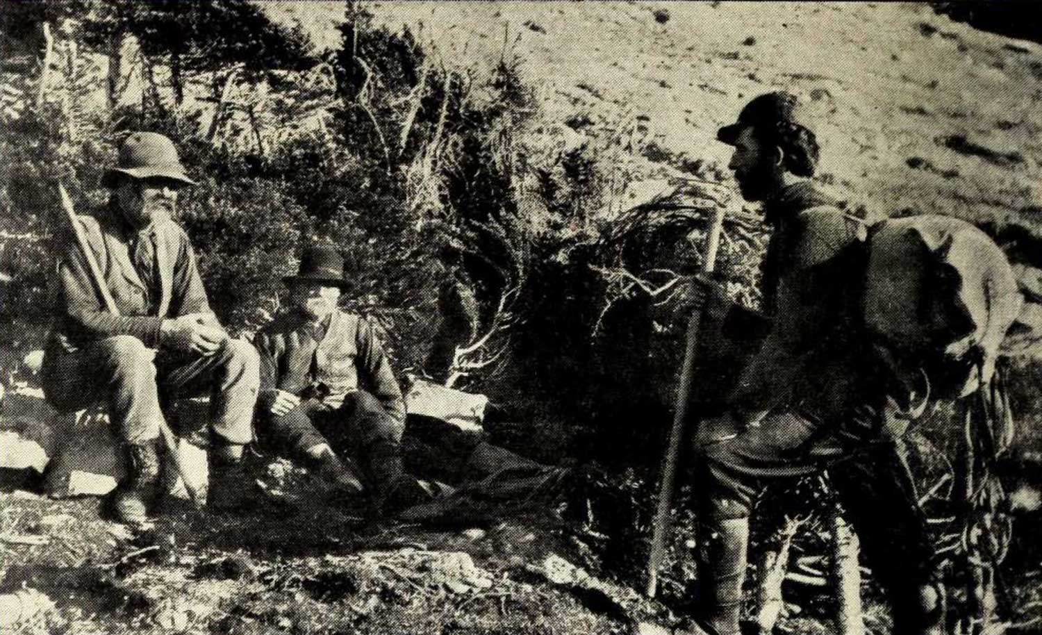
According to Milton and Cheadle, who crossed the Yellowhead Pass in 1863, Bostonais’s original cache was at the confluence of the Robson River and Fraser River. The present location of Tête Jaune Cache is near the site selected during the construction of the Grand Trunk Pacific Railway, at the head of navigation on the Fraser River.

“Bostonais” was a name applied by Indigenous people to Americans of European descent, “Boston Men.” Normally a nickname, Pierre Bostonais may have acquired it as a family name after his family moved from American territory to the Montreal area. (As early as 1670, a number of Iroquois, converted by French priests, left what is now New York State to live near Montreal.) Iroquois were brought out west by the fur trade companies in the late eighteenth and early nineteenth centuries, as voyageurs, hunters, guides, and trappers. Many Iroquois stayed in the west when their contracts with the fur companies expired, settling east of the Rockies between the Athabasca and Peace Rivers.

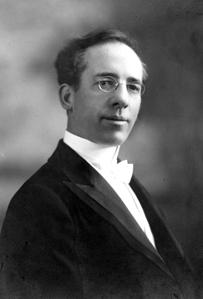
Pierre Bostonais first appears in the archives of the Hudson’s Bay Company in January 1805, when the factor at the fur trading post of St. Croix (now in Minnesota) wrote, “This afternoon Tête Jaune’s son expired after a long and painful malady of upwards of three months.” In 1810 Tête Jaune was for a time employed by the North West Company, perhaps arriving at Rocky Mountain House, on the North Saskatchewan River. By 1816, when he is mentioned in the North West Company ledger, Tête Jaune was a “free” Iroquois, not engaged to any fur trade company. Twice in Hudson’s Bay Company books from 1821 to 1823 there are entries of “Pierre Bostonais dit Tête Jaune.”

Colin Robertson [1783–1842], in charge of Fort St. Mary (near the present-day town of Peace River, British Columbia), recorded in his journal for December 1819, “Tête Jaune, the free Iroquois, has given me a chart of that country across the Rocky Mountains.” Tête Jaune guided a party across the mountains the next spring and returned at the end of October. “Tête Jaune and Brother Baptiste arrived — the Iroquois all enjoyed themselves with a booze.” Tête Jaune and Baptiste appear again in 1825, when the Hudson’s Bay Company required a guide over the Yellowhead Pass, then a little-known route. (There is no record that this pass was used by either company prior to 1824, when chief trader Joseph Felix LaRocque tried to establish a post at “Moose or Cranberry Lake.”)

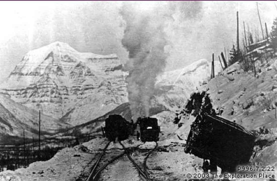
In 1825, Hudson’s Bay Company governor George Simpson [1792–1860] ordered chief trader James McMillan [1783-1858] to explore the pass. At Jasper House, McMillan hired Tête Jaune as guide. They left Jasper House on 18 October, and by October 24, after a trip of about 120 miles, reached Tête Jaune Cache. In his report to William Connolly, McMillan specifically mentioned “Tête Jaune’s Cache,” the first recorded reference to this place name.

Tête Jaune probably spent the winter of 1825-26 at Fort Alexandria, on the Fraser River north of Quesnel. In early May 1826, just before the departure of the fur brigade from Fort St. James for Fort Vancouver, Connolly received word about the “Iroquois guide who remains sick at Alexandria.”

In early November 1826, Tête Jaune and Baptiste arrived at Fort St. James. “In the evening that old rogue Tête Jaune, and his brother, arrived from below, dread of the Carriers who threaten vengeance for the death of their relatives, is the cause of their coming this way. These people brought nearly one Pack of Beaver between them.”

Tête Jaune and Baptiste apparently spent the winter of 1826–27 with the Carriers (Dakelh). The brothers returned to Fort St. James in mid-April. Connolly wrote, “I never saw two more wretched beings in my life — since the Fall they have not Killed one Marten between them. They are however good Beaver Trappers & being well furnished with Traps they may perhaps do well — But they are such notorious rascals that no dependence whatever Can be placed in them.” That fall, the brothers were at Bear Lake (Fort Connelly). “I am glad this district is rid of them,” wrote Connolly. “They are brothers who seldom do any good. And very frequently do Mischief.”

In the spring of 1828 word reached Connolly that Tête Jaune, Baptiste, and their families had been “cut off by the Beaver Indians, as a punishment for Hunting upon their lands.” Connolly wrote that “this Melancholy Occurrence took place last fall at Finlay’s Branch, but by whom perpetrated could not be ascertained — The natives throughout the District have for a long While past looked upon the Iroquois as Robbers and despoilers of their lands, and it is only in Consideration for us that they have not long before this taken the only means in their power to rid themselves of their depredators.”

Events in the Mount Robson region in which Bostonais dit “Tête Jaune” was involved:

  • 1824 Tête Jaune crosses YHP
References:

  • McMillan, James [1783–1858]. Winnipeg: Hudson’s Bay Company archives. Portion of letter James McMillan to William Connelly HBCA B.188/b/4 fo. 9-10 (1825).
  • Milton and Cheadle; Milton, William Wentworth Fitzwilliam [1839–1877]; Cheadle, Walter Butler [1835–1910]. The North-West Passage by Land. Being the narrative of an expedition from the Atlantic to the Pacific, undertaken with the view of exploring a route across the continent to British Columbia through British territory, by one of the northern passes in the Rocky Mountains. London: Cassell, Petter and Galpin, 1865. Internet Archive [accessed 10 March 2025]
  • Gates, Charles Marvin. Five fur traders of the Northwest : being the narrative of Peter Pond and the diaries of John Macdonell, Archibald N. McLeod, Hugh Faries, and Thomas Conner . Minneapolis: University of Minnesota Press, 1933
  • Smyth, David. “Tête Jaune.” Alberta History, 32, no. 1 (1984)
  • Klan, Yvonne Mearns. “That old Rogue, the Iroquois Tête Jaune.” British Columbia Historical News, Vol 34 No. 1 (Winter 2000/2001):19–22. University of British Columbia Archives

Alpine Club of Canada

The founders of the Alpine Club of Canada. First meeting at Winnipeg. Left to right, back row: Rev. Thurlow Fraser, L.D. Armstrong, Tom Martin, W.H. Belford, Rev. Alex Gordon. Middle row: Miss Jean Parker, J. Stanley Wills, S.H. Mitchell, L.Q. Coleman. Front row: J.W. Kelly, W. J. Taylor, A.O. Wheeler, Mrs. H.J. Parker, E.A. Haggen, Rev. J.C. Herdman, Dr. A.S. [sic] Coleman, Dean Paget, W. Brewster. Picture is taken in front of Y.M.C.A., Portage Ave.

The founders of the Alpine Club of Canada. First meeting at Winnipeg. Left to right, back row: Rev. Thurlow Fraser, L.D. Armstrong, Tom Martin, W.H. Belford, Rev. Alex Gordon. Middle row: Miss Jean Parker, J. Stanley Wills, S.H. Mitchell, L.Q. Coleman. Front row: J.W. Kelly, W. J. Taylor, A.O. Wheeler, Mrs. H.J. Parker, E.A. Haggen, Rev. J.C. Herdman, Dr. A.S. [sic] Coleman, Dean Paget, W. Brewster. Picture is taken in front of Y.M.C.A., Portage Ave. University of Toronto Library

Alpine Club of Canada
Founded 1906 Winnipeg

In the spirit of the Alpine Club, London, created in England in 1857, and the American Alpine Club, founded in 1902, the Alpine Club of Canada was established in 1906.

The inaugural meeting was held in Winnipeg, arranged by Arthur Oliver Wheeler [1860–1945] and Elizabeth Parker [1856–1944], with the support of the Canadian Pacific Railway.

It was his work among the magnificent peaks of the Selkirks that prompted pioneer surveyor A.O. Wheeler to conceive the notion of an “Alpine Club of Canada” similar to ones that already existed in Britain and the U.S. By this means, he hoped, Canadians would take advantage of one of their most valuable assets. The Railway notwithstanding, most found their country too big for them and their mountains “as remote as Afghanistan”.

In 1906, Wheeler met in Winnipeg with other like minded individuals to make the Alpine Club of Canada a reality and, in the process, become its first president. The Club’s aims, as spelled out in its Constitution, were sixfold: 1) promotion of scientific study and exploration of Canadian alpine and glacial regions, 2) cultivation of art in relation to mountain scenery, 3) education of Canadians to an appreciation of their mountain heritage, 4) encouragement of the mountain craft and the opening of new regions as a national playground, 5) preservation of the natural beauties of the mountain places and of the fauna and flora in their habitat, 6) interchange of literature with other alpine and geographical organizations. To promote aims 3 and 4, the Club instituted its annual summer camp. Over and above these aims, the Camp provided the only opportunity for members, along with specially invited guests from mountaineering organizations in the U.S. and abroad, to meet together. This “meeting together” took on formal expression in the Annual Meetings incorporated into the Camps’ program.[1]

Some pertinent ACC records at the Whyte Museum Archives. Articles in the Canadian Alpine Journal not included.

  • —   Banff: Whyte Museum Archives. Alpine Club of Canada, minute book, 1906-1914. V14/AC 041M/7 (1906–1914).
  • —   Banff: Whyte Museum Archives. Executive papers (1906–1924).
  • —   Banff: Whyte Museum Archives. Club records (1906–1924).
  • —   Banff: Whyte Museum Archives. Clubhouse register (1910–1913).
  • —   Member’s register, Banff Clubhouse (M200 / AC 0M / 126) (1910–1913). Whyte Museum
  • —   Banff: Whyte Museum Archives. Notice of the Alpine Club of Canada, Eighth Annual Camp, 1913, to be held at Mount Robson, on the great Divide, Summit of Robson Pass (AC 0 129) (1913).
  • —  . Inventory of the Alpine Club of Canada Collection (1986).
Events in the Mount Robson region in which Alpine Club of Canada was involved:

    1906 ACC organized, Mount Robson attempt proposed
    1909 ACC Camp – Lake O’Hara
    1911 ACC-Smithsonian Robson expedition
    1913 ACC Camp – Mount Robson
    1924 ACC Camp – Mount Robson
    1926 ACC Camp – Tonquin Valley
References:

  • 1. Andrews, Mary. “Passport to Paradise: The Alpine Club of Canada Summer Camps.” British Columbia Historical News, Vol. 24 No. 2 Spring (1991):19-27. University of British Columbia Library [accessed 19 April 2025]

George R. B. Kinney

The Reverend George R.B. Kinney; Proctor, BC.

The Reverend George R.B. Kinney; Proctor, BC. BC Archives


Camp among last bushes. 7000 feet. Lucius Coleman, Arthur Coleman, George Kinney. 1907

Camp among last bushes. 7000 feet. Lucius Coleman, Arthur Coleman, George Kinney. 1907 Coleman, The Canadian Rockies. New and Old trails. p. 327


A.O. Wheeler, Donald “Curly” Phillips, Harry Blagden, Ned Hollister, Charles Walcott Jr., James Shand-Harvey, Casey Jones and Rev. George B. Kinney, near Maligne Lake, Smithsonian-ACC Robson Expedition Photo: Byron Harmon, 1911

A.O. Wheeler, Donald “Curly” Phillips, Harry Blagden, Ned Hollister, Charles Walcott Jr., James Shand-Harvey, Casey Jones and Rev. George B. Kinney, near Maligne Lake, Smithsonian-ACC Robson Expedition
Photo: Byron Harmon, 1911 Whyte Museum of the Canadian Rockies

George Rex Boyer Kinney [1872–1961]

b. 1872 — Victoria Corner, New Brunswick, Canada
d. 1961 — Victoria, British Columbia, Canada

Kinney became interested in climbing while serving as a minister of the Methodist Church in Banff and Field [1]. He accompanied Arthur Philemon Coleman [1852–1939] on his unsuccessful trips to Mount Robson in 1907 and 1908 [2]. Kinney returned alone in July 1909, met Donald “Curly” Phillips [1884–1938] near Jasper, and travelled with him through the Yellowhead Pass and the Moose River valley to Mount Robson. After being repelled by weather several times, they reached what Kinney and Phillips reported to be the peak of Mount Robson [3] [4].

During the Alpine Club of Canada camp at Mount Robson in 1913, Phillips stated that he and Kinney had not ascended a final 50-foot dome of snow [5], and official credit for climbing the highest peak in the Canadian Rockies goes to Conrad Kain, William Wasborough Foster [1875–1954], and Albert H. McCarthy [1876–1956] [6].

See Kinney at Robson for more information.
[7]

Kinney is the namesake of the following places in the Mount Robson region:

Events in the Mount Robson region in which Kinney was involved:

  • 1906 ACC organized, Mount Robson attempt proposed
  • 1906 ACC Camp – Yoho
  • 1907 Schaffer meets Coleman in Wilcox Pass
  • 1907 ACC Camp – Paradise Valley
  • 1907 Coleman – Laggan to Robson
  • 1908 Coleman – Edmonton to Robson
  • 1909 Kinney and Phillips at Mount Robson
  • 1909 kinney returns to Edmonton
  • 1911 ACC-Smithsonian Robson expedition (assistant)
Works pertinent to the Mount Robson region of which Kinney was author or co-author:

  • —   Banff: Whyte Museum Archives. AC 014M George Kinney photographs and price lists. (1907). Whyte Museum
  • —   Photographs and price lists (M200 / AC 014M) (1907). Whyte Museum
  • —   Banff: Whyte Museum Archives. Alpine Club of Canada fonds, V14, M200 (1907). Whyte Museum
  • —   “Mount Stephen.” Canadian Alpine Journal, Vol. 1 (1907):91
  • —   “Mount Robson.” Canadian Alpine Journal, Vol. 2 (1909):10-16
  • —   Banff: Whyte Museum Archives. ACC fonds M200/III (1909). Whyte Museum
  • —   “The ascent of Mount Robson, the highest peak in the Canadian Rockies.” Bulletin of the American Geographical Society, vol. 42, no. 7 (1910):496-511. JSTOR
  • —  and Phillips, Donald “Curly” [1884–1938]. “To the top of Mount Robson.” Canadian Alpine Journal, Vol. 2, No. 2 (1910):21-44
  • —   “Trail From Maligne Lake To Laggan. Report of the Rev. G. Kinney to the Alpine Club of Canada.” Canadian Alpine Journal, Vol. 4 (1912):81
  • —   Canadian Mountain Climbing. Vancouver, B.C.: The Canadian Club of Vancouver, 1913
  • —   London, England: Royal Geographical Society Archives. Letter to Arthur Hinks (1917).
  • —   Carnet de visites, agenda medical (sketchbook created in France) (1919). Library and Archives Canada
  • —   London, England: Royal Geographical Society Archives. Letter to Doctor Hinks (1936).
References:

  • 1. Mortimore, G. E. “The preacher who climbed Mount Robson Peak.” Daily Colonist [Victoria, BC], (9 April 1950)
  • 2. Coleman, Arthur Philemon P. [1852–1939]. The Canadian Rockies: New and Old Trails. London: T. Fisher Unwin, 1911. Internet Archive [accessed 3 March 2025]
  • 3. Kinney, George Rex Boyer [1872–1961], and Phillips, Donald “Curly” [1884–1938]. “To the top of Mount Robson.” Canadian Alpine Journal, Vol. 2, No. 2 (1910):21-44. Alpine Club of Canada
  • 4. Kinney, George Rex Boyer [1872–1961]. Banff: Whyte Museum Archives. ACC fonds M200/III (1909). Whyte Museum
  • 5. Parker, Elizabeth J. [1856–1944]. “A new field for mountaineering.” Scribner’s Magazine, 55 (1914)
  • 6. Kain, Conrad [1883–1934]. “The first ascent of Mt. Robson, the highest peak of the Rockies.” Canadian Alpine Journal, Vol. 6 (1914–1915):22-
  • 7. Swanson, James L. [1947–]. Banff: George Kinney and the first ascent of Mount Robson (1999). Spiral Road

Grand Trunk Pacific Railway

Construction work on the Grand Trunk Pacific Railway line, Smithsonian-A.C.C. Robson expedition, 1911

Construction work on the Grand Trunk Pacific Railway line, Smithsonian-A.C.C. Robson expedition, 1911
Whyte Museum of the Canadian Rockies [accessed 14 October 2025]


Train derailment on the main line west near Mile 13 during construction of the Grand Trunk Pacific Railway. Circa 1912

Train derailment on the main line west near Mile 13 during construction of the Grand Trunk Pacific Railway. Circa 1912
Fraser Fort George Regional Museum [accessed 14 October 2025]


Grand Trunk Pacific track near Mount Robson. Canadian National track above. Photo: William James Topley, 1914

Grand Trunk Pacific track near Mount Robson. Canadian National track above.
Photo: William James Topley, 1914
Library and Archives Canada [accessed 14 October 2025]


Jasper — Grand Trunk Pacific Railway. Photo: William Topley, 1914

Jasper — Grand Trunk Pacific Railway.
Photo: William Topley, 1914
Library and Archives Canada [accessed 14 October 2025]


Grand Trunk Pacific railway station at Lucerne, 1917

Grand Trunk Pacific railway station at Lucerne, 1917


Raush Valley station on the Grand Trunk Pacific Railway, 1921

Raush Valley station on the Grand Trunk Pacific Railway, 1921

Grand Trunk Pacific Railway
1914–1919

The Grand Trunk Pacific Railway (reporting mark GTP) was an historic Canadian transcontinental railway running from Fort William (now Thunder Bay) to the Pacific coast port of Prince Rupert, British Columbia. East of Winnipeg the line continued as the National Transcontinental Railway (NTR), running across northern Ontario and Quebec, crossing the St. Lawrence River at Quebec City and ending at Moncton, New Brunswick. The Grand Trunk Railway (GTR) managed and operated the entire line.

Largely constructed between 1907 and 1914, the railway operated from 1914 to 1919. Despite poor decision-making by the various levels of government and the railway management, the GTPR established local employment opportunities, a telegraph service, and freight, passenger and mail transportation.

The track of the Canadian Northern Railway through the Canadian Rockies in 1913 roughly paralleled the GTPR line of 1911 and created about 100 miles of duplication. In 1917, a contingent from the Corps of Canadian Railway Troops added several crossovers to amalgamate the tracks into a single line along the preferred grade as far west as Red Pass Junction. The surplus rails were lifted and the heavier grade GTPR ones shipped to France for use during World War I.

In 1915, unable to meet its debts, the GTP asked the federal government to take over the GTPR. The CNoR was in worse financial shape. The royal commission that considered the issue in 1916 released its findings in 1917. In March 1919, after the GTPR has defaulted on construction loans to the federal government, the federal Department of Railways and Canals effectively took control of the GTPR before it was merged into the CNR in July 1920. Noting numerous construction blunders, the 1921 arbitration on worth also ranked its significance within the naïve railway schemes of that era by this observation: It would be difficult to imagine a more misconceived project. The GTP itself was nationalized in 1922.

It has already been described how the importance of the Jasper area as a transcontinental route deteriorated after the decision was made to build the Canadian Pacific Railway through another pass further south. But during the last few years of the nineteenth century, once the Canadian Pacific Railway was constructed, certain businessmen and politicians became convinced of the need for an alternative trans- continental railway line, following a more northerly route across the prairies. The advantages to railroads of the Yellowhead over the other passes through the Rockies were well known, and just after the turn of the century the Grank Trunk Pacific project was begun. However, it was to be another decade before steel reached the new national park which had been established along the right-of-way.

The National Transcontinental Railway Act became law near the end of 1903, representing an agreement between the Ministry of Railways and Canals and the newly incorporated Grand Trunk Pacific Railway Company for the construction of a railway from Moncton, New Brunswick, to the Pacific Coast. The early plans for the western line, developed in 1902, were to follow the route from Edmonton to the coast through the Yellowhead Pass, along the original Sandford Fleming survey.

— Gainer
  • —   “The Canadian Rockies. Yellowhead Pass Route.” Whyte Museum 02.6 G76 pam (1913)
  • —   Main Line Between Winnipeg, Edmonton, and Prince George. Table 5 — Tête Jaune to Prince George. 1914
  • 1907 GTPR begins construction along Skeena and Bulkley Rivers
  • 1919 Federal Government takes over GTP
  • 1911 GTP Yellowhead Pass
  • 1923 GTP part of CNR
  • 1909 Washburn GTP still e of edmonton; YHP
  • 1910 Talbot through YHP with GTP party
  • 1910 GTP at Wolf Creek
  • 1913 GTP as far as TJC
  • 1912 GTP to TJC
  • 1914 GTP Last Spike
  • 1914 First passenger train to Prince George
  • 1912 GTP scow arrives Ft George
  • 1922 GTPR and Canadian Northern Railway merge to form the Canadian National Railway
  • 1908 GTP identifies Reserve 1 as site for station
References:

  • Grand Trunk Pacific Railway [1914–1919]. Main Line Between Winnipeg, Edmonton, and Prince George. Table 5 — Tête Jaune to Prince George. 1914
  • Lower, Joseph Arthur [1907–]. The Grand Trunk Pacific Railway and British Columbia (thesis). University of British Columbia, 1939. University of British Columbia Library
  • Lower, Joseph Arthur [1907–]. “The construction of the Grand Trunk Pacific Railway in British Columbia.” B.C. Historical Quarterly, 4, no. 3 (1940):163-181
  • Bohi, Charles W. Canadian National’s Western Depots. The Country Stations in Western Canada. Railfare Enterprises, 1977
  • Gainer, Brenda. The human history of Jasper National Park, Alberta. Manuscript report 441. Ottawa: Parks Canada, 1981. Parks Canada [accessed 28 January 2025]

Alberta-British Columbia Boundary Commission

Alberta-British Columbia Boundary Commission

The Commission produced the following maps of the Mount Robson area:
Alberta-British Columbia Boundary Commission maps 1924

The Interprovincial Boundary Commission as first formed in 1913 was composed of three members, Viz., J. N. Wallace, D.L.S., Dominion representative, A. O. Wheeler, B.C.L.S., British Columbia representative, and R. W. Cautley, A.L.S., Alberta representative. These three gentlemen carried on the work of the Commission until July, 1915, when the Dominion Government decided that its interests could be looked after by the Alberta representative, Mr. Cautley. So, from July, 1915, Messrs. Wheeler and Cautley have carried on the boundary work to the satisfaction of the various governments involved.

— McCaw 1919

References:

  • Wheeler, Arthur Oliver [1860–1945]. Boundary survey between the provinces of British Columbia and Alberta. Victoria: Government of British Columbia, 1913
  • Wheeler, Arthur Oliver [1860–1945]. Boundary survey between the provinces of British Columbia and Alberta. Victoria: Government of British Columbia, 1914
  • Wheeler, Arthur Oliver [1860–1945]. Boundary survey between the provinces of British Columbia and Alberta. Victoria: Government of British Columbia, 1915
  • Wheeler, Arthur Oliver [1860–1945]. Survey of the boundary between the provinces of Alberta and British Columbia. Victoria: Government of British Columbia, 1916
  • Wheeler, Arthur Oliver [1860–1945]. Survey of the boundary between the Provinces of Alberta and British Columbia.. Victoria: Government of British Columbia, 1917
  • Cautley, Richard William, D.L.S., A.L.S., C.E. [1873–1953], and Wheeler, Arthur Oliver [1860–1945]. Report of the Commission Appointed to Delimit the Boundary between the Provinces of Alberta and British Columbia. Part I: From 1913 to 1916. Ottawa: Office of the Surveyor General, 1917. Internet Archive
  • McCaw, R. D. “Report of the Alberta and British Columbia Boundary Survey, Part I., 1913 to 1916 [review].” Canadian Alpine Journal, Vol. 10 (1919):77-79, p. 77
  • Cautley, Richard William, D.L.S., A.L.S., C.E. [1873–1953], and Wheeler, Arthur Oliver [1860–1945]. Report of the Commission appointed to delimit the boundary between the Provinces of Alberta and British Columbia. Part II. 1917 to 1921. From Kicking Horse Pass to Yellowhead Pass.. Ottawa: Office of the Surveyor General, 1924. Whyte Museum
  • Boundary between Alberta and British Columbia. Index Sheet 3. Ottawa: Office of the Surveyor General, 1924. Internet Archive
  • Cautley, Richard William, D.L.S., A.L.S., C.E. [1873–1953], and Wheeler, Arthur Oliver [1860–1945]. Report of the Commission Appointed to Delimit the Boundary between the Provinces of Alberta and British Columbia – Part III – from 1918 to 1924. Atlas. Ottawa: Office of the Surveyor General, 1925
  • Sherwood, Jay. Surveying the Great Divide. The Alberta/BC Boundary Survey, 1913-1917. Qualicum Beach, BC: Caitlin Press, 2017
  • Sherwood, Jay. Surveying the 120th Meridian and the Great Divide: The Alberta/BC Boundary Survey, 1918–1924. Qualicum Beach, BC: Caitlin Press, 2019