British Columbia. Mountain
NE of
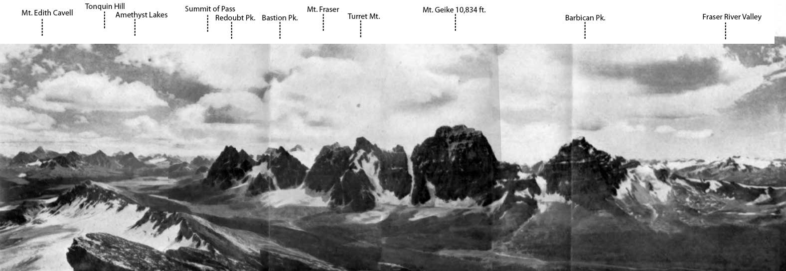
Mount Robson
53.0833 N 119.0833 W — Map 83E/3 —
Google —
GeoHack —
Bivouac
Earliest known reference to this name is 1910 (Coleman)
Name officially adopted in 1923
Official in
BC –
Canada
Elevation: 3408 m
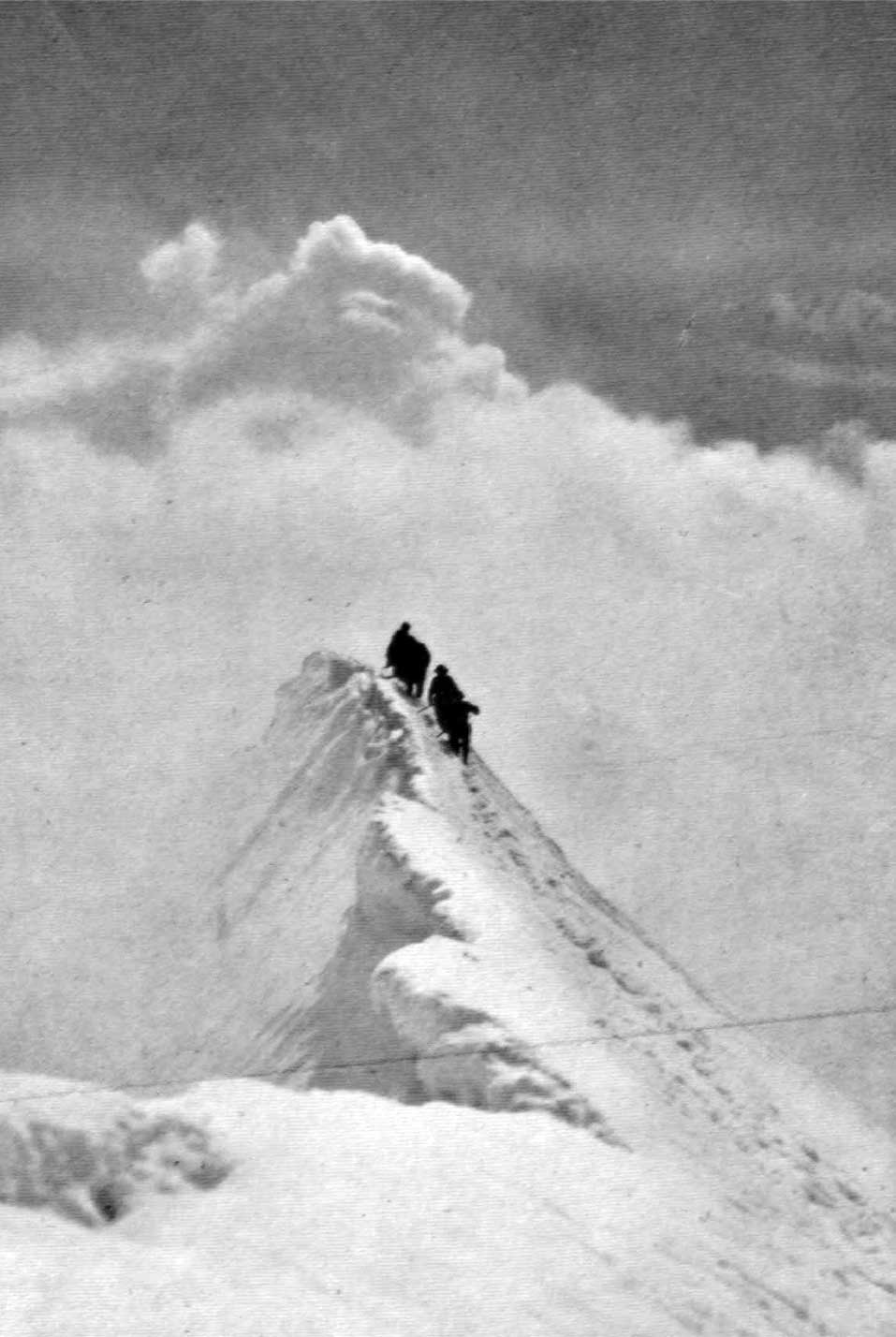
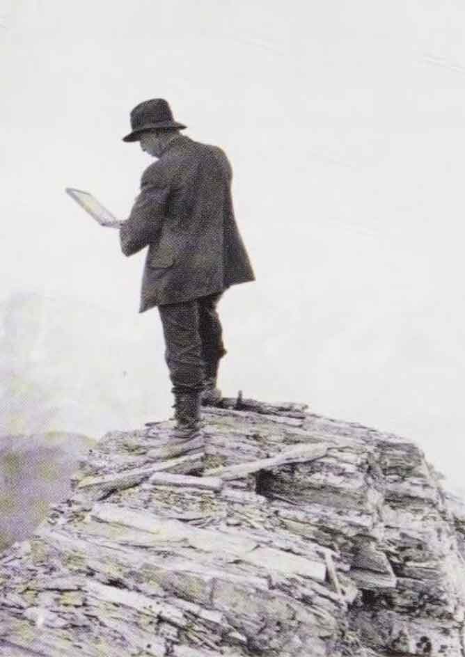
Summit of Mt. Resplendent. The Ice Horn
Photo: Byron Harmon, 1913
Canadian Alpine Journal 1915
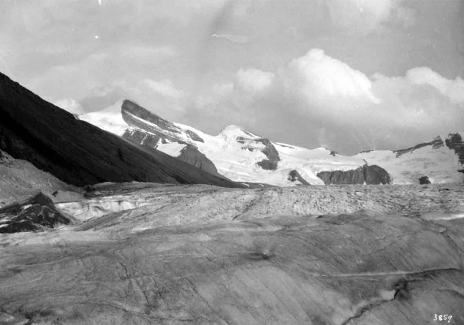
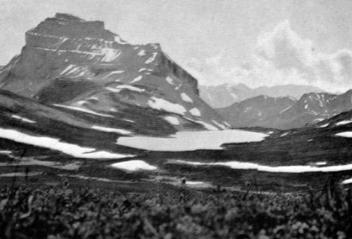
Clinging to our doubtful footholds, we were not in a mood to delay long at the highest point, and yet we could not help delighting in the marvellous view over the great glacier, the Helmet, the Rearguard, the lovely lakes in the valley to the north, and white-robed Mount Resplendent rising probably a thousand feet above us close by to the east, with numberless mountains in all directions beyond these nearer summits.
— Coleman, p. 325
Arthur Philemon Coleman [1852–1939] explored around Mount Robson in 1907 and 1908. He wrote of his 1908 visit in the quote above. His book The Canadian Rockies: New and Old Trails contains a couple of other uses of “resplendent:”
Passing through Fletcher’s ranch, sleek cows eyed us placidly, and men at work in the yellow oatfields stopped to look at us. This morning Jimmy had appeared once more in the long-tailed black coat, and Mark was resplendent in a newly pipeclayed hat, all his beads round his neck and on his long forelocks, and with a little sleigh-bell tinkling on his bridle. The white men had no finery to put on, and looked ragged and poverty-stricken as compared with the red men. [p. 166]
On our way to Moberly’s two young halfbreed swells passed us in the same direction on fine horses with showy trappings, and later we made the closer acquaintance of one of them, Adolphus Moberly, resplendent in one of the silk-embroidered buck- skin suits just mentioned and with a mirror flashing on the brow of his sleek black pony. We engaged him as guide to the rear of Mount Robson. [p. 302]
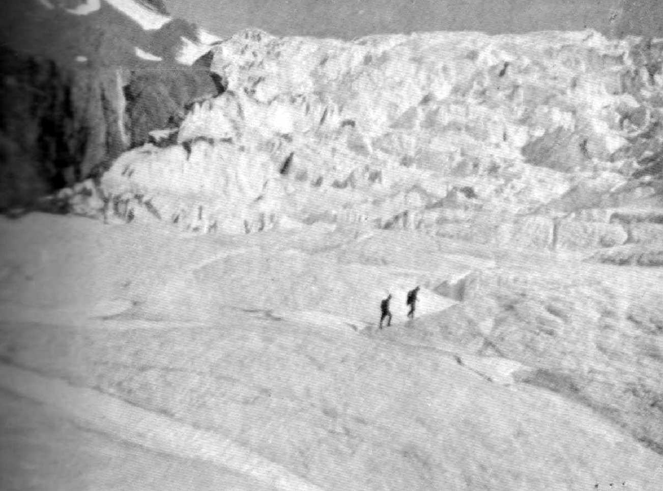
“[Resplendent Mountain] was named, and well named, by Coleman,” wrote Arthur Oliver Wheeler [1860–1945] in the report of the 1911 Alpine Club of Canada–Smithsonian Robson Expedition. “On the east side it is clad from top to bottom in pure white snow, and presents with the sun shining upon it a spectacle of such wonderful brilliance that the aptness of the name became immediately apparent. It rose in great snow masses and ice walls sheer to the summit, and showed several of the largest and widest bergschrunds I have ever seen in the Rockies. Enormous cornices overhung on the north and east sides. Later, the mountain was ascended by Konrad Kain and Byron Harmon. It proved to be altogether a snow and ice climb, and Konrad reported having seen some of the greatest ice cracks he had met with throughout the course of his professional experience. The crest of the mountain he described as an immense cornice reaching far out into space over the depths below.”
Conrad Kain [1883–1934] was guide on the expedition; Byron Harmon [1876–1942] was photographer.
The name was officially adopted in 1923 as labelled on Wheeler’s map .