Category Archives: Place

Mount Bagg

British Columbia. Mount
S of Morkill River, between Hellroaring Creek and Cushing Creek
53.6333 N 120.45 W — Map 93H/9 — GoogleGeoHack
Earliest known reference to this name is 1915
Name officially adopted in 1965
Official in BCCanada

“Mt. Bagg” appears on the “Preliminary Map of the Canadian Rocky Mountains between Jarvis Pass and Yellowhead Pass” showing the route followed by Mary Lenore Jobe Akeley [1878–1966] in August 1914 with guide Donald “Curly” Phillips [1884–1938].

The name was adopted in 1965 as labelled on BC Lands’ map 1G, 1916. Origin/significance not recorded.

References:

  • Jobe Akeley, Mary Lenore [1878–1966]. “Mt. Kitchi: A New Peak in the Canadian Rockies.” Bulletin of the American Geographical Society, Volume 47, No. 7 (1915):481-497, Map follows p. 496. JSTOR
  • British Columbia Geographical Names. Bagg, Mount

Avalanche Pass

Alberta-BC boundary. Pass
Fraser River and Smoky River drainages
Between Morkill River and Pauline Creek
53.6161 N 119.9108 W — Map 083E12 — GoogleGeoHack
Earliest known reference to this name is 1914 (Jobe)
Name officially adopted in 1925
Official in BCCanada
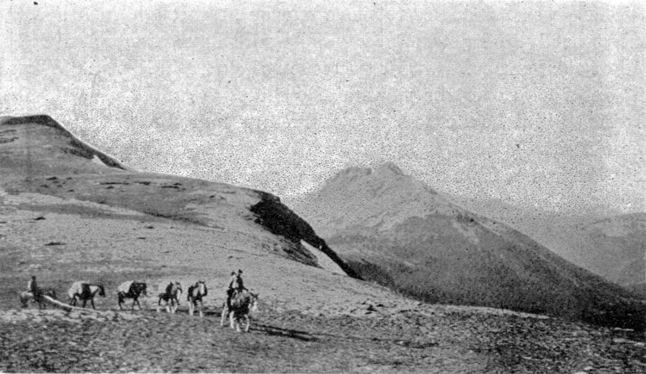
Alpland above Avalanche Pass, 1914.

Alpland above Avalanche Pass, 1914.
Bulletin of the American Geographical Society

The pass was named by members of the 1914 expedition to Mount Sir Alexander (then know as Mount Kitchi) led by Mary Lenore Jobe Akeley [1878–1966] and Donald “Curly” Phillips [1884–1938].

From Jones Pass we cut our way through dense woods down a steep declivity to broad open muskeg on the West Branch of the Jack Pine. After traveling about six miles through this meadow we came to a low pass, 5,300 feet, filled with beaver dams and houses. We named this pass Beaver Dam Pass. It separates Fraser and Peace waters. Another broad stretch of muskeg and we reached another pass, on which a huge avalanche of trees and rocks had descended. At Avalanche Pass our aneroid registered 5,300 feet. Our further progress was here checked by dense woods filled with an undergrowth of devils’ club and rhododendron of the British Columbia variety.

— Jobe 1914

“The reason for the name is unknown,” wrote boundary surveyor Arthur Oliver Wheeler [1860–1945] in 1924, “but may be due to a snow-slide that happened close by the summit of the pass many years ago and has left some rotting debris of the timber it swept down at the time. It is not a spectacular slide and but slight indication of it is left to tell the tale. There are no other indications of avalanches in the immediate vicinity.”

References:

  • Jobe Akeley, Mary Lenore [1878–1966]. “The expedition to ‘Mt. Kitchi:’ A new peak in the Canadian Rockies.” Canadian Alpine Journal, Vol. 6 (1914–1915):135-143
  • Jobe Akeley, Mary Lenore [1878–1966]. “Mt. Kitchi: A New Peak in the Canadian Rockies.” Bulletin of the American Geographical Society, Volume 47, No. 7 (1915):481-497. JSTOR
  • Cautley, Richard William [1873–1953], and Wheeler, Arthur Oliver [1860–1945]. Report of the Commission appointed to delimit the boundary between the Provinces of Alberta and British Columbia. Part II. 1917 to 1921. From Kicking Horse Pass to Yellowhead Pass.. Ottawa: Office of the Surveyor General, 1924. Whyte Museum
  • Cautley, Richard William [1873–1953], and Wheeler, Arthur Oliver [1860–1945]. Report of the Commission Appointed to Delimit the Boundary between the Provinces of Alberta and British Columbia. Parts IIIA & IIIB, 1918 to 1924. From Yellowhead Pass Northerly. Ottawa: Office of the Surveyor General, 1925. Whyte Museum
  • British Columbia Geographical Names. Avalanche Pass

Alpland station

British Columbia. Former railway point
Between Lucerne (GTP railway point) and Grant Brook (GTP railway point)
53.0278 N 119.1778 W — Map 83E/3 — GoogleGeoHack
Earliest known reference to this name is 1912 (Wheeler map)
Name officially adopted in 1951
Not currently an official name
10 miles west of the Yellowhead Pass on the Canadian National Railway
Grand Trunk Pacific Railway station built in 1913. Formerly Mt. Robson

Adopted in 1951 on Jasper Park (North) sheet (file J.1.34), as identified on Canadian National Railway timetables; name cancelled in 1989.

Grand Trunk Pacific Railway station Mount Robson (railway point) had originally been located here, but the station by that name was relocated southward and the Canadian National Railway renamed the facility at this location “Alpland” in 1924.

References:

  • British Columbia Geographical Names. Alpland
Also see:

Alpland Ridge

British Columbia. Ridge
NE of Moose Lake in Mount Robson Park
52.9831 N 119.0953 W — Map 083D14 — GoogleGeoHack
Name officially adopted in 1980
Official in BCCanada

Adopted 31 December 1973 in the 1973 Cumulative Supplement to the 1966 BC Gazetteer, as recommended March 1972 by BC Parks “…the ridge lies above the railway station of Alpland.”

References:

Also see:

Knutson Creek

British Columbia. Creek: North Thompson River drainage
Flows SW into Azure River, Wells Grey Park
52.4956 N 119.7872 W — Map 083D05 — GoogleGeoHack
Name officially adopted in 1963
Official in BCCanada

Louie Knutson [1891-1982] was one of the first persons of European descent to settle in the Robson valley. Born in Norway, Knutson emigrated to Canada from the United States in 1910. After a short stint logging on Vancouver Island, he bought two pack horses in Edmonton and headed for the North Thompson valley. He spent the summer in the hills and in the fall came out the Raush River valley to McBride.

After surveying the tar sands for the Alberta government, in 1911 he returned to McBride and went to work for the Grand Trunk Pacific Railway. He was soon back trapping the North Thompson. On a trip out he married Francis Rose Frye [1905–1992], sister of Ella and Mike Frye. Francis was born in North Dakota and had come with her family to the Valemount area in 1911.

Louie and Francis spent their honeymoon on the trapline. Louis discovered a deposit of high-grade ore at the headwaters of the Azure and Hobson rivers in 1916. He built trails and worked this property until he was unable to walk, but failed to get anything out of it. The site was closed to development when it became part of Wells Grey Provincial Park.

References:

  • Robson Valley Courier. Weekly newspaper published by Pyramid Press of Jasper from 1968–88 (1968–1988).
  • Wheeler, Marilyn [1932–2016]. The Robson Valley Story. McBride, B.C.: Robson Valley Story Group, 1979
  • Valemount Historic Society. Yellowhead Pass and its People. Valemount, B.C.: 1984
  • Wheeler, Marilyn [1932–2016]. The Robson Valley Story. McBride, B.C.: Sternwheeler Press, 2008
  • British Columbia Geographical Names. Knutson Creek
Also see:

Adolph Creek

British Columbia. Creek: North Thompson River drainage
Flows SE into North Thompson River, W of junction with Albreda River
52.4994 N 119.3711 W — Map 83D/11 — GoogleGeoHack
Earliest known reference to this name is 1932 (BCGN)
Name officially adopted in 1961
Official in BCCanada

Adolph Anderson was a guide and trapper on the North Thompson River. The creek was named in 1932 in association with War Colt Group of mineral claims in this vicinity, owned by Adolph Anderson and Louis Knutson of Albreda.

References:

Also see:

Abernathy Road

British Columbia. Road
Forks off Highway 5 near Valemount
52.8687 N 119.3018 W GoogleGeoHack
Roads are not in the official geographical names databases

Pinkney Bee Abernathy [1900–1961] and his wife Elizabeth [b. 1905] arrived at Red Pass from Gainford, Alberta, in 1949. Abernathy, a native of North Carolina, set up a lumber mill at Swift Current Creek, which he operated until 1960.

A supporter of the Yellowhead Route, he worked on the construction of the highway through Mount Robson Park. Before there was year-round maintenance of this section of Highway 16, Abernathy kept the road open to obtain mail and freight from Red Pass and to reach a long-distance phone at Jasper.

References:

  • Valemount Historic Society. Yellowhead Pass and its People. Valemount, B.C.: 1984
  • Carson, Art. Personal correspondence. 2008 Mountain Mania. Mountain Mania

Albreda (railway point)

British Columbia. Locality
Canadian National Railway, N of junction of Albreda River and North Thompson River
52.6375 N 119.1625 W — Map 83D/11 — GoogleGeoHack
Name officially adopted in 1956
Official in BCTopo map from Canadian Geographical Names
74 miles west of the Yellowhead Pass on the Canadian National Railway
Mile 92 in Albreda Subdivision (Jasper to Blue River as of 1977)
Canadian Northern Railway station built in 1915
This locality appears on:
Canadian National Railway map 1925

Named in association with Albreda Lake, a name dating to 1863.

During construction of the Canadian Northern Railway around 1915, Albreda had the first telegraph in the area. Albreda was the inspection point for the Blue River–Jasper subdivision of the rail line and may have had a CNoR 3rd Class depot at one time. (1)

The Albreda post office was open from 1923 to 1948, and again from 1956 to 1959. The small settlement was the site of a Japanese internment camp during World War II. (2)

The original Albreda station was on the Grand Trunk Pacific Railway line, as indicated on Arthur Wheeler’s 1912 topographical map of the Mount Robson region and on British Columbia Pre-emptor’s map 3H, 1914. That early station was located just east of Tête Jaune Cache and repositioned westward as shown Pre-emptor’s map Tête Jaune 3H 1919.

Entry from the 1918 Wrigley’s Directory (3)

ALBREDA — a station on the C.N.R., in the Fort George Provincial Electoral District, 7 miles from Tete Jaune Cache and 40 from Blue River, the post office and nearest commercial telegraph. Population, 21. Three homesteads open for pre-emption, four taken; all good land for gardening. Abundance of mica about 2 miles distant, and cordwood.
Abrams T farming
Askin A farming
Browson Julius A farming
Frederick John section foreman CNR
Frye Fred farming
Joyle Clifford farming
Lavoie Joseph farming
McGuiness C L telegraph operator CNR
McLaren David assistant postmaster
Swanson P farming

Entry from the 1922 Wrigley’s Directory (4)

ALBREDA — a station on the C.N.R. and G.T.P. Rys. Has G. N. W. Telegraph. Population, 21. Abundance of mica about 2 miles distant, and cordwood.
Christoff Steve sec foreman GTP
Frederick John sec foreman CNR
Frye Fred farming
Lavoie Joseph farming
MeGuinness C L tel opr
Nichols C Z agt CNR
Stewart Peter farming

The Great North Western Telegraph Co was established in 1880 and taken over by the Canadian Northern Railway on 1 January 1915. The railway itself was in financial difficulty, however, and was soon purchased by the federal government, subsequently forming a component of Canadian National Railways Co. In this way Great North Western Telegraph Co became Canadian National Telegraph Co. (5)

References:

  • 1. Wrigley Directories, Limited. Wrigley’s British Columbia Directory. Vancouver: 1918. Internet Archive
  • 2. British Columbia Geographical Names. Albreda
  • 3. Wrigley Directories, Limited. Wrigley’s British Columbia Directory. Vancouver: 1918. Internet Archive
  • 4. Telegraph. 2025 Canadian Encyclopedia [accessed 7 February 2025] [accessed 2/7/2025] .
  • 5. Telegraph. 2025 Canadian Encyclopedia [accessed 7 February 2025] [accessed 2/7/2025] .
Also see:

Albreda River

British Columbia. River: North Thompson River drainage
Flows S into North Thompson River at Gosnell (railway point)
52.4833 N 119.1333 W — Map 83D/6 — GoogleGeoHack
Earliest known reference to this name is 1900 (McEvoy)
Name officially adopted in 1961
Official in BCCanada
This river appears on:
McEvoy’s map Yellowhead Pass 1900
So labelled on British Columbia Map 3J, 1914, and following maps, in association with Mount Albreda, which amed in association with Albreda Lake, a name dating to 1863.
References:

  • McEvoy, James [1862–1935]. “Map Showing Yellowhead Pass Route From Edmonton To Tête-Jaune Cache.” (1900). Natural Resources Canada
  • McEvoy, James [1862–1935]. Report on the geology and natural resources of the country traversed by the Yellowhead Pass route from Edmonton to Tête Jaune Cache comprising portions of Alberta and British Columbia. Ottawa: Geological Survey of Canada, 1900. Natural Resources Canada
  • British Columbia Geographical Names. Albreda River