Alberta-BC boundary. Peak
S of Amethyst Lakes
52.6547 N 118.2981 W — Map 083D09 — Google — GeoHack — Bivouac
Name officially adopted in 1951
Official in BC – Canada
Elevation: 3260 m
S of Amethyst Lakes
52.6547 N 118.2981 W — Map 083D09 — Google — GeoHack — Bivouac
Name officially adopted in 1951
Official in BC – Canada
Elevation: 3260 m
This peak appears on:
Boundary Commission Sheet 28 (surveyed in 1921)
Boundary Commission Sheet 28 (surveyed in 1921)
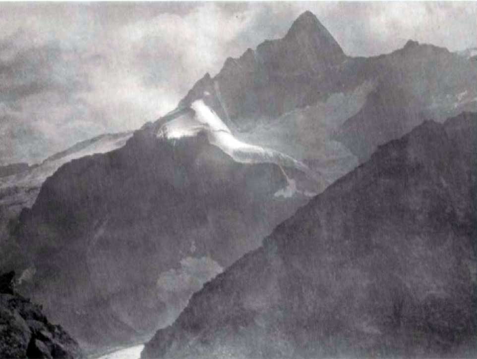
Mt. Bennington From Surprise Point
Canadian Alpine Journal 1927
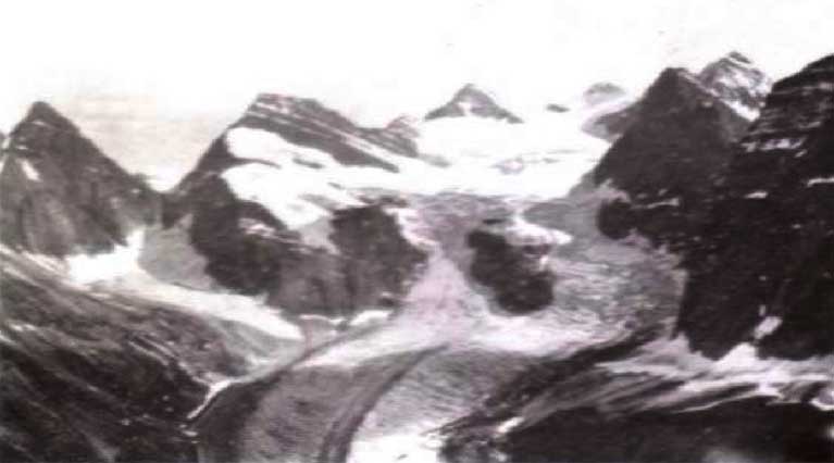
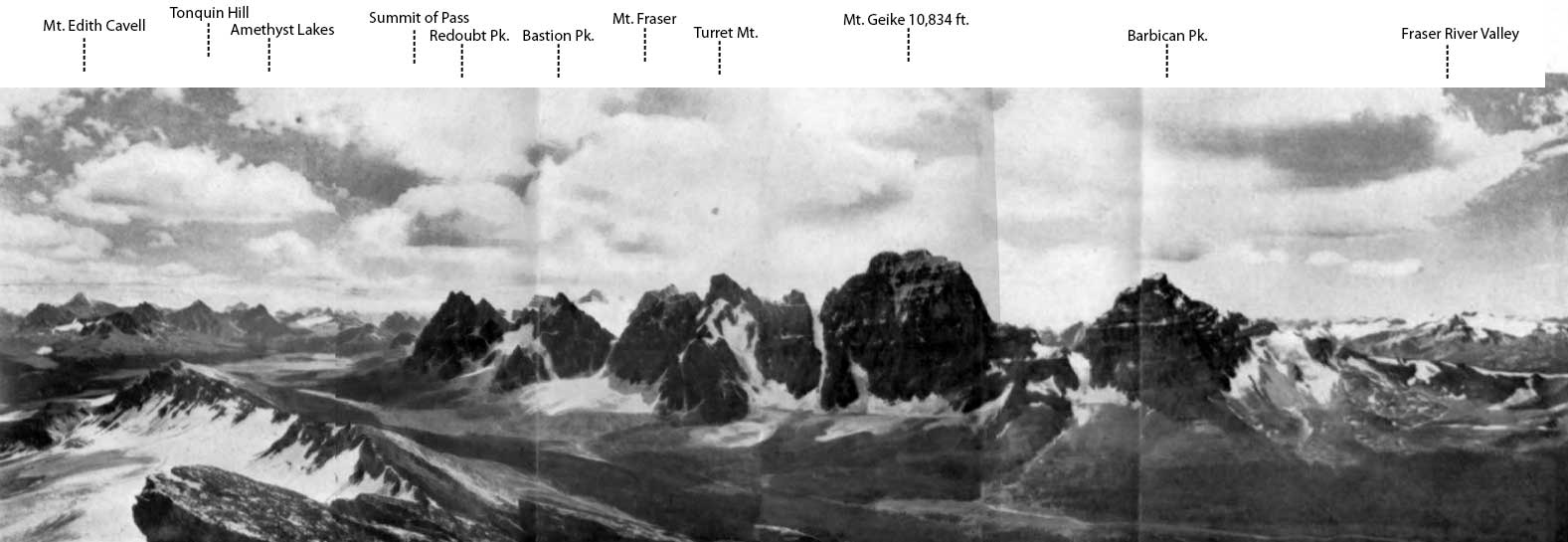
This mountain near the headwaters of the Fraser River was named for North West Company explorer Simon Fraser [1776–1862]. Fraser was born in Bennington, Vermont. The peak was named by the Alberta-British Columbia Boundary Commission in 1921.
The afternoon of Sunday, August 1st [1926], Messrs. Henry Hall, of Boston, J. E. Johnson, of Scarsdale, N.Y., and the writer started from the main camp at Moat Lake to the camp at Surprise Point with the intention of starting from there early Monday morning for an attempt at the Easterly “Fraser” Peak, or Mt. Bennington. However, we failed to awaken in the morning (due to late attendance at the camp-fire the previous evening), and had to give up the attempt for that day, which, of course, turned out to be perfect, and was spent in scrambling up Surprise Point!
— N. W. Spadavecchia
References:
- Cautley, Richard William [1873–1953], and Wheeler, Arthur Oliver [1860–1945]. Report of the Commission appointed to delimit the boundary between the Provinces of Alberta and British Columbia. Part II. 1917 to 1921. From Kicking Horse Pass to Yellowhead Pass.. Ottawa: Office of the Surveyor General, 1924. Whyte Museum
- Cautley, Richard William [1873–1953], and Wheeler, Arthur Oliver [1860–1945]. Report of the Commission Appointed to Delimit the Boundary between the Provinces of Alberta and British Columbia. Parts IIIA & IIIB, 1918 to 1924. From Yellowhead Pass Northerly. Ottawa: Office of the Surveyor General, 1925. Whyte Museum
- Spadavecchia, N. W. “Mt. Bennington.” Canadian Alpine Journal, Vol. 16 (1927):58-62
Also see: