British Columbia.
Not currently an official name.
Not currently an official name.
This appears on:
BC Lands Central BC 1892
BC Lands Central BC 1892
British Columbia.
Published by Geo. F. Cram, Chicago,Ill.
Norman B. Leventhal Map & Education Center
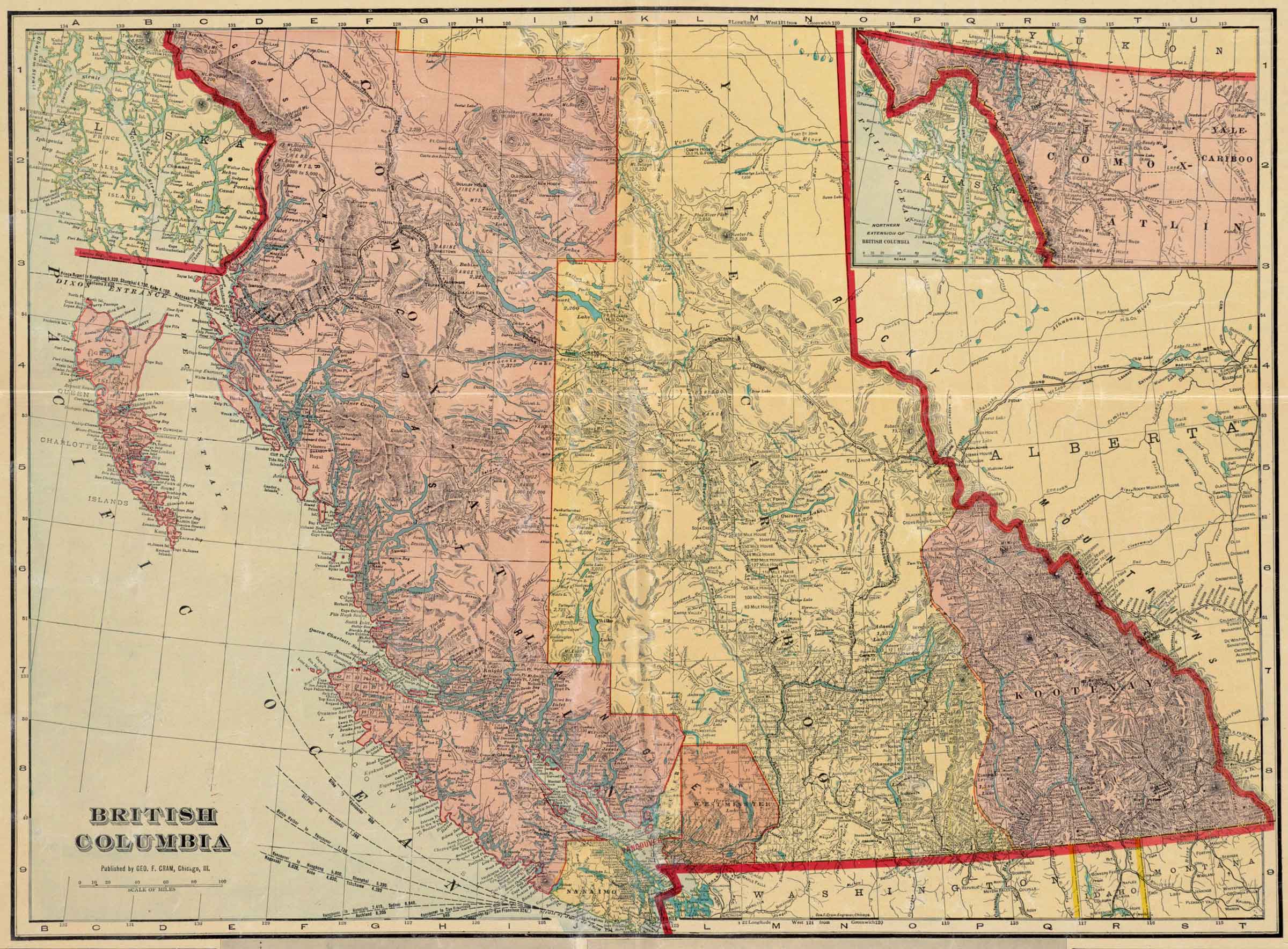
![British Columbia [detail].
Published by Geo. F. Cram, Chicago,Ill.](/wp-content/uploads/2024/12/map-cram-british_columbia-1913-detail.jpg)
British Columbia [detail].
Published by Geo. F. Cram, Chicago,Ill.
Norman B. Leventhal Map & Education Center
George Franklin Cram [1842-1928] was an American map publisher. He served in the U.S. Army during the American Civil War. Upon mustering out he joined his uncle Rufus Blanchard’s Evanston, Illinois, map business in 1867. Two years later, he became sole proprietor of the firm and renamed it the George F. Cram Co. which became a leading map firm in the United States.
The map indicates the constructon of both the Grand Trunk Pacific Railwayand the Canadian Northern Railway, both traversing the Yellowhead Pass and branching at Tête Jaune Cache.
On the Grand Trunk route following the Fraser River between Tête Jaune Cache and Fort George there are no settlements indicated. South of Tête Jaune Cache the first settlements along the CNoR are near Kamloops on the North Thompson River.
Peter Pond’s maps of 1785 and 1787 refer to the River of Peace.
Other names have included Un-ja-ga/Unjigah, as recorded on a map to accompany Mackenzie’s “Voyage to the Pacific… 1793”
![Buckskin Suit [1872]](/wp-content/uploads/2024/11/rylatt-buckskin-suit.jpg)
Buckskin Suit [1872]
In 1871 Rylatt was recruited by fellow Royal Engineer veteran Walter Moberly [1832–1915], who was in charge of S party of the Canadian Pacific Railway Survey. Rylatt served as quartermaster for the party until 1873, when he got word that his wife had died. He wrote a memoir of the trip for his family, now published under the title Surveying the Canadian Pacific — Memoir of a Railroad Pioneer[1].
Upon starting, our party consisted of 4 officers (surveyors), 16 men, principally axeman about one half of them Canadian, 8 Mexican and Indian Packers, and one hunter for the party — a Bavarian. There were 45 animals in the Pack Train, each carrying about 300 pounds.
S Party spent winter 1871-72 on the Columbia River near the Blaeberry River at the west end of Howse Pass. Moberly, who had spent the winter in Ottawa, arrived at their camp on June 16th. The ‘S’ party spent the entire season moving their equipment, supplies and pack trains through the Athabasca Pass, and north, arriving in January at the east end of the Yellowhead Pass, which Rylatt consistently called the Leatherhead Pass. On May 13, 1873, Rylatt set off through the Yellowhead Pass with one companion and three horses, reaching Kamloops on June 14. Rylatt continued on by stage to his home at New Westminster.
And now, my reminiscence is done. I might go on to state I found an empty house, my goods intact but stored in a ware-house. My return to my empty home, and the replacing of everything therein as it used to be in the days that were gone. My sad thoughts as l lay stretched upon the bed my poor wife had breathed her last upon. My many visits to her grave, and my final sale of home and belongings, and my wandering away to seek another home, under another government. But to what end?