Alberta-BC boundary. Pass
Headwaters of Tonquin Creek and Moat Creek
52.7333 N 118.3333 W — Map 083D09 — Google — GeoHack
Name officially adopted in 1956
Official in BC – Canada
Headwaters of Tonquin Creek and Moat Creek
52.7333 N 118.3333 W — Map 083D09 — Google — GeoHack
Name officially adopted in 1956
Official in BC – Canada
This pass appears on:
Boundary Commission Sheet 28 (surveyed in 1921) [as “Moat Passage”]
Boundary Commission Sheet 28 (surveyed in 1921) [as “Moat Passage”]
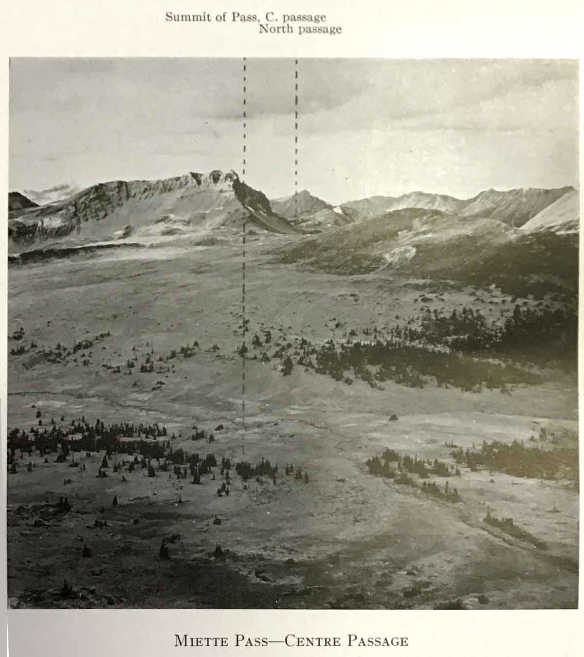
“Your Commissioners suggest that the name of Moat Passage should be given to the lower summit of Tonquin Pass, in reference to Moat Lake, a pretty sheet of water, one mile long, which approaches within a few chains of the summit on the Alberta side.”
The Commissioners were Arthur Oliver Wheeler [1860–1945] and Richard William Cautley [1873–1953] of the Alberta-British Columbia Boundary Commission in 1921.
References:
- Cautley, Richard William [1873–1953], and Wheeler, Arthur Oliver [1860–1945]. Report of the Commission appointed to delimit the boundary between the Provinces of Alberta and British Columbia. Part II. 1917 to 1921. From Kicking Horse Pass to Yellowhead Pass.. Ottawa: Office of the Surveyor General, 1924. Whyte Museum
- Cautley, Richard William [1873–1953], and Wheeler, Arthur Oliver [1860–1945]. Report of the Commission Appointed to Delimit the Boundary between the Provinces of Alberta and British Columbia. Parts IIIA & IIIB, 1918 to 1924. From Yellowhead Pass Northerly. Ottawa: Office of the Surveyor General, 1925. Whyte Museum
Also see: