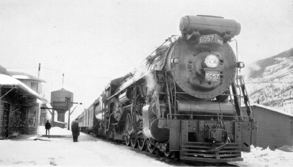
Water tower and locomotive at Red Pass station. Canadian National steam engine 6057 (manufactured by Montreal Locomotive Works in 1930 and scrapped in 1960, 4-8-2, U-1-e). Valemount & Area Museum
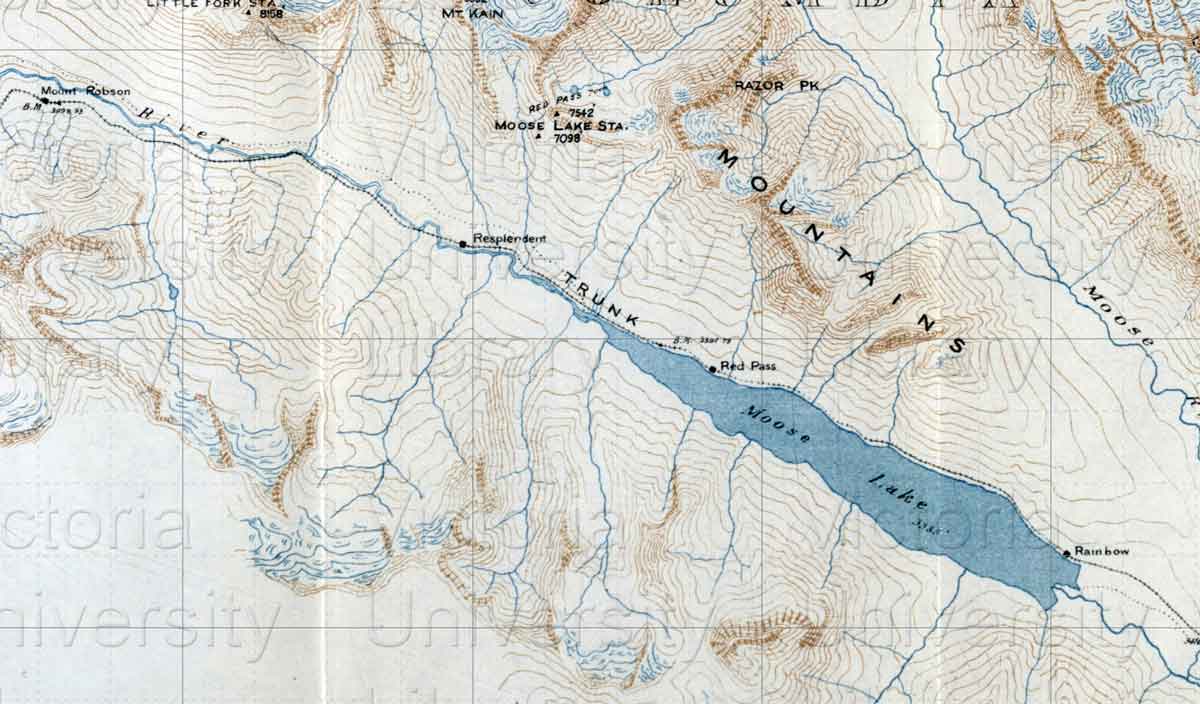
The Red Pass railway point on Arthur Wheeler’s 1912 Topographical Map Showing Mount Robson and Mountains of the Continental Divide North of Yellowhead Pass is located near the middle of Moose Lake, not at the current location on the western end. The Grand Trunk Pacific Railway was the only railway through the pass at that time. The railway junction at Mile 27 at the west end of Moose Lake was originally called Resplendent, a name also deriving from the color of the rocks.
East of Red Pass junction, the tracks of the Grand Trunk Pacific Railway, descending to the Fraser River on route to Prince George in 1912, were kept as low as possible. The tracks of the Canadian Northern Railway, heading for Albreda, were kept high. After the consolidation of the railways in 1923 as the Canadian National Railway, Lucerne disappeared as a divisional point and Resplendent blossomed as the current Red Pass Junction, the point where the removal of the separate tracks stopped and where the two lines diverged. Red Pass probably had a GTP Type E station at one time.
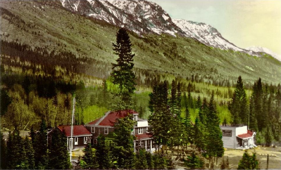
During the 1930s there was a hobo jungle at Red Pass where the vagabonds waited for trains. About 50 people lived at Red Pass in the 1940s. During World War II it was the site of a Japanese internment camp. The Red Pass hotel burned down in 1949. After the highway opened in 1962, the need for Red Pass diminished. Canadian National Railway still uses some buildings at Red Pass. The headquarters of Mount Robson Park were moved from Red Pass to Valemount in 1987. The lower railway line has since been discontinued and the junction was moved near Charles north of Valemount.
The post office was open from 1921 to 1976, when it was closed and moved to Valemount.
Postmasters:
C. W. Palmer 1921-1923
Earl Francis Woodley 1923-1946
Lloyd Francis Williams 1946-1967
Robert Francis McLeod 1967-1969
Lionel D. Young 1969-1972
Mrs Diane Audrey Rogers 1972-1973
Mrs Winnifred Lynn Castle 1973-1974
Mrs Margaret Wentzel 1974-1976
Mrs M. A. Watt 1976
Mrs P. Murphy 1976
Wrigleys 1918 Directory lists Red Pass junction as a “flag-station on the G. T. P. Ry., 22 miles west of Lucerne. Lucerne is nearest post office.”
The Jasper Booster weekly newspaper published a story on August 12, 1981, entitled “Mayor of Red Pass Steps Down”:
Since the end of July, Red Pass has been without a mayor and it is doubtful that the position will be filled in the near future. In fact, the mayor’s residence and office will no longer be available to serve as town hall but will be purchased by the Province of B.C. and removed from Mt Robson provincial park. The mayor has moved to Cranbrook and so ends the last private residence on the shores of Moose Lake. William Hallam (aka the mayor of Red Pass Junction or Old Bill) was a familiar face to most railroaders. Other than the CN gangs he was the only person to wave to in Red Pass and he was often out with his dog Pard checking over the trains. Many residents of Jasper would recognize Bill from his monthly trips into town to buy pipe tobacco and “visit his girlfriends.” Anyone who has ever talked to Bill knows he’s been around and he has lots of stories to prove it.
References:
- Bohi, Charles W. Canadian National’s Western Depots. The Country Stations in Western Canada. Railfare Enterprises, 1977
- Waxu, Warren. “Mayor of Red Pass steps down.” Jasper Booster, 12 August (1981)
- Topping, William. A checklist of British Columbia post offices. Vancouver: published by the author, 7430 Angus Drive, 1983
- Canadian National Railways Steam Locomotive Roster. Trainweb