Feature type: falls
Province: British Columbia
Location: Pyramid Creek
Province: British Columbia
Location: Pyramid Creek
Descriptive.
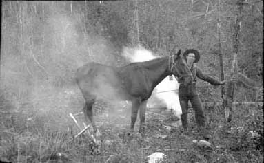
James Shand-Harvey with horse in smudge, Smithsonian-ACC Robson expedition, 1911
Whyte Museum of the Canadian Rockies
Perhaps named for James Shand Harvey [1880–1968], who spent decades as a guide and packer in the area around the Yellowhead Pass and Téte Jaune Cache and retired to a cabin near Entrance, Alberta.
Harvey was born in Scotland, the son of a wealthy family who owned the Castle Semple estate in Lochwinnoch, Renfrewshire. He left behind his life of privilege and wealth and emigrated to Canada, arriving in Edmonton in 1905. After a brief stint at homesteading, he worked on surveys for the Grand Trunk Pacific Railway, and for the Dominion Land Survey on the 14th base line from Lac Ste. Anne to Jasper. In 1909, he guided Arnold Louis Mumm [1859–1927] on a mountaineering expedition from Wolf Creek to their rendezvous with John Yates, and accompanied the expedition to Mount Robson. By 1911, with a few horses of his own, he hauled supplies from Lac Ste. Anne to Tête Jaune Cache.
He was assistant packer to Donald “Curly” Phillips [1884–1938] on the 1911 Alpine Club of Canada–Smithsonian Robson Expedition.
In the winter of 1917, Shand Harvey accompanied Phillips and Mary Lenore Jobe Akeley [1878–1966] on their trip to the Wapiti River. Shand Harvey later became a forest ranger and fire warden in the Grande Cache district of Alberta.
In 1921 he built a cabin near Entrance, at the east boundary of Jasper National Park, and trapped in the surrounding hills. James MacGregor’s book Pack Saddles to Tête Jaune Cache is about Shand Harvey.
Roy Frederick Hargreaves (1891–1971) founded what is now the Mount Robson Ranch in the early 1920s. In 1959, Roy sold the ranch to Alice Wright, who named it the Mount Robson Ranch and hired Myrtle Isabel Hargreaves and her husband Murray Cochrane to manage it. Isabel and Murray purchased the ranch from Wright in 1980.
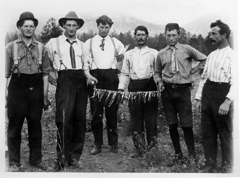
The Hargreaves Brothers: Frank, Roy, George, (unknown), Jack, (unknown), 1922-1930, Mount Robson. Credit: Ishbel Cochrane.
Valemount & Area Museum
Roy Frederick Hargreaves (1891–1971) founded Mount Robson Ranch and built the Berg Lake Chalet. He and brothers Frank (1885–1940), Jack (1895–1971), George (1883–1936) and Dick (1908–1987) homesteaded at Mount Robson after World War I. For many years, they were well-known guides and outfitters in the Mount Robson area.
Their parents Edward (1846–1939) and Matilda (1852–1904) moved to Oregon from England in 1881, but soon immigrated to Canada “to live under the British flag.” After Matilda died, the family was frequently on the move. George and Roy were the first to leave home, and in 1905 they helped cut a trail from Golden to Tête Jaune Cache.
Jack came to Jasper in the winter of 1913–14 to play hockey. The next summer he started working for the Otto Brothers outfitters, and in the winter of 1917, accompanied Donald “Curly” Phillips [1884–1938] and Mary Jobe on their trip to the Wapiti and Mount Sir Alexander area. Mary Jobe wrote, “Phillips had an assistant, Jack Hargreaves, a strong, manly young fellow, willing in every emergency, and always good tempered. I have rarely had a more unselfish companion on the trail.”
Roy, Frank, and Jack served in the Canadian Army in the World War I. Roy survived the first gas attack on Canadian forces, but he spent many months in a British hospital. Edward and Matilda’s daughter Myrtle married and stayed in Jasper, and daughter Ethel married and moved to Iowa.
In 1921, Jack and Frank filed on homesteads near Mount Robson. With an eye towards the tourist business, they erected several log buildings and a small store. They were soon joined by George and later by Roy. The four brothers began to outfit and guide hunting parties, using about 70 head of horses and concentrating on the Berg Lake area. Although they carried on business under the name of Hargreaves Brothers, each maintained his own separate part of the pack string and his share of the equipment. In 1922, Jack married Jasper teacher Gladys Guild (1897–1985). The following year he moved back to Jasper, where he operated a guiding and outfitting business, having up to 85 horses on the trail at one time. Both he and Hargreaves Brothers operated separately for many years.
In 1923, Roy married Sophia MacLean (1892-1991), a school teacher from Cape Breton working in Jasper. That same year, Edward pre-empted a homestead at Mount Robson, a couple of miles from the ranch. In 1924, George, Frank and Jack rebuilt Curly Phillips’s trail to Kinney Lake. In 1926, George filed on land close to Jackman Flats. Frank later took an adjoining homestead, and they all kept guiding and outfitting. Dick married Alice Couture, and after a short stay at Jackman, they moved to Jasper where was a carpenter for the park and the railway. George died on the trail.
The “CN Cabins” which the brothers built near Robson Pass in 1921 were operated by the Hargreaves for several years, until Roy obtained a lease on five acres of land on Berg Lake. In 1927, he built the Berg Lake Chalet, a tourist facility which provided meals and accommodation for over 50 years. Chuck Chesser, who had been working for Roy since about 1926, became a partner in 1931, the same year that he married Sophia’s sister Anne Maclean. “Chesser and Hargreaves, Guides and Outfitters” lasted until the late 1940s, when Chesser went to work for the Canadian National Railway. Roy raised beaver, farmed fox for several years, tried mink for one year, and couldn’t get marten to breed. During the war he got rid of the foxes and ran a sawmill at Tête Jaune Cache with Harry Partridge.
Frank was murdered at his cabin at Jackman in 1940. In 1951, Arthur Cunningham admitted to murdering a man at Endako, and before he was hanged, also claimed to have shot Frank Hargreaves.
In 1959, Roy sold the ranch to Alice Wright, who named it the Mount Robson Ranch. Roy and Sophia moved to Ladysmith, returning to visit Mount Robson several times a year. Sophia made regular trips to Berg Lake until 1976, when she was 84. In 1977, when the Berg Lake Chalet was closed, she made her last trip, by helicopter. In 1988, she was living at a senior citizens’ lodge in Salmon Arm. The operation of Mount Robson Ranch was taken over by Roy and Sophia’s daughter Myrtle Mae Ishbel Hargreaves and her husband Murray Cochrane.
Formerly called “No Name Creek,” settler Hankins put down his own name when he filed for water rights.
The lake is crescent shaped.
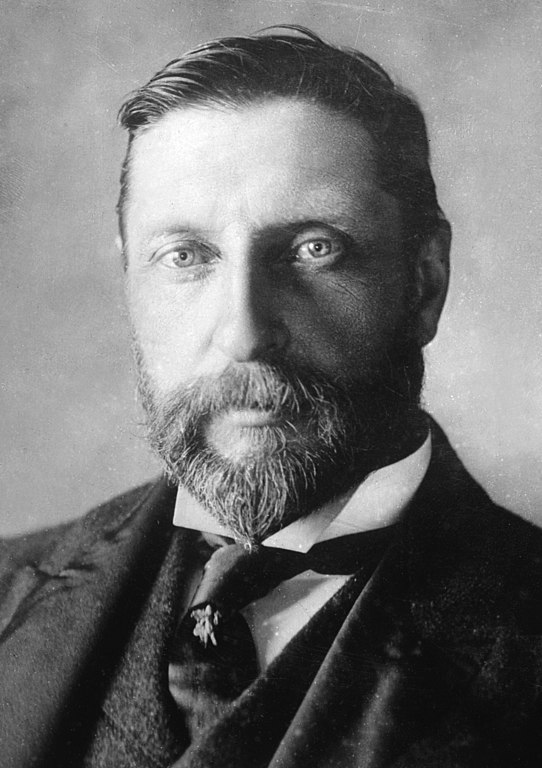
Henry Rider Haggard circa 1905
British novelist Henry Rider Haggard [1856–1925] passed through the area by train in 1916, on a tour of the Commonwealth investigating prospects for settling war veterans.
Feature type: road
Province: British Columbia
Location: Intersects Hwy 16 E of Dunster
Latitude: 53.14440 N
Longitude: 119.8095 W
Google Maps
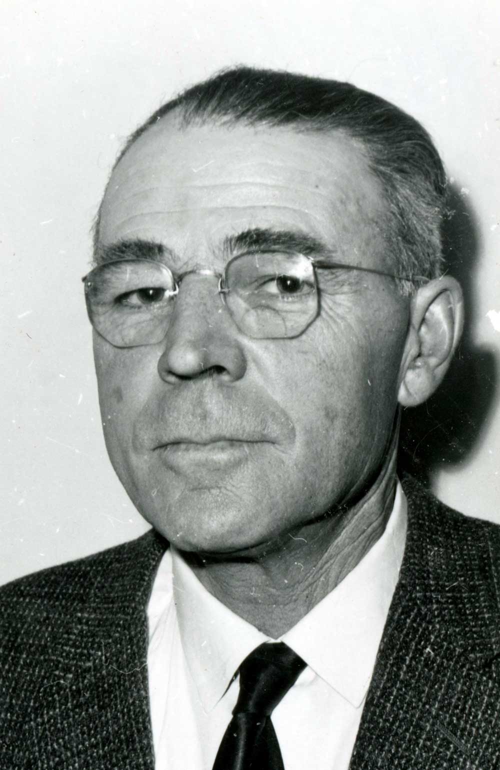
1963 portrait of Robert P. Haan, who was the chairman of the McBride and District Hospital Board of Directors.
Valley Museum & Archives Society
Robert Phillip Haan (1901–1976) and Leola (Rankin) arrived in Dunster from Alberta in 1943, along with their son Robert Desmond Haan (1928–1980) and four brothers and sisters. Robert Desmond Haan was born on the family farm near Provost, Alberta. With his English-born wife Betty (Sargent) (b. 1932) and their children, he operated a beef farm in Dunster. When Bob was killed in a tractor accident, the farm was sold and his family moved to Kelowna. Bob was active in the Dunster Farmers’ Institute, the Dunster 4-H Club, the Community Hall Association, square dancing, and sports.
His mother Leola Haan writes, “Now little is left of his years of work. Even the beautiful house he built himself for his family is sold and moved away. Sagging fences, weedy field corners, a few farm out-buildings, and neglected fruit trees aren’t much of a memento for over thirty-two years of hard work and endeavor. But there still remains a memory no one can subdue, a memory of a busy, happy, progressive, ambitious family who once lived at the end of this road.”
In July 1925, Walter Alfred Don Munday [1890–1950] and Phyllis Munday [1894–1990] made an expedition into the Cariboo Range. Two parties of climbers had preceded them: Edward Willet Dorland Holway [1853–1923] and Andrew James Gilmour [1871–1941] in 1916; and Allen Carpé [1894–1932] and Rollin Thomas Chamberlin [1881–1948] in 1924.
The latter party made two major climbs, the first ascents of Mt. Titan (11,850 ft.) and Mt. Challenger (10,900 ft.). They also climbed three minor mountains: Gunboat (10,000 ft.); a shoulder of Mt. Titan which they called Bivouac Peak (10,150 ft.) and a triple summit (10,250 ft.), which Mr. Munday refers to as Holway’s Peak, he having made the first ascent of its northerly summit. (The elevation and other names are Mr. Carpé’s.)
— Munday