Flows north into Miette River near Yellowhead Pass
52.8767 N 118.3111 W — Map 083D16 — Google — GeoHack
Name officially adopted in 1951
Official in Canada
Boundary Commission Sheet 29 (surveyed in 1917)
Origin of the name unknown.

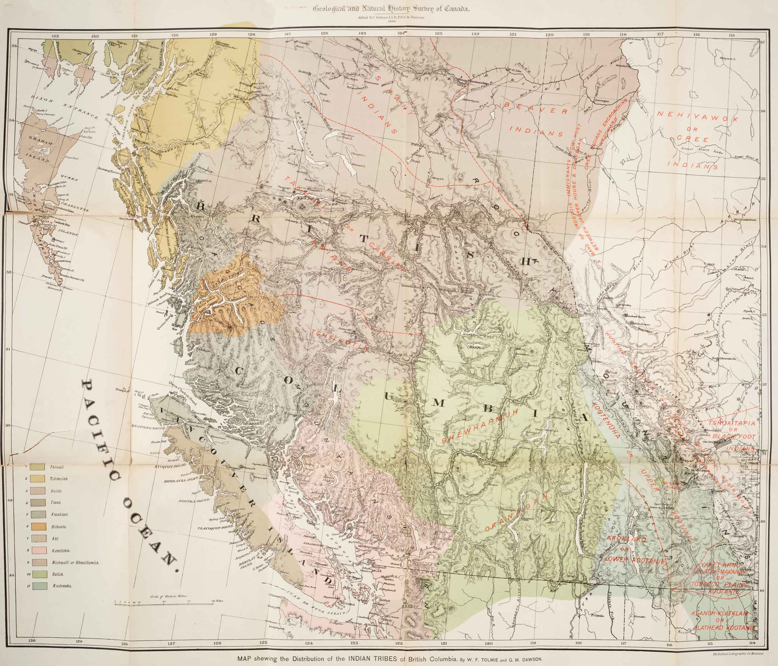
Map showing distribution of Indian Tribes of British Columbia
Toronto Public Library

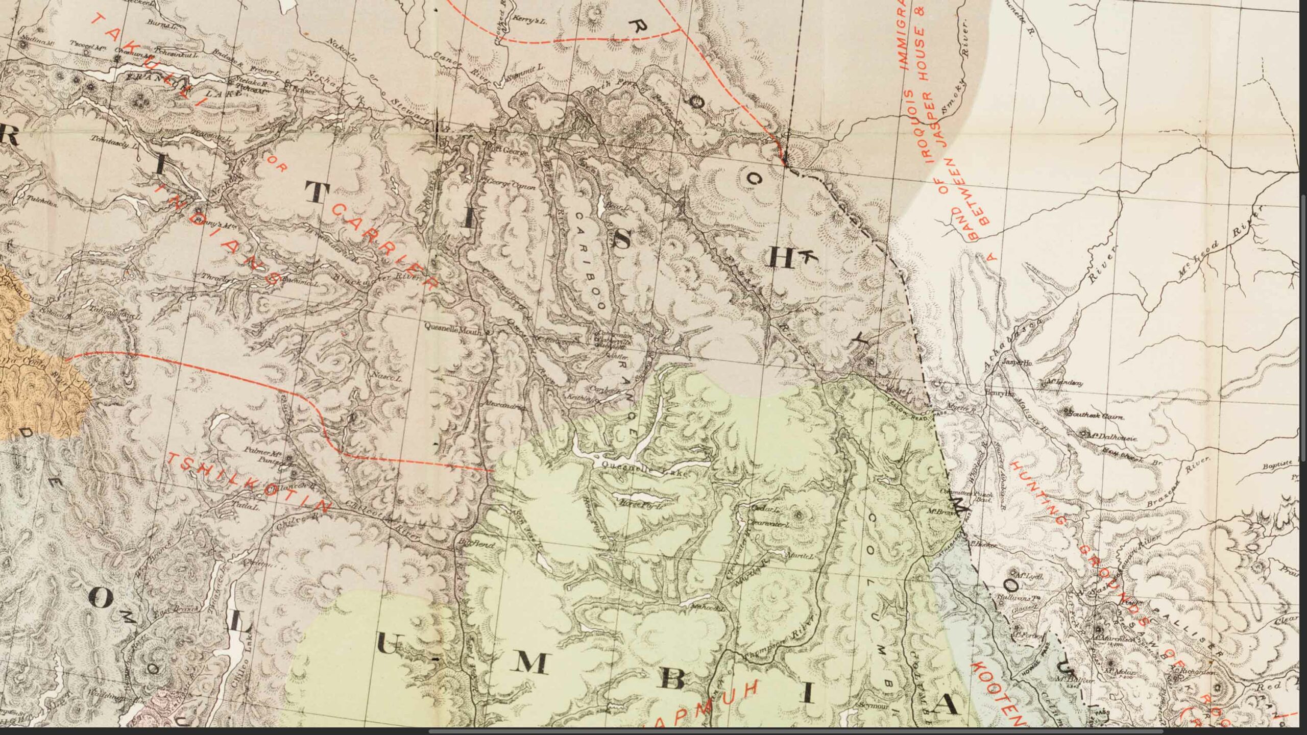
Detail of Yellowhead Pass region
Toronto Public Library
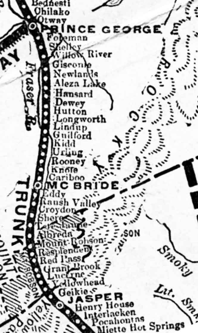
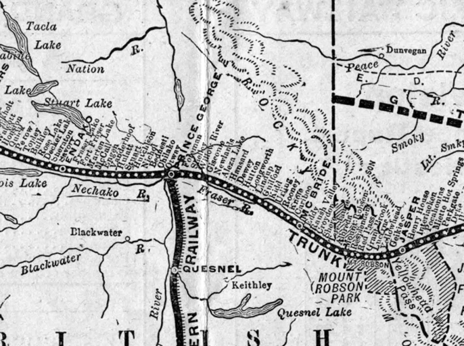
Early Grand Trunk Pacific Railway map (above) cropped and orientated to show the original stations between McBride and Jasper, which were built between 1912 and 1914.
There are only 17 stations shown between Prince George and McBride on this original plan. Missing is Legrand, which was added in 1914 during construction, to make up the original 18 stations built on that stretch. Knole station became Rider sometime after 1916, so this map seems to be from between 1912 and 1916. Rooney station was renamed Goat River (railway point) sometime between 1918 and 1923.
The rail line between Prince George and McBride was often referred to as the “East Line.” The only access from McBride to the communities west of McBride was by rail.
William Pittman Hinton, general manager of the railway’s western lines, asked Josiah Clement Wedgwood, of the Wedgwood china family, to submit a list of names suitable for naming the stations on the new railway line. Many station names on the Grand Trunk Pacific Railway have a connection to England [excerpt taken from Penny for your thoughts].
“Mastodon Peak” adopted in 1924, derived from name on BC-Alberta Boundary sheet 28, 1921. Form of name changed to “Mastodon Mountain” in 1962 by Alberta and 1963 by British Columbia.
Named in 1922 by the Alberta-British Columbia Boundary Commission survey party because of a resemblance to the extinct form of elephant.
Located about 71 km west of McBride leaving Highway 16 to the north. The Walker Creek FSR has been heavily logged but one can still find stands of old-growth cedar/hemlock at 7km and between 10-20km along the road. There are also viewscapes of cedar/hemlock forests reaching up the mountain sides along this road. Watch for grizzly bear on the road and salmon at 22km.
The Walker Creek Forest Service Road provides primary access to Kakwa Provincial Park, but since September 2021 the road is closed at 37 km.
Surveying the view to the west from Gendarme Mountain during the 1911 Alpine Club of Canada–Smithsonian Robson Expedition, Arthur Oliver Wheeler [1860–1945] wrote:
The valley is a very beautiful one with green alp-lands, shining silver streams and two large ponds visible beside them. It drains to a larger timbered valley trending N. W. and S.E. to the Smoky River. Phillips has named the stream in the valley below us “Wolverine Creek.
Donald “Curly” Phillips [1884–1938]
In French-speaking parts of Canada, the wolverine is referred to as carcajou, borrowed from the Innu-aimun or Montagnais kuàkuàtsheu. However, in France, the wolverine’s name is glouton (glutton).
Hector’s entry for February 13, 1859:
Tekarra’s foot is so much inflamed with his hunting exertions, that he will not be able to guide us up the valley to the Committee’s Punch Bowl, so changed my plan and followed up the main stream of the Athabasca instead. At noon we reached the mouth of Whirlpool River, which is the stream that descends from the Committee’s Punch Bowl, and I found the latitude 52° 46′ 54″
David Thompson [1770–1857] followed the Whirlpool River when he made the first recorded crossing of the Athabasca Pass in 1811. Working for the North West Company, he was in search of the mouth of the Columbia River.
Thompson makes a score of references to whirlpools in his narrative, but does not give that name to this river. He considered he was ascending to the head of the Athabasca River, whose headwaters actually lead as far south the Columbia Icefield.
In 1912 I found myself in a position to take an extended vacation during the summer and I immediately planned to re-visit the Canadian Rockies … I determined to take hunting trip north of the Yellowhead Pass. On August 8th I left a Hinton, a station on the Grand Trunk Pacific Ry., with Fred Brewster, from whom I obtained the outfit of horses. Our definite plans were to get as far as possible into the country beyond the Smoky River — a tributary of the Peace — and there hunt. The real object of our trip was to determine the species of sheep existing in the mountains between the Athabasca and Peace Rivers. After five weeks of travelling through badly fallen timber, which made our progress slow, we reached the head of Sheep Creek, a stream flowing into the Smoky River.
— S. P. Fay

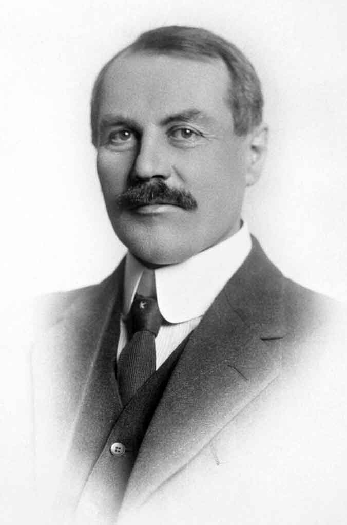
Jean Léon Côté, M.L.A., Edmonton. Ca. 1915
Wikipedia

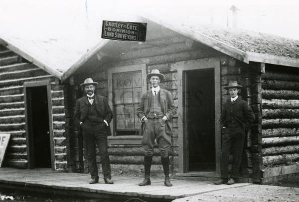
J. L. Côté and Reginald Cautley, Dawson, Yukon, ca. 1902
Provincial Archives of Alberta
Named for the French-Canadian politician Jean Léon Côté (1867-1924), born in Les Éboulements, Canada East. Côté was a surveyor and civil engineer by trade, and first visited the Edmonton area in 1886 as part of a survey crew. He returned to the East and trained as a Dominion Land Surveyor for the Department of the Interior, where he worked from 1893 to 1900. In 1899, Côté was sent by the Department to the Klondike gold rush, arriving in Dawson City that summer. Sometime after his arrival in Dawson City, Côté joined the Cautley brothers in a surveying partnership that lasted several years.
In the spring of 1909, Côté was induced to enter politics as a Liberal as he was well known in the Athabasca, Lesser Slave Lake, Peace River, and Fort McMurray areas through his numerous surveying activities. He was elected in the new Grouard riding in 1913 and re-elected by acclamation in 1918 and again in 1921. Côté was provincial secretary and Minister of Mines, Railways and Telephones. As Minister, Côté promoted the issue and approval by the Government of Alberta of an Order in Council establishing what would become known as the Alberta Research Council.
He died suddenly on September 24, 1924, at the age of 57 from peritonitis.