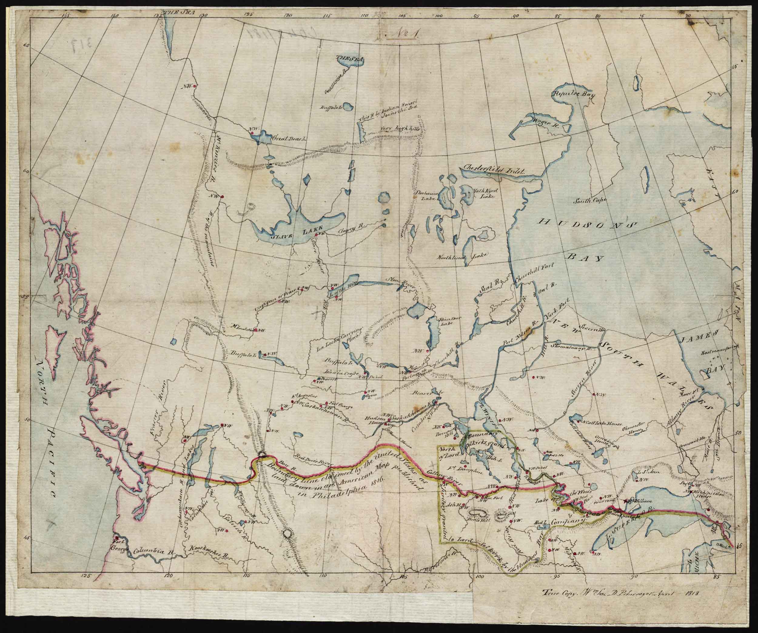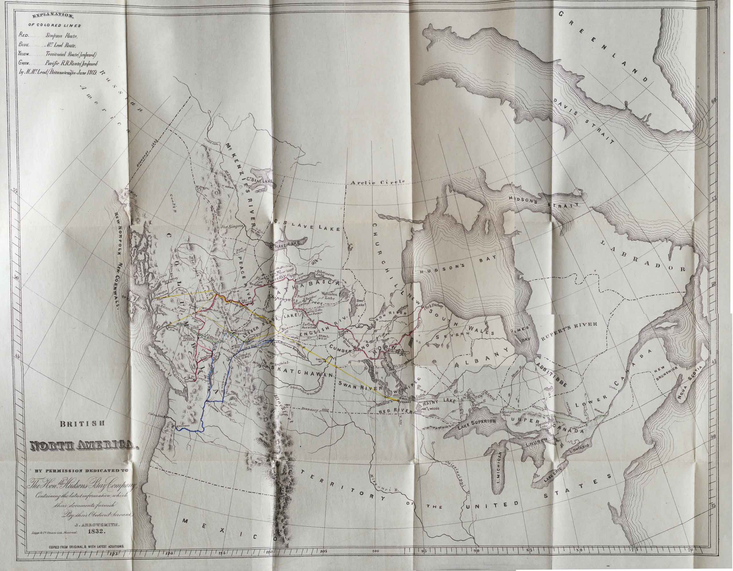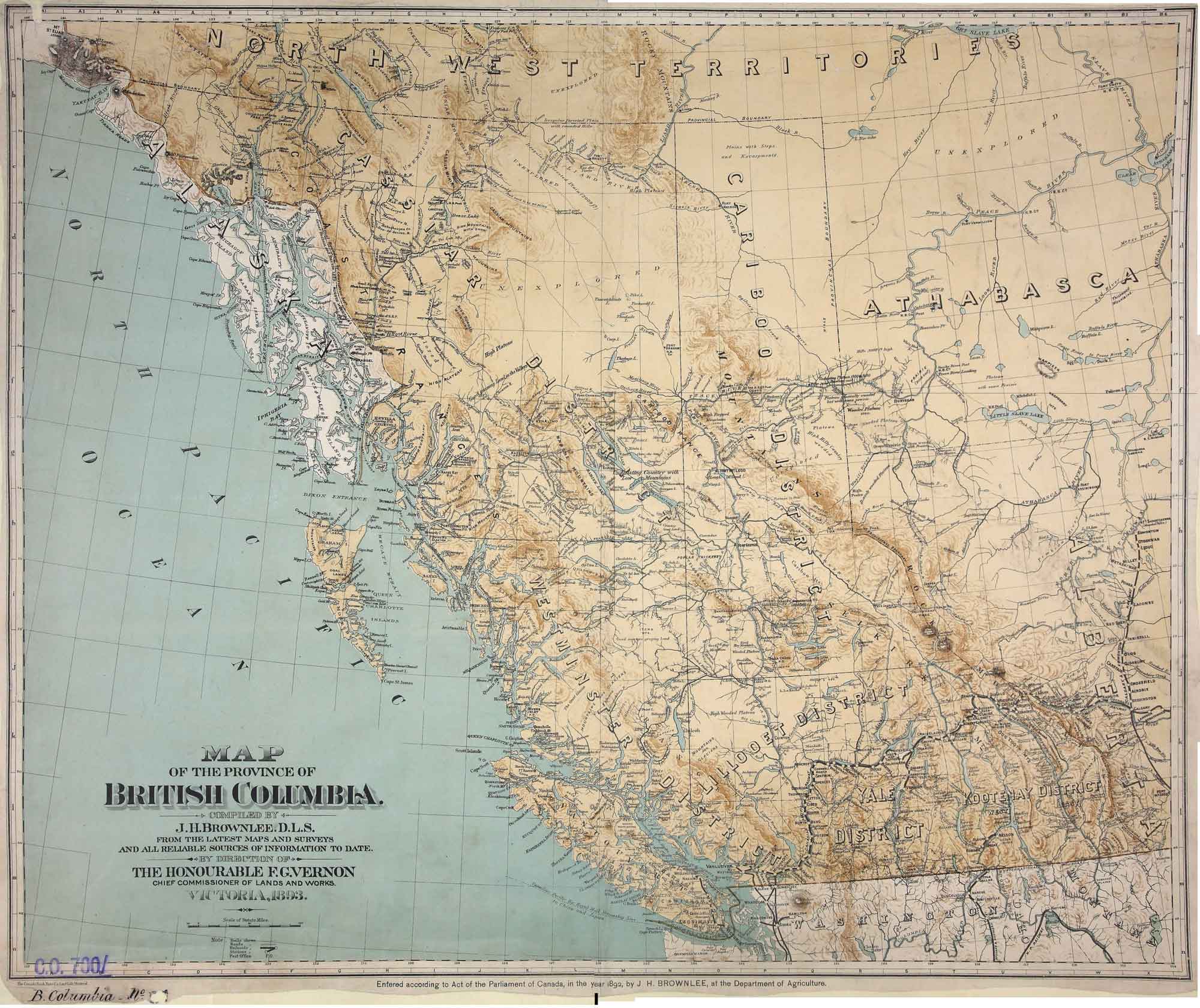
Map of the Province of British Columbia. Compiled by J. H. Brownlee, D.L.S., from the latest Maps and Surveys and all reliable sources of information to date.
UVic Libraries
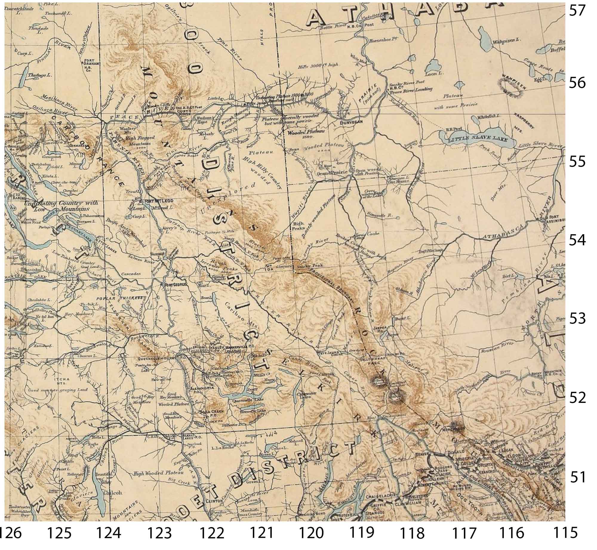
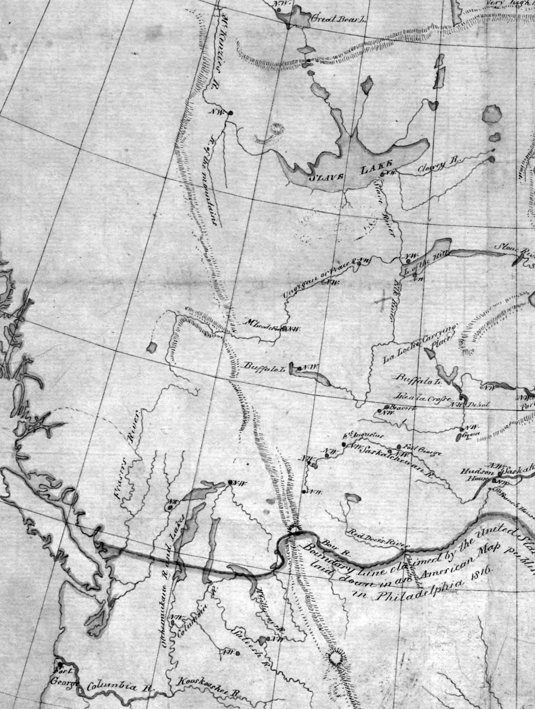
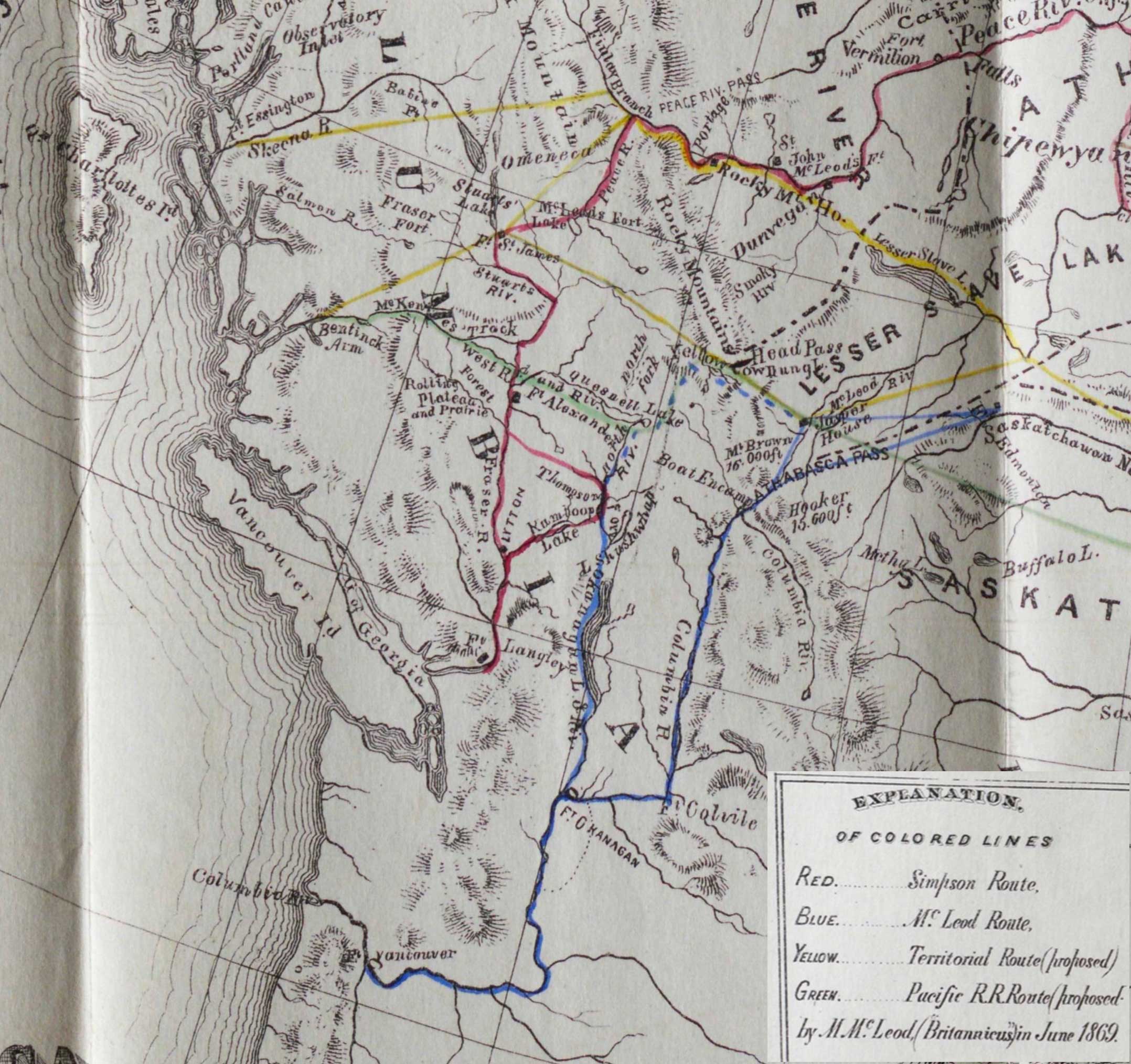
Detail of map of BC compiled by J. H. Brownlee, D.L.S.
UVic Libraries
Map of the Province of British Columbia.
Compiled by J. H. Brownlee, D.L.S.
From the latest Maps and Surveys and all reliable sources of information to date.
By direction of
The Honourable F. G. Vernon,
Chief Commissioner of Lands and Works.
Victoria, 1893.
Lithographed by the Canada Bank Note Co. Limited, Montreal.
Physical repository: National Archives (Great Britain)
This includes:
Athabasca River
Bad River (James Creek)
Boat Encampment
Brûlé Lake [as “Burnt L.”]
Canoe River
Columbia River
Cowdung Lake
Finlay River
Fort George
Fraser River
Grand Canyon [as “Grande Rapids”]
Grand Fork
Henry House
Jasper House
Jasper Lake
Kinbasket Lake
Maligne River
Moose Lake
Fraser River North Fork
North Thompson River
Parsnip River
Peace River
Smoky River
Smoky Peak
Tête Jaune Cache [with note “Iroquois Village”]
Wapiti River
Willow River
Yellowhead Pass
References:
- Brownlee, James Harrison, D.L.S. [d. 1934]. Montreal: Map of the province of British Columbia. Compiled by J.H. Brownlee, D.L.S. from the latest maps and surveys and all reliable sources of information to date by direction of the Honourable F.G. Vernon, Chief Commissioner of Lands and Works. (1893). UVic Libraries